Brandon’s post office opened in 1801, and 48% of its homes were built before 1940
More historic than 98% of U.S. towns · #12 of 71 in Vermont. What drives it
5 places in town are on the National Register, among them two historic districts with 252 buildings between them. Below: 11 old photos and papers, maps from 1885 on, and the census since 1790.
Founding year: the first Brandon post office (Blevins & Helbock, CC0).The full story ↓
History grade
What drives Brandon’s History grade
On its age, its old homes and the National Register, Brandon is more historic than 98% of U.S. towns, #12 of 71 in Vermont. All 3 inputs are above most U.S. towns; its share of homes from before 1940 ranks highest and its age lowest.
A+
HistoryA character grade: shown, never part of Brandon’s overall grade.
Vermont towns list more on the Register than most of the country (a typical Vermont town has 147 per 10,000 residents, the U.S. 2.4), so Brandon’s 612 sits above most of its state (90% of Vermont towns have fewer) while its 252 historic buildings outnumber those of 94% of U.S. towns.
How sure. Graded on any two of the three inputs instead, the letter would range from A to A+. The pre-1940 share is a Census survey estimate (±7.6 points). The founding year is the first post office, not a stated founding date.
Founding year: the first post office (other dates in Quick answers). Homes: Census ACS 2020–24. National Register: National Park Service, May 2026 list; each listing counted once (boundary changes and added documentation belong to their listing), and a historic district counts its contributing buildings. How TownRatings grades history →
What stands out about Brandon’s past
Read from the archive, the National Register and the record. The page puts what stands out first.
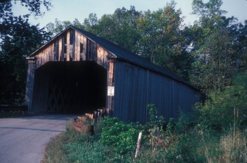
National Park Service, National Register of Historic Places. Photos from Wikimedia Commons, credited on each place’s page.
Every building
Brandon, building by building, 1885–1920
Fire insurance maps drew every building, what it was made of and what it was used for, so insurers could price the risk of fire. Pick a year, then a sheet.
On October 20, 1761, the town of Neshobe was chartered to Capt. Josiah Powers. In October 1784, the name of the town was changed to Brandon by an act of the legislature.
Passages that mention Brandon, cut from the printed page as they were published.
History of Rutland County, Vermont, with illustrations and biographical sketches of some of its prominent men and pioneers1886 · page 504Read the page →
Read the text
Brandon Water Works. — On the evening of the 28th of July, 1878, Fire District No. I of Brandon, adopted resolutions empowering and directing the the prudential committee of that district to construct a suitable aqueduct in the village of Brandon at an expense not exceeding forty thousand dollars.
Text read by machine from the scan; it may contain errors.
History of Rutland County, Vermont, with illustrations and biographical sketches of some of its prominent men and pioneers1886 · page 433Read the page →
Read the text
time they finished and exhibited specimens of their hay scales and other smaller styles at the fair of the American Institute, in New York, where the)' attracted favorable attention. In the spring of 1857 John Howe, jr., then of Brandon, Rutland county, became impressed with the value of the invention, purchased the patent of the inventors and began their manufacture at Brandon. A stock company was subsequentl}- organized and the business continued until 1877; but the works at Brandon were not conveniently situated relative to railroad shipments, and it was determined in 1877 to remove the entire
Text read by machine from the scan; it may contain errors.
choose town officers: And whereas, the inhabitants of said town have requested that the name of said town of Neshobe be altered to that of Brandon; Therefore, Be it enacted, and it is hereby enacted by the representatives of trie treemen of the State of Vermont, in General Assembly met, and by the authority of the same, that such
Text read by machine from the scan; it may contain errors.
he never failed to attend Freeman's meeting and to deposit his vote, aud what is most remarkable, he not only voted in this State, but in the town of Brandon, for seventyone consecutive years, having voted for the first town representative from Brandon, Nathan Daniels — and for the last — Dr. Volney Ross — and he was always able to go to
Text read by machine from the scan; it may contain errors.
Scans and text from the Internet Archive. Books published in 1930 or earlier, which are in the public domain.
Timeline
Brandon, 1801 to 1941
Woven from the archive, old maps, post office records, the National Register and the people born here.
Nothing in the archives for these yearsWeddings on Main Street, storms, parades, school pictures, the old store. If it’s in your family album, it belongs here.
The Brandon post office opened in 1801, the earliest record of the town by name (U.S. post office records).
How does Brandon rank for history?
Brandon is more historic than 98% of U.S. towns, #12 of 71 in Vermont. The History grade combines the town’s founding era, the share of homes built before 1940 and its National Register listings. It’s a character grade, so it isn’t part of the overall grade. How it works.
What is on the National Register in Brandon?
5 listings: 2 historic districts, the Brandon Village Historic District and the Brandon State School, with 252 contributing buildings, 1 site, and 2 structures. 252 historic buildings in all.
How old are the homes in Brandon?
48% of Brandon’s homes were built before 1940 (Census estimate, ±7.6 points), against a typical 22% for a Vermont town; the median home was built in 1951.
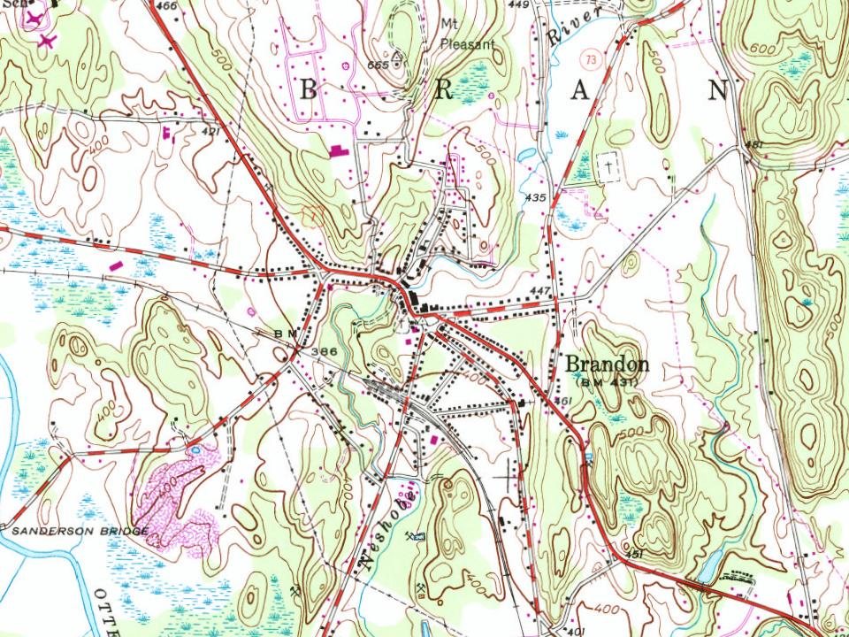
Founding dates: Wikidata, Wikipedia, the U.S. post office records of Blevins & Helbock (CC0) and the Census. Homes by year built: Census ACS 2020–24. National Register of Historic Places: National Park Service (list of May 22, 2026). Old photos, postcards and papers: Wikimedia Commons, the Library of Congress and other public archives, credited on each item’s page. Maps: U.S. Geological Survey historical topographic maps (via Esri) and Sanborn fire-insurance maps (Library of Congress). History text and census tables: Wikipedia (CC BY-SA 4.0). Places that used to be: USGS Geographic Names Information System (2021).
From Wikimedia Commons (6), the Library of Congress (5), Wikidata (1), the National Register of Historic Places (5), Wikipedia, Wikidata and Wikipedia for famous people, U.S. Geological Survey historical maps, U.S. Census counts (via Wikipedia), the US Post Offices dataset (Blevins & Helbock), the USGS Geographic Names Information System, Sanborn fire insurance maps (Library of Congress) and old county and town histories (Internet Archive). Archive images are copied here with their credits and licenses, shown on each photo’s page. Refreshed monthly.






 1859
 1903
 1914
 1941
 1941

