Sudbury’s post office opened in 1811, and 24% of its homes were built before 1940
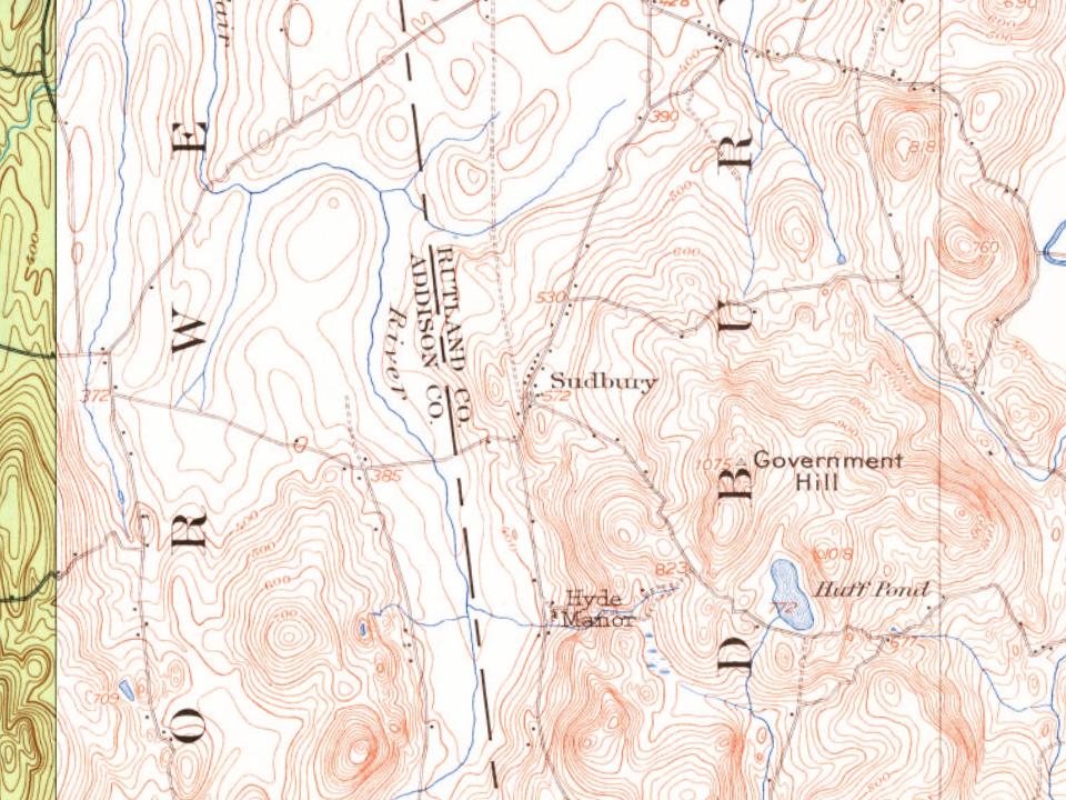
Its Register listings are the Sudbury Congregational Church, the Sudbury School No. 3 and the Hyde's Hotel. Below: 5 old photos and papers, maps from 1902 on, and the census since 1790.
Wikipedia doesn’t have a history of Sudbury yet. The photos, dates and memories neighbors add here are how it gets written.
Sudbury is a town in Rutland County, Vermont, United States. The population was 545 at the 2020 census.
Its first post office opened in 1811. Between the 2010 and 2020 censuses its population fell from 560 to 545 (-3%).
Intro from Wikipedia. Population: U.S. Census Bureau.
From the old history books
What they wrote about Sudbury in 1886
Passages that mention Sudbury, cut from the printed page as they were published.
History of Rutland County, Vermont, with illustrations and biographical sketches of some of its prominent men and pioneers1886 · page 431Read the page →
Read the text
In the year 1854 the North River Mining Company, which had been prospecting for marble in the town of Sudbury, undertook the resuscitiaton of the Sutherland Falls business. The railroad was now in operation, supplying means of transportation, and circumstances seemed more favorable for the business. But the quarries at West Rutland had been largely worked, as we have before shown, and there was a large quantity of the marble in the market; it was of a finer grain than that taken out at the falls and easier worked ; this labor being then nearly all done by hand labor, it was for the interest of mar-
Text read by machine from the scan; it may contain errors.
History of Rutland County, Vermont, with illustrations and biographical sketches of some of its prominent men and pioneers1886 · page 476Read the page →
Read the text
Captain Thomas Tuttle came here about 1774 from Pittsford, although hehad formerly lived in Tinmouth. He first settled on what has since been known as the Farrington farm, owned by Franklin Farrington ; his log house stood near the creek and the present road to Sudbury, a few rods from where the railroad crossing now is. The original survey contained one hundred and ten acres. His house was burnt by the Indians in 1779, as were also those of his son, and his son-in-law, Barker. He was killed in an attempt to escape from Fort Washington after the surrender of that stronghold to the British.
Text read by machine from the scan; it may contain errors.
Scans and text from the Internet Archive. Books published in 1930 or earlier, which are in the public domain.
By decade
Sudbury, decade by decade
2 decades in the archive, from the 1860s to the 1900s. Scroll each row; tap a photo for its story.
Nothing in the archives for these yearsWeddings on Main Street, storms, parades, school pictures, the old store. If it’s in your family album, it belongs here.
Founding dates: Wikidata, Wikipedia, the U.S. post office records of Blevins & Helbock (CC0) and the Census. Homes by year built: Census ACS 2020–24. National Register of Historic Places: National Park Service (list of May 22, 2026). Old photos, postcards and papers: Wikimedia Commons, the Library of Congress and other public archives, credited on each item’s page. Maps: U.S. Geological Survey historical topographic maps (via Esri) and Sanborn fire-insurance maps (Library of Congress). History text and census tables: Wikipedia (CC BY-SA 4.0). Places that used to be: USGS Geographic Names Information System (2021). How TownRatings grades history →
From Wikimedia Commons (5), the Library of Congress (3), Wikidata (3), the National Register of Historic Places (3), Wikidata and Wikipedia for famous people, U.S. Geological Survey historical maps, U.S. Census counts (via Wikipedia), the US Post Offices dataset (Blevins & Helbock), the USGS Geographic Names Information System and old county and town histories (Internet Archive). Archive images are copied here with their credits and licenses, shown on each photo’s page. Refreshed monthly.






 c. 1868
 1900
 1900
 2016
 2010
 2004

