7 places in town are on the National Register, among them a historic district with 74 buildings. Below: 13 old photos and papers, maps from 1887 on, and the census since 1790.
On its age, its old homes and the National Register, Bethel is more historic than 96% of U.S. towns. All 3 inputs are above most U.S. towns; its share of homes from before 1940 ranks highest and its age lowest.
A+
HistoryA character grade: shown, never part of Bethel’s overall grade.
Vermont towns list more on the Register than most of the country (a typical Vermont town has 147 per 10,000 residents, the U.S. 2.4), so Bethel’s 507 sits above most of its state (85% of Vermont towns have fewer) while its 88 historic buildings outnumber those of 89% of U.S. towns.
NoteThe founding year comes from Wikidata alone; no second source gives 1779.
How sure. Graded on any two of the three inputs instead, the letter would range from A to A+. The pre-1940 share is a Census survey estimate (±7.9 points).
Founding year: Wikidata (other dates in Quick answers). Homes: Census ACS 2020–24. National Register: National Park Service, May 2026 list; each listing counted once (boundary changes and added documentation belong to their listing), and a historic district counts its contributing buildings. How TownRatings grades history →
What stands out about Bethel’s past
Read from the archive, the National Register and the record. The page puts what stands out first.
National Park Service, National Register of Historic Places. Photos from Wikimedia Commons, credited on each place’s page.
Every building
Bethel, building by building, 1887–1922
Fire insurance maps drew every building, what it was made of and what it was used for, so insurers could price the risk of fire. Pick a year, then a sheet.
1887Sheet 1 of 1
Edition
Sheets
BrickWoodStone
Sanborn Map Company, via the Library of Congress. Editions published in 1930 or earlier, which are in the public domain.
Places that used to be
Lost post offices, old corners and burying grounds
Bethel’s post office has been open since 1818. Another post office, East Bethel, opened and closed inside today’s town.
Cherry HillEast BethelFairviewGileadLympusOld ChurchQuarry Hill - Woodworth
US Post Offices dataset (Blevins & Helbock, CC0). Places and cemeteries from the USGS Geographic Names Information System (2021).
The story so far
Bethel, in brief
Wikipedia doesn’t have a history of Bethel yet. The photos, dates and memories neighbors add here are how it gets written.
Bethel is a town in Windsor County, Vermont, United States. The population was 1,942 at the 2020 census. The town includes the locations of Bethel village, Bethel-Gilead, East Bethel, Lilliesville, Lympus (formerly Olympus), and West Bethel. Bethel is best known for being the source of Bethel White granite which was used to build Washington Union Station and the National Museum of Natural History. Bethel was the first town created by the independent Republic of Vermont in 1779 and was named after the Biblical village of Bethel.
Bethel was established in 1779. Between the 2010 and 2020 censuses its population fell from 2,030 to 1,942 (-4%).
Intro from Wikipedia. Population: U.S. Census Bureau.
From the old history books
What they wrote about Bethel in 1891
Passages that mention Bethel, cut from the printed page as they were published.
History of Windsor county, Vermont1891 · page 565Read the page →
Read the text
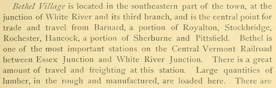
Bethel Village is located in the southeastern part of the town, at the junction of White River and its third branch, and is the central point for trade and travel from Barnard, a portion of Royalton, Stockbridge, Rochester, Hancock, a portion of Sherburne and Pittsfield. Bethel is one of the most important stations on the Central Vermont Railroad between Essex Junction and White River Junction. There is a great amount of travel and freighting at this station. Large quantities of lumber, in the rough and manufactured, are loaded here. There are
Text read by machine from the scan; it may contain errors.
History of Windsor County, Vermont, with illustrations and biographical sketches of some of its prominent men and pioneers1891 · page 565Read the page →
Read the text
Bethel Village is located in the southeastern part of the town, at the junction of White River and its third branch, and is the central point for trade and travel from Barnard, a portion of Royalton, Stockbridge, Rochester, Hancock, a portion of Sherburne and Pittsfield. Bethel is one of the most important stations on the Central Vermont Railroad between Essex Junction and White River Junction. There is a great amount of travel and freighting at this station. Large quantities of lumber, in the rough and manufactured, are loaded here. There are
Text read by machine from the scan; it may contain errors.
History of Windsor county, Vermont1891 · page 574Read the page →
Read the text
Geographically, Barnard is situated in the northwestern part of Windsor county, being bounded north by Bethel and Royalton; east by Pomfret ; south by Bridgewater and Sherburne, the latter being a town of Rutland county; and west by the town of Stockbridge. The character of the surface of the land generally throughout this town is rolling and hilly, but there is a noticeable absence of commanding or unusual heights found in many others of the inland towns of the county. The best approach to what may be called mountain formations are found in
Text read by machine from the scan; it may contain errors.
History of Windsor County, Vermont, with illustrations and biographical sketches of some of its prominent men and pioneers1891 · page 574Read the page →
Read the text
Geographically, Barnard is situated in the northwestern part of Windsor county, being bounded north by Bethel and Royalton; east by Pomfret ; south by Bridgewater and Sherburne, the latter being a town of Rutland county; and west by the town of Stockbridge. The character of the surface of the land generally throughout this town is rolling and hilly, but there is a noticeable absence of commanding or unusual heiglits found in many others of the inland towns of the county. The best approach to what may be called mountain formations are found in
Text read by machine from the scan; it may contain errors.
Scans and text from the Internet Archive. Books published in 1930 or earlier, which are in the public domain.
Timeline
Bethel, 1779 to 1974
Woven from the archive, old maps, post office records, the National Register and the people born here.
Nothing in the archives for these yearsWeddings on Main Street, storms, parades, school pictures, the old store. If it’s in your family album, it belongs here.
In 1779, according to Wikidata. Bethel’s post office opened in 1818, and the first U.S. census counted 473 people here in 1790.
How does Bethel rank for history?
Bethel is more historic than 96% of U.S. towns. The History grade combines the town’s founding era, the share of homes built before 1940 and its National Register listings. It’s a character grade, so it isn’t part of the overall grade. How it works.
What is on the National Register in Bethel?
7 listings: 5 buildings, 1 historic district, the Bethel Village Historic District, with 74 contributing buildings, and 1 structure. 88 historic buildings in all.
How old are the homes in Bethel?
38% of Bethel’s homes were built before 1940 (Census estimate, ±7.9 points), against a typical 22% for a Vermont town; the median home was built in 1966.
Founding dates: Wikidata, Wikipedia, the U.S. post office records of Blevins & Helbock (CC0) and the Census. Homes by year built: Census ACS 2020–24. National Register of Historic Places: National Park Service (list of May 22, 2026). Old photos, postcards and papers: Wikimedia Commons, the Library of Congress and other public archives, credited on each item’s page. Maps: U.S. Geological Survey historical topographic maps (via Esri) and Sanborn fire-insurance maps (Library of Congress). History text and census tables: Wikipedia (CC BY-SA 4.0). Places that used to be: USGS Geographic Names Information System (2021).
From Wikimedia Commons (11), the Library of Congress (7), Wikidata (2), the National Register of Historic Places (7), Wikidata and Wikipedia for famous people, U.S. Geological Survey historical maps, U.S. Census counts (via Wikipedia), the US Post Offices dataset (Blevins & Helbock), the USGS Geographic Names Information System, Sanborn fire insurance maps (Library of Congress) and old county and town histories (Internet Archive). Archive images are copied here with their credits and licenses, shown on each photo’s page. Refreshed monthly.










 1913
 1937
 1937
 1939
 1943
 1943
 1943
 1943
 2007
 2006
 2006
 2006
 2004


