Royalton dates to 1769, and 40% of its homes were built before 1940
Among the most historic 1% of U.S. towns · #7 of 71 in Vermont. What drives it
5 places in town are on the National Register, among them a historic district with 81 buildings. Below: 4 old photos and papers, maps from 1919 on, and the census since 1790.
Founding year: Wikidata; Wikipedia’s history section gives the same year. First post office: 1797.The full story ↓
History grade
What drives Royalton’s History grade
On its age, its old homes and the National Register, Royalton is among the most historic 1% of U.S. towns, #7 of 71 in Vermont. All 3 inputs are above most U.S. towns; its age ranks highest and its National Register listings lowest.
A+
HistoryA character grade: shown, never part of Royalton’s overall grade.
Vermont towns list more on the Register than most of the country (a typical Vermont town has 147 per 10,000 residents, the U.S. 2.4), so Royalton’s 316 sits above most of its state (78% of Vermont towns have fewer) while its 87 historic buildings outnumber those of 89% of U.S. towns.
How sure. Graded on any two of the three inputs instead, the letter would still be A+. The pre-1940 share is a Census survey estimate (±9.6 points). Two sources give 1769.
Founding year: Wikidata (other dates in Quick answers). Homes: Census ACS 2020–24. National Register: National Park Service, May 2026 list; each listing counted once (boundary changes and added documentation belong to their listing), and a historic district counts its contributing buildings. How TownRatings grades history →
What stands out about Royalton’s past
Read from the archive, the National Register and the record. The page puts what stands out first.
The town was chartered on November 23, 1769, by Cadwallader Colden, Royal Lieutenant Governor of New York. The first permanent settlers were Robert Havens and his family, who arrived in 1771. Royalton was re-chartered by the Independent Republic of Vermont on December 20, 1781. The 1780 Royalton Raid was the last major British raid of the American War of Independence in New England. In 1848, the Vermont Central Railroad opened to South Royalton, which developed as a freight depot.
During the Revolutionary War Royalton was visited by Gilbert du Motier, Marquis de Lafayette
Although Joseph Smith, founder of Mormonism, was born in the adjacent town of Sharon near the Royalton boundary, the Joseph Smith Birthplace Memorial lies in the town.
Passages that mention Royalton, cut from the printed page as they were published.
History of Royalton, Vermont, with family genealogies, 1769-19111911 · page 745Read the page →
Read the text
The mother of Mr. Davis was Lydia Phillips, the second wife of Jacob Davis. His father held considerable property in the town of Royalton. James removed from Randolph to Royalton in March, 1838, and located near the "Sever schoolhouse" in his last days, and his son William took the farm which he at first bought. He was interested in the mills on the Second Branch, He served in various town offices, and was representative in the legislature of 1849.
Text read by machine from the scan; it may contain errors.
trading center, where was kept a store and a shop, and a post-office when the latter was established in the State generally, and this locality, this pretty though quiet little hamlet, has always been known by the name of the village of Royalton. This is the old historic center of "the town, although the later creation, known as South Royalton, has taken away much of the business enterprise and prosperity that naturally belonged to the older town. Here was the trading center of the town one hundred years ago, and here it should be to-day, but circumstances
Text read by machine from the scan; it may contain errors.
History of Royalton, Vermont, with family genealogies, 1769-19111911 · page 650Read the page →
Read the text
650 History of Royalton, Vermont Mr. Adams spent his entire life in Royalton, He was a mechanic, but owned considerable real estate in town, and at one time had an interest in a store at Royalton village. He held various town offices, that of selectman for the usual term, and was town treasurer for twenty-two years. He was highly esteemed as a citizen. At the time of his death he was living near the "Mills," then owned by his son, M, S. Adams.
Text read by machine from the scan; it may contain errors.
Scans and text from the Internet Archive. Books published in 1930 or earlier, which are in the public domain.
Timeline
Royalton, 1769 to 2010
Woven from the archive, old maps, post office records, the National Register and the people born here.
Nothing in the archives for these yearsWeddings on Main Street, storms, parades, school pictures, the old store. If it’s in your family album, it belongs here.
In 1769, according to Wikidata and Wikipedia’s history of the town. Royalton’s post office opened in 1797, and the first U.S. census counted 748 people here in 1790.
How does Royalton rank for history?
Royalton is among the most historic 1% of U.S. towns, #7 of 71 in Vermont. The History grade combines the town’s founding era, the share of homes built before 1940 and its National Register listings. It’s a character grade, so it isn’t part of the overall grade. How it works.
What is on the National Register in Royalton?
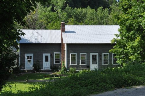
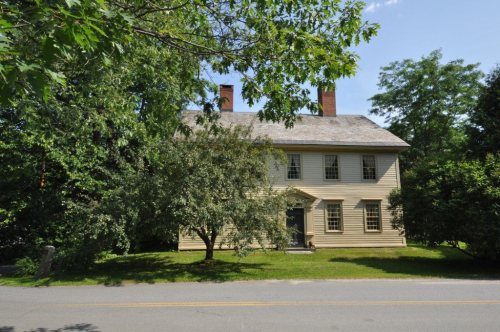
5 listings: 4 buildings and 1 historic district, the South Royalton Historic District, with 81 contributing buildings. 87 historic buildings in all.
How old are the homes in Royalton?
40% of Royalton’s homes were built before 1940 (Census estimate, ±9.6 points), against a typical 22% for a Vermont town; the median home was built in 1965.
Founding dates: Wikidata, Wikipedia, the U.S. post office records of Blevins & Helbock (CC0) and the Census. Homes by year built: Census ACS 2020–24. National Register of Historic Places: National Park Service (list of May 22, 2026). Old photos, postcards and papers: Wikimedia Commons, the Library of Congress and other public archives, credited on each item’s page. Maps: U.S. Geological Survey historical topographic maps (via Esri) and Sanborn fire-insurance maps (Library of Congress). History text and census tables: Wikipedia (CC BY-SA 4.0). Places that used to be: USGS Geographic Names Information System (2021).
From Wikimedia Commons (8), the Library of Congress (2), Wikidata (2), the National Register of Historic Places (5), Wikipedia, Wikidata and Wikipedia for famous people, U.S. Geological Survey historical maps, U.S. Census counts (via Wikipedia), the US Post Offices dataset (Blevins & Helbock), the USGS Geographic Names Information System and old county and town histories (Internet Archive). Archive images are copied here with their credits and licenses, shown on each photo’s page. Refreshed monthly.





 1907–1915
 1914
 2011
 2011
 2011
 2011
 2010
 2004


