192 years in pictures
The archive holds 17 old photos and papers going back to 1935 and 3 maps from 1961 on.
1 place on the National Register of Historic Places.
- 1834Sperryville is settled
Each edition grades its towns against each other only.

Sperryville’s midpoint age is 72.3 years, above both Virginia’s towns (38.5 years) and U.S. towns (40.5 years). Montpelier and Sperryville Historic District is on the National Register of Historic Places. Sperryville has fewer than 1,000 residents, too few for fair grades; the figures below are still real.
Where Sperryville beats most towns.
In a town this size, neighbors are the best guide. Ask them anything.
The archive holds 17 old photos and papers going back to 1935 and 3 maps from 1961 on.
1 place on the National Register of Historic Places.
Museums, parks, gardens and other places to visit around Sperryville. Close and well known come first.
in town National ParkShenandoah National Park1.7M visitors a year
Big draw34 mi LandmarkMount Weather Emergency Operations Center
13 mi CaveLuray Caverns
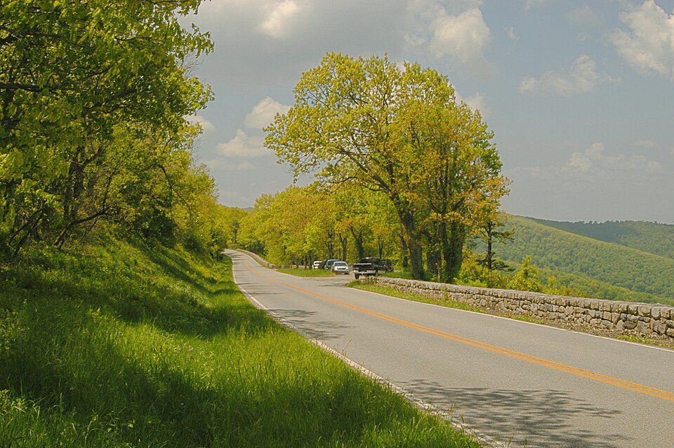
14 mi Scenic driveSkyline Drive
34 mi Ski areaMassanutten Resort22 runs · 1,064 ft vertical
37 mi National park siteManassas National Battlefield Park473K visitors a yearShenandoah National Park: Image copyright 2005 by user G. Edward Johnson (user Lorax) and released under t, CC BY-SA 3.0 · Mount Weather Emergency Operations Center: Unknown, Public domain · Luray Caverns: Paulo Ordoveza from Washington, DC, CC BY 2.0 · Skyline Drive: Image copyright 2005 by user G. Edward Johnson (user Lorax) and released under t, CC BY-SA 3.0 · Massanutten Resort: Arbogastlw at English Wikipedia, Public domain · Manassas National Battlefield Park: Billy Hathorn, CC BY 3.0
Sperryville is unincorporated, so Rappahannock County and regional agencies provide most services.
EPA SDWIS (Oct 9, 2026) · HIFLD + EIA-861 2025 · Census 2020 ZCTAs · NCES 2024–25 · registration: vote.gov, updated Sep 30, 2026.
Ordered by what stands out in Sperryville.
A bachelor’s degree or higher: 38% of adults 25 and older, vs 42% across Virginia.
Somewhere between 46% and 79% women
The Census survey reached too few of Sperryville’s residents to say more: its margin here is ±16.5 points. Across Virginia, 50.6% of residents are women.
| Sperryville | VA | U.S. | |
|---|---|---|---|
| Under 10 | 14.2% | 11.6% | 11.6% |
| 10 to 17 | 0% | 10.1% | 10.3% |
| 18 to 24 | 1.1% | 9.3% | 9.1% |
| 25 to 34 | 2% | 13.5% | 13.7% |
| 35 to 44 | 3.9% | 13.6% | 13.2% |
| 45 to 54 | 8.4% | 12.5% | 12.2% |
| 55 to 64 | 5.9% | 12.8% | 12.7% |
| 65 to 74 | 40.5% | 9.9% | 10.2% |
| 75 and older | 24% | 6.8% | 7% |
| No diploma | 0% | 8.4% | 10.4% |
| High school | 45.5% | 23.9% | 26% |
| Some college | 13.5% | 17.7% | 19.1% |
| Associate’s | 3% | 7.8% | 8.8% |
| Bachelor’s | 24.1% | 23.7% | 21.6% |
| Graduate | 13.9% | 18.5% | 14.1% |
U.S. Census Bureau · ACS 2020-2024 5-year estimates · in a town of 400, single groups can be off by several points
Home values are up 3.4% over the year to September 2026. In Sperryville, four in five households live in a home they own.
Zillow Home Value Index · Redfin Data Center
Expect July afternoons of 86° and January nights of 24°, with about 21 inches of snow a winter.
NOAA U.S. Climate Normals, 1991–2020
Half commute less than 37 miles. Jobs based in Sperryville grew to 127 in 2023, 51 more than in 2013. Most people who work leave Sperryville to do it: just 1% work in town. The top destinations are Warrenton (5%), Culpeper (5%) and Washington (4%).
| Sperryville | Virginia towns | U.S. towns | |
|---|---|---|---|
| Working residents who work in town | 1% | 4.9% | 8% |
| Below the poverty line | 10% | 7.7% | 9.6% |
Census LEHD 2023 · ACS
Sperryville: 15% of adults binge drink. CDC measures, 32 in all: Sperryville beats Virginia on 3 and trails on 5. 14% of adults here have diabetes; 15% report frequent physical distress.
| Sperryville | Virginia towns | U.S. towns | |
|---|---|---|---|
| High blood pressure (CDC PLACES) | 40% | 33% | 35% |
| Diabetes (CDC PLACES) | 14% | 11% | 12% |
| Frequent physical distress (CDC PLACES) | 15% | 12% | 14% |
| Feel lonely (CDC PLACES) | 31% | 34% | 33% |
| What stands out | Sperryville | VA |
|---|---|---|
| Fewer adults facing housing insecurity | 8.4% | 10.9% |
| Fewer adults facing a utility shut-off | 5.6% | 7.1% |
| More adults who have had cancer | 10.7% | 7.7% |
CDC PLACES 2025 · modeled estimates for adults · CMS · HRSA
Compared with 55% of U.S. communities, expected storm and flood damage in Sperryville is higher. Of the losses FEMA expects locally, 66% come from inland flooding and 10% from strong winds.
FEMA National Risk Index · OpenFEMA
None within 15 miles of Sperryville; the nearest are
About 0 of every 100 Sperryville residents are enrolled in college, against 7 across Virginia.
Census-designated place in Virginia, United States
Sperryville is a census-designated place (CDP) located in the western section of Rappahannock County, Virginia, United States, near Shenandoah National Park. It consists of a village with two main streets along the two branches of the Thornton River, together with surrounding pasture and farmland. As of the 2020 census, Sperryville had a population of 302.
From Wikipedia, licensed CC BY-SA 4.0 · facts via Wikidata (CC0)
Short answers, built from the data on this page.
Sperryville has fewer than 1,000 residents, too few for fair grades; the figures below are still real.