RipplemeadVA
Today 294 people live in this town, first settled in 1883.
Is Ripplemead a good place to live?
Ripplemead’s mean commuting time is 91 minutes, where Virginia’s towns sit at 27 minutes and U.S. towns at 25 minutes. No town among the 254 in Virginia we compare has a higher age of the median resident than Ripplemead. Ripplemead’s concentration of trails is 2.4 miles per square mile, against 0.7 in Virginia’s towns and 0.4 across U.S. towns. Ripplemead has fewer than 1,000 residents, too few for fair grades; the figures below are still real.
294 people, and everyone knows the way
In a town this size, neighbors are the best guide. Ask them anything.
Moving to Ripplemead: who provides what
Ripplemead is unincorporated, so Giles County and regional agencies provide most services.
EPA SDWIS (Oct 9, 2026) · HIFLD + EIA-861 2025 · Census 2020 ZCTAs · NCES 2024–25 · registration: vote.gov, updated Sep 30, 2026.
The data
Ordered by what stands out in Ripplemead.
Compared with most of Virginia and the rest of the country, more of Ripplemead’s households own their home
A typical home in Ripplemead is worth about $194,000, up 10.9% in a year, 53% below the Virginia typical home.
Typical home value
Census ACS, 2020–24 · Zillow Home Value Index · Redfin Data Center
Most of Ripplemead’s workers commute out: the town has 0.1 jobs for each of them
Half of commuters travel less than 16 miles. The share of working residents in Ripplemead who work locally: 0.9%. The top destinations are Pearisburg (17%), Roanoke (9%) and Blacksburg (6%). The median household income for Ripplemead comes to $79,000.
| Ripplemead | Virginia towns | U.S. towns | |
|---|---|---|---|
| Working residents who work in town | 0.9% | 4.9% | 8% |
| Median household income | $79,000 | $102,000 | $80,000 |
Where working residents work
Census LEHD 2023 · ACS
Four seasons and pleasant summers: that is Ripplemead’s year
Ripplemead’s midsummer high is 85°F.
Typical low → high °F
NOAA U.S. Climate Normals, 1991–2020
Natural hazards: low risk in Ripplemead, mostly inland flooding
Expected damage from storms and floods is lower here than in 63% of U.S. communities. Of the losses FEMA expects in Ripplemead, 78% come from inland flooding and 9% from cold waves. Federal aid has come to Ripplemead households in 2 declared disasters; the latest was in 2024.
FEMA disaster declarations and aid · FEMA National Risk Index · OpenFEMA
How healthy Ripplemead is
27% of adults get no exercise outside work in Ripplemead. On the CDC’s 32 measures, Ripplemead is ahead of Virginia on 1 and behind on 10. In Ripplemead, 15% of adults have diabetes, and 16% report frequent physical distress.
| Ripplemead | Virginia towns | U.S. towns | |
|---|---|---|---|
| High blood pressure (CDC PLACES) | 41% | 33% | 35% |
| Diabetes (CDC PLACES) | 15% | 11% | 12% |
| Frequent physical distress (CDC PLACES) | 16% | 12% | 14% |
| Smoke cigarettes (CDC PLACES) | 16% | 12% | 14% |
| What stands out | Ripplemead | VA |
|---|---|---|
| More adults treating high blood pressure | 80.8% | 76.8% |
| More adults with COPD | 9.3% | 6.2% |
CDC PLACES 2025 · modeled estimates for adults · CMS · HRSA
Trails & parks © OpenStreetMap contributors · Conserved land: USGS PAD-US
Appalachian Trail and 9 more within 40 miles
Museums, parks, gardens and other places to visit around Ripplemead. Close and well known come first.
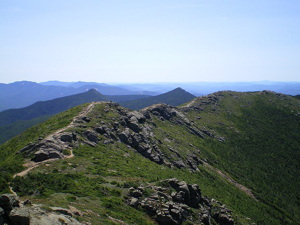 Big draw17 mi Park & preserveAppalachian Trail3.0M visitors a year
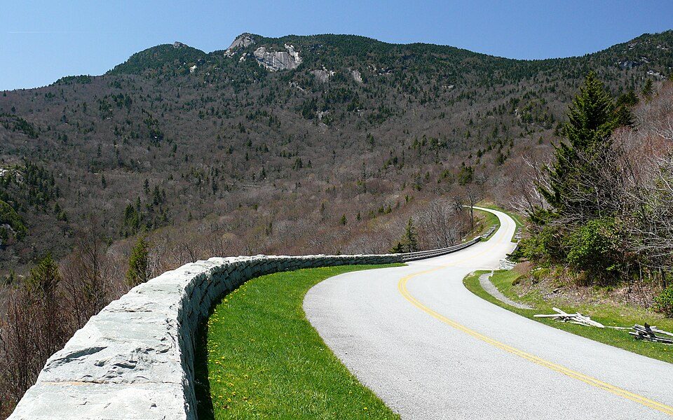 34 mi ParkwayBlue Ridge Parkway16.5M visitors a year
 9 mi LakeMountain Lake
 17 mi Stadium & arenaLane Stadium
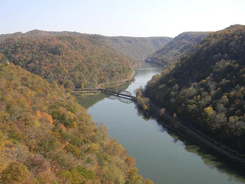 26 mi National PreserveNew River Gorge National Park and Preserve2.0M visitors a year
 37 mi LandmarkProject Greek Island
Photo credits
Appalachian Trail: Paulba. Original uploader was Paulbalegend at en.wikipedia, CC BY-SA 3.0 · Blue Ridge Parkway: Ken Thomas, Public domain · Mountain Lake: Rolfmueller, CC BY-SA 3.0 · Lane Stadium: User:B, CC BY-SA 4.0 · New River Gorge National Park and Preserve: NKS22, Public domain · Project Greek Island: Z22, CC BY-SA 4.0


Everything we know about Ripplemead
Colleges nearby
None within 15 miles of Ripplemead; the nearest are
About 0 of every 100 Ripplemead residents are enrolled in college, against 7 across Virginia.
99% of working residents leave Ripplemead for work
Where Ripplemead’s working residents go each day. Line width shows the share.
Census LEHD 2023
About Ripplemead
Unincorporated community in Virginia, United States
Ripplemead is an unincorporated community and census designated place (CDP) in Giles County, Virginia, United States. As of the 2020 census, Ripplemead had a population of 306. Ripplemead is located along the New River, 2.8 miles (4.5 km) east-northeast of Pearisburg. Ripplemead has a post office with ZIP code 24150.
From Wikipedia, licensed CC BY-SA 4.0 · facts via Wikidata (CC0)
- Area
- 1.2 sq mi
- Elevation
- 1,827 ft
- ZIP code
- 24150
Questions about Ripplemead
Short answers, built from the data on this page.
Is Ripplemead, VA a good place to live?
Ripplemead has fewer than 1,000 residents, too few for fair grades; the figures below are still real.