
Untitled photo, 2008
Cloverdale’s story
Cloverdale in pictures
Census counts: 2,986 in 2000, 3,410 in 2020. The archive holds 2 old photos and papers going back to 2008 and 5 maps from 1929 on.
Explore the history →Each edition grades its towns against each other only.
Public schools that outperform most of Virginia. This town in Virginia has a population of 3,208.
Plenty in its favour, and one clear drawback. Its strongest is schools (A): its schools outperform 93% of the state's. It is strong on incomes as well: the median household earns $80K. Homes run about $303K for a typical one, 4.4 times the Roanoke metro’s $69K median household income. What counts against it is walkability. Most errands need a car: it is less walkable than 90% of U.S. towns. The overall grade comes out at A, 74th of 249 in Virginia. On that grade it does better than 87% of U.S. towns.
Figures: schools, state test and graduation results · incomes, Census ACS, 2020–24 · home values, Zillow.
Where Cloverdale beats most towns.
Each subject compared with towns across the country (schools within Virginia), ordered by how far Cloverdale is from typical.
How TownRatings grades towns →
Census counts: 2,986 in 2000, 3,410 in 2020. The archive holds 2 old photos and papers going back to 2008 and 5 maps from 1929 on.
Explore the history →Museums, parks, gardens and other places to visit around Cloverdale. Close and well known come first.
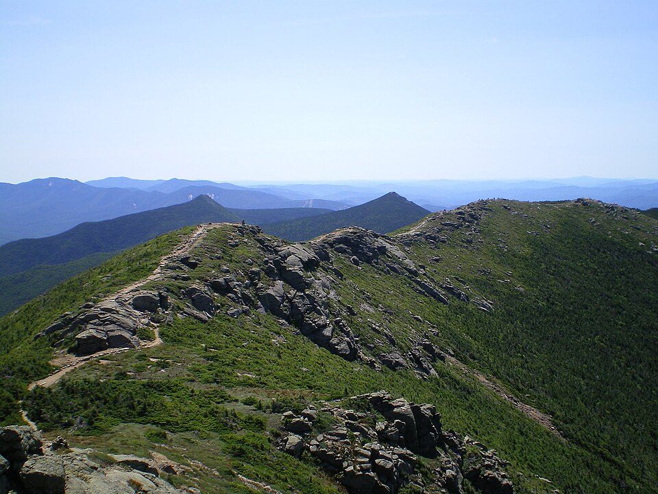 Big draw27 mi Park & preserveAppalachian Trail3.0M visitors a year
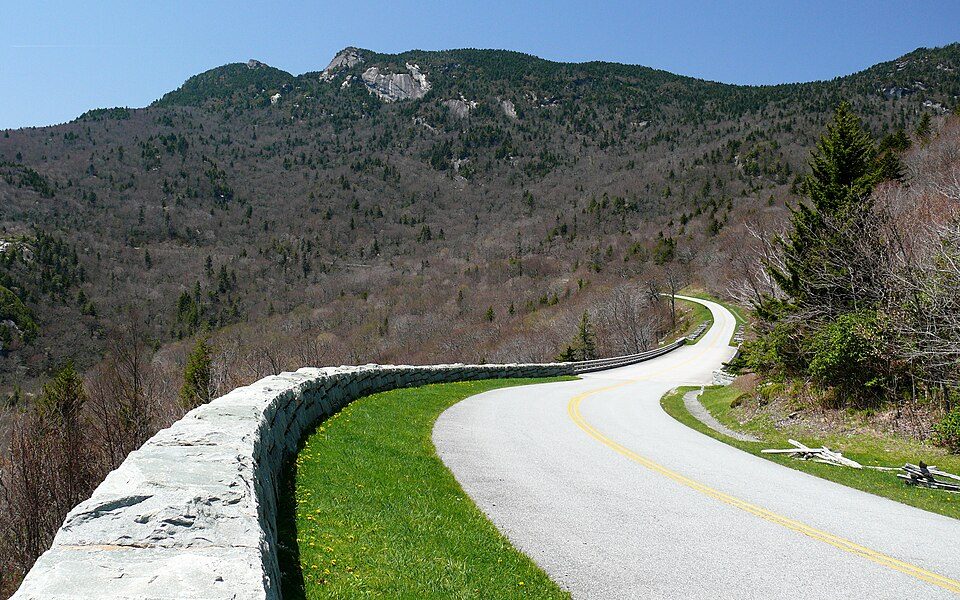 3 mi ParkwayBlue Ridge Parkway16.5M visitors a year
 30 mi Stadium & arenaLane Stadium
 38 mi LandmarkProject Greek Island
 29 mi LakeSmith Mountain Lake
 35 mi LakeMountain Lake
Appalachian Trail: Paulba. Original uploader was Paulbalegend at en.wikipedia, CC BY-SA 3.0 · Blue Ridge Parkway: Ken Thomas, Public domain · Lane Stadium: User:B, CC BY-SA 4.0 · Project Greek Island: Z22, CC BY-SA 4.0 · Smith Mountain Lake: Jay White, Public domain · Mountain Lake: Rolfmueller, CC BY-SA 3.0
Cloverdale is unincorporated, so Botetourt County and regional agencies provide most services.
EPA SDWIS (Oct 9, 2026) · HIFLD + EIA-861 2025 · Census 2020 ZCTAs · NCES 2024–25 · registration: vote.gov, updated Sep 30, 2026.
Ordered by what stands out in Cloverdale.
Cloverdale pairs an A overall with homes cheaper than the Virginia norm, has schools in the top 5% of Virginia and trades workers with Roanoke and other neighbors.
That grade ranks #10 of the 250 Virginia towns we grade for schools.
The Botetourt County Public Schools runs its public schools. Its one school is below. 670 students attend Cloverdale’s public school.
| School | Level | Students | Letter |
|---|---|---|---|
| Read Mountain MiddleLargest public middle schoolGrades 6–8 | Grades 6–8 | 670 | A− |
NCES · EDFacts · graded within VA on state tests and graduation
Cloverdale’s FEMA hazard score stands at 12 of 100, where Virginia’s towns sit at 22 of 100 and U.S. towns at 44 of 100. Of the losses FEMA expects in the town, 71% come from inland flooding and 10% from strong winds. One declared disaster, in 2004, has brought federal aid to Cloverdale households.
FEMA disaster declarations and aid · FEMA National Risk Index · OpenFEMA
Cloverdale grades A overall with a typical home of about $303K, below the Virginia typical value; only 8 of the 38 Virginia towns graded A− or better can say that.
Cloverdale’s median rent comes in at $921 a month. The typical Cloverdale home is worth about $303,000, up 2.3% in a year, 26% below the Virginia typical home. 29% of the homes sold in Cloverdale went for more than their asking price.
| Cloverdale | Virginia towns | U.S. towns | |
|---|---|---|---|
| Median rent | $921 a month | $1,764 a month | $1,185 a month |
| Households that own their home | 75% | 68% | 73% |
Census ACS, 2020–24 · Zillow Home Value Index · Redfin Data Center
For adults in Cloverdale, the share who worry about having enough food is 9.3%. CDC measures, 32 in all: Cloverdale beats Virginia on 8 and trails on 2. 30% of adults feel lonely locally, below both Virginia’s towns (34%) and U.S. towns (33%). Two figures for adults locally: 38% have high blood pressure, 33% sleep under 7 hours.
| Cloverdale | Virginia towns | U.S. towns | |
|---|---|---|---|
| Feel lonely (CDC PLACES) | 30% | 34% | 33% |
| High blood pressure (CDC PLACES) | 38% | 33% | 35% |
| Sleep under 7 hours (CDC PLACES) | 33% | 36% | 36% |
| Food insecurity (CDC PLACES) | 9.3% | 12% | 14% |
| What stands out | Cloverdale | VA |
|---|---|---|
| Fewer adults facing a utility shut-off | 5% | 7.1% |
| Fewer adults facing food insecurity | 9.3% | 13.1% |
| More adults who have had cancer | 10.3% | 7.7% |
CDC PLACES 2025 · modeled estimates for adults · CMS · HRSA
The range runs from 27° on a January night to 87° on a July afternoon, with about 15 inches of snow a winter.
NOAA U.S. Climate Normals, 1991–2020
Cloverdale has about as many jobs (1,486) as working residents, but only 28 people both live and work here. Jobs based here fell from 1,861 in 2013 to 1,486.
Cloverdale: 1.9% of working residents work locally. Jobs based in the town fell to 1,486 in 2023, 375 fewer than in 2013. Half the trips to work are shorter than 7 miles. The top destinations are Roanoke (30%), Salem (8%) and Hollins (8%).
| Cloverdale | Virginia towns | U.S. towns | |
|---|---|---|---|
| Average trip to work | 17 minutes | 27 minutes | 25 minutes |
| Working residents who work in town | 1.9% | 5% | 8% |
| Median household income | $80,000 | $102,000 | $80,000 |
| Below the poverty line | 6.9% | 7.7% | 9.6% |
Census LEHD 2023 · ACS
1.1 miles of trail. The trail density in Cloverdale is 0.4 miles per square mile.
| Cloverdale | Virginia towns | U.S. towns | |
|---|---|---|---|
| Miles of trail per square mile | 0.4 miles per square mile | 0.7 | 0.4 |
| Conserved land | 4.4% | 4.7% | 4.3% |
Trails & parks © OpenStreetMap contributors · Conserved land: USGS PAD-US
4 within 15 miles of the center of Cloverdale
About 2 of every 100 Cloverdale residents are enrolled in college, against 7 across Virginia.
Census-designated place in Virginia, United States
Cloverdale is a census-designated place (CDP) in southern Botetourt County, Virginia, United States. The population was 3,410 at the 2020 census. The community is located along State Route 654. It is part of the Roanoke metropolitan area.
From Wikipedia, licensed CC BY-SA 4.0 · facts via Wikidata (CC0)
One town shares a border with Cloverdale.
| Town | VA rank | Overall | Cost | Safety | Schools | Health |
|---|---|---|---|---|---|---|
| Cloverdale | #74 | A | B− | — | A | B+ |
| Hollins | #131 | B+ | C+ | — | A | B− |
Cloverdale and Hollins report no FBI crime data of their own. Compare Cloverdale with a neighbor →
Short answers, built from the data on this page.
By most measures, yes. Cloverdale grades A overall, better than 87% of U.S. towns and #74 of 249 in Virginia. It grades B+ for health and A for schools. Walkability is its weak spot, with a D.


