148 years in pictures
Census counts: 333 in 1890, 5,366 in 2020. The archive holds 17 old photos and papers going back to 1889 and 3 maps from 1959 on.
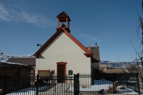
9 places on the National Register of Historic Places.
- 1878Moab is settled
Each edition grades its towns against each other only.

A town of 5,206, settled in 1878. 6.5 times the nonprofits per person than the typical Utah town.
Trash & recyclingMoab earns a D, better than 11% of U.S. towns, mostly because of safety. It reports more crime per resident than 85% of U.S. towns, including 36 violent crimes reported to the FBI in 2025. What it does well: it is more walkable than 92% of U.S. towns. 60% of working residents work locally in Moab, above both Utah’s towns (8.2%) and U.S. towns (8%). No town in Utah scores higher than Moab on civic life. Moab has 9 places on the National Register of Historic Places, among them Courthouse Wash Pictographs and Arthur Taylor House.
Where Moab beats most towns.
Census counts: 333 in 1890, 5,366 in 2020. The archive holds 17 old photos and papers going back to 1889 and 3 maps from 1959 on.
9 places on the National Register of Historic Places.
Each subject compared with towns across the country (schools within Utah), ordered by how far Moab is from typical.
How TownRatings grades towns →
Museums, parks, gardens and other places to visit around Moab. Close and well known come first.
Big draw3 mi National ParkArches National Park1.5M visitors a year
13 mi National ParkCanyonlands National Park796K visitors a year
11 mi State parkDead Horse Point State Park
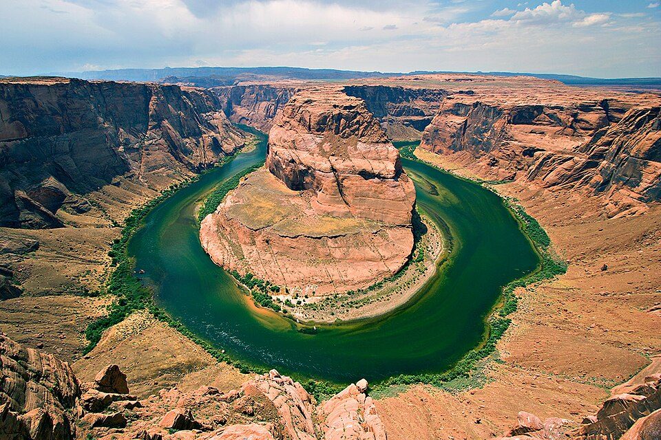
27 mi Canyon & gorgeHorseshoe Canyon
26 mi National Recreation AreaGlen Canyon National Recreation Area3.7M visitors a yearArches National Park: m01229 from USA, CC BY-SA 2.0 · Canyonlands National Park: Phil Armitage, Public domain · Dead Horse Point State Park: Nikater, Public domain · Horseshoe Canyon: Surfsupusa at en.wikipedia, CC0 · Glen Canyon National Recreation Area: User:Moondigger, CC BY-SA 2.5
Who provides power, water and the rest in Moab, and how to reach them.
EPA SDWIS (Oct 9, 2026) · HIFLD + EIA-861 2025 · Census 2020 ZCTAs · NCES 2024–25 · registration: vote.gov, updated Mar 13, 2026.
Ordered by what stands out in Moab.
Moab has more 90° days than nearly all U.S. towns and is healthier than towns with similar incomes, but it reports violent crime at 3 times the Utah rate.
Only 9 of the 117 Utah towns we compare have a higher trail network density than Moab. Trails total 16 miles in 8 parks and preserves.
| Biggest places to walk | Trails | Acres |
|---|---|---|
| 1. Bullick Cross Creek Park | 0.1 mi | 9 |
| 2. Swanny City Park | — | 8 |
| 3. Center Street Ballparks | — | 6 |
Trails & parks © OpenStreetMap contributors · Conserved land: USGS PAD-US
Its public schools are run by the Grand District. Two of its 6 schools are below, each with the reason it’s listed. The largest public high school is Grand County High, with 469 students.
| School | Level | Students | Letter |
|---|---|---|---|
| Helen M. Knight SchoolLargest public elementary schoolGrades K–6 | Grades K–6 | 686 | C− |
| Grand County HighLargest public high schoolGrades 9–12 | Grades 9–12 | 469 | C |
NCES · EDFacts · graded within UT on state tests and graduation
Violent crime runs at 6.9 per 1,000 residents, 3 times the Utah rate; the Safety Grade counts each violent crime four times, so this weighs most on that grade.
Moab’s level of property crime comes in at 15.4 per 1,000 residents. Only 2 of the 62 Utah towns we compare have a higher violent crime rate than Moab.
| Moab | Utah towns | U.S. towns | |
|---|---|---|---|
| Violent crimes per 1,000 (2025) | 6.9 per 1,000 residents | 1.4 | 1.6 |
| Property crimes per 1,000 (2025) | 15.4 per 1,000 residents | 8.6 | 9.9 |
FBI crime data, 2025 · crimes reported to police
The Moab weather station records that about 108 days a year reach 90°, more than in 96% of U.S. towns. July afternoons average 98.3°, hotter than in 99% of U.S. towns; January nights average 20.2°.
In Moab, the peak summer temperature is 98°F. About 9 inches of snow falls in a winter.
| Moab | Utah towns | U.S. towns | |
|---|---|---|---|
| July high | 98°F | 92°F | 85°F |
| January low | 20°F | 20°F | 22°F |
NOAA U.S. Climate Normals, 1991–2020
The average commute for its 3,040 working residents takes 11.7 minutes, against 22.1 across Utah.
16% of Moab residents live below the poverty line. Of the 119 Utah towns we compare, none has a lower average trip to work than Moab. Since 2013, Moab has added 917 jobs, to 4,254 in 2023. The median commute is under 1 miles.
| Moab | Utah towns | U.S. towns | |
|---|---|---|---|
| Average trip to work | 12 minutes | 22 minutes | 25 minutes |
| Below the poverty line | 16% | 6.2% | 9.6% |
| Median household income | $62,000 | $101,000 | $80,000 |
| Work from home | 8.4% | 16% | 11% |
Census LEHD 2023 · ACS
15.9% of residents live below the poverty line, against 8.5% across Utah, which weighs on its C for jobs and income.
In Moab, 39% of adults 25 and older hold a bachelor’s degree or more. People 65 and older are 18% of residents (12% statewide); children under 18 are 22% of residents (28% statewide). Since 2020, Moab has lost 2.8% of its people, to 5,206 in the Census Bureau’s 2025 estimate.
| Moab | Utah towns | U.S. towns | |
|---|---|---|---|
| Under 18 | 22% | 30% | 22% |
| Median age | 35.8 years | 32.6 years | 40.5 years |
| Bachelor’s degree or more, 25+ | 39% | 36% | 29% |
| Aged 65 or older | 18% | 11% | 18% |
47% women, 53% men
That’s an even split within the survey’s margin of ±5.1 points. Across Utah, 49.3% of residents are women.
| Moab | UT | U.S. | |
|---|---|---|---|
| Under 10 | 9.2% | 14.6% | 11.6% |
| 10 to 17 | 12.9% | 13.2% | 10.3% |
| 18 to 24 | 9.7% | 11.6% | 9.1% |
| 25 to 34 | 16.4% | 14.8% | 13.7% |
| 35 to 44 | 15.9% | 13.8% | 13.2% |
| 45 to 54 | 8.6% | 11% | 12.2% |
| 55 to 64 | 9.7% | 9.1% | 12.7% |
| 65 to 74 | 13.6% | 7.3% | 10.2% |
| 75 and older | 4.1% | 4.6% | 7% |
| No diploma | 6.8% | 6.6% | 10.4% |
| High school | 18.5% | 22.3% | 26% |
| Some college | 28.3% | 23.5% | 19.1% |
| Associate’s | 7% | 9.9% | 8.8% |
| Bachelor’s | 27% | 24.7% | 21.6% |
| Graduate | 12.4% | 13% | 14.1% |
Census population estimates, 2025 · U.S. Census Bureau · ACS 2020-2024 5-year estimates
Against the 9,319 U.S. towns with household incomes like Moab’s, it is healthier than 81%, so its B isn’t only a matter of income. Within Utah it is less healthy than 94% of the 118 graded towns: Utah sets a high bar.
For adults in Moab, the share who get no exercise outside work is 22%. On the CDC’s 32 measures, Moab is ahead of Utah on 1 and behind on 17. Only 5 of the 118 Utah towns we compare have a higher share of adults who report frequent physical distress than Moab.
| Moab | Utah towns | U.S. towns | |
|---|---|---|---|
| Yearly checkup (CDC PLACES) | 71% | 72% | 79% |
| Frequent physical distress (CDC PLACES) | 15% | 12% | 14% |
| Binge drink (CDC PLACES) | 12% | 11% | 16% |
| Fair or poor health (CDC PLACES) | 21% | 15% | 19% |
| What stands out | Moab | UT |
|---|---|---|
| More adults treating high blood pressure | 70.5% | 65.6% |
| More older adults who have lost all their teeth | 16.1% | 9.8% |
CDC PLACES 2025 · modeled estimates for adults · CMS · HRSA
At 8.6 years of the county’s $67K median household income, the typical home (about $576K) costs more against local pay than in 94% of Utah towns; that ratio is one input to its C− for cost of living. Values fell 2.6% in the past year while the Utah typical home rose 1.2%.
Moab’s midpoint rent stands at $969 a month. Typical home values fell 2.6% in the year to September 2026.
Census ACS, 2020–24 · Zillow Home Value Index · Redfin Data Center
Expected losses in Moab break down as 59% from inland flooding and 19% from lightning. FEMA expects less storm and flood damage in the town than in 56% of U.S. communities. Also worth knowing: the national flood insurance program has paid 5 claims locally since 2021.
FEMA flood insurance claims · FEMA National Risk Index · OpenFEMA
None within 15 miles of Moab; the nearest are
About 3 of every 100 Moab residents are enrolled in college, against 8 across Utah.
25.5% of the town is conserved land, across 8 parks and preserves.
9 places in Moab on the National Register of Historic Places.
5 notable people were born in Moab.
City in the United States
Moab ( ) is the largest city in and the county seat of Grand County in eastern Utah in the western United States, known for its dramatic scenery. The population was 5,366 at the 2020 census. Moab attracts many tourists annually, mostly visitors to the nearby Arches and Canyonlands National Parks. The town is a popular base for mountain bikers who ride the extensive network of trails including the Slickrock Trail, and for off-roaders who come for the annual Moab Jeep Safari. Moab is home to one of the nine regional campuses of Utah State University.
From Wikipedia, licensed CC BY-SA 4.0 · facts via Wikidata (CC0)
Short answers, built from the data on this page.
Moab grades D overall, better than 11% of U.S. towns. It grades B for health, C− for safety and C for schools. Safety is its weak spot, with a C−.
Yes. That is 8.6 years of the area's median household income ($67,106 across the county). Cost of living, which also weighs rents, property taxes and how many households pay 30% or more of their income for housing, grades C−.
5 notable people were born here, including Jacques Boyer and Rex Berry.