Guest, Sign inJoin
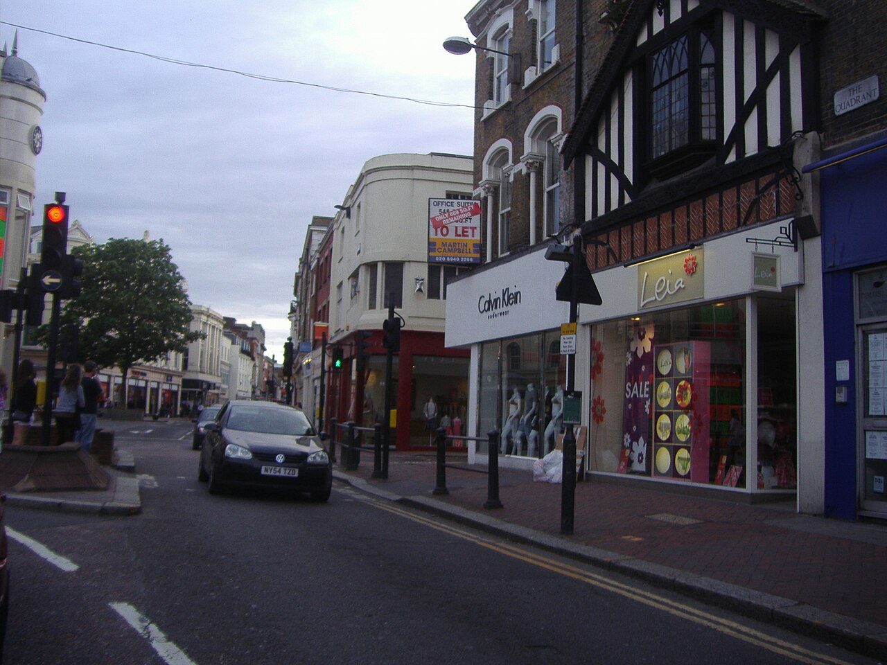
The Quadrant, Richmond town centrePhoto: David Howard · CC BY-SA 2.0
A−Outdoors Grade
Outdoors in Richmond upon Thames · parks, paths & countryside

Richmond upon Thames has more footpath per square kilometre than 9 in 10 UK towns

Footpaths add up to 645 km in the borough and the kilometre around it, 7.6 for every square kilometre. Parks and playing fields in Richmond upon Thames add up to 5.7 ha for every 1,000 residents; the typical UK town has 2.1. 83% of residents live within a 5-minute walk of a park or playing field. Richmond upon Thames grades A− for the outdoors: #4 of 33 in London. A character grade: it isn’t part of the overall grade.

Green space
5.7 ha
per 1,000 residents
Typical UK town 2.1
Near a park
83%
of residents within 400 m
Typical UK town 83%
Footpaths
645 km
7.6 km per km², town + 1 km
Typical UK town 3.0 per km²
Protected landscape
0%
of the land within 5 km
Nearest: Surrey Hills National Landscape
Character

What kind of outdoors borough is Richmond upon Thames?

Read from the data: what stands out first, good and bad.

Richmond upon Thames’ strongest suit is dense footpaths, followed by plenty of park space.

Outdoors grade

Richmond upon Thames grades A− for the outdoors

Each chart is every UK town of 1,000 or more on one measure: the green bar is Richmond upon Thames, the dashed line the typical town. The number is the share of towns it beats; the five are averaged and the average ranked again.

A−
Better than 82% of UK towns#4 of 33 in London · 10th of 40 UK boroughs its size
Public green space5.7 haper 1,000 residents: parks, gardens, playing fields, play spaces
typical 2.1 ha010+
89out of
100
A park within a walk83%of residents within 400 m (a 5-minute walk)
typical 83%0100+
53out of
100
National Park or National Landscape0%of the land within 5 km · None within 5 km
none100+
31out of
100
Footpaths7.6 kmper km², the town and 1 km around it
typical 3.0 km010+
99out of
100
The sea0%of the area within 5 km · Inland: 1.3% sea, under the 5% that counts
none80+
42out of
100

Graded, never part of the overall grade (like History and Civic life). It measures what is mapped: OS Open Greenspace leaves out woodland and open-access land that isn’t a park, and OpenStreetMap’s rural paths are more complete in some places than others.

Boroughs its size

Richmond upon Thames is 10th of 40 UK boroughs its size for the outdoors

The 40 UK towns and cities of 135,000 to 260,000 people with an Outdoors Grade. Hover a dot for its figures; tap one for its page.

0255075100Wolverhampton (West Midlands): C · 1.8 ha green space per 1,000 · 76% near a park · 2.8 km path per km²Slough (Berkshire): C · 1.9 ha green space per 1,000 · 82% near a park · 2.8 km path per km²Barking and Dagenham (London): C+ · 2.4 ha green space per 1,000 · 82% near a park · 2.8 km path per km²Blackpool (Lancashire): C+ · 1.6 ha green space per 1,000 · 75% near a park · 2.3 km path per km²Southend-on-Sea (Essex): C+ · 1.5 ha green space per 1,000 · 62% near a park · 3 km path per km²Havering (London): C+ · 2.6 ha green space per 1,000 · 72% near a park · 3.3 km path per km²Hammersmith and Fulham (London): B− · 1 ha green space per 1,000 · 93% near a park · 5.6 km path per km²Islington (London): B− · 0.6 ha green space per 1,000 · 98% near a park · 7.7 km path per km²Sunderland (Tyne and Wear): B− · 1.5 ha green space per 1,000 · 76% near a park · 3.3 km path per km²Bolton (Greater Manchester): B · 2.2 ha green space per 1,000 · 85% near a park · 4.2 km path per km²Cambridge (Cambridgeshire): B · 2.3 ha green space per 1,000 · 79% near a park · 5.4 km path per km²Northampton (Northamptonshire): B · 2.6 ha green space per 1,000 · 85% near a park · 4.1 km path per km²Kingston upon Thames (London): B · 3.3 ha green space per 1,000 · 71% near a park · 5.4 km path per km²Hackney (London): B · 1.4 ha green space per 1,000 · 97% near a park · 8.6 km path per km²Kensington and Chelsea (London): B · 1.5 ha green space per 1,000 · 99% near a park · 7.1 km path per km²York (North Yorkshire): B · 2.3 ha green space per 1,000 · 89% near a park · 4.4 km path per km²Reading (Berkshire): B+ · 1.7 ha green space per 1,000 · 73% near a park · 4.6 km path per km²Camden (London): B+ · 2 ha green space per 1,000 · 90% near a park · 7.9 km path per km²Norwich (Norfolk): B+ · 1.9 ha green space per 1,000 · 77% near a park · 5.4 km path per km²Huddersfield (West Yorkshire): B+ · 1.4 ha green space per 1,000 · 94% near a park · 4.3 km path per km²Oxford (Oxfordshire): B+ · 2.4 ha green space per 1,000 · 90% near a park · 5.4 km path per km²Warrington (Cheshire): B+ · 3.5 ha green space per 1,000 · 93% near a park · 3.5 km path per km²Peterborough (Cambridgeshire): B+ · 3.7 ha green space per 1,000 · 96% near a park · 3.3 km path per km²Portsmouth (Hampshire): A− · 1.2 ha green space per 1,000 · 82% near a park · 3.5 km path per km²Ipswich (Suffolk): A− · 2.6 ha green space per 1,000 · 79% near a park · 3.9 km path per km²Luton (Bedfordshire): A− · 1.9 ha green space per 1,000 · 78% near a park · 4.9 km path per km²Sutton (London): A− · 2.9 ha green space per 1,000 · 85% near a park · 3.8 km path per km²Merton (London): A− · 3.3 ha green space per 1,000 · 89% near a park · 5.5 km path per km²Westminster (London): A− · 2.6 ha green space per 1,000 · 98% near a park · 8.2 km path per km²Bournemouth (Dorset): A− · 1.9 ha green space per 1,000 · 81% near a park · 3.2 km path per km²Richmond upon Thames (London): A− · 5.7 ha green space per 1,000 · 83% near a park · 7.6 km path per km²Swansea (West Glamorgan): A · 3.2 ha green space per 1,000 · 86% near a park · 2.1 km path per km²Middlesbrough (North Yorkshire): A · 2.6 ha green space per 1,000 · 85% near a park · 2.9 km path per km²Kingswood and Fishponds (Gloucestershire): A · 3.1 ha green space per 1,000 · 85% near a park · 6.1 km path per km²Telford (Shropshire): A · 3.2 ha green space per 1,000 · 96% near a park · 4 km path per km²Milton Keynes (Buckinghamshire): A · 8 ha green space per 1,000 · 99% near a park · 6.3 km path per km²Poole (Dorset): A · 2.5 ha green space per 1,000 · 81% near a park · 3.4 km path per km²Southampton (Hampshire): A · 2.3 ha green space per 1,000 · 80% near a park · 5.6 km path per km²Bexley (London): A+ · 2.8 ha green space per 1,000 · 84% near a park · 5.2 km path per km²Swindon (Wiltshire): A+ · 3.1 ha green space per 1,000 · 96% near a park · 5.9 km path per km²Richmond upon Thames
Outdoors score: the share of UK towns each one beats
Footpath, km per km²
Richmond upon Thames7.6
Boroughs its size4.3
London towns5.7
All UK towns3.0
Green space, ha per 1,000 residents
Richmond upon Thames5.7
Boroughs its size2.3
London towns2.0
All UK towns2.1
Residents within 400 m of a park
Richmond upon Thames83%
Boroughs its size85%
London towns85%
All UK towns83%

Against boroughs its size, Richmond upon Thames stands out most for park space per resident: only 1 of the other 39 has more.

Show as a table
TownOutdoorsGreen spaceNear a parkPath per km²Protected
1Swindon WiltshireA+3.196%5.921%
2Bexley LondonA+2.884%5.20%
3Southampton HampshireA2.380%5.613%
4Poole DorsetA2.581%3.420%
5Milton Keynes BuckinghamshireA899%6.30%
6Telford ShropshireA3.296%46%
7Kingswood and Fishponds GloucestershireA3.185%6.110%
8Middlesbrough North YorkshireA2.685%2.93%
9Swansea West GlamorganA3.286%2.19%
10Richmond upon Thames LondonA−5.783%7.60%
11Bournemouth DorsetA−1.981%3.21%
12Westminster LondonA−2.698%8.20%
13Merton LondonA−3.389%5.50%
14Sutton LondonA−2.985%3.81%
15Ipswich SuffolkA−2.679%3.912%
16Luton BedfordshireA−1.978%4.926%
17Portsmouth HampshireA−1.282%3.52%
18Peterborough CambridgeshireB+3.796%3.30%
19Warrington CheshireB+3.593%3.50%
20Oxford OxfordshireB+2.490%5.40%
21Huddersfield West YorkshireB+1.494%4.31%
22Norwich NorfolkB+1.977%5.44%
23Camden LondonB+290%7.90%
24Reading BerkshireB+1.773%4.626%
25York North YorkshireB2.389%4.40%
26Kensington and Chelsea LondonB1.599%7.10%
27Hackney LondonB1.497%8.60%
28Kingston upon Thames LondonB3.371%5.40%
29Northampton NorthamptonshireB2.685%4.10%
30Cambridge CambridgeshireB2.379%5.40%
31Bolton Greater ManchesterB2.285%4.20%
32Sunderland Tyne and WearB−1.576%3.30%
33Islington LondonB−0.698%7.70%
34Hammersmith and Fulham LondonB−193%5.60%
35Havering LondonC+2.672%3.30%
36Blackpool LancashireC+1.675%2.30%
37Southend-on-Sea EssexC+1.562%30%
38Barking and Dagenham LondonC+2.482%2.80%
39Slough BerkshireC1.982%2.80%
40Wolverhampton West MidlandsC1.876%2.80%
The map

Parks, footpaths & countryside

Tap a number to zoom to a park. Tap a layer to hide it. The dashed line is Richmond upon Thames’ built-up area.

12345678
Green space: parks, gardens, playing fields and play spaces, named or not.© OpenStreetMap contributors · Contains OS data © Crown copyright · Natural England / NRW
Places to walk

Parks to walk in, in and around Richmond upon Thames

The biggest is Richmond Park, 951 ha (2,351 acres). Directions go to the park’s nearest public entrance where Ordnance Survey maps one.

All 30 named parks by size: 2,668 ha (6,593 acres) and 428 km of pathRichmond Park951 ha · 179.6 km of pathRichmond Park: 951 ha, 179.6 km of pathBushy Park347 ha · 81.2 km of pa…Bushy Park: 347 ha, 81.2 km of pathHampton Court Park259 ha · 15.9 km of pa…Hampton Court Park: 259 ha, 15.9 km of pathHampton Court…259 ha · 15.9 km o…Hampton Court Park: 259 ha, 15.9 km of pathHampton Court…259 ha · 15.9 km o…Hampton Court Park: 259 ha, 15.9 km of pathRoyal Bo…129 ha · 29…Royal Botanic Gardens: 129 ha, 29.8 km of path91 haHounslow Heath: 91 ha, 14.4 km of path43 haHam Common: 43 ha, 9.4 km of path41 haBarnes Common: 41 ha, 11.2 km of pathCrane Park: 31 ha, 5.1 km of path28 haOld Deer Park Recreation Ground: 28 ha, 1.4 km of path26 haMarble Hill Park: 26 ha, 2.9 km of path24 haHurst Park: 24 ha, 4.1 km of path24 haPetersham Park: 24 ha, 3.5 km of pathPutney Lower Common: 18 ha, 7.6 km of pathWaterhouse Woodland Garden: 17 ha, 4.5 km of pathRiverside Lands School Playing Fields: 17 haBarn Elms Playing Fields: 14 ha, 1.3 km of pathHampton Common: 13 ha, 2.5 km of pathDe Brome Open Space: 13 ha, 4.1 km of pathThe Copse: 10 ha, 3.7 km of pathHatherop Road Recreation Ground: 9.4 ha, 1.8 km of pathHampton Court Green: 6.7 ha, 1 km of pathTerrace Gardens: 6.7 ha, 2.7 km of pathHeathfield Recreation Ground: 6.4 ha, 1.4 km of pathCanbury Gardens: 6.1 ha, 1.5 km of pathPalewell Common: 5.7 ha, 1 km of pathRichmond Green: 4.1 ha, 1 km of pathHampton Court Gardens the Wilderness: 3.7 ha, 1.8 km of pathBarnes Green: 3.4 ha, 1.4 km of path
Parks & gardens 2,580 haPlaying fields 88 ha

The two biggest, Richmond Park and Bushy Park, are 49% of the named green space and carry 261 km of path between them.

Richmond upon Thames’ biggestHistoric park · Grade I

Richmond Park

Park or garden
951 ha (2,351 acres)179.6 km of path
39 h 55 minto walk all 179.6 km of path
1,332 pitchesfootball pitches would fit
0.9 mi eastfrom the centre
Playground Peak Viewpoint 1 listedQueen's RideTerrace WalkCamellia Walk+4 paths
Directionsto the nearest entrance

Bushy Park

Park or garden
347 ha (857 acres)81.2 km of path
18 hto walk all 81.2 km of path
486 pitchesfootball pitches would fit
2 mi south-westfrom the centre
11 listed
Directionsto the nearest entrance

Hampton Court Park

Park or garden
259 ha (641 acres)15.9 km of path
3 h 35 minto walk all 15.9 km of path
363 pitchesfootball pitches would fit
2.7 mi southfrom the centre
Banqueting House Grade I Tennis Court Grade I +5 listedSurbiton Avenue
Directionsto the nearest entrance

Hampton Court Park

Park or garden
259 ha (641 acres)15.9 km of path
3 h 35 minto walk all 15.9 km of path
363 pitchesfootball pitches would fit
2.7 mi southfrom the centre
Banqueting House Grade I Tennis Court Grade I +5 listedSurbiton Avenue
Directionsto the nearest entrance

Hampton Court Park

Park or garden
259 ha (641 acres)15.9 km of path
3 h 35 minto walk all 15.9 km of path
363 pitchesfootball pitches would fit
2.7 mi southfrom the centre
Banqueting House Grade I Tennis Court Grade I +5 listedSurbiton Avenue
Directionsto the nearest entrance

Royal Botanic Gardens

Park or garden
129 ha (319 acres)29.8 km of path
6 h 40 minto walk all 29.8 km of path
181 pitchesfootball pitches would fit
1.9 mi north-eastfrom the centre
Viewpoint Aroid House Number 1 Grade II* Avenue Lodge Grade II* +19 listedHolly WalkCart TrackRiverside Walk+5 paths
Directionsto the nearest entrance

Hounslow Heath

Park or garden
91 ha (226 acres)14.4 km of path
3 h 10 minto walk all 14.4 km of path
128 pitchesfootball pitches would fit
2.5 mi westfrom the centre
Nature reserve
Directionsto the nearest entrance

Barnes Common

Park or garden
41 ha (102 acres)11.2 km of path
2 h 30 minto walk all 11.2 km of path
58 pitchesfootball pitches would fit
3.3 mi eastfrom the centre
Directionsto the nearest entrance
All 30 named parks and green spaces
Richmond ParkPark or garden · 951 ha · 179.6 km of path
Directions
Bushy ParkPark or garden · 347 ha · 81.2 km of path
Directions
Hampton Court ParkPark or garden · 259 ha · 15.9 km of path
Directions
Hampton Court ParkPark or garden · 259 ha · 15.9 km of path
Directions
Hampton Court ParkPark or garden · 259 ha · 15.9 km of path
Directions
Royal Botanic GardensPark or garden · 129 ha · 29.8 km of path
Directions
Hounslow HeathPark or garden · 91 ha · 14.4 km of path
Directions
Barnes CommonPark or garden · 41 ha · 11.2 km of path
Directions
Ham CommonPark or garden · 43 ha · 9.4 km of path
Directions
Crane ParkPark or garden · 31 ha · 5.1 km of path
Directions
Putney Lower CommonPark or garden · 18 ha · 7.6 km of path
Directions
Hurst ParkPark or garden · 24 ha · 4.1 km of path · just outside town
Directions
Marble Hill ParkPark or garden · 26 ha · 2.9 km of path
Directions
Petersham ParkPark or garden · 24 ha · 3.5 km of path
Directions
Waterhouse Woodland GardenPark or garden · 17 ha · 4.5 km of path · just outside town
Directions
De Brome Open SpacePark or garden · 13 ha · 4.1 km of path · just outside town
Directions
Old Deer Park Recreation GroundPlaying field · 28 ha · 1.4 km of path
Directions
The CopsePark or garden · 10 ha · 3.7 km of path
Directions
Hampton CommonPlaying field · 13 ha · 2.5 km of path
Directions
Terrace GardensPark or garden · 6.7 ha · 2.7 km of path
Directions
Barn Elms Playing FieldsPlaying field · 14 ha · 1.3 km of path
Directions
Riverside Lands School Playing FieldsPlaying field · 17 ha · just outside town
Directions
Hatherop Road Recreation GroundPlaying field · 9.4 ha · 1.8 km of path
Directions
Canbury GardensPark or garden · 6.1 ha · 1.5 km of path · just outside town
Directions
Hampton Court GreenPark or garden · 6.7 ha · 1.0 km of path
Directions
Palewell CommonPark or garden · 5.7 ha · 1.0 km of path
Directions
Hampton Court Gardens the WildernessPark or garden · 3.7 ha · 1.8 km of path
Directions
Heathfield Recreation GroundPlaying field · 6.4 ha · 1.4 km of path
Directions
Barnes GreenPark or garden · 3.4 ha · 1.4 km of path
Directions
Richmond GreenPark or garden · 4.1 ha · 1.0 km of path
Directions
Close to home

8 in 10 Richmond upon Thames residents live within a 5-minute walk of a park

Each square is 1 in 100 residents: green lives within 400 m of a public park, garden or playing field (Census 2021 output areas against OS Open Greenspace).

Within 400 m (83%)Further (17%)
Richmond upon Thames83%
Boroughs its size85%
London towns85%
All UK towns83%

About 33,000 people live further than that. Playing fields count, so a park within reach isn’t always one with paths or trees; 296 playgrounds are mapped in and around the borough, about one for every 652 residents.

National Parks & National Landscapes

The Surrey Hills National Landscape is 7.7 mi away

Protected landscapes within 30 km, by direction and distance from the edge of the built-up area; circle size shows each one’s area. National Landscapes were called Areas of Outstanding Natural Beauty until 2023.

4.5 mi9 mi13.5 mi18 miNSurrey Hills7.7 mi southSurrey Hills National Landscape: 7.7 mi south of Richmond upon Thames’ edge · 422 km² · since 1958Chilterns14 mi north-westChilterns National Landscape: 14 mi north-west of Richmond upon Thames’ edge · 838 km² · since 1990Kent Downs17 mi south-eastKent Downs National Landscape: 17 mi south-east of Richmond upon Thames’ edge · 879 km² · since 1968Richmond upon Thames
National ParkNational LandscapeThe 5 km the grade counts
National Landscape

Surrey Hills

7.7 mi south422 km²since 1958
Official site
National Landscape

Chilterns

14 mi north-west838 km²since 1990
Official site
National Landscape

Kent Downs

17 mi south-east879 km²since 1968
Official site
Footpaths & waymarked walks

24 waymarked walks pass through or near Richmond upon Thames

645 km of footpaths, bridleways and rights of way are mapped in Richmond upon Thames and the kilometre around it, 7.6 km for every square kilometre (the typical UK town has 3.0). Bars show each route’s kilometres within 2 km of the borough.

NationalRegionalLocalOther waymarked
Thames Path32.5 km
Thames Path - northern bank24.5 km
London LOOP (Section 9)14.2 km
Tamsin Trail - hiking9.5 km
Beverley Brook Walk6.5 km
Kingston Station to Ham House Walk, Ham House5.9 km
Thames Path Kew Gardens diverted due to bank collapse5.9 km
Capital Ring (Section 06)5.3 km
Barnes Trail Extension5.1 km
Capital Ring (Section 07)5.0 km
Historic views of Ham House walk, Ham House4.9 km
Richmond Station to Ham House Historic Scenic Walk, Ham House4.4 km
Barnes Trail3.6 km
London LOOP (Section 8)2.9 km
Thames Down Link2.6 km
Hogsmill Valley Walk2.6 km

Plus 8 more waymarked walks on the map.

The Thames Path, a national route, passes Richmond upon Thames. Close to home, the Tamsin Trail - hiking has 10 km of local walk within 2 km of the borough. 12 regional routes pass through, including the Thames Path - northern bank, London LOOP (Section 9), Capital Ring (Section 06) and Capital Ring (Section 07).

Waymarked walks are OpenStreetMap walking routes. Public rights of way are only as complete as the map in each area.

History along the way

15 historic parks, and what stands in them

Historic England’s register of parks and gardens, and the listed buildings and scheduled monuments that stand inside Richmond upon Thames’ named parks.

Registered park · Grade II

Terrace Gardens

6.7 ha. Part of Terrace and Buccleuch Gardens, a registered historic park (Grade II). 5 listed structures and monuments stand inside it or at its edge.

IIFormer Service Wing and Library Langholm LodgeIIFormer Stables and Coach House, Langholm LodgeIIIron Overthrow Lampholder on Edge of Pavement in Front of the WickIIPark Keepers Hut, Terrace GardensIITunnel under Petersham Road
Registered · Grade IBushy Park9.6 haInside: Brick Boundary Walls and 10 more
Registered · Grade IHampton Court15 ha
Registered · Grade IRichmond Park4.2 ha
Registered · Grade IRoyal Botanic Gardens, Kew23 ha
Registered · Grade II*Ham House7.1 ha
Registered · Grade II*Hampton Court House3.5 ha
Registered · Grade II*Marble Hill2.6 ha
Registered · Grade II*Richmond Terrace Walk0.4 ha
Registered · Grade II*Strawberry Hill5.0 ha
Show 8 more
Registered · Grade IIGarrick's Villa1.9 ha
Registered · Grade IILandscape at Fieldend2.1 ha
Registered · Grade IIPope's Garden1.3 ha
Registered · Grade IITeddington Cemetery5.5 ha
Registered · Grade IIYork House2.4 ha
Listed buildings insideMarble Hill ParkGazebo in Grounds of South End House, Stable Block to Marble Hill and White Lodge to Marble Hill Park and 1 more
Listed buildings insideRoyal Botanic GardensAroid House Number 1, Avenue Lodge and Herbarium Complex, Royal Botanic Gardens, Kew - Hunter House and Wings C, B and A, including the entrance gates and railings and 18 more
Listed buildings insideHampton Court Gardens the WildernessHampton Court Lion Gates, Hampton Court Tilt Yard Tower and Tennis Court and 3 more
Heritage walks
Historic views of Ham House walk, Ham House 4.9 km Richmond Station to Ham House Historic Scenic Walk, Ham House 4.4 km Grand Union Canal Walk 2.0 km

A listed building or monument counts when it sits inside the park’s OS Open Greenspace outline (to about 15 m), so a few at the boundary are included. Historic England, National Heritage List for England.

When to get out

The best walking months in Richmond upon Thames: May to September

The borough’s 1991–2020 averages (Met Office HadUK-Grid) and the daylight at its latitude. Outlined months have 12½+ hours of daylight, highs of 15 °C or more and little rain for the town.

JanFebMarAprMayJunJulAugSepOctNovDec
Daylight (h)8.39.911.713.815.616.616.214.612.510.68.87.9
High (°C)891215182123232016119
Rain (mm)604538434450455452676860

March is the driest month (38 mm) and July the warmest (highs of 23 °C). Winter days are short, about 8 hours of daylight in December, and 68 mm of rain falls in November, the wettest month. Frost comes on about 30 nights a year. The climate in Richmond upon Thames →

The coast

Beaches near Richmond upon Thames

1% of the area within 5 km of Richmond upon Thames is sea, so the Outdoors Grade counts it as inland. 75 beaches are mapped within 5 km, 3 with a name.

The Hollows0.1 mi from town
Directions
Hog Hole0.1 mi from town
Directions

Sea: the area outside the ONS coastline (mean high water). Bathing water quality is published by the Environment Agency (England) and Natural Resources Wales; check it before swimming.

Things to do

14 viewpoints and 296 playgrounds

Mapped within 2 km of the borough in OpenStreetMap, against the typical UK borough its size per resident. Named places are listed with directions; unnamed ones are only counted.

Every named place, with directions

Viewpoints 14

Meridian Line Marker0.1 mi from town
Directions
King Henry VIII's Mound0.2 mi from town
Directions
Syon Outlook0.5 mi from town
Directions

Plus 11 viewpoints without a name on the map.

Hills and peaks 1

Spankers Hill1.1 mi from town
Directions

Waterfalls 1

Plus 1 waterfall without a name on the map.

Nature reserves 14

Beveree Wildlife Site1.7 ha · in town
Directions
Oak Avenue Nature Reserve1.7 ha · 0.0 mi from town
Directions
Snail Reserve0.0 mi from town
Directions
Crane Park Island Nature Reserve1.7 ha · 0.1 mi from town
Directions
Ham Lands30 ha · 0.1 mi from town
Directions
Charter Quay Wildlife Habitat0.1 mi from town
Directions
Pevensey Road Nature Reserve3.0 ha · 0.1 mi from town
Directions
Kempton Nature Reserve54 ha · 0.1 mi from town
Directions

Plus 6 nature reserves without a name on the map.

Picnic sites 19

Plus 19 picnic sites without a name on the map.

Playgrounds 296

Addison Road Community Sports Parkin town
Directions
Adventure Playgroundin town
Directions
Alpha Road Play Areain town
Directions
Church Road Play Areain town
Directions
Craneford Way Recreation Groundin town
Directions
Diamond Jubilee Gardens Playgroundin town
Directions
Ham Close Play Areain town
Directions
Hampton Common Play Areain town
Directions

Plus 288 playgrounds without a name on the map.

Dog parks 7

Kempton dog park0.3 mi from town
Directions
Gwendwr Gardens Dog Exercise Area0.9 mi from town
Directions

Plus 5 dog parks without a name on the map.

Campsites 1

Apps Court Camping0.8 mi from town
Directions

Slipways 27

Drawdockin town
Directions
Teddington Lock Boat Rollersin town
Directions
Richmond Lock Boat Rollers0.0 mi from town
Directions
Chiswick Mall Public Drawdock0.2 mi from town
Directions
Putney Embankment0.6 mi from town
Directions
Sunbury Lock Boat Rollers0.9 mi from town
Directions

Plus 21 slipways without a name on the map.

Next door

The outdoors in nearby towns

The nearest towns of 1,000+ within 12 miles. Tap a town for its outdoors page.

ABCDOutdoors Grade
TownOutdoorsGreen space, ha per 1,000Near a parkProtected within 5 km
Richmond upon ThamesA−5.783%0%
Hounslow 2.2 miB+3.083%0%
Kingston upon Thames 4.0 miB3.371%0%
West Molesey 4.3 miB+4.480%0%
Sunbury-on-Thames 4.6 miC+2.079%0%
Ealing 4.9 miB−1.887%0%
Hammersmith and Fulham 5.3 miB−1.093%0%

Richmond upon Thames grades higher for the outdoors than every neighbour in the table. None of the neighbours has a protected landscape within 5 km either.

Questions about the outdoors in Richmond upon Thames

What is the biggest park in Richmond upon Thames?

Richmond Park, 951 ha (2,351 acres), with 179.6 km of path. Bushy Park (347 ha) is second. 30 named parks, gardens and playing fields are in the borough or within 400 m of it.

Is Richmond upon Thames near a National Park?

The nearest protected landscape is the Surrey Hills National Landscape, 7.7 mi south of the borough’s edge. It covers 422 km² and was designated in 1958.

What are the best walks near Richmond upon Thames?

24 waymarked walking routes pass within 2 km of the borough, including the Thames Path, Thames Path - northern bank and London LOOP (Section 9). Richmond Park alone has 179.6 km of path.

How many people in Richmond upon Thames live near a park?

83% of residents live within 400 m, about a 5-minute walk, of a public park, garden or playing field (Census 2021 output areas against OS Open Greenspace). The typical UK town is 83%.

When is the best time of year for walking in Richmond upon Thames?

May to September: the longest days, the warmest afternoons and the least rain of the year, from the Met Office 1991–2020 averages.

Which parks in Richmond upon Thames are historic?

Bushy Park (Grade I), Hampton Court (Grade I), Richmond Park (Grade I) and Royal Botanic Gardens, Kew (Grade I) are on Historic England’s register of parks and gardens.

Is Richmond upon Thames good for walking?

For paths, yes: 7.6 km of footpath and right of way per square kilometre, more than 99% of UK towns. For park space per person it beats 89% (5.7 ha per 1,000 residents).

How is the Outdoors Grade worked out?

From five measures, each placed among UK towns of 1,000 or more: public green space per resident, the share living near a park, National Park or National Landscape within 5 km, footpaths per square kilometre, and the sea within 5 km. It is a character grade and isn’t part of Richmond upon Thames’ overall grade.

Sources

Where Richmond upon Thames’ outdoors figures come from

  • Parks and green space: Ordnance Survey OS Open Greenspace (parks and gardens, playing fields, play spaces, and their access points). Contains OS data © Crown copyright and database right 2026, Open Government Licence v3.0.
  • National Parks and National Landscapes: Natural England and Natural Resources Wales boundaries, areas and designation dates, Open Government Licence v3.0.
  • Footpaths, walking routes, beaches and things to do: © OpenStreetMap contributors, Open Database License (ODbL), via Geofabrik, 16 October 2026.
  • Historic parks, listed buildings and monuments: Historic England, National Heritage List for England, Open Government Licence v3.0.
  • Rain and temperature: Met Office HadUK-Grid 1991–2020 averages for the town; daylight calculated from its latitude.
  • The sea: ONS Countries (December 2024) boundaries clipped to mean high water. Residents near a park: ONS Census 2021 output areas.
  • Grade: TownRatings’ Outdoors Grade, ranked against UK towns only.

Contains public sector information licensed under the Open Government Licence v3.0. Contains HM Land Registry data © Crown copyright and database right 2026. Contains OS data © Crown copyright and database right 2026 (ONS boundaries). Northern Ireland: Source: NISRA; contains Land & Property Services data and Ordnance Survey of Northern Ireland information, © Crown copyright, licensed under the Open Government Licence v3.0. Scotland: contains National Records of Scotland data, Registers of Scotland data and SEPA data, © Crown copyright / © SEPA 2025, licensed under the Open Government Licence v3.0.