Jamestown’s post office opened in 1836, and 28% of its homes were built before 1940
More historic than 93% of U.S. towns · #12 of 38 in Rhode Island. What drives it
11 places in town are on the National Register, among them three historic districts with 123 buildings between them. Below: 9 old photos and papers, maps from 1889 on, and the census since 1790.
The Jamestown post office opened in 1836, the earliest record of the town by name. Another post office, Fort Greble (1910), opened inside today’s town and later closed.
First census: 507 in 17902020 census: 5,559190 years
How did Jamestown get its name?
Jamestown was named for James, Duke of York, who became King James II in 1685.
How historic is Jamestown?
A
More historic than 93% of U.S. towns, on its age, its old homes and the National Register.
On its age, its old homes and the National Register, Jamestown is more historic than 93% of U.S. towns, #12 of 38 in Rhode Island. All 3 inputs are above most U.S. towns; its National Register listings ranks highest and its age lowest.
A
HistoryA character grade: shown, never part of Jamestown’s overall grade.
Rhode Island towns list more on the Register than most of the country (a typical Rhode Island town has 94.7 per 10,000 residents, the U.S. 2.4), so Jamestown’s 240 sits above most of its state (79% of Rhode Island towns have fewer) while its 133 historic buildings outnumber those of 91% of U.S. towns.
How sure. Graded on any two of the three inputs instead, the letter would still be A. The pre-1940 share is a Census survey estimate (±8.8 points). The founding year is the first post office, not a stated founding date.
Founding year: the first post office (other dates in Quick answers). Homes: Census ACS 2020–24. National Register: National Park Service, May 2026 list; each listing counted once (boundary changes and added documentation belong to their listing), and a historic district counts its contributing buildings. How TownRatings grades history →
What stands out about Jamestown’s past
Read from the archive, the National Register and the record. The page puts what stands out first.
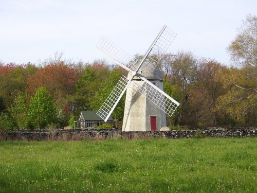
Clark SchoolschoolConanicut BatterymilitaryConanicut Island LightlocaleFort DumplingmilitaryFort GreblemilitaryGould Island LightlocaleHazard FarmlocaleJamestown Primary SchoolschoolJamestown WindmilllocaleJamestown-Newport FerrylocaleNewport Naval Air Facilitymilitary
11cemeteries and burying grounds inside Jamestown
Captain Josiah Arnold LotCautantowwit's Indian LotCedarCottrell GreenFriendsGovernor Caleb CarrHazard LotHenry TewJamestown TownPaineSaint Mark's Catholic
US Post Offices dataset (Blevins & Helbock, CC0). Places and cemeteries from the USGS Geographic Names Information System (2021).
In 1524, Italian navigator Giovanni da Verrazzano and his crew visited Narragansett Bay. Dutch Island was used by fur traders c. 1622, and English colonists in 1638 made arrangements with the Native Americans to use Conanicut Island for grazing sheep.
Ferries were in operation between Conanicut Island and Newport by 1675. In 1678, Conanicut Island was incorporated as the town of Jamestown, when there were about 150 residents. It was named for James, Duke of York, who became King James II in 1685.
By 1710, many of Conanicut Island's current roads were in place. In 1728, the town of Jamestown built a windmill for grinding corn, which used the sea breeze for power since there was no source of running water to turn a waterwheel.
Passages that mention Jamestown, cut from the printed page as they were published.
History of Newport County, Rhode Island. From the year 1638 to the year 1887, including the settlement of its towns, and their subsequent progress1888 · page 740Read the page →
Read the text
Ferry Meadow is a name given to a tract of land upon which considerable of the village of Jamestown has been built, especially the more recent portion. It is a part of the old Howland farm, the land having been taken up by Job Howland in 1670.
Text read by machine from the scan; it may contain errors.
Scans and text from the Internet Archive. Books published in 1930 or earlier, which are in the public domain.
Timeline
Jamestown, 1749 to 1922
Woven from the archive, old maps, post office records, the National Register and the people born here.
Nothing in the archives for these yearsWeddings on Main Street, storms, parades, school pictures, the old store. If it’s in your family album, it belongs here.
Fire insurance maps drew every building, what it was made of and what it was used for, so insurers could price the risk of fire. Pick a year, then a sheet.
The Jamestown post office opened in 1836, the earliest record of the town by name (U.S. post office records).
How does Jamestown rank for history?
Jamestown is more historic than 93% of U.S. towns, #12 of 38 in Rhode Island. The History grade combines the town’s founding era, the share of homes built before 1940 and its National Register listings. It’s a character grade, so it isn’t part of the overall grade. How it works.
What is on the National Register in Jamestown?
11 listings: 4 buildings, 3 historic districts, the Windmill Hill Historic District, the Horsehead-Marbella and the Shoreby Hill Historic District, with 123 contributing buildings, 2 sites, and 2 structures. 133 historic buildings in all.
How old are the homes in Jamestown?
28% of Jamestown’s homes were built before 1940 (Census estimate, ±8.8 points), against a typical 20% for a Rhode Island town; the median home was built in 1975.
Founding dates: Wikidata, Wikipedia, the U.S. post office records of Blevins & Helbock (CC0) and the Census. Homes by year built: Census ACS 2020–24. National Register of Historic Places: National Park Service (list of May 22, 2026). Old photos, postcards and papers: Wikimedia Commons, the Library of Congress and other public archives, credited on each item’s page. Maps: U.S. Geological Survey historical topographic maps (via Esri) and Sanborn fire-insurance maps (Library of Congress). History text and census tables: Wikipedia (CC BY-SA 4.0). Places that used to be: USGS Geographic Names Information System (2021).
From Wikimedia Commons (8), the Library of Congress (1), Wikidata (3), the National Register of Historic Places (11), Wikipedia, Wikidata and Wikipedia for famous people, U.S. Geological Survey historical maps, U.S. Census counts (via Wikipedia), the US Post Offices dataset (Blevins & Helbock), the USGS Geographic Names Information System, Sanborn fire insurance maps (Library of Congress) and old county and town histories (Internet Archive). Archive images are copied here with their credits and licenses, shown on each photo’s page. Refreshed monthly.




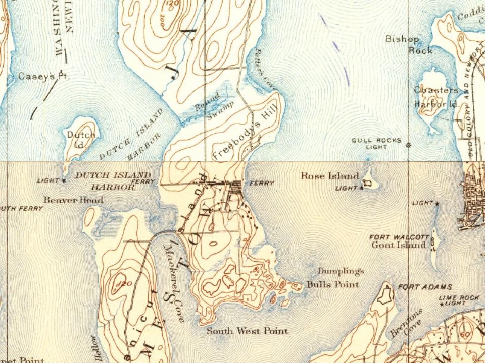
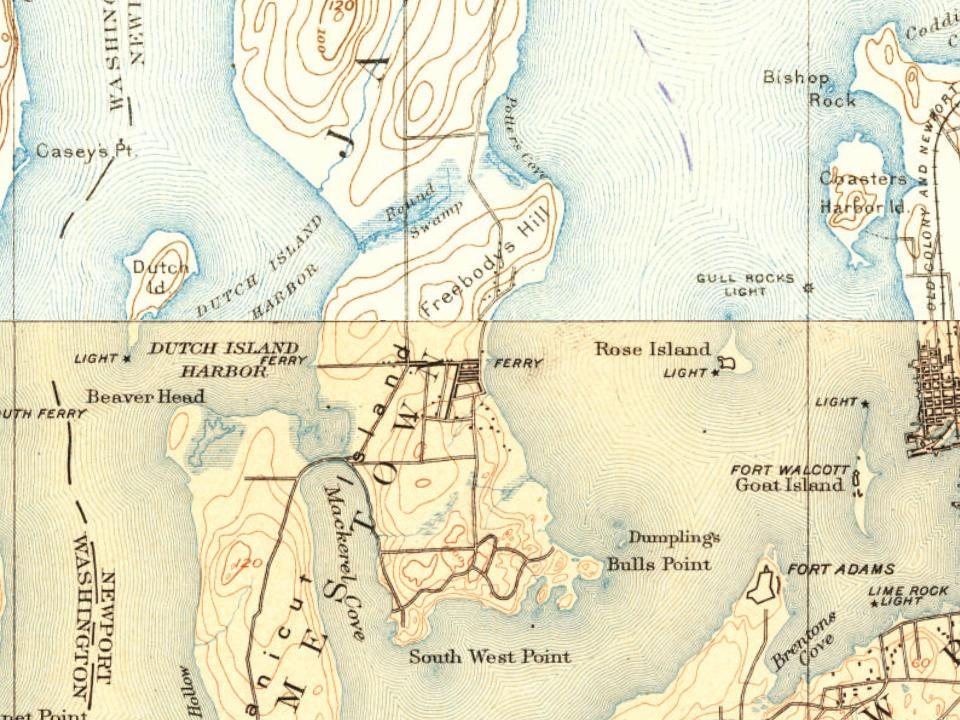
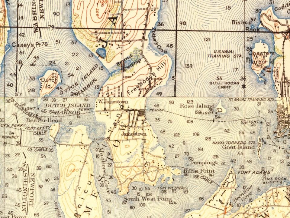
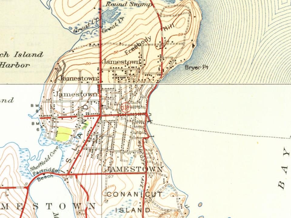
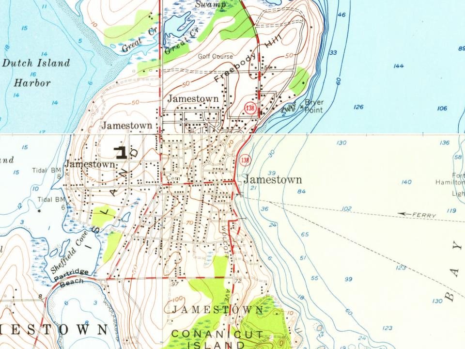
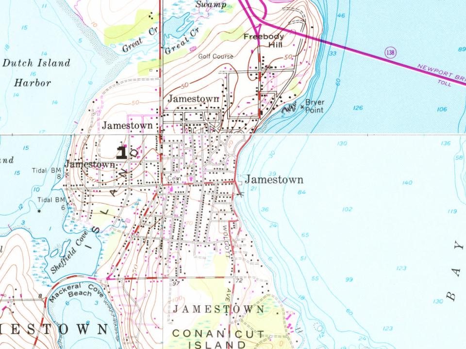


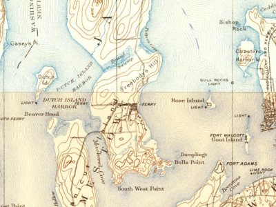


 1877
 1879
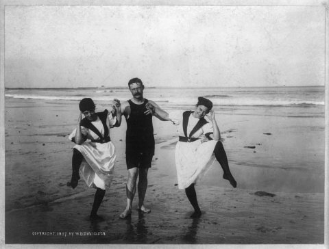 1897
 1897
 1897
 1897
