Guest, Sign inJoin

Post to Hopkinton

We’ll email a one-tap link to publish your post. No password, and nothing is public until you click it.
Already a member? Sign in
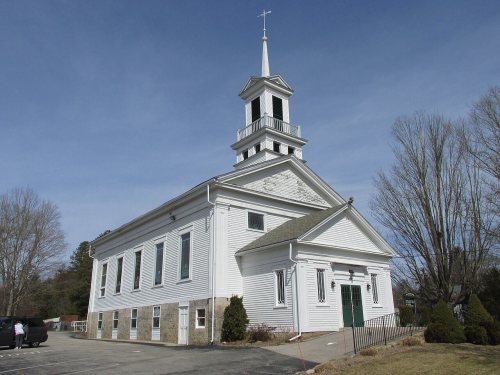
First Baptist Church, Hope Valley RIPhoto: John Phelan · CC BY-SA 3.0
AHistory
History · Hopkinton

Hopkinton’s post office opened in 1811, and 19% of its homes were built before 1940

More historic than 87% of U.S. towns · #20 of 38 in Rhode Island. What drives it

4 places in town are on the National Register, among them two historic districts with 155 buildings between them. Below: 1 old photo or paper, maps from 1889 on, and the census since 1790.

1811first post office
4on the National Register
19%homes built before 1940
1old photo or paper
5famous people
From Hopkinton’s archive · credits on each photo
Quick answers

How Hopkinton began

When was Hopkinton founded?

1811

The Hopkinton post office opened in 1811, the earliest record of the town by name. Three smaller post offices, Woodville (1853), Barberville (1854) and Canonchet (1883), opened inside today’s town and later closed.

First census: 2,462 in 17902020 census: 8,398215 years

How historic is Hopkinton?

A

More historic than 87% of U.S. towns, on its age, its old homes and the National Register.

What drives the grade ↓
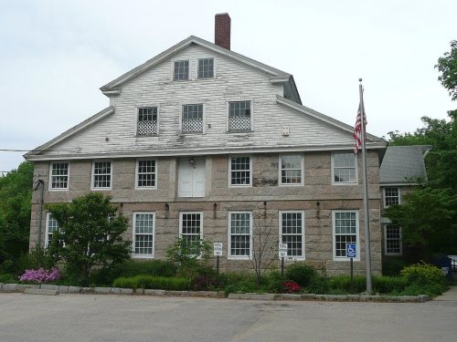
Founding year: the first Hopkinton post office (Blevins & Helbock, CC0).The full story ↓
History grade

What drives Hopkinton’s History grade

On its age, its old homes and the National Register, Hopkinton is more historic than 87% of U.S. towns, #20 of 38 in Rhode Island. All 3 inputs are above most U.S. towns; its National Register listings ranks highest and its share of homes from before 1940 lowest.

A
HistoryA character grade: shown, never part of Hopkinton’s overall grade.
All U.S. towns we grade (21,289)Ahead of 87%
NewerOlder
Rhode Island towns of 2,500+ (38)Ahead of 49%

Rhode Island towns list more on the Register than most of the country (a typical Rhode Island town has 94.7 per 10,000 residents, the U.S. 2.4), so Hopkinton’s 192 sits above most of its state (68% of Rhode Island towns have fewer) while its 162 historic buildings outnumber those of 92% of U.S. towns.

How sure. Graded on any two of the three inputs instead, the letter would still be A−. The pre-1940 share is a Census survey estimate (±5.4 points). The founding year is the first post office, not a stated founding date.

Founding year: the first post office (other dates in Quick answers). Homes: Census ACS 2020–24. National Register: National Park Service, May 2026 list; each listing counted once (boundary changes and added documentation belong to their listing), and a historic district counts its contributing buildings. How TownRatings grades history →

What stands out about Hopkinton’s past

Read from the archive, the National Register and the record. The page puts what stands out first.

★ What stands out · On the National Register

4 listings protect 162 historic buildings

The country’s official list of buildings and places worth saving.

places listed
4
National Historic Landmarks
0
none yet
historic buildings protected
162
each building in a district counts
first listed
1974
Hopkinton City Historic District
BuildingsDistricts

Architectural styles listings

Greek Revival3
Colonial1
Federal1
Italianate1
Vernacular1
Gothic Revival1
All 4 listings

National Park Service, National Register of Historic Places. Photos from Wikimedia Commons, credited on each place’s page.

Places that used to be

Lost post offices, old corners and burying grounds

Hopkinton’s post office has been open since 1811. Three other post offices opened and closed inside today’s town.

Hopkinton
1811–today
Rockville
1849–today
Ashaway
1852–today
Woodville
1853–1925
Barberville
1854–1856
Hope Valley
1864–today
Canonchet
1883–1931
18101920today
Hamlets and corners on the map
AshawayBarbervilleBethelBrudickvilleBurdickvilleCanonchetCentervilleHope ValleyLocustvilleMoscowRockvilleSouth HopkintonWoodville
63family graveyards and cemeteries inside Hopkinton
Avis Barber PlotBabcock Family PlotBarber PlotBitgood PlotBoss PlotBramen PlotBrightman Family PlotBurdick PlotBurton PlotCarpenter PlotCaswell PlotCurtis Maine PlotDaniel Lewis PlotDaniel Peckham LotDoctor Isaac Collins PlotElias Lewis PlotEnos - Crandall PlotFenner PlotFones Palmer PlotFoster - Spencer PlotFrancis Tanner LotFriendsGardiner - Green PlotGeer - Hall LotGeneral George Thurston PlotGeorge Babcock PlotHenry Maryott PlotHezekiah Collins PlotHopkintonHoxie Family PlotHoxsie - Cayer PlotJoseph Burdick LotKenyon PlotLarkin PlotLawton Foster PlotMary Lewis PlotMurre PlotNathan Collins PlotNathan Kinyon PlotNathaniel Cook PlotNathaniel Hall PlotNichols PlotNoyes - Wells LotOak GroveOatley PlotPalmer - Burdick - Appley PlotPalmer Family PlotPeter Davis PlotPine GrovePine GroveReynolds - Johnson LotRobert Browning PlotRockvilleSarah Larkin PlotSmith PlotSpicer PlotThomas Wilbur PlotThompson Wells PlotWells PlotWilbur PlotWitter PlotWoodmansee PlotWorden Plot
See all 63

Avis Barber Plot · Babcock Family Plot · Barber Plot · Bitgood Plot · Boss Plot · Bramen Plot · Brightman Family Plot · Burdick Plot · Burton Plot · Carpenter Plot · Caswell Plot · Curtis Maine Plot · Daniel Lewis Plot · Daniel Peckham Lot · Doctor Isaac Collins Plot · Elias Lewis Plot · Enos - Crandall Plot · Fenner Plot · Fones Palmer Plot · Foster - Spencer Plot · Francis Tanner Lot Cemetery · Friends Burial Ground · Gardiner - Green Plot · Geer - Hall Lot · General George Thurston Plot · George Babcock Plot · Henry Maryott Plot · Hezekiah Collins Plot · Hopkinton Cemetery · Hoxie Family Plot · Hoxsie - Cayer Plot · Joseph Burdick Lot · Kenyon Plot · Larkin Plot · Lawton Foster Plot · Mary Lewis Plot · Murre Plot · Nathan Collins Plot · Nathan Kinyon Plot · Nathaniel Cook Plot · Nathaniel Hall Plot · Nichols Plot · Noyes - Wells Lot · Oak Grove Cemetery · Oatley Plot · Palmer - Burdick - Appley Plot · Palmer Family Plot · Peter Davis Plot · Pine Grove Cemetery · Pine Grove Cemetery · Reynolds - Johnson Lot · Robert Browning Plot · Rockville Cemetery · Sarah Larkin Plot · Smith Plot · Spicer Plot · Thomas Wilbur Plot · Thompson Wells Plot · Wells Plot · Wilbur Plot · Witter Plot · Woodmansee Plot · Worden Plot

US Post Offices dataset (Blevins & Helbock, CC0). Places and cemeteries from the USGS Geographic Names Information System (2021).

The story

How Hopkinton came to be

From Wikipedia’s history of Hopkinton.

Read it all →

Hopkinton is named after Stephen Hopkins, a signer of the Declaration of Independence who was governor of the Colony of Rhode Island and Providence Plantations when the town was partitioned from Westerly and incorporated in 1757. Hopkinton once featured a number of industrial villages, such as Locustville, Moscow, Centerville, and Wood River Iron Works, each being named after the mill which they surrounded. Today only Hope Valley, Rockville, Ashaway, and Bradford are recognized with a post office. The town hall is located in the village of Hopkinton City, which was once a stagecoach hub.

Text from Wikipedia, licensed CC BY-SA 4.0.

Timeline

Hopkinton, 1804 to 1968

Woven from the archive, old maps, post office records, the National Register and the people born here.

  1. 19th century
  2. 1804Born hereBenjamin Babock Thurston is born here
  3. 1811Post officeThe Hopkinton post office opens
  4. 1841Born hereDorcas James Spencer is born here
  5. 1843Born hereEdward Lee Greene is born here
  6. 1849Post officeThe Rockville post office opens
  7. 1852Post officeThe Ashaway post office opens
  8. 1889On the mapFirst mapped by the U.S. Geological Survey
  9. 20th century
  10. 1926Born herePieter Willem Leenhouts is born here
  11. 1968In the archivePawcatuck River Bridge. Burdickville, Washington Co., RI. sec. 4215, mp 147.45. - Northea…
By decade

Hopkinton, decade by decade

One decade in the archive so far: the 1960s. Scroll each row; tap a photo for its story.

1970s–1990snothing yet
Nothing in the archives for these yearsWeddings on Main Street, storms, parades, school pictures, the old store. If it’s in your family album, it belongs here.
Add from your album
On the map

Hopkinton on the map, 1889 to 2001

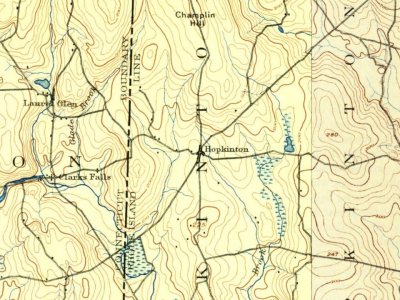
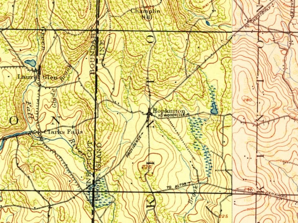
Every edition of the U.S. Geological Survey’s map of Hopkinton. Tap a year, or press play to watch the town change.

Hopkinton on the 1889 USGS mapHopkinton on the 1893 USGS mapHopkinton on the 1921 USGS mapHopkinton on the 1984 USGS mapHopkinton on the 2001 USGS map1889Stonington sheet · 1:62,500

U.S. Geological Survey historical topographic maps (public domain), via Esri’s collection of the scans. The red ring marks the center of Hopkinton.

Then & now

Stand where they stood

No then-and-now pairs yet. Take a photo from the same spot as an old one and they appear here side by side.

Pawcatuck River Bridge. Burdickville, Washington Co., RI. sec. 4215, mp 147.45. - Northeast Railroad Corridor, Amtrak r…
Retake this viewPawcatuck River Bridge. Burdickville, Washington Co., RI. sec. 4215, mp 147.45. - Northeast Railroad Corridor, Amtrak r…, 1968

Find the spot, match the angle, and add your photo. It becomes the first then-and-now pair on Hopkinton’s page.

Retake this view · +15
People over time

Hopkinton, census by census

02,0004,0006,0008,000180018501900195020008,398

Grew from 2,462 people in 1790 to 8,398 in 2020, 3 times over.

24 censuses, 1790–2020.

U.S. Census Bureau decennial counts, from the census table on Hopkinton’s Wikipedia page.

Famous people

5 famous people were born in Hopkinton

Writers, athletes, leaders and more, ranked by how widely they’re known.

See all →
Help out

Start Hopkinton’s collection

The first neighbors to add old photos shape how Hopkinton’s history is told.

Decades since 1900 with photos
00s10s20s30s40s50s60s70s80s90s
1 of 10 decades. The empty ones are waiting for someone’s album.
Stories next door

History across the town line

Each neighbor’s History grade, on the same three inputs.

Questions about Hopkinton’s history

What year was Hopkinton founded?

The Hopkinton post office opened in 1811, the earliest record of the town by name (U.S. post office records).

How does Hopkinton rank for history?

Hopkinton is more historic than 87% of U.S. towns, #20 of 38 in Rhode Island. The History grade combines the town’s founding era, the share of homes built before 1940 and its National Register listings. It’s a character grade, so it isn’t part of the overall grade. How it works.

What is on the National Register in Hopkinton?

4 listings: 2 buildings and 2 historic districts, the Hopkinton City Historic District and the Hope Valley Historic District, with 155 contributing buildings. 162 historic buildings in all.

How old are the homes in Hopkinton?

19% of Hopkinton’s homes were built before 1940 (Census estimate, ±5.4 points), against a typical 20% for a Rhode Island town; the median home was built in 1977.

Memory lane

What the archives can’t tell you, neighbors can.

Town Square →
Start a conversation
Sources

Where this page comes from

Founding dates: Wikidata, Wikipedia, the U.S. post office records of Blevins & Helbock (CC0) and the Census. Homes by year built: Census ACS 2020–24. National Register of Historic Places: National Park Service (list of May 22, 2026). Old photos, postcards and papers: Wikimedia Commons, the Library of Congress and other public archives, credited on each item’s page. Maps: U.S. Geological Survey historical topographic maps (via Esri) and Sanborn fire-insurance maps (Library of Congress). History text and census tables: Wikipedia (CC BY-SA 4.0). Places that used to be: USGS Geographic Names Information System (2021).

From Wikimedia Commons (8), Wikidata (4), the National Register of Historic Places (4), Wikipedia, Wikidata and Wikipedia for famous people, U.S. Geological Survey historical maps, U.S. Census counts (via Wikipedia), the US Post Offices dataset (Blevins & Helbock) and the USGS Geographic Names Information System. Archive images are copied here with their credits and licenses, shown on each photo’s page. Refreshed monthly.