Toledo dates to 1833, and 31% of its homes were built before 1940
More historic than 97% of U.S. towns · #32 of 993 in Ohio. What drives it
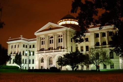
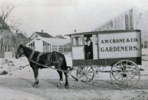
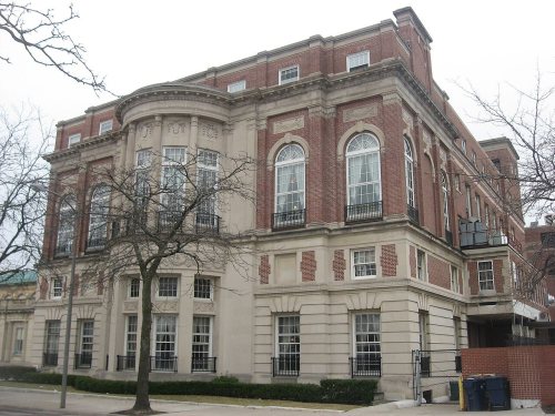
71 places in town are on the National Register, among them the Edward D. Libbey House, a National Historic Landmark, and ten historic districts with 6,417 buildings between them. 71 places in town are on the National Register, among them the Edward D. Libbey House, a National Historic Landmark, and ten historic districts with 6,417 buildings between them. Below: 16 old photos and papers, maps from 1888 on, and the census since 1840.
Founding year: Wikidata; Wikipedia’s history section gives the same year. First post office: 1836.The full story ↓
History grade
What drives Toledo’s History grade
On its age, its old homes and the National Register, Toledo is more historic than 97% of U.S. towns, #32 of 993 in Ohio. All 3 inputs are above most U.S. towns; its National Register listings ranks highest and its age lowest.
A+
HistoryA character grade: shown, never part of Toledo’s overall grade.
Among the 400 U.S. cities of 100,000 or more, Toledo ranks #34 on History.
Ohio towns list about as much on the Register as the country (a typical Ohio town has 2.9 per 10,000 residents, the U.S. 2.4), so Toledo’s 242 sits above most of its state (97% of Ohio towns have fewer) while its 6,479 historic buildings outnumber those of 100% of U.S. towns.
How sure. Graded on any two of the three inputs instead, the letter would range from A to A+. The pre-1940 share (±1.0 points) is firm at this size. Two sources give 1833.
Founding year: Wikidata (other dates in Quick answers). Homes: Census ACS 2020–24. National Register: National Park Service, May 2026 list; each listing counted once (boundary changes and added documentation belong to their listing), and a historic district counts its contributing buildings. How TownRatings grades history →
What stands out about Toledo’s past
Read from the archive, the National Register and the record. The page puts what stands out first.
The country’s official list of buildings and places worth saving. One is a National Historic Landmark, the highest tier. Boundary changes and added documentation are counted with their listing.
National Park Service, National Register of Historic Places. Photos from Wikimedia Commons, credited on each place’s page.
Places that used to be
Lost post offices, old corners, places now gone and burying grounds
Toledo’s post office has been open since 1836. 10 other post offices opened and closed inside today’s town.
Toledo
1836–today
Utah
1851–1859
East Toledo
1859–1882
Ironville
1872–1895
South Toledo
1875–1887
West Toledo
1876–1908
Wagon Works
1879–1886
Airline Junction
1884–1896
Auburndale
1886–1896
Trilby
1898–1906
18301930today
Hamlets and corners on the map
Air Line JunctionAuburndaleBoulevardEast ToledoFerndaleFitchFreemans GardensGouldHallettHopewell HeightsIronvilleJohnston CornersMayfair ParkMellwoodNasbyNorthgatePoint PlaceReynolds CornersShore AcresTrilbyVulcanWernerts CornersWest ToledoWillow Beach
Gone or out of use
Airline Junction Post Officepost officeAuburndale Post Officepost officeDeaconess HospitalhospitalEast Toledo Post Officepost officeFirst Baptist ChurchchurchFort IndustrymilitaryIronville Post Officepost officeLibbey High SchoolschoolMacomber-Whitney High SchoolschoolMcAuley High SchoolschoolMercy HospitalhospitalOwens-Illinois Technical CenterschoolReynolds Corners Post Officepost officeTrilby Post Officepost officeWest Toledo Post Officepost office
11cemeteries and burying grounds inside Toledo
CalvaryCollingwoodForestHaughtonMemorial ParkMount CarmelResurrectionSaint Johns LutheranSunshineToledo State HospitalWoodlawn
US Post Offices dataset (Blevins & Helbock, CC0). Places and cemeteries from the USGS Geographic Names Information System (2021).
The region was part of a larger area controlled by the historic tribes of the Wyandot and the people of the Council of Three Fires (Ojibwe, Potawatomi, and Odawa). The French established trading posts in the area by 1680 to take advantage of the lucrative fur trade. The Odawa moved from Manitoulin Island and the Bruce Peninsula at the invitation of the French, who established a trading post at Fort Detroit, about 60 miles to the north. They settled an area extending into northwest Ohio.
CATHOLIC. — Rev. Amadeus Rappe came to Toledo in 1841 and with a parish limits extended from Toledo to the Indiana state line and as far south as Allen county — he had no church building for many years — was a missionary in every sense, but finally his parishioners here bought the church building corner of Superior and Cherry Streets, formerly occupied by the Congregationalists, and the
Text read by machine from the scan; it may contain errors.
ship. In 1833 the agreement to consolidate Port Lawrence and Vistula was entered into. In 1835 Lucas county, Ohio, was organized by the legislature of Ohio to include Toledo. In 1837 the incorporated town of Toledo was created by act of the Ohio legislature. The date of the settlement of the boundary question has been given.
Text read by machine from the scan; it may contain errors.
Transactions at the annual meeting of the Maumee Valley pioneer and historical association, held at Toledo, February 22d, 18771877 · page 44Read the page →
Read the text
by the advice of friends, one of whom Chester Walbridge, warm hearted and zealous, is prominently worthy of our remembrance, it located in the city of Toledo. A new and commodious office on the corner of Superior and Lagrange streets had just been erected, and was then occupied, and continued to be their office while the junior member at that time remained in Toledo.
Text read by machine from the scan; it may contain errors.
Scans and text from the Internet Archive. Books published in 1930 or earlier, which are in the public domain.
Timeline
Toledo, 1833 to 1978
Woven from the archive, old maps, post office records, the National Register and the people born here.
Nothing in the archives for these yearsWeddings on Main Street, storms, parades, school pictures, the old store. If it’s in your family album, it belongs here.
Every edition of the U.S. Geological Survey’s map of Toledo. Tap a year, or press play to watch the town change.
1900Toledo sheet · 1:62,500
U.S. Geological Survey historical topographic maps (public domain), via Esri’s collection of the scans. The red ring marks the center of Toledo.
Every building
Toledo, building by building, 1888–1921
Fire insurance maps drew every building, what it was made of and what it was used for, so insurers could price the risk of fire. Pick a year, then a sheet.
In 1833, according to Wikidata and Wikipedia’s history of the town. Toledo’s post office opened in 1836, and the census of 1840 counted 1,222 people here.
How does Toledo rank for history?
Toledo is more historic than 97% of U.S. towns, #32 of 993 in Ohio. The History grade combines the town’s founding era, the share of homes built before 1940 and its National Register listings. It’s a character grade, so it isn’t part of the overall grade. How it works.
What is on the National Register in Toledo?
71 listings: 46 buildings, among them the Edward D. Libbey House (a National Historic Landmark since 1983) and the Albert Neukom House (listed 1971, the first), 24 historic districts with 6,417 contributing buildings, and 1 structure. 6,479 historic buildings in all.
How old are the homes in Toledo?
31% of Toledo’s homes were built before 1940 (Census estimate, ±1.0 points), against a typical 15% for an Ohio town; the median home was built in 1955.
Founding dates: Wikidata, Wikipedia, the U.S. post office records of Blevins & Helbock (CC0) and the Census. Homes by year built: Census ACS 2020–24. National Register of Historic Places: National Park Service (list of May 22, 2026). Old photos, postcards and papers: Wikimedia Commons, the Library of Congress and other public archives, credited on each item’s page. Maps: U.S. Geological Survey historical topographic maps (via Esri) and Sanborn fire-insurance maps (Library of Congress). History text and census tables: Wikipedia (CC BY-SA 4.0). Places that used to be: USGS Geographic Names Information System (2021).
From Wikimedia Commons (16), Wikidata (2), the National Register of Historic Places (71), Wikipedia, Wikidata and Wikipedia for famous people, U.S. Geological Survey historical maps, U.S. Census counts (via Wikipedia), the US Post Offices dataset (Blevins & Helbock), the USGS Geographic Names Information System, Sanborn fire insurance maps (Library of Congress) and old county and town histories (Internet Archive). Archive images are copied here with their credits and licenses, shown on each photo’s page. Refreshed monthly.


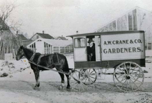

 ★ Landmark


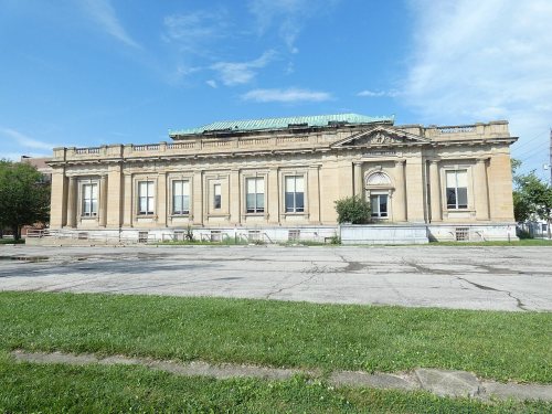
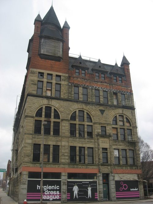
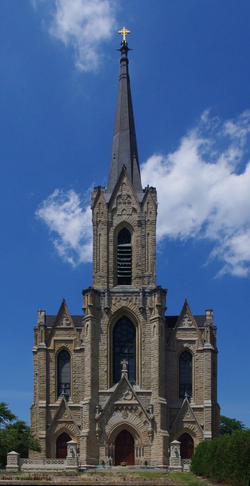





 1887
 1888
 1896
 1899
 1899
 1899
 1899
 1899
 1899
 1899
 1899
 1899


