Perrysburg Township dates to 1816, and 3 of its places are on the National Register
More historic than 73% of U.S. towns · #396 of 993 in Ohio. What drives it
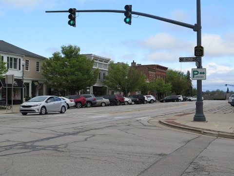
Most of Perrysburg Township was built recently: 8% of its homes predate 1940 and the median home dates from 1990. 3 places in town are on the National Register, among them two historic districts with 12 buildings between them. Below: 3 old photos and papers, maps from 1900 on, and the census since 1830.
Founding year: Wikidata. First post office: 1874.The full story ↓
History grade
What drives Perrysburg Township’s History grade
On its age, its old homes and the National Register, Perrysburg Township is more historic than 73% of U.S. towns, #396 of 993 in Ohio. Its National Register listings hold the grade up; its share of homes from before 1940 pulls it down.
B+
HistoryA character grade: shown, never part of Perrysburg Township’s overall grade.
Ohio towns list about as much on the Register as the country (a typical Ohio town has 2.9 per 10,000 residents, the U.S. 2.4), so Perrysburg Township’s 10.2 sits above most of its state (74% of Ohio towns have fewer) while its 14 historic buildings outnumber those of 78% of U.S. towns.
NoteThe founding year comes from Wikidata alone; no second source gives 1816.
How sure. Graded on any two of the three inputs instead, the letter would range from B to A−. The pre-1940 share (±2.4 points) is firm at this size.
Founding year: Wikidata (other dates in Quick answers). Homes: Census ACS 2020–24. National Register: National Park Service, May 2026 list; each listing counted once (boundary changes and added documentation belong to their listing), and a historic district counts its contributing buildings. How TownRatings grades history →
What stands out about Perrysburg Township’s past
Read from the archive, the National Register and the record. The page puts what stands out first.
Lost post offices, old corners, places now gone and burying grounds
Three other post offices opened and closed inside today’s town.
Lime City
1874–1953
Dowling
1883–1934
Hobart
1890–1898
18701950today
Hamlets and corners on the map
BatesBayer Trailer CourtBelmont FarmsBelmont WoodsDowlingFive Point Mobile Home CourtFive PointsFoxboroughFriendly Village I Mobile Home ParkFriendly Village II Mobile Home ParkGlenwoodGlenwood AdditionHobartHoliday ParkLakemontLime CityOak MeadowsOakmontParliament PlacePerrysburg Estates Mobile Home ParkPerrysburg HeightsRockledge FarmsSecor WoodsStarbright Addition
Gone or out of use
Cooks SidinglocaleJessie Hill MissionchurchLime City QuarrymineRanchport AirportairportRossford Ordnance Depotmilitary
3cemeteries and burying grounds inside Perrysburg Township
HuffordNew Belleville RidgeSaint Rose
US Post Offices dataset (Blevins & Helbock, CC0). Places and cemeteries from the USGS Geographic Names Information System (2021).
Help out
Start Perrysburg Township’s collection
The first neighbors to add old photos shape how Perrysburg Township’s history is told.
Decades since 1900 with photos
00s10s20s30s40s50s60s70s80s90s
2 of 10 decades. The empty ones are waiting for someone’s album.
Every edition of the U.S. Geological Survey’s map of Perrysburg Township. Tap a year, or press play to watch the town change.
1900Toledo sheet · 1:62,500
U.S. Geological Survey historical topographic maps (public domain), via Esri’s collection of the scans. The red ring marks the center of Perrysburg Township.
Perrysburg lies near the center of the Twelve Mile Square Reservation, a tract of land ceded in 1795 to the United States by the Odawa people following their defeat in the Northwest Indian Wars. They had occupied this territory since the turn of the 18th century, after having settled in the region of the French trading post at Fort Detroit. Also known as the Ottawa, they had controlled much of the territory along the Maumee River in present-day northwestern Ohio.
Nothing in the archives for these yearsWeddings on Main Street, storms, parades, school pictures, the old store. If it’s in your family album, it belongs here.
In 1816, according to Wikidata. Perrysburg Township’s post office opened in 1874, and the census of 1830 counted 182 people here.
How does Perrysburg Township rank for history?
Perrysburg Township is more historic than 73% of U.S. towns, #396 of 993 in Ohio. The History grade combines the town’s founding era, the share of homes built before 1940 and its National Register listings. It’s a character grade, so it isn’t part of the overall grade. How it works.
What is on the National Register in Perrysburg Township?
Three places: the Edwin H. Simmons House (listed 1991), the East River Road Historic District I (1976) and the East River Road Historic District II (1976).
How old are the homes in Perrysburg Township?
8% of Perrysburg Township’s homes were built before 1940 (Census estimate, ±2.4 points), against a typical 15% for an Ohio town; the median home was built in 1990.
Founding dates: Wikidata, Wikipedia, the U.S. post office records of Blevins & Helbock (CC0) and the Census. Homes by year built: Census ACS 2020–24. National Register of Historic Places: National Park Service (list of May 22, 2026). Old photos, postcards and papers: Wikimedia Commons, the Library of Congress and other public archives, credited on each item’s page. Maps: U.S. Geological Survey historical topographic maps (via Esri) and Sanborn fire-insurance maps (Library of Congress). History text and census tables: Wikipedia (CC BY-SA 4.0). Places that used to be: USGS Geographic Names Information System (2021).
From Wikimedia Commons (18), Wikidata (8), the National Register of Historic Places (3), Wikipedia, U.S. Geological Survey historical maps, U.S. Census counts (via Wikipedia), the US Post Offices dataset (Blevins & Helbock) and the USGS Geographic Names Information System. Archive images are copied here with their credits and licenses, shown on each photo’s page. Refreshed monthly.


 2025
 2025
 2025
 2025
 2025
 2025
 2025
 2023
 2018
 2017
 2016
 2016
 2013
 2008
 2008
