Maumee’s post office opened in 1835, and 16% of its homes were built before 1940
More historic than 88% of U.S. towns · #184 of 993 in Ohio. What drives it
14 places in town are on the National Register, among them two historic districts with 51 buildings between them. Below: 12 old photos and papers, maps from 1900 on, and the census since 1840.
The Maumee post office opened in 1835, the earliest record of the town by name. Another post office, Maumee City (1838), opened inside today’s city and later closed.
First census: 840 in 18402020 census: 13,896191 years
How historic is Maumee?
A
More historic than 88% of U.S. towns, on its age, its old homes and the National Register.
Founding year: the first Maumee post office (Blevins & Helbock, CC0).The full story ↓
History grade
What drives Maumee’s History grade
On its age, its old homes and the National Register, Maumee is more historic than 88% of U.S. towns, #184 of 993 in Ohio. All 3 inputs are above most U.S. towns; its National Register listings ranks highest and its share of homes from before 1940 lowest.
A
HistoryA character grade: shown, never part of Maumee’s overall grade.
Ohio towns list about as much on the Register as the country (a typical Ohio town has 2.9 per 10,000 residents, the U.S. 2.4), so Maumee’s 45.9 sits above most of its state (88% of Ohio towns have fewer) while its 63 historic buildings outnumber those of 86% of U.S. towns.
How sure. Graded on any two of the three inputs instead, the letter would range from A− to A. The pre-1940 share (±2.9 points) is firm at this size. The founding year is the first post office, not a stated founding date.
Founding year: the first post office (other dates in Quick answers). Homes: Census ACS 2020–24. National Register: National Park Service, May 2026 list; each listing counted once (boundary changes and added documentation belong to their listing), and a historic district counts its contributing buildings. How TownRatings grades history →
What stands out about Maumee’s past
Read from the archive, the National Register and the record. The page puts what stands out first.
In pre-colonial times, Native Americans (notably the Ottawa) began using the rich resources at the present site of Maumee, Ohio, in the Maumee River valley. Throughout much of the eighteenth century, French, British and American forces struggled for control of the lower Maumee River as a major transportation artery linking East and West through Lake Erie.
Passages that mention Maumee, cut from the printed page as they were published.
History of the Maumee River basin from the earliest account to its organization into counties1905 · page 520Read the page →
Read the text
purpose of attending to the erection and repairs of the public buildings of the Countv.' The Commissioners at this time were John Pray, Samuel Spafford, and Hiram P. Barlow. They examined the County Jail 'which had been removed from the town of Maumee and erected in the town of Perrysburg agreeable to a contract entered into for that purpose with Daniel Hubbell' at a cost of $48. It was further "ordered that so much of the Township of Waynesfield as is included in the organized County of Wood, and lying and being on the south of the
Text read by machine from the scan; it may contain errors.
History of the Maumee River basin from the earliest account to its organization into counties1905 · page 416Read the page →
Read the text
For this purpose $12,000 was appropriated, on account of the former great sufferings of these people with smallpox. Doctor Oscar White of the Village of Maumee was employed for this purpose by James Jackson, the Agent then residing at Maumee, and in the vear 1833 he vaccinated eight hundred Aborigines thereabout, the most of them being Ottawas.
Text read by machine from the scan; it may contain errors.
one story Second National Bank Building of Toledo, also erected the Cherry Street bridge of that city, the Damascus bridge over the Maumee near Napoleon, and their bridges may be found all the way from New York to San Francisco. Recently a bridge was shipped from the company's plant to Los Angeles, California, and they have also done
Text read by machine from the scan; it may contain errors.
He is one of Toledo's successful business men who have established beautiful country homes away from the city's noise and dirt at Maumee and Perrysburg. His own home is in the village of Maumee, and is situated on historic ground and the residence is a fine old colonial mansion. While improving his grounds Mr. Ormond unearthed a number of
Text read by machine from the scan; it may contain errors.
Scans and text from the Internet Archive. Books published in 1930 or earlier, which are in the public domain.
Timeline
Maumee, 1813 to 1991
Woven from the archive, old maps, post office records, the National Register and the people born here.
Nothing in the archives for these yearsWeddings on Main Street, storms, parades, school pictures, the old store. If it’s in your family album, it belongs here.
The Maumee post office opened in 1835, the earliest record of the town by name (U.S. post office records).
How does Maumee rank for history?
Maumee is more historic than 88% of U.S. towns, #184 of 993 in Ohio. The History grade combines the town’s founding era, the share of homes built before 1940 and its National Register listings. It’s a character grade, so it isn’t part of the overall grade. How it works.
What is on the National Register in Maumee?
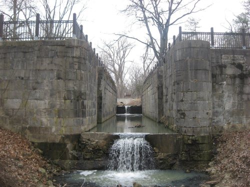
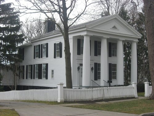
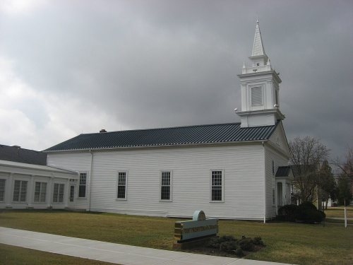
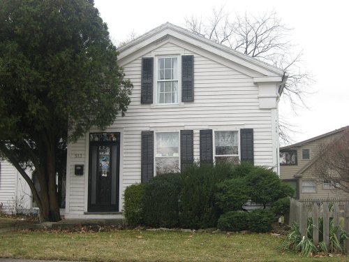
14 listings: 11 buildings, among them the Hull-Wolcott House (listed 1970, the first), 2 historic districts, the Maumee Historic District and the Maumee Uptown Historic District, with 51 contributing buildings, and 1 structure. 63 historic buildings in all.
How old are the homes in Maumee?
16% of Maumee’s homes were built before 1940 (Census estimate, ±2.9 points), against a typical 15% for an Ohio town; the median home was built in 1963.
Founding dates: Wikidata, Wikipedia, the U.S. post office records of Blevins & Helbock (CC0) and the Census. Homes by year built: Census ACS 2020–24. National Register of Historic Places: National Park Service (list of May 22, 2026). Old photos, postcards and papers: Wikimedia Commons, the Library of Congress and other public archives, credited on each item’s page. Maps: U.S. Geological Survey historical topographic maps (via Esri) and Sanborn fire-insurance maps (Library of Congress). History text and census tables: Wikipedia (CC BY-SA 4.0). Places that used to be: USGS Geographic Names Information System (2021).
From Wikimedia Commons (12), the National Register of Historic Places (14), Wikipedia, Wikidata and Wikipedia for famous people, U.S. Geological Survey historical maps, U.S. Census counts (via Wikipedia), the US Post Offices dataset (Blevins & Helbock), the USGS Geographic Names Information System and old county and town histories (Internet Archive). Archive images are copied here with their credits and licenses, shown on each photo’s page. Refreshed monthly.






 1879
 1879
 1890
 1900
 1900
 1900


