Granville’s post office opened in 1809, and 24% of its homes were built before 1940
More historic than 94% of U.S. towns · #79 of 993 in Ohio. What drives it
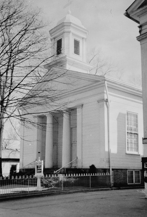
12 places in town are on the National Register, among them two historic districts with 125 buildings between them. Below: 9 old photos and papers, maps from 1896 on, and the census since 1820.
Founding year: the first Granville post office (Blevins & Helbock, CC0).The full story ↓
History grade
What drives Granville’s History grade
On its age, its old homes and the National Register, Granville is more historic than 94% of U.S. towns, #79 of 993 in Ohio. All 3 inputs are above most U.S. towns; its National Register listings ranks highest and its age lowest.
A
HistoryA character grade: shown, never part of Granville’s overall grade.
Ohio towns list about as much on the Register as the country (a typical Ohio town has 2.9 per 10,000 residents, the U.S. 2.4), so Granville’s 223 sits above most of its state (97% of Ohio towns have fewer) while its 134 historic buildings outnumber those of 91% of U.S. towns.
How sure. Graded on any two of the three inputs instead, the letter would range from A− to A. The pre-1940 share is a Census survey estimate (±6.4 points). The founding year is the first post office, not a stated founding date.
Founding year: the first post office (other dates in Quick answers). Homes: Census ACS 2020–24. National Register: National Park Service, May 2026 list; each listing counted once (boundary changes and added documentation belong to their listing), and a historic district counts its contributing buildings. How TownRatings grades history →
What stands out about Granville’s past
Read from the archive, the National Register and the record. The page puts what stands out first.
National Park Service, National Register of Historic Places. Photos from Wikimedia Commons, credited on each place’s page.
Every building
Granville, building by building, 1896–1926
Fire insurance maps drew every building, what it was made of and what it was used for, so insurers could price the risk of fire. Pick a year, then a sheet.
Granville is the location of the prehistoric Alligator Effigy Mound, built by the indigenous people of the Fort Ancient culture, between 800 and 1200 CE, more than four hundred years before European contact. It may be an effigy of the underwater panther featured in Native American mythology. The mound is listed on the National Register of Historic Places. The area has evidence of Indigenous cultures. Less than five miles from the Alligator Effigy Mound are the Newark Earthworks, associated with the earlier Hopewell culture of roughly 100 BCE to 500 CE.
Passages that mention Granville, cut from the printed page as they were published.
History of Licking County, Ohio1881 · page 260Read the page →
Read the text
The Granville feeder extended from Licking Summit to Raccoon creek, at Paige’s woollen factory, about a mile and a quarter southeast of Granville. In order to have navigation as near Granville as possible, the commissioners agreed to make the feeder navigable for boats as far as Paige’s factory, provided the people of Granville would make it navigable from thence to the bridge at the Lan-
Text read by machine from the scan; it may contain errors.
History of Licking County, Ohio1881 · page 750Read the page →
Read the text
In 1805 he accompanied his parents, Timothy and Lydia Rose, who came with the first colony from Granville, Massachusetts, to this county, and settled in Granville township, where the village of Granville is now located, where Timothy Rose, father of the subject of this sketch, and a soldier of the Revolution, deceased, November 27, 1813, at the age of fifty-one years. He was the prin-
Text read by machine from the scan; it may contain errors.
Centennial history of Licking County, Ohio1876 · page 16Read the page →
Read the text
the present limits of Harrison Township; and George Ernst, John Feasel and John and Jacob Swisher formed a settlement near the source of Swamp Run, now in Franklin Township. In November of this year, (1805.) the Granville Colony arrived and established themselves at and around the village of Granville. General John Spencer also settled in the Spring of this 3'ear, in the North Fork Valley, five miles north of Newark. When he settled at the " Big Spring," he found in the vicinity a man named Evan Humphrey,
Text read by machine from the scan; it may contain errors.
Centennial History of the City of Newark and Licking County Ohio1909 · page 76Read the page →
Read the text
Lewellyn and Lemuel, twins, both of Kansas; Alice, the wife of John M. Brooks, of Granville township; Frank, living in the village of Granville; and Edward, at home. All are married with the exception of the last named. Mr. Richards has usually supported the democracy and has always felt a keen and abiding interest in the vital questions of the day affecting the general welfare.
Text read by machine from the scan; it may contain errors.
Scans and text from the Internet Archive. Books published in 1930 or earlier, which are in the public domain.
Timeline
Granville, 1809 to 1914
Woven from the archive, old maps, post office records, the National Register and the people born here.
Nothing in the archives for these yearsWeddings on Main Street, storms, parades, school pictures, the old store. If it’s in your family album, it belongs here.
The Granville post office opened in 1809, the earliest record of the town by name (U.S. post office records).
How does Granville rank for history?
Granville is more historic than 94% of U.S. towns, #79 of 993 in Ohio. The History grade combines the town’s founding era, the share of homes built before 1940 and its National Register listings. It’s a character grade, so it isn’t part of the overall grade. How it works.
What is on the National Register in Granville?
12 listings: 10 buildings, among them the Buxton Inn (listed 1972, the first), and 2 historic districts, the Granville Historic District and the Colony Burying Ground, Old, with 125 contributing buildings. 134 historic buildings in all.
How old are the homes in Granville?
24% of Granville’s homes were built before 1940 (Census estimate, ±6.4 points), against a typical 15% for an Ohio town; the median home was built in 1987.
Founding dates: Wikidata, Wikipedia, the U.S. post office records of Blevins & Helbock (CC0) and the Census. Homes by year built: Census ACS 2020–24. National Register of Historic Places: National Park Service (list of May 22, 2026). Old photos, postcards and papers: Wikimedia Commons, the Library of Congress and other public archives, credited on each item’s page. Maps: U.S. Geological Survey historical topographic maps (via Esri) and Sanborn fire-insurance maps (Library of Congress). History text and census tables: Wikipedia (CC BY-SA 4.0). Places that used to be: USGS Geographic Names Information System (2021).
From Wikimedia Commons (6), the Library of Congress (5), the National Register of Historic Places (12), Wikipedia, U.S. Geological Survey historical maps, U.S. Census counts (via Wikipedia), the US Post Offices dataset (Blevins & Helbock), the USGS Geographic Names Information System, Sanborn fire insurance maps (Library of Congress) and old county and town histories (Internet Archive). Archive images are copied here with their credits and licenses, shown on each photo’s page. Refreshed monthly.




 1892
 1905
 1905
 1905
 1909
 1909
 2004
 2004


