Wawarsing dates to 1685, and 33% of its homes were built before 1940
Among the most historic 1% of U.S. towns · #23 of 758 in New York. What drives it
12 places in town are on the National Register, among them two historic districts with 221 buildings between them. Below: 6 old photos and papers, maps from 1903 on, and the census since 1820.
Founding year: Wikidata. First post office: 1817.The full story ↓
History grade
What drives Wawarsing’s History grade
On its age, its old homes and the National Register, Wawarsing is among the most historic 1% of U.S. towns, #23 of 758 in New York. All 3 inputs put Wawarsing near the top nationally; its age ranks highest.
A+
HistoryA character grade: shown, never part of Wawarsing’s overall grade.
New York towns list more on the Register than most of the country (a typical New York town has 12.3 per 10,000 residents, the U.S. 2.4), so Wawarsing’s 202 sits above most of its state (82% of New York towns have fewer) while its 253 historic buildings outnumber those of 94% of U.S. towns.
NoteThe founding year comes from Wikidata alone; no second source gives 1685.
How sure. Graded on any two of the three inputs instead, the letter would still be A+. The pre-1940 share is a Census survey estimate (±5.3 points).
Founding year: Wikidata (other dates in Quick answers). Homes: Census ACS 2020–24. National Register: National Park Service, May 2026 list; each listing counted once (boundary changes and added documentation belong to their listing), and a historic district counts its contributing buildings. How TownRatings grades history →
What stands out about Wawarsing’s past
Read from the archive, the National Register and the record. The page puts what stands out first.
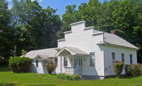
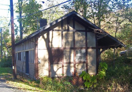
National Park Service, National Register of Historic Places. Photos from Wikimedia Commons, credited on each place’s page.
Places that used to be
Lost post offices, old corners, places now gone and burying grounds
Wawarsing’s post office has been open since 1817. Six other post offices opened and closed inside today’s town.
Wawarsing
1817–today
Ellenville
1823–today
Lackawack
1835–1958
Napanock
1844–1886
Greenfield
1852–1928
Homowack
1852–1891
Kerhonkson
1852–today
Dairyland
1864–1948
Ulster Heights
1885–1910
Napanoch
1886–today
18101920today
Hamlets and corners on the map
BrownvilleCragsmoorDairylandEllenvilleGreenfield ParkHonk HillJenny Brook Mobile Home ParkKerhonksonLackawackNapanochNappy Mobile Home ParkPort BenShady Acre Mobile Home ParkSholamSpring GlenThe CapeUlster Heights
Gone or out of use
District School 17schoolEast Wawarsing SchoolschoolFoords More SanitariumhospitalGreenfield Park SchoolschoolGreenwood SchoolschoolHillsdale SchoolschoolLackawack SchoolschoolLower Briggs SchoolschoolNapanoch SchoolschoolSoccanissing SchoolschoolSouth Hill SchoolschoolSpring Glen SchoolschoolStangle Hill SchoolschoolState Institution for Male Defective DelinquentshospitalTunessassa LodgebuildingUlster Heights Lower SchoolschoolVeterans Memorial HospitalhospitalWawarsing Schoolschool
2cemeteries and burying grounds inside Wawarsing
FantinekillFurman
US Post Offices dataset (Blevins & Helbock, CC0). Places and cemeteries from the USGS Geographic Names Information System (2021).
Timeline
Wawarsing, 1685 to 1958
Woven from the archive, old maps, post office records, the National Register and the people born here.
The Lenape settlement "at Wawarasinke" was burned by English militiamen, led by Marten Crieger, after the Natives attacked Wiltwyck and took captives in 1663. In 1685, Warnaar Hoornbeek leased land there and was accepted as its first European pioneer. In 1703 the areas of Mombaccus and Wawarasink, Ulster County, were made The Town of Rochester. During The Revolutionary War, Wawarsing, Napanoch and Pinebush (Kerhonkson area) were attacked by British raiders, who massacred many women and children and burned the farms. In 1906, Wawarsing, Napanoch, Laurenkil, Lackawack and Grenfield joined together to form The Town of Wawarsing out of Southern Rochester and parts of unincorporated Ulster County.
Passages that mention Wawarsing, cut from the printed page as they were published.
The history of Ulster County, New York1907 · page 479Read the page →
Read the text
The Friends’ Church of Greenfield, in the town of Wawarsing, was organized in 1808, by Zadock Southern, Catharine Billew, and the Washburn and Holmes families, with a membership of about twenty-five. The meeting house was erected in 1818, and the first “approved minister” was Catharine Billew.
Text read by machine from the scan; it may contain errors.
History of Ulster County, New York, with illustrations and biographical sketches of its prominent men and pioneers1880Read the page →
Read the text
The town of Wawarsing was formed from Rochester, March 14, 1806. The latter had held jurisdiction over this territory for a century or more, though for many years there were oft course but few inhabitants located upon it.
Text read by machine from the scan; it may contain errors.
History of Ulster County, New York, with illustrations and biographical sketches of its prominent men and pioneers1880Read the page →
Read the text
of the compass. They may be given as follows : Northwest by the town of Ilardcnhurgli ; northeast by the town of Shandaken ; southeast by the towns of Olive and Rochester ; southwest by the town of Wawarsing and the county line of Sullivan. The area, as given in the census of 1875, is 04,050 acres. Of this, 4800 are classed as improved land, and 59.250 acres as unimproved. Of the unimproved, 14,234 acres are stated as woodland, leaving 45,010 acres
Text read by machine from the scan; it may contain errors.
The history of Ulster County, New York1907 · page 54Read the page →
Read the text
On this patent was founded the old village of Wawarsing, and the name of the boundmark became the name of the present town. The name was from that of the southeast boundmark of the patent where Rondout Kill bends abruptly to the north which it describes as a point, a stone or corner “where the current bends, winds, or eddies around.” The precise point is a large stone lying on the bank of the stream which has been identified by surveys of the patent.
Text read by machine from the scan; it may contain errors.
Scans and text from the Internet Archive. Books published in 1930 or earlier, which are in the public domain.
By decade
Wawarsing, decade by decade
3 decades in the archive, from the 1860s to the 1900s. Scroll each row; tap a photo for its story.
Nothing in the archives for these yearsWeddings on Main Street, storms, parades, school pictures, the old store. If it’s in your family album, it belongs here.
In 1685, according to Wikidata. Wawarsing’s post office opened in 1817, and the census of 1820 counted 1,811 people here.
How does Wawarsing rank for history?
Wawarsing is among the most historic 1% of U.S. towns, #23 of 758 in New York. The History grade combines the town’s founding era, the share of homes built before 1940 and its National Register listings. It’s a character grade, so it isn’t part of the overall grade. How it works.
What is on the National Register in Wawarsing?
12 listings: 10 buildings, among them the Chetolah (listed 1980, the first), and 2 historic districts, the Cragsmoor Historic District and the Ellenville Downtown Historic District, with 221 contributing buildings. 253 historic buildings in all.
How old are the homes in Wawarsing?
33% of Wawarsing’s homes were built before 1940 (Census estimate, ±5.3 points), against a typical 27% for a New York town; the median home was built in 1955.
Founding dates: Wikidata, Wikipedia, the U.S. post office records of Blevins & Helbock (CC0) and the Census. Homes by year built: Census ACS 2020–24. National Register of Historic Places: National Park Service (list of May 22, 2026). Old photos, postcards and papers: Wikimedia Commons, the Library of Congress and other public archives, credited on each item’s page. Maps: U.S. Geological Survey historical topographic maps (via Esri) and Sanborn fire-insurance maps (Library of Congress). History text and census tables: Wikipedia (CC BY-SA 4.0). Places that used to be: USGS Geographic Names Information System (2021).
From Wikimedia Commons (6), the National Register of Historic Places (12), Wikipedia, Wikidata and Wikipedia for famous people, U.S. Geological Survey historical maps, U.S. Census counts (via Wikipedia), the US Post Offices dataset (Blevins & Helbock), the USGS Geographic Names Information System and old county and town histories (Internet Archive). Archive images are copied here with their credits and licenses, shown on each photo’s page. Refreshed monthly.




 1875
 1875
 1875


