Wappinger dates to 1875, and 10 of its places are on the National Register
More historic than 64% of U.S. towns · #569 of 758 in New York. What drives it
10 places in town are on the National Register, among them three historic districts with 614 buildings between them. Most of Wappinger was built recently: 10% of its homes predate 1940 and the median home dates from 1971. Below: maps from 1893 on and the census since 1880.
Founding year: Wikidata. First post office: 1836.The full story ↓
History grade
What drives Wappinger’s History grade
On its age, its old homes and the National Register, Wappinger is more historic than 64% of U.S. towns, #569 of 758 in New York. Its National Register listings hold the grade up; its age pulls it down.
B
HistoryA character grade: shown, never part of Wappinger’s overall grade.
New York towns list more on the Register than most of the country (a typical New York town has 12.3 per 10,000 residents, the U.S. 2.4), so Wappinger’s 221 sits above most of its state (83% of New York towns have fewer) while its 623 historic buildings outnumber those of 98% of U.S. towns.
NoteThe founding year comes from Wikidata alone; no second source gives 1875.
How sure. Graded on any two of the three inputs instead, the letter would range from C to A−. The pre-1940 share (±2.1 points) is firm at this size.
Founding year: Wikidata (other dates in Quick answers). Homes: Census ACS 2020–24. National Register: National Park Service, May 2026 list; each listing counted once (boundary changes and added documentation belong to their listing), and a historic district counts its contributing buildings. How TownRatings grades history →
What stands out about Wappinger’s past
Read from the archive, the National Register and the record. The page puts what stands out first.
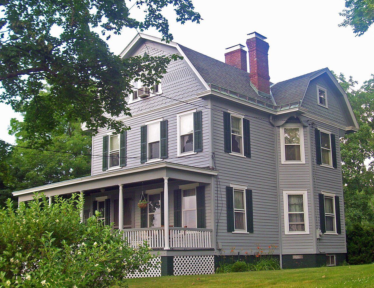
National Park Service, National Register of Historic Places. Photos from Wikimedia Commons, credited on each place’s page.
Places that used to be
Lost post offices, old corners and burying grounds
Three other post offices opened and closed inside today’s town.
New Hackensack
1836–1943
Wappingers Falls
1849–today
Carthage Landing
1850–1901
Hughsonville
1850–today
Diddell
1898–1903
Chelsea
1901–today
Castle Point
1924–today
18301930today
Hamlets and corners on the map
Birchwood ParkCastle PointChelseaCooper Road Mobile Home ParkDiddellDuchess Park Mobile Home ParkHughsonvilleMyers CornerNew HackensackRoberts Mobile Home ParkSwartoutvilleWappingers FallsWappingers Falls Mobile Home Park
2cemeteries and burying grounds inside Wappinger
MiddlebushVan Dyne
US Post Offices dataset (Blevins & Helbock, CC0). Places and cemeteries from the USGS Geographic Names Information System (2021).
Help out
Start Wappinger’s collection
The first neighbors to add old photos shape how Wappinger’s history is told.
Decades since 1900 with photos
00s10s20s30s40s50s60s70s80s90s
0 of 10 decades. The empty ones are waiting for someone’s album.
The Wappinger were a confederacy of Native Americans whose territory, in the 17th century, was spread along the eastern shore of the Hudson River. Primarily based in what is now Dutchess County, their territory bordered Manhattan Island to the south, the Mahican territory bounded by the Roeliff Jansen Kill to the north, and extended east into parts of Connecticut.
They spoke an eastern-Algonkian language. Culturally they were closely related to the Lenape people (Delaware Indians) to the west and south of Wappinger lands, and also related to the Mahican people to their immediate north and to the Indigenous peoples of Long Island. Wappinger means "easterner" in most Algonkian languages.
Passages that mention Wappinger, cut from the printed page as they were published.
The history of Dutchess County, New York1909 · page 715Read the page →
Read the text
Mr. Goring had always at heart the best interest of the community and was active in bringing about many changes and improvements. He was the initiator and promoter in creating the town of Wappinger from the town of Pishkill; in the incorporation of the Wappingers Falls Savings Bank and the Bank of Wappingers; in the incorporation of Wappingers Falls as a village; in the laying out of the road to New Hamburg along the lower creek as a pubUc instead of a toll road, as chartered by the legislature; in the law authorizing the erection of the public school building and in other like enterprises. Mr. Goring was a trustee of the Wappingers ceme-
Text read by machine from the scan; it may contain errors.
The history of Dutchess County, New York1909 · page 465Read the page →
Read the text
THE town of Wappinger, originally a part of the town of Fishkill, was erected May 20, 1875, and lies wholly within the limits of the Rombout patent granted in 1685. It is bounded on the north by LaGrange; east by Sprout creek, which separates it from East FishkiU; south by Fishkill, and on the west by Wappinger creek and the Hudson river.
Text read by machine from the scan; it may contain errors.
Scans and text from the Internet Archive. Books published in 1930 or earlier, which are in the public domain.
Timeline
Wappinger, 1836 to 2020
Woven from the archive, old maps, post office records, the National Register and the people born here.
In 1875, according to Wikidata. Wappinger’s post office opened in 1836, and the census of 1880 counted 4,961 people here.
How does Wappinger rank for history?
Wappinger is more historic than 64% of U.S. towns, #569 of 758 in New York. The History grade combines the town’s founding era, the share of homes built before 1940 and its National Register listings. It’s a character grade, so it isn’t part of the overall grade. How it works.
What is on the National Register in Wappinger?
10 listings: 7 buildings and 3 historic districts, the Wappingers Falls Historic District, the Cypress Avenue West Historic District and the Wheeler Hill Historic District, with 614 contributing buildings. 623 historic buildings in all.
How old are the homes in Wappinger?
10% of Wappinger’s homes were built before 1940 (Census estimate, ±2.1 points), against a typical 27% for a New York town; the median home was built in 1971.
Founding dates: Wikidata, Wikipedia, the U.S. post office records of Blevins & Helbock (CC0) and the Census. Homes by year built: Census ACS 2020–24. National Register of Historic Places: National Park Service (list of May 22, 2026). Old photos, postcards and papers: Wikimedia Commons, the Library of Congress and other public archives, credited on each item’s page. Maps: U.S. Geological Survey historical topographic maps (via Esri) and Sanborn fire-insurance maps (Library of Congress). History text and census tables: Wikipedia (CC BY-SA 4.0). Places that used to be: USGS Geographic Names Information System (2021).
From Wikimedia Commons (5), Wikidata (1), the National Register of Historic Places (10), Wikipedia, U.S. Geological Survey historical maps, U.S. Census counts (via Wikipedia), the US Post Offices dataset (Blevins & Helbock), the USGS Geographic Names Information System and old county and town histories (Internet Archive). Archive images are copied here with their credits and licenses, shown on each photo’s page. Refreshed monthly.






 2014
 2010
 2009
 2008
 2008


