Orangetown dates to 1680, and 19% of its homes were built before 1940
More historic than 84% of U.S. towns · #357 of 758 in New York. What drives it
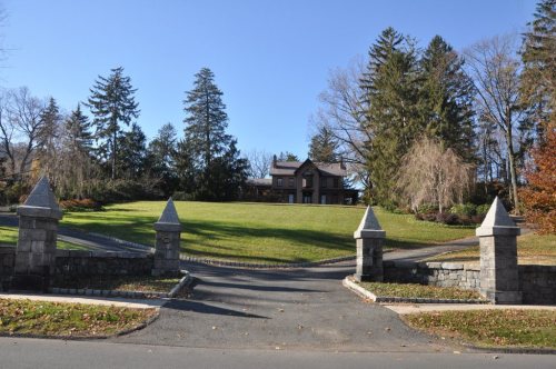
36 places in town are on the National Register, among them the De Wint House, a National Historic Landmark, and five historic districts with 104 buildings between them. Below: maps from 1892 on and the census since 1790.
Founding year: Wikipedia. First post office: 1812.The full story ↓
History grade
What drives Orangetown’s History grade
On its age, its old homes and the National Register, Orangetown is more historic than 84% of U.S. towns, #357 of 758 in New York. All 2 inputs are above most U.S. towns; its National Register listings ranks highest and its share of homes from before 1940 lowest.
A−
HistoryA character grade: shown, never part of Orangetown’s overall grade.
New York towns list more on the Register than most of the country (a typical New York town has 12.3 per 10,000 residents, the U.S. 2.4), so Orangetown’s 31.5 sits near the middle of its state (63% of New York towns have fewer) while its 153 historic buildings outnumber those of 92% of U.S. towns.
NoteThe founding year comes from Wikipedia alone; no second source gives 1680.
How sure. Graded on two of the three inputs, so a change in either one moves the letter more than it would with three. The pre-1940 share (±2.1 points) is firm at this size.
Founding year: Wikipedia (other dates in Quick answers). Homes: Census ACS 2020–24. National Register: National Park Service, May 2026 list; each listing counted once (boundary changes and added documentation belong to their listing), and a historic district counts its contributing buildings. How TownRatings grades history →
What stands out about Orangetown’s past
Read from the archive, the National Register and the record. The page puts what stands out first.
Camp BluefieldsmilitaryCamp ShanksmilitaryNike Site NY-03/04CmilitaryNike Site NY-03/04LmilitaryNike Site NY-09CmilitaryNike Site NY-09LmilitaryNyack Drive-InlocaleOld State Rifle RangelocaleRockland County Fair GroundslocaleRoute 303 Drive-InlocaleSaint Dominic Schoolschool
5cemeteries and burying grounds inside Orangetown
BlaisdellOak HillRocklandSaint CatharinesTemple Israel Memorial Park
US Post Offices dataset (Blevins & Helbock, CC0). Places and cemeteries from the USGS Geographic Names Information System (2021).
Help out
Start Orangetown’s collection
The first neighbors to add old photos shape how Orangetown’s history is told.
Decades since 1900 with photos
00s10s20s30s40s50s60s70s80s90s
0 of 10 decades. The empty ones are waiting for someone’s album.
Orangetown was first settled around 1680. The first settlers were Dutch men who purchased a tract of land from the Tappan people in 1686; their patent of the same year called the place Orange, but it was also known as Orangetown and Tappan (after the first village). When the state's first twelve counties were established in 1683, the territory that would become Orangetown lay within Orange County. It became part of Rockland County when that county was created in 1798.
Historical material from the Gazetteer of New York, 1860 & 1861:
ORANGETOWN—was formed March 7, 1788, and was named from Orange co., of which it
then formed a part. It lies upon the Hudson, in the S. angle of the co. Its surface is broken by
The early history of Rockland county is the early history of the town of Orangetown. The first settlers were sixteen farmers from Holland, who purchased from the Tappan Indians a tract of land bounded north by Greenbush swamp, east by the Nyack Mountains, south by the Dues Kill or Cross Creek (near the present Randall’s Station on the West Shore Railroad), then supposed to be the north line of the province of New Jersey, and
Text read by machine from the scan; it may contain errors.
is now owned by the heirs of his son, John R. His shop was in the rear of this lot. He remained in New York city until 1812 when he moved to Orangeville in the town of Orangetown. where he bought a farm of 13 acres, together with a saw mill and grist mill. He was industrious and prosperous in business. He became the owner of about 250 acres of land in Orangetown, and built new mills and dams. He was one of the organizers and
Text read by machine from the scan; it may contain errors.
Scans and text from the Internet Archive. Books published in 1930 or earlier, which are in the public domain.
Timeline
Orangetown, 1680 to 1966
Woven from the archive, old maps, post office records, the National Register and the people born here.
In 1680, according to Wikipedia’s history of the town. Orangetown’s post office opened in 1812, and the first U.S. census counted 1,175 people here in 1790.
How does Orangetown rank for history?
Orangetown is more historic than 84% of U.S. towns, #357 of 758 in New York. The History grade combines the town’s founding era, the share of homes built before 1940 and its National Register listings. It’s a character grade, so it isn’t part of the overall grade. How it works.
What is on the National Register in Orangetown?
36 listings: 28 buildings, among them the De Wint House (a National Historic Landmark since 1966), 5 historic districts with 104 contributing buildings, 1 site, and 2 structures. 153 historic buildings in all.
How old are the homes in Orangetown?
19% of Orangetown’s homes were built before 1940 (Census estimate, ±2.1 points), against a typical 27% for a New York town; the median home was built in 1962.
Founding dates: Wikidata, Wikipedia, the U.S. post office records of Blevins & Helbock (CC0) and the Census. Homes by year built: Census ACS 2020–24. National Register of Historic Places: National Park Service (list of May 22, 2026). Old photos, postcards and papers: Wikimedia Commons, the Library of Congress and other public archives, credited on each item’s page. Maps: U.S. Geological Survey historical topographic maps (via Esri) and Sanborn fire-insurance maps (Library of Congress). History text and census tables: Wikipedia (CC BY-SA 4.0). Places that used to be: USGS Geographic Names Information System (2021).
From Wikimedia Commons (6), Wikidata (5), the National Register of Historic Places (36), Wikipedia, U.S. Geological Survey historical maps, U.S. Census counts (via Wikipedia), the US Post Offices dataset (Blevins & Helbock), the USGS Geographic Names Information System and old county and town histories (Internet Archive). Archive images are copied here with their credits and licenses, shown on each photo’s page. Refreshed monthly.


 ★ Landmark



 2026
 2023
 2015
 2008
 2008
 2006


