Niagara Falls’ post office opened in 1823, and 37% of its homes were built before 1940
More historic than 95% of U.S. towns · #149 of 758 in New York. What drives it
39 places in town are on the National Register, among them 2 National Historic Landmarks and eight historic districts with 261 buildings between them. Below: 10 old photos and papers, maps from 1888 on, and the census since 1870.
From Niagara Falls’ archive · credits on each photo
Quick answers
How Niagara Falls began
When was Niagara Falls founded?
1823
The Niagara Falls post office opened in 1823, the earliest record of the town by name. Two smaller post offices, Manchester (1811) and Lasalle (1851), opened inside today’s city and later closed.
First census: 3,006 in 18702020 census: 48,671203 years
How historic is Niagara Falls?
A+
More historic than 95% of U.S. towns, on its age, its old homes and the National Register.
Founding year: the first Niagara Falls post office (Blevins & Helbock, CC0).The full story ↓
History grade
What drives Niagara Falls’ History grade
On its age, its old homes and the National Register, Niagara Falls is more historic than 95% of U.S. towns, #149 of 758 in New York. All 3 inputs are above most U.S. towns; its share of homes from before 1940 ranks highest and its age lowest.
A+
HistoryA character grade: shown, never part of Niagara Falls’ overall grade.
New York towns list more on the Register than most of the country (a typical New York town has 12.3 per 10,000 residents, the U.S. 2.4), so Niagara Falls’ 63.8 sits above most of its state (71% of New York towns have fewer) while its 306 historic buildings outnumber those of 95% of U.S. towns.
How sure. Graded on any two of the three inputs instead, the letter would range from A to A+. The pre-1940 share (±2.3 points) is firm at this size. The founding year is the first post office, not a stated founding date.
Founding year: the first post office (other dates in Quick answers). Homes: Census ACS 2020–24. National Register: National Park Service, May 2026 list; each listing counted once (boundary changes and added documentation belong to their listing), and a historic district counts its contributing buildings. How TownRatings grades history →
What stands out about Niagara Falls’ past
Read from the archive, the National Register and the record. The page puts what stands out first.
National Park Service, National Register of Historic Places. Photos from Wikimedia Commons, credited on each place’s page.
On the map
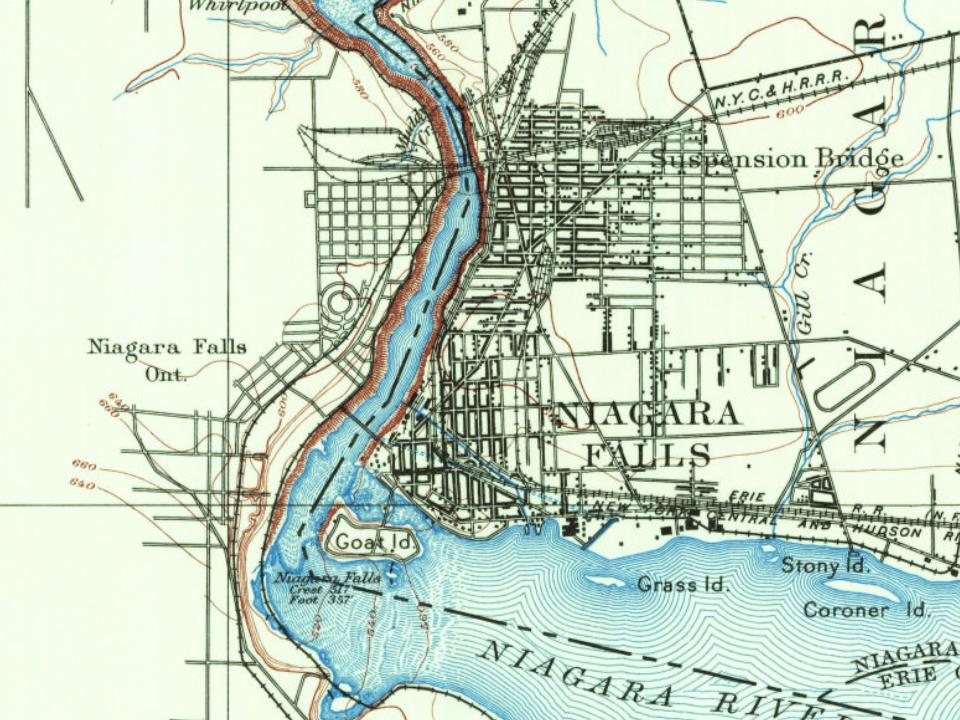
Niagara Falls on the map, 1894 to 1995
Every edition of the U.S. Geological Survey’s map of Niagara Falls. Tap a year, or press play to watch the town change.
1894Niagara Falls sheet · 1:62,500
U.S. Geological Survey historical topographic maps (public domain), via Esri’s collection of the scans. The red ring marks the center of Niagara Falls.
Before Europeans entered the area, it was dominated by the Neutral Nation of Native Americans. European migration into the area began in the 17th century. The first recorded European to visit the area was Frenchman Robert de la Salle, who built Fort Conti at the mouth of the Niagara River early in 1679, with permission from the Iroquois, as a base for boatbuilding; his ship Le Griffon was built on the upper Niagara River at or near Cayuga Creek in the same year. He was accompanied by Belgian priest Louis Hennepin, who was the first known European to see the falls. The influx of newcomers may have been a catalyst for already hostile native tribes to turn to open warfare in competition for the fur trade.
Passages that mention Niagara Falls, cut from the printed page as they were published.
Official record of the Niagara Falls Memorial Commission, in succession to the William B. Rankine Memorial Commission1920 · page 52Read the page →
Read the text
Mr. Welch played a most important part in the incorporation of the city of Niagara Falls. He was a member of the charter committee, and, with Hon. W. Caryl Ely, was in Albany when Governor Roswell P. Flower signed the Niagara Falls city charter bill, March 1 7, 1892, in fact Governor Flower was ready to sign the bill the day before, but Mr.
Text read by machine from the scan; it may contain errors.
Niagara Falls falling to the east of the centre of population, bears a relation to the number of inhabitants in two important particulars, first as its being close to the densest population, and second, being so situated as to have remarkable advantages in railroad and water communication by canal, by the lakes, and by all the great trunk lines of railroads that run east and west.
Text read by machine from the scan; it may contain errors.
Official record of the Niagara Falls Memorial Commission, in succession to the William B. Rankine Memorial Commission1920 · page 17Read the page →
Read the text
We will look ahead a few years for a perspective before we begin this sketch chronologically. Judge Augustus Porter was virtually the first white settler of what is now the city of Niagara Falls, called Manchester up to 1 840. He was a pathfinder and pioneer in the promotion of the development of the power of the Niagara river and in those things which have made this city great. He was an engineer, a lawyer and a business man, as well as a statesman. He built the
Text read by machine from the scan; it may contain errors.
Scans and text from the Internet Archive. Books published in 1930 or earlier, which are in the public domain.
Timeline
Niagara Falls, 1811 to 1983
Woven from the archive, old maps, post office records, the National Register and the people born here.
Fire insurance maps drew every building, what it was made of and what it was used for, so insurers could price the risk of fire. Pick a year, then a sheet.
Lost post offices, old corners, places now gone and burying grounds
Niagara Falls’s post office has been open since 1823. Two other post offices opened and closed inside today’s town.
Manchester
1811–1823
Niagara Falls
1823–today
Lasalle
1851–1928
Bridge
1908–today
18101920today
Hamlets and corners on the map
Black Creek VillageLa SalleLove CanalMaple Estates Mobile Home Park
Gone or out of use
Best Western Red Jacket Inn HeliportairportCapitol TheatrebuildingCataract TheatrebuildingCenter Avenue SchoolschoolLaSalle TheatrebuildingLove CanalcanalNiagara Falls CinemabuildingNinetyninth Street SchoolschoolRainbow TheaterbuildingRapids TheatrebuildingStrand Theatrebuilding
2cemeteries and burying grounds inside Niagara Falls
OakwoodSaint Joseph's
US Post Offices dataset (Blevins & Helbock, CC0). Places and cemeteries from the USGS Geographic Names Information System (2021).
Help out
Finish Niagara Falls’s story
Most archives stop around 1920. The photos from after that are in family albums, not libraries.
Decades since 1900 with photos
00s10s20s30s40s50s60s70s80s90s
0 of 10 decades. The empty ones are waiting for someone’s album.
The Niagara Falls post office opened in 1823, the earliest record of the town by name (U.S. post office records).
How does Niagara Falls rank for history?
Niagara Falls is more historic than 95% of U.S. towns, #149 of 758 in New York. The History grade combines the town’s founding era, the share of homes built before 1940 and its National Register listings. It’s a character grade, so it isn’t part of the overall grade. How it works.
What is on the National Register in Niagara Falls?
39 listings, 2 of them National Historic Landmarks: 28 buildings, 8 historic districts with 261 contributing buildings, and 3 sites. 306 historic buildings in all.
How old are the homes in Niagara Falls?
37% of Niagara Falls’ homes were built before 1940 (Census estimate, ±2.3 points), against a typical 27% for a New York town; the median home was built in 1949.
Founding dates: Wikidata, Wikipedia, the U.S. post office records of Blevins & Helbock (CC0) and the Census. Homes by year built: Census ACS 2020–24. National Register of Historic Places: National Park Service (list of May 22, 2026). Old photos, postcards and papers: Wikimedia Commons, the Library of Congress and other public archives, credited on each item’s page. Maps: U.S. Geological Survey historical topographic maps (via Esri) and Sanborn fire-insurance maps (Library of Congress). History text and census tables: Wikipedia (CC BY-SA 4.0). Places that used to be: USGS Geographic Names Information System (2021).
From Wikimedia Commons (10), Wikidata (2), the National Register of Historic Places (39), Wikipedia, Wikidata and Wikipedia for famous people, U.S. Geological Survey historical maps, U.S. Census counts (via Wikipedia), the US Post Offices dataset (Blevins & Helbock), the USGS Geographic Names Information System, Sanborn fire insurance maps (Library of Congress) and old county and town histories (Internet Archive). Archive images are copied here with their credits and licenses, shown on each photo’s page. Refreshed monthly.


 ★ Landmark
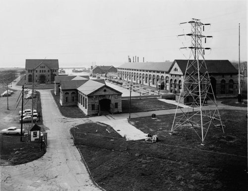 ★ Landmark
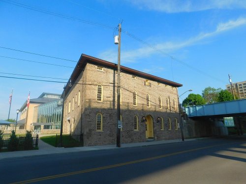


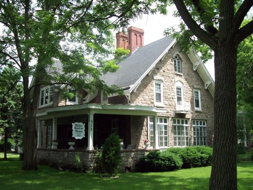




 1853
 c. 1854
 c. 1854
 1854
 1854
 c. 1855
 1855
 c. 1855
 c. 1855


