33% of New Rochelle’s homes were built before 1940
More historic than 97% of U.S. towns · #92 of 758 in New York. What drives it
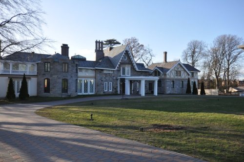
13 places in town are on the National Register, among them the Thomas Paine Cottage, a National Historic Landmark, and a historic district with 513 buildings. Below: 5 old photos and papers, maps from 1887 on, and the census since 1790.
On its age, its old homes and the National Register, New Rochelle is more historic than 97% of U.S. towns, #92 of 758 in New York. All 2 inputs are above most U.S. towns; its share of homes from before 1940 ranks highest and its National Register listings lowest.
A+
HistoryA character grade: shown, never part of New Rochelle’s overall grade.
New York towns list more on the Register than most of the country (a typical New York town has 12.3 per 10,000 residents, the U.S. 2.4), so New Rochelle’s 63.8 sits above most of its state (71% of New York towns have fewer) while its 528 historic buildings outnumber those of 97% of U.S. towns.
How sure. Graded on two of the three inputs, so a change in either one moves the letter more than it would with three. The pre-1940 share (±2.7 points) is firm at this size.
Founding year: our sources. Homes: Census ACS 2020–24. National Register: National Park Service, May 2026 list; each listing counted once (boundary changes and added documentation belong to their listing), and a historic district counts its contributing buildings. How TownRatings grades history →
What stands out about New Rochelle’s past
Read from the archive, the National Register and the record. The page puts what stands out first.
This area was occupied by cultures of indigenous peoples for thousands of years. They made use of the rich resources of Long Island Sound and inland areas.
By the 17th century, the historic Lenape bands, who spoke a language in the Algonquian family, were prominent in the area. Their territory extended from the coastal areas of western present-day Connecticut, Long Island, and south through New Jersey, Maryland, and Delaware.
Passages that mention New Rochelle, cut from the printed page as they were published.
History of Westchester county, New York, including Morrisania, Kings Bridge, and West Farms, which have been annexed to New York city1886 · page 657Read the page →
Read the text
boundary of the township. The area of the town is about six thousand acres, and the general regularity of its outline is broken just west of the southern angle by a projecting portion of the town of New Rochelle, nearly a mile in length and ranging from one-half to one-quarter of a mile in breadth. The town is bounded on the northeast by White Plains and a small part of Mamaroneck ; on the southeast, by Mamaroneck and
Text read by machine from the scan; it may contain errors.
History of Westchester county, New York, including Morrisania, Kings Bridge, and West Farms, which have been annexed to New York city1886 · page 695Read the page →
Read the text
The Beechwood Cemetery. — For many years the town of New Rochelle had felt the need of some better place for the burial of the dead, the growing population having no other facilities for this purpose than the private or denominational burying-grounds afforded. On the 30th of January, 1854, the Beechwood Cemetery was incorporated upon land owned by the late Dr. Albert Smith, of New Rochelle. It
Text read by machine from the scan; it may contain errors.
the country. Doubtless with his family he attended worship at New Rochelle, perhaps walking thither every Sabbath morning, along the newly opened country road which passed his door : even as the Huguenots of New Rochelle are said to have walked to New York to attend service in the French Church there, before their own house of worship was built in 1692.
Text read by machine from the scan; it may contain errors.
Scans and text from the Internet Archive. Books published in 1930 or earlier, which are in the public domain.
Timeline
New Rochelle, 1688 to 1972
Woven from the archive, old maps, post office records, the National Register and the people born here.
Nothing in the archives for these yearsWeddings on Main Street, storms, parades, school pictures, the old store. If it’s in your family album, it belongs here.
Every edition of the U.S. Geological Survey’s map of New Rochelle. Tap a year, or press play to watch the town change.
1897Harlem sheet · 1:62,500
U.S. Geological Survey historical topographic maps (public domain), via Esri’s collection of the scans. The red ring marks the center of New Rochelle.
Every building
New Rochelle, building by building, 1887–1911
Fire insurance maps drew every building, what it was made of and what it was used for, so insurers could price the risk of fire. Pick a year, then a sheet.
New Rochelle is more historic than 97% of U.S. towns, #92 of 758 in New York. The History grade combines the town’s founding era, the share of homes built before 1940 and its National Register listings. It’s a character grade, so it isn’t part of the overall grade. How it works.
What is on the National Register in New Rochelle?
13 listings: 11 buildings, among them the Thomas Paine Cottage (a National Historic Landmark since 1972), 1 historic district, the Rochelle Park-Rochelle Heights Historic District, with 513 contributing buildings, and 1 structure. 528 historic buildings in all.
How old are the homes in New Rochelle?
33% of New Rochelle’s homes were built before 1940 (Census estimate, ±2.7 points), against a typical 27% for a New York town; the median home was built in 1955.
Founding dates: Wikidata, Wikipedia, the U.S. post office records of Blevins & Helbock (CC0) and the Census. Homes by year built: Census ACS 2020–24. National Register of Historic Places: National Park Service (list of May 22, 2026). Old photos, postcards and papers: Wikimedia Commons, the Library of Congress and other public archives, credited on each item’s page. Maps: U.S. Geological Survey historical topographic maps (via Esri) and Sanborn fire-insurance maps (Library of Congress). History text and census tables: Wikipedia (CC BY-SA 4.0). Places that used to be: USGS Geographic Names Information System (2021).
From Wikimedia Commons (5), Wikidata (1), the National Register of Historic Places (13), Wikipedia, Wikidata and Wikipedia for famous people, U.S. Geological Survey historical maps, U.S. Census counts (via Wikipedia), the US Post Offices dataset (Blevins & Helbock), the USGS Geographic Names Information System, Sanborn fire insurance maps (Library of Congress) and old county and town histories (Internet Archive). Archive images are copied here with their credits and licenses, shown on each photo’s page. Refreshed monthly.


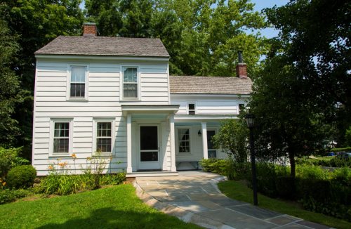 ★ Landmark




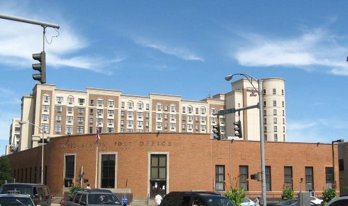


 1688


