Eastchester dates to 1664, and 35% of its homes were built before 1940
More historic than 97% of U.S. towns · #73 of 758 in New York. What drives it
6 places in town are on the National Register, among them a historic district with 94 buildings. Below: 1 old photo or paper, maps from 1897 on, and the census since 1800.
Founding year: Wikidata. First post office: 1798.The full story ↓
History grade
What drives Eastchester’s History grade
On its age, its old homes and the National Register, Eastchester is more historic than 97% of U.S. towns, #73 of 758 in New York. All 3 inputs are above most U.S. towns; its age ranks highest and its National Register listings lowest.
A+
HistoryA character grade: shown, never part of Eastchester’s overall grade.
New York towns list more on the Register than most of the country (a typical New York town has 12.3 per 10,000 residents, the U.S. 2.4), so Eastchester’s 29.1 sits near the middle of its state (61% of New York towns have fewer) while its 99 historic buildings outnumber those of 89% of U.S. towns.
NoteThe founding year comes from Wikidata alone; no second source gives 1664.
How sure. Graded on any two of the three inputs instead, the letter would range from A to A+. The pre-1940 share (±2.6 points) is firm at this size.
Founding year: Wikidata (other dates in Quick answers). Homes: Census ACS 2020–24. National Register: National Park Service, May 2026 list; each listing counted once (boundary changes and added documentation belong to their listing), and a historic district counts its contributing buildings. How TownRatings grades history →
What stands out about Eastchester’s past
Read from the archive, the National Register and the record. The page puts what stands out first.
The town that is now called Eastchester began settlement in 1664 when ten families migrated from Fairfield, Connecticut. Thomas Pell, who at that time also owned the territory that is now New Rochelle and Pelham, granted a deed to the group to "settle down at Hutchinsons'," where the home of Anne Hutchinson had stood some twenty years before. The ten original families were shortly joined by another 26.
Laws for the region were established the following year, in 1665, under an agreement called the "Eastchester Covenant". The covenant was a rare document for this period. It contained 26 provisions, including such items as education of children, disposition and upkeep of property, and support of a minister.
Passages that mention Eastchester, cut from the printed page as they were published.
History of Westchester County, New York, from its earliest settlement to the year 19001900 · page 233Read the page →
Read the text
Eastchester, incorporated in the parish of Westchester by the act of 1693, was made a separate parish in 1700. From early times Eastchester parish was known as Saint Paul's. To this day the Westchester and Eastchester Episcopalian churches preserve their original names of Saint Peter's and Saint Paul's, respectively. The present Saint Peter's Church edifice in Westchester village is entirely modern, but Saint Paul's in Eastchester dates from about 1761, and is one of the most interesting of the old-time structures in our
Text read by machine from the scan; it may contain errors.
History of Westchester County, New York, from its earliest settlement to the year 19001900 · page 579Read the page →
Read the text
Although the Township of Eastchester, at least at its southern extremity, was one of the earliest settled localities of the county, no village of any noticeable pretensions or expectations had been established within its limits until Mount Vernon sprang into being. The hamlet of Eastchester, at the head of sloop navigation where Hutchinson's River or Eastchester Creek empties into Eastchester Ray.
Text read by machine from the scan; it may contain errors.
History of Westchester county, New York, including Morrisania, Kings Bridge, and West Farms, which have been annexed to New York city1886 · page 731Read the page →
Read the text
when it was described as ** Beginning between the home lots formally laid out to Thomas Brown and Caleb Hyatt, where the road is laid out that goeth down to Eastchester; from thence northerly by the fronts of said home lots on each side of the street ; said street or highway to be the same as now left until it cometh to the great meadow brook."
Text read by machine from the scan; it may contain errors.
Scans and text from the Internet Archive. Books published in 1930 or earlier, which are in the public domain.
By decade
Eastchester, decade by decade
One decade in the archive so far: the 1890s. Scroll each row; tap a photo for its story.
Nothing in the archives for these yearsWeddings on Main Street, storms, parades, school pictures, the old store. If it’s in your family album, it belongs here.
In 1664, according to Wikidata. Eastchester’s post office opened in 1798, and the census of 1800 counted 738 people here.
How does Eastchester rank for history?
Eastchester is more historic than 97% of U.S. towns, #73 of 758 in New York. The History grade combines the town’s founding era, the share of homes built before 1940 and its National Register listings. It’s a character grade, so it isn’t part of the overall grade. How it works.
What is on the National Register in Eastchester?
6 listings: 5 buildings and 1 historic district, the Lawrence Park Historic District, with 94 contributing buildings. 99 historic buildings in all.
How old are the homes in Eastchester?
35% of Eastchester’s homes were built before 1940 (Census estimate, ±2.6 points), against a typical 27% for a New York town; the median home was built in 1952.
Founding dates: Wikidata, Wikipedia, the U.S. post office records of Blevins & Helbock (CC0) and the Census. Homes by year built: Census ACS 2020–24. National Register of Historic Places: National Park Service (list of May 22, 2026). Old photos, postcards and papers: Wikimedia Commons, the Library of Congress and other public archives, credited on each item’s page. Maps: U.S. Geological Survey historical topographic maps (via Esri) and Sanborn fire-insurance maps (Library of Congress). History text and census tables: Wikipedia (CC BY-SA 4.0). Places that used to be: USGS Geographic Names Information System (2021).
From Wikimedia Commons (22), Wikidata (2), the National Register of Historic Places (6), Wikipedia, Wikidata and Wikipedia for famous people, U.S. Geological Survey historical maps, U.S. Census counts (via Wikipedia), the US Post Offices dataset (Blevins & Helbock), the USGS Geographic Names Information System and old county and town histories (Internet Archive). Archive images are copied here with their credits and licenses, shown on each photo’s page. Refreshed monthly.


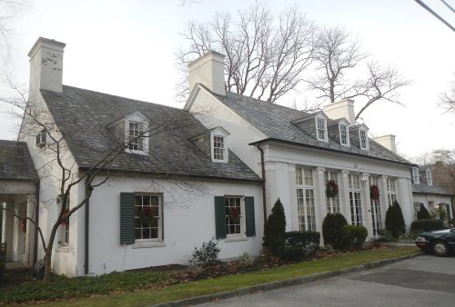


 2012
 2012
 2012
 2012
 2012
 2012
 2012
 2012
 2012
 2012
 2012
 2012
 2010
 2008
 2008
 2007
 2006
 2006
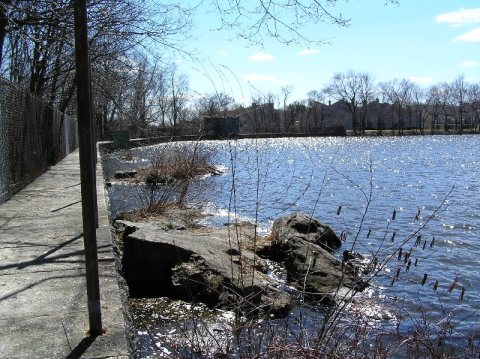 2006
 2006
 2006


