Mexico’s post office opened in 1813, and 24% of its homes were built before 1940
More historic than 92% of U.S. towns · #230 of 758 in New York. What drives it
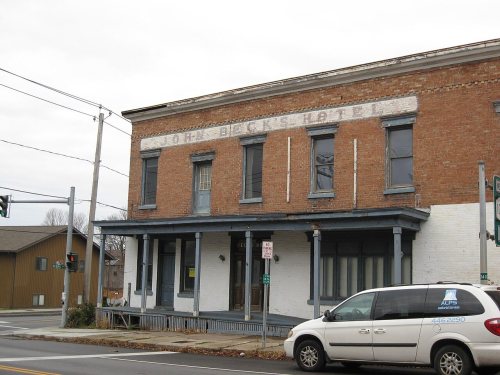
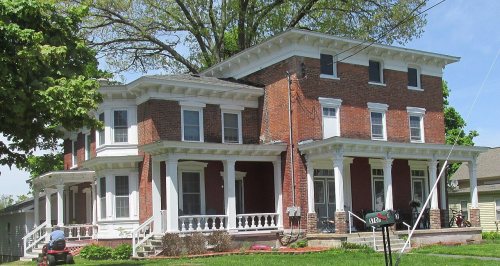
19 places in town are on the National Register, among them seven historic districts with 97 buildings between them. Below: 3 old photos and papers, maps from 1885 on, and the census since 1820.
The Mexico post office opened in 1813, the earliest record of the town by name. Six smaller post offices, Four Corners (1817), Colosse (1821) and Texas (1839), opened inside today’s town and later closed.
First census: 2,728 in 18202020 census: 5,259213 years
How historic is Mexico?
A
More historic than 92% of U.S. towns, on its age, its old homes and the National Register.
Founding year: the first Mexico post office (Blevins & Helbock, CC0).The full story ↓
History grade
What drives Mexico’s History grade
On its age, its old homes and the National Register, Mexico is more historic than 92% of U.S. towns, #230 of 758 in New York. All 3 inputs are above most U.S. towns; its National Register listings ranks highest and its age lowest.
A
HistoryA character grade: shown, never part of Mexico’s overall grade.
New York towns list more on the Register than most of the country (a typical New York town has 12.3 per 10,000 residents, the U.S. 2.4), so Mexico’s 210 sits above most of its state (83% of New York towns have fewer) while its 111 historic buildings outnumber those of 90% of U.S. towns.
How sure. Graded on any two of the three inputs instead, the letter would range from A− to A. The pre-1940 share is a Census survey estimate (±5.9 points). The founding year is the first post office, not a stated founding date.
Founding year: the first post office (other dates in Quick answers). Homes: Census ACS 2020–24. National Register: National Park Service, May 2026 list; each listing counted once (boundary changes and added documentation belong to their listing), and a historic district counts its contributing buildings. How TownRatings grades history →
What stands out about Mexico’s past
Read from the archive, the National Register and the record. The page puts what stands out first.
Lost post offices, old corners, places now gone and burying grounds
Mexico’s post office has been open since 1813. Six other post offices opened and closed inside today’s town.
Mexico
1813–today
Four Corners
1817–1821
Colosse
1821–1938
Texas
1839–1905
Prattham
1879–1902
Arthur
1880–1904
Wellwood
1890–1904
Maple View
1907–today
18101920today
Hamlets and corners on the map
ArthurColosseGraftons SquareMaple ViewNorth Church CornerPleasant Meadow Mobile Home ParkPratthamQuiet Acres Mobile Home ParkRed MillTexasWellwood
Gone or out of use
Saint Annes ChurchchurchSchool Number 11schoolSchool Number 12schoolSchool Number 12schoolSchool Number 13schoolSchool Number 14schoolSchool Number 2schoolSchool Number 2schoolSchool Number 3schoolSchool Number 8schoolSchool Number 9school
The first Mexico (a proposed county), with all the surrounding towns, was originally created from Town of Whitestown, Oneida County, New York, on April 10, 1792, by the State Land Commissioner. It was to include present day Oswego and Jefferson Counties. The original organization of the proposed Mexico County and a town of that name was abandoned for a time. In December 1794, George Frederick William Augustus Scriba purchased and patented a large tract of land; subsequently becoming a second Mexico, hence the Village of Mexico and the Town of Mexico.
George Scriba also later opened roads traveling from Mexico Bay and Mexico Point from what is now Mexico Point State Park to present-day Constantia, as well as a highway to present-day Oswego.
The Cortes family remained in Spain till Pedro, the fourth marquis, a brother of his predecessor and whose wife was Ana de Pacheco de la Cerda, a sister of the conde de Montalvan, came to Mexico, where he died J anuary 30, 1629, without issue. It is said that at his funeral were in attendance 300 Franciscan friars from the city of Mexico and neighboring towns. The entail went to his niece, Estefania Cortes, wife of the Neapolitan nobleman duke of Terranova and Monteleone. The estates and seignorial rights remained in the house till the war of succession to the Spanish crown, when, the duke having
Text read by machine from the scan; it may contain errors.
Pacheco dJoA Cardenas, Col. Doc., xvi. 560-2. The new town was built on the margin of the river Atoyac. Tlie site was five leagues south of Tlascala, 20 leagues east of the city of Mexico, and 40 leagues west of Vera Cruz. Upon it were very ancient ruins, those, according to tradition, of the city of Quilaxcolapan, founded centuries before by Vemecat and Xicalantoalt.
Text read by machine from the scan; it may contain errors.
Scans and text from the Internet Archive. Books published in 1930 or earlier, which are in the public domain.
Timeline
Mexico, 1813 to 1967
Woven from the archive, old maps, post office records, the National Register and the people born here.
Nothing in the archives for these yearsWeddings on Main Street, storms, parades, school pictures, the old store. If it’s in your family album, it belongs here.
Every edition of the U.S. Geological Survey’s map of Mexico. Tap a year, or press play to watch the town change.
1905Mexico sheet · 1:62,500
U.S. Geological Survey historical topographic maps (public domain), via Esri’s collection of the scans. The red ring marks the center of Mexico.
Every building
Mexico, building by building, 1885–1911
Fire insurance maps drew every building, what it was made of and what it was used for, so insurers could price the risk of fire. Pick a year, then a sheet.
The Mexico post office opened in 1813, the earliest record of the town by name (U.S. post office records).
How does Mexico rank for history?
Mexico is more historic than 92% of U.S. towns, #230 of 758 in New York. The History grade combines the town’s founding era, the share of homes built before 1940 and its National Register listings. It’s a character grade, so it isn’t part of the overall grade. How it works.
What is on the National Register in Mexico?
19 listings: 12 buildings and 7 historic districts with 97 contributing buildings. 111 historic buildings in all.
How old are the homes in Mexico?
24% of Mexico’s homes were built before 1940 (Census estimate, ±5.9 points), against a typical 27% for a New York town; the median home was built in 1975.
Founding dates: Wikidata, Wikipedia, the U.S. post office records of Blevins & Helbock (CC0) and the Census. Homes by year built: Census ACS 2020–24. National Register of Historic Places: National Park Service (list of May 22, 2026). Old photos, postcards and papers: Wikimedia Commons, the Library of Congress and other public archives, credited on each item’s page. Maps: U.S. Geological Survey historical topographic maps (via Esri) and Sanborn fire-insurance maps (Library of Congress). History text and census tables: Wikipedia (CC BY-SA 4.0). Places that used to be: USGS Geographic Names Information System (2021).
From Wikimedia Commons (3), the Library of Congress (2), Wikidata (1), the National Register of Historic Places (19), Wikipedia, Wikidata and Wikipedia for famous people, U.S. Geological Survey historical maps, U.S. Census counts (via Wikipedia), the US Post Offices dataset (Blevins & Helbock), the USGS Geographic Names Information System, Sanborn fire insurance maps (Library of Congress) and old county and town histories (Internet Archive). Archive images are copied here with their credits and licenses, shown on each photo’s page. Refreshed monthly.





 1941
 2009
 2009


