7 places in town are on the National Register, among them the Jethro Wood House, a National Historic Landmark, and two historic districts with 100 buildings between them. Below: 2 old photos and papers, maps from 1902 on, and the census since 1830.
Founding year: Wikipedia. First post office: 1810.The full story ↓
History grade
What drives Ledyard’s History grade
On its age, its old homes and the National Register, Ledyard is more historic than 97% of U.S. towns. All 3 inputs are above most U.S. towns; its share of homes from before 1940 ranks highest and its age lowest.
A+
HistoryA character grade: shown, never part of Ledyard’s overall grade.
New York towns list more on the Register than most of the country (a typical New York town has 12.3 per 10,000 residents, the U.S. 2.4), so Ledyard’s 607 sits above most of its state (93% of New York towns have fewer) while its 110 historic buildings outnumber those of 90% of U.S. towns.
NoteThe founding year comes from Wikipedia alone; no second source gives 1823.
How sure. Graded on any two of the three inputs instead, the letter would range from A to A+. The pre-1940 share is a Census survey estimate (±6.6 points).
Founding year: Wikipedia (other dates in Quick answers). Homes: Census ACS 2020–24. National Register: National Park Service, May 2026 list; each listing counted once (boundary changes and added documentation belong to their listing), and a historic district counts its contributing buildings. How TownRatings grades history →
What stands out about Ledyard’s past
Read from the archive, the National Register and the record. The page puts what stands out first.
The south part of Ledyard was in the New York Military Tract, and the northern part was originally a reservation designated for the Cayuga tribe. The first settlers arrived around 1789. It was then part of the town of Scipio, one of the original towns of the Military Tract. The town of Ledyard was established in 1823 as part of a division of towns from the original town of Scipio.
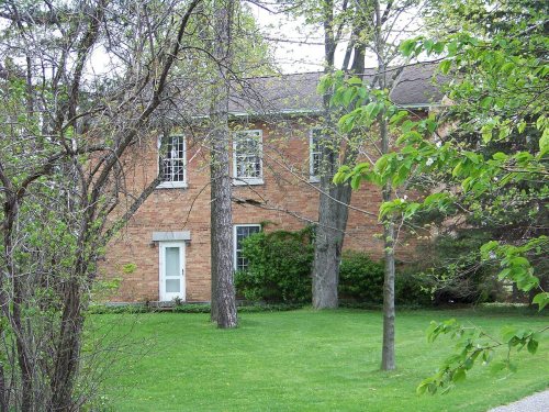
The North Street Friends Meetinghouse was listed on the National Register of Historic Places in 2005.
Passages that mention Ledyard, cut from the printed page as they were published.
History of Cayuga County, New York1908 · page 244Read the page →
Read the text
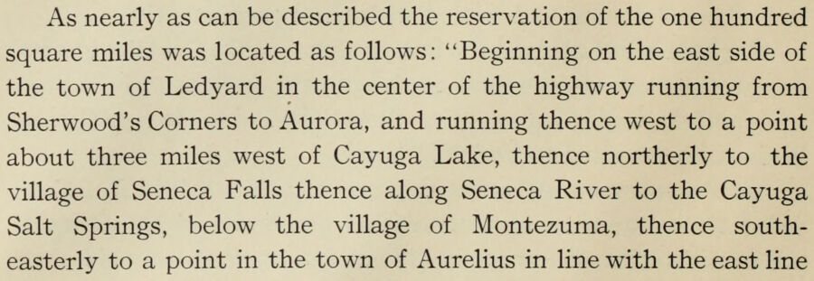
As nearly as can be described the reservation of the one hundred square miles was located as follows: "Beginning on the east side of the town of Ledyard in the center of the highway running from Sherwood's Corners to Aurora, and running thence west to a point about three miles west of Cayuga Lake, thence northerly to the village of Seneca Falls thence along Seneca River to the Cayuga Salt Springs, below the village of Montezuma, thence southeasterly to a point in the town of Aurelius in line with the east line
Text read by machine from the scan; it may contain errors.
Onondaga county, set off in 1804 ; and the towns of Ledyard, Venice and a part of Springport, which were set off January 30th, 1823. It lies south of the center of the County, upon the west shore of Owasco Lake, which forms its eastern boundary. It is bounded on the north by Fleming, on the south by Venice, and on the west by Springport and Ledyard.
Text read by machine from the scan; it may contain errors.
History of Cayuga County, New York1879 · page 35Read the page →
Read the text
town of Ledyard, and the first general election in the town of Whitestown, was held at the Cayuga Ferry. If the voters residing as far east as Utica came to Cayuga to vote, traversing over eighty miles of forest roads, they paid a full equivalent for the right.
Text read by machine from the scan; it may contain errors.
History of Cayuga County, New York1908 · page 419Read the page →
Read the text
Ledyard was formed from Scipio January 30, 1823, and was named after Benjamin Ledyard agent and clerk for the apportionment of lands in the Military Tract. It lies on the east bank of Cayuga Lake southwest of the center of the county. The surface inclines toward the west, its extreme east border being elevated five hundred or six hundred feet above the lake level. Generally the hill slopes are gradual and the streams are small, rapid brooks, the principal one being Paine's Creek which flows through a narrow
Text read by machine from the scan; it may contain errors.
Scans and text from the Internet Archive. Books published in 1930 or earlier, which are in the public domain.
Timeline
Ledyard, 1810 to 1968
Woven from the archive, old maps, post office records, the National Register and the people born here.
Nothing in the archives for these yearsWeddings on Main Street, storms, parades, school pictures, the old store. If it’s in your family album, it belongs here.
In 1823, according to Wikipedia’s history of the town. Ledyard’s post office opened in 1810, and the census of 1830 counted 2,427 people here.
How does Ledyard rank for history?
Ledyard is more historic than 97% of U.S. towns. The History grade combines the town’s founding era, the share of homes built before 1940 and its National Register listings. It’s a character grade, so it isn’t part of the overall grade. How it works.
What is on the National Register in Ledyard?
7 listings: 5 buildings, among them the Jethro Wood House (a National Historic Landmark since 1964), and 2 historic districts, the Aurora Village-Wells College Historic District and the Mosher Farmstead, with 100 contributing buildings. 110 historic buildings in all.
How old are the homes in Ledyard?
40% of Ledyard’s homes were built before 1940 (Census estimate, ±6.6 points), against a typical 27% for a New York town; the median home was built in 1959.
Founding dates: Wikidata, Wikipedia, the U.S. post office records of Blevins & Helbock (CC0) and the Census. Homes by year built: Census ACS 2020–24. National Register of Historic Places: National Park Service (list of May 22, 2026). Old photos, postcards and papers: Wikimedia Commons, the Library of Congress and other public archives, credited on each item’s page. Maps: U.S. Geological Survey historical topographic maps (via Esri) and Sanborn fire-insurance maps (Library of Congress). History text and census tables: Wikipedia (CC BY-SA 4.0). Places that used to be: USGS Geographic Names Information System (2021).
From Wikimedia Commons (2), the National Register of Historic Places (7), Wikipedia, Wikidata and Wikipedia for famous people, U.S. Geological Survey historical maps, U.S. Census counts (via Wikipedia), the US Post Offices dataset (Blevins & Helbock), the USGS Geographic Names Information System and old county and town histories (Internet Archive). Archive images are copied here with their credits and licenses, shown on each photo’s page. Refreshed monthly.

 ★ Landmark




 Date?


