Founding year: Wikidata; Wikipedia’s history section gives the same year. First post office: 1816.The full story ↓
History grade
What drives Hartland’s History grade
On its age, its old homes and the National Register, Hartland is more historic than 92% of U.S. towns, #216 of 758 in New York. All 3 inputs are above most U.S. towns; its share of homes from before 1940 ranks highest and its National Register listings lowest.
A
HistoryA character grade: shown, never part of Hartland’s overall grade.
New York towns list more on the Register than most of the country (a typical New York town has 12.3 per 10,000 residents, the U.S. 2.4), so Hartland’s 41.8 sits above most of its state (66% of New York towns have fewer) while its 16 historic buildings outnumber those of 78% of U.S. towns.
How sure. Graded on any two of the three inputs instead, the letter would range from A− to A. The pre-1940 share is a Census survey estimate (±8.7 points). Two sources give 1803.
Founding year: Wikidata (other dates in Quick answers). Homes: Census ACS 2020–24. National Register: National Park Service, May 2026 list; each listing counted once (boundary changes and added documentation belong to their listing), and a historic district counts its contributing buildings. How TownRatings grades history →
What stands out about Hartland’s past
Read from the archive, the National Register and the record. The page puts what stands out first.
The town was founded when Zebulon Barnum, Isaac Southwell, and John Morrison settled in the area in 1803. The Town of Hartland was created in 1812 from an eastern section of the Town of Cambria. Subsequently, the other towns were formed from its territory by cutting out, in whole or part, the towns of Somerset, Royalton, and Newfane by 1824.
Upon the completion of the Erie Canal in 1824, the town lost its commercial prominence to Lockport, which was centered on the canal.
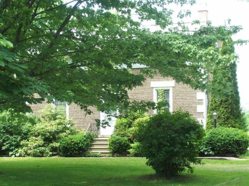
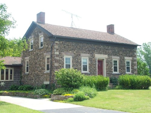
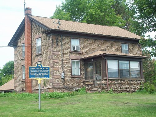
The following are listed on the National Register of Historic Places: Constant Riley W. Bixby House, Amzi Bradley Farmstead, District#10 Schoolhouse, Harrington Cobblestone Farmhouse and Barn Complex, and Philo Newton Cobblestone House.
Passages that mention Hartland, cut from the printed page as they were published.
History of Niagara county, N. Y., with illustrations descriptive of its scenery, private residences, public buildings, fine blocks, and important manufactories, and portraits of old pioneers and prominent residents1878 · page 241Read the page →
Read the text
Jesse Aldrich and wife, in company with Asa Baker and wife, moved from Perinton, Monroe county, into the town of Hartland June 6th, 1815, and became the first settlers of that part of the town now known as the Quaker Settlement, and are believed to have been the first settlers north of the Ridge road in what is now known as Hartland. These families were accompanied by Joseph Bird-
Text read by machine from the scan; it may contain errors.
Souvenir history of Niagara County, New York1902 · page 125Read the page →
Read the text
The town was formed February 8, 1823, from a portion of the Town of Hartland, on the south, and in the year 1824 a portion of the Town of Newfane was added on the west, to complete its present size. It would be interesting to know who gave the name to the town, but we have not been able to ascertain that fact.
Text read by machine from the scan; it may contain errors.
Souvenir history of Niagara County, New York1902 · page 144Read the page →
Read the text
the portion east of the West Transit line constituting Hartland, in'. which the eastern part of the present Town of Lockport was located. This became a part of Royalton when that town was taken from Hartland in 1817. On February 2, 1824, the Town of Lockport was formed from Cambria and Royalton, with its present boundaries ; up to which time it was nearly enveloped with the primeval forest, through which the Red men roamed, and wild beasts made their
Text read by machine from the scan; it may contain errors.
History of Niagara county, N. Y., with illustrations descriptive of its scenery, private residences, public buildings, fine blocks, and important manufactories, and portraits of old pioneers and prominent residents1878 · page 141Read the page →
Read the text
Company E was from Niagara county, and most of the men were from the towns of Hartland and Royalton. It was raised by Captain Benjamin F. Foote, of the town of Hartland, and consisted of the following named men, besides himself and First Lieutenant Alpha Whiton, of Royalton, who enlisted September 5, 1861, and was discharged May 22, 1863.
Text read by machine from the scan; it may contain errors.
Scans and text from the Internet Archive. Books published in 1930 or earlier, which are in the public domain.
Timeline
Hartland, 1803 to 1970
Woven from the archive, old maps, post office records, the National Register and the people born here.
Lost post offices, old corners, places now gone and burying grounds
Hartland had its own post office from 1816 to 1901. Two other post offices opened and closed inside today’s town.
Hartland
1816–1901
Johnson Creek
1825–1901
North Hartland
1858–1901
18101920today
Hamlets and corners on the map
Johnson CreekNorth Hartland
Gone or out of use
School Number 10schoolSchool Number 11schoolSchool Number 18schoolSchool Number 2schoolSchool Number 3schoolSchool Number 5schoolSchool Number 7schoolSchool Number 8school
6cemeteries and burying grounds inside Hartland
Hartland CentralJohnsons Creek BaptistLeValleyMorehouseSaint PatricksSmiths
US Post Offices dataset (Blevins & Helbock, CC0). Places and cemeteries from the USGS Geographic Names Information System (2021).
Stories next door
History across the town line
Each neighbor’s History grade, on the same three inputs.
In 1803, according to Wikidata and Wikipedia’s history of the town. Hartland’s post office opened in 1816, and the census of 1820 counted 1,448 people here.
How does Hartland rank for history?
Hartland is more historic than 92% of U.S. towns, #216 of 758 in New York. The History grade combines the town’s founding era, the share of homes built before 1940 and its National Register listings. It’s a character grade, so it isn’t part of the overall grade. How it works.
What is on the National Register in Hartland?
5 listings: 5 buildings, among them the District #10 Schoolhouse (listed 2000, the first). 16 historic buildings in all.
How old are the homes in Hartland?
37% of Hartland’s homes were built before 1940 (Census estimate, ±8.7 points), against a typical 27% for a New York town; the median home was built in 1953.
Founding dates: Wikidata, Wikipedia, the U.S. post office records of Blevins & Helbock (CC0) and the Census. Homes by year built: Census ACS 2020–24. National Register of Historic Places: National Park Service (list of May 22, 2026). Old photos, postcards and papers: Wikimedia Commons, the Library of Congress and other public archives, credited on each item’s page. Maps: U.S. Geological Survey historical topographic maps (via Esri) and Sanborn fire-insurance maps (Library of Congress). History text and census tables: Wikipedia (CC BY-SA 4.0). Places that used to be: USGS Geographic Names Information System (2021).
From Wikimedia Commons (6), Wikidata (2), the National Register of Historic Places (5), Wikipedia, Wikidata and Wikipedia for famous people, U.S. Geological Survey historical maps, U.S. Census counts (via Wikipedia), the US Post Offices dataset (Blevins & Helbock), the USGS Geographic Names Information System and old county and town histories (Internet Archive). Archive images are copied here with their credits and licenses, shown on each photo’s page. Refreshed monthly.




 1875
 2018
 2018
 2018
 2018