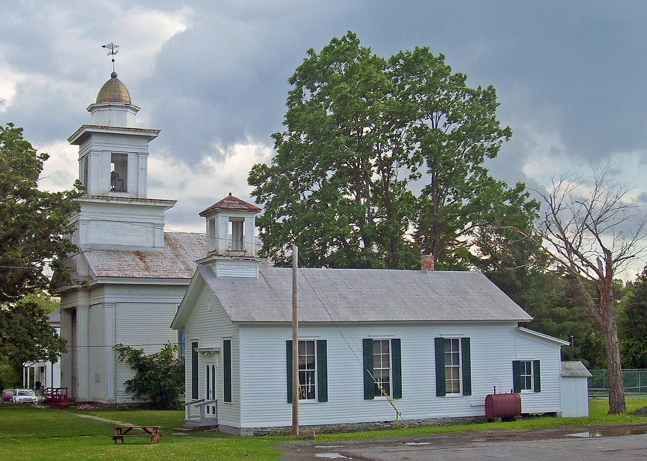
Founding year: Wikidata. First post office: 1800.The full story ↓
History grade
What drives Greenville’s History grade
On its age, its old homes and the National Register, Greenville is more historic than 79% of U.S. towns, #431 of 758 in New York. All 2 inputs are above most U.S. towns; its National Register listings ranks highest and its share of homes from before 1940 lowest.
A−
HistoryA character grade: shown, never part of Greenville’s overall grade.
New York towns list more on the Register than most of the country (a typical New York town has 12.3 per 10,000 residents, the U.S. 2.4), so Greenville’s 37.2 sits near the middle of its state (64% of New York towns have fewer) while its 14 historic buildings outnumber those of 78% of U.S. towns.
NoteThe founding year comes from Wikidata alone; no second source gives 1774.
How sure. Graded on two of the three inputs, so a change in either one moves the letter more than it would with three. The pre-1940 share is a Census survey estimate (±6.5 points).
Founding year: Wikidata (other dates in Quick answers). Homes: Census ACS 2020–24. National Register: National Park Service, May 2026 list; each listing counted once (boundary changes and added documentation belong to their listing), and a historic district counts its contributing buildings. How TownRatings grades history →
What stands out about Greenville’s past
Read from the archive, the National Register and the record. The page puts what stands out first.
Lost half of its people between 1830 and 1930, then more than doubled.
21 censuses, 1820–2020.
U.S. Census Bureau decennial counts, from the census table on Greenville’s Wikipedia page.
Places that used to be
Lost post offices, old corners, places now gone and burying grounds
Greenville’s post office has been open since 1812. Two other post offices opened and closed inside today’s town.
Freehold
1800–today
Greenville
1812–today
Norton Hill
1849–today
Greenville Centre
1887–1960
Surprise
1889–1988
18001910today
Hamlets and corners on the map
East GreenvilleFreeholdGreenville CenterNewrysNorton HillPlace CornersSurpriseWest Greenville
Gone or out of use
Greenville Drive-InlocaleSchool Number 10schoolSchool Number 11schoolSchool Number 12schoolSchool Number 14schoolSchool Number 6schoolSchool Number 7school
11cemeteries and burying grounds inside Greenville
The area of the town was first settled circa 1774. The town was established in 1803 as "Greenfield" from the towns of Coxsackie and Durham. The adjoining town is "Freehold", just south of Greenville.
In 1810, the Greenville town population was 2,300, but by 1900 that figure had fallen to 1,362.
Passages that mention Greenville, cut from the printed page as they were published.
A history of the Minisink Region1867 · page 110Read the page →
Read the text
better suited at having paid ten dollars for the military covering of his caput instead of five. , There is an old tradition current among the legends of Minisink and Greenville, that Joseph Brandt in order to acquaint himself with the state of affairs in the Minisink neighborhood, paid it a visit in secret, some time before his second invasion, and remained concealed in a swamp in the present town of Greenville, nearly a
Text read by machine from the scan; it may contain errors.
A history of the Minisink Region1867 · page 159Read the page →
Read the text
village of Middletown is said to be built on what was part of his farm, portions of which he donated for church and educational purposes. The first who came to this section located in what is now the town of Greenville, some time during the Revolutionary war. If we are informed rightly it was the "svife of Daniel Green who met with an exciting adventure with the Indians during Brandt's last invasion of the Minisink Region. Her
Text read by machine from the scan; it may contain errors.
Scans and text from the Internet Archive. Books published in 1930 or earlier, which are in the public domain.
Timeline
Greenville, 1770 to 2020
Woven from the archive, old maps, post office records, the National Register and the people born here.
Every edition of the U.S. Geological Survey’s map of Greenville. Tap a year, or press play to watch the town change.
1893Durham sheet · 1:62,500
U.S. Geological Survey historical topographic maps (public domain), via Esri’s collection of the scans. The red ring marks the center of Greenville.
Every building
Greenville, building by building, 1903–1912
Fire insurance maps drew every building, what it was made of and what it was used for, so insurers could price the risk of fire. Pick a year, then a sheet.
1903Sheet 1 of 1
Edition
Sheets
BrickWoodStone
Sanborn Map Company, via the Library of Congress. Editions published in 1930 or earlier, which are in the public domain.
On the National Register
6 historic places in Greenville
The country’s official list of buildings and places worth saving.
In 1774, according to Wikidata. Greenville’s post office opened in 1800, and the census of 1820 counted 2,374 people here.
How does Greenville rank for history?
Greenville is more historic than 79% of U.S. towns, #431 of 758 in New York. The History grade combines the town’s founding era, the share of homes built before 1940 and its National Register listings. It’s a character grade, so it isn’t part of the overall grade. How it works.
What is on the National Register in Greenville?
6 listings: 5 buildings, among them the Prevost Manor House (listed 1972, the first), and 1 historic district, the Stevens Hill Farm, with 5 contributing buildings. 14 historic buildings in all.
How old are the homes in Greenville?
17% of Greenville’s homes were built before 1940 (Census estimate, ±6.5 points), against a typical 27% for a New York town; the median home was built in 1975.
Founding dates: Wikidata, Wikipedia, the U.S. post office records of Blevins & Helbock (CC0) and the Census. Homes by year built: Census ACS 2020–24. National Register of Historic Places: National Park Service (list of May 22, 2026). Old photos, postcards and papers: Wikimedia Commons, the Library of Congress and other public archives, credited on each item’s page. Maps: U.S. Geological Survey historical topographic maps (via Esri) and Sanborn fire-insurance maps (Library of Congress). History text and census tables: Wikipedia (CC BY-SA 4.0). Places that used to be: USGS Geographic Names Information System (2021).
From Wikidata (2), the National Register of Historic Places (6), Wikipedia, Wikidata and Wikipedia for famous people, U.S. Geological Survey historical maps, U.S. Census counts (via Wikipedia), the US Post Offices dataset (Blevins & Helbock), the USGS Geographic Names Information System, Sanborn fire insurance maps (Library of Congress) and old county and town histories (Internet Archive). Archive images are copied here with their credits and licenses, shown on each photo’s page. Refreshed monthly.