Durham dates to 1790, and 25% of its homes were built before 1940
More historic than 93% of U.S. towns · #202 of 758 in New York. What drives it
22 places in town are on the National Register, among them two historic districts with 57 buildings between them. Below: 7 old photos and papers, maps from 1893 on, and the census since 1820.
Founding year: Wikipedia. First post office: 1808.The full story ↓
History grade
What drives Durham’s History grade
On its age, its old homes and the National Register, Durham is more historic than 93% of U.S. towns, #202 of 758 in New York. All 3 inputs are above most U.S. towns; its National Register listings ranks highest and its age lowest.
A
HistoryA character grade: shown, never part of Durham’s overall grade.
New York towns list more on the Register than most of the country (a typical New York town has 12.3 per 10,000 residents, the U.S. 2.4), so Durham’s 314 sits above most of its state (87% of New York towns have fewer) while its 83 historic buildings outnumber those of 88% of U.S. towns.
How sure. Graded on any two of the three inputs instead, the letter would range from A− to A. The pre-1940 share is a Census survey estimate (±6.4 points). Two sources give 1790.
Founding year: Wikipedia (other dates in Quick answers). Homes: Census ACS 2020–24. National Register: National Park Service, May 2026 list; each listing counted once (boundary changes and added documentation belong to their listing), and a historic district counts its contributing buildings. How TownRatings grades history →
What stands out about Durham’s past
Read from the archive, the National Register and the record. The page puts what stands out first.
The land that would become the town was first settled circa 1755 within Albany County. The town was established from part of the town of Coxsackie in 1790 as the "Town of Freehold". In the spring of 1800, Freehold became part of the newly formed Greene County. The town's name was changed to "Durham" in 1805, the town having been called informally "New Durham" by the many settlers from Connecticut.
Part of the town was lost in 1803 to form the new towns of Cairo, Greenville, and Windham. In 1836, the western part of Durham became the town of Conesville in Schoharie County.
Passages that mention Durham, cut from the printed page as they were published.
An historical, topographical, and descriptive view of the county palatine of Durham1834 · page 142Read the page →
Read the text
John-George Lambton was bom 12th April, 1792, and became representative in parliament for the county of Durham in 1818, for which county he continued to sit until 17th January, 1828, when he was called to the Upper House, by the title of Baron Durham, of the City of Durham, and of Lambton Castle in the County of Durham. As jthe title had never before been appropriated to any private family, it excited much remark in certain quarters. *< The bishop of Durham,^ it was said, <<has always been the Count Palatine, and, sharing more of the character of a temporal peer than any other bishop, has never been jostled by a secular earl." On the 22d November^ 1830, his lordship was made Lord Privy Seal.
Text read by machine from the scan; it may contain errors.
Elder Benjamin Randall held meetings in Lisbon in 1780, in which some from Durham were converted, and a church was gathered, made up of inhabitants from both sides of the river. In 1790 a Free Baptist church was organized on the Durham side by Elders E. Stinchfield and Christopher Tracy. A record of baptisms kept by Elder Stinchfield contains the following names
Text read by machine from the scan; it may contain errors.
An historical, topographical, and descriptive view of the county palatine of Durham1834 · page 98Read the page →
Read the text
' The Tyne Bridge is undoubtedly of Roman origin.* In the reign of Henry II. it was coiliposed of wood, and was burnt witli a great part of Newcastle. Many benefactions and indulgences were, at di£Perent times, granted for its repair. In 1339, part of it was washed away by a flood In 1414, Bishop Langley recovered the third part of the bridge belonging to the see of Durham, which third paft Bishop Tunstal repaired in 1530. In 1582, a decree passed in the Exchequer, that the bishop of Durham, and not the inhabitants of the toUnty at large, should be charged with the repairs of the third part bf the bridge. In 1649, Charles I., it seems» had given timber out of the crown woods at Chopwell towards its repair. In 177^9 the bishop of Durham repaired
Text read by machine from the scan; it may contain errors.
Durham is proud of him, and he has no reason to be ashamed of Durham. He showed his loyalty to his native town by delivering the principal address at her Centennial in 1889.
Text read by machine from the scan; it may contain errors.
Scans and text from the Internet Archive. Books published in 1930 or earlier, which are in the public domain.
Timeline
Durham, 1790 to 1977
Woven from the archive, old maps, post office records, the National Register and the people born here.
Nothing in the archives for these yearsWeddings on Main Street, storms, parades, school pictures, the old store. If it’s in your family album, it belongs here.
In 1790, according to Wikipedia’s history of the town. Durham’s post office opened in 1808, and the census of 1820 counted 2,979 people here.
How does Durham rank for history?
Durham is more historic than 93% of U.S. towns, #202 of 758 in New York. The History grade combines the town’s founding era, the share of homes built before 1940 and its National Register listings. It’s a character grade, so it isn’t part of the overall grade. How it works.
What is on the National Register in Durham?
22 listings: 12 buildings, 2 historic districts, the Oak Hill Historic District and the Dunix, with 57 contributing buildings, 2 sites, and 6 structures. 83 historic buildings in all.
How old are the homes in Durham?
25% of Durham’s homes were built before 1940 (Census estimate, ±6.4 points), against a typical 27% for a New York town; the median home was built in 1976.
Founding dates: Wikidata, Wikipedia, the U.S. post office records of Blevins & Helbock (CC0) and the Census. Homes by year built: Census ACS 2020–24. National Register of Historic Places: National Park Service (list of May 22, 2026). Old photos, postcards and papers: Wikimedia Commons, the Library of Congress and other public archives, credited on each item’s page. Maps: U.S. Geological Survey historical topographic maps (via Esri) and Sanborn fire-insurance maps (Library of Congress). History text and census tables: Wikipedia (CC BY-SA 4.0). Places that used to be: USGS Geographic Names Information System (2021).
From Wikimedia Commons (16), Wikidata (2), the National Register of Historic Places (22), Wikipedia, Wikidata and Wikipedia for famous people, U.S. Geological Survey historical maps, U.S. Census counts (via Wikipedia), the US Post Offices dataset (Blevins & Helbock), the USGS Geographic Names Information System and old county and town histories (Internet Archive). Archive images are copied here with their credits and licenses, shown on each photo’s page. Refreshed monthly.


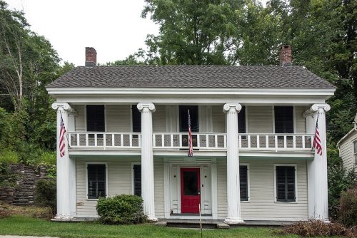

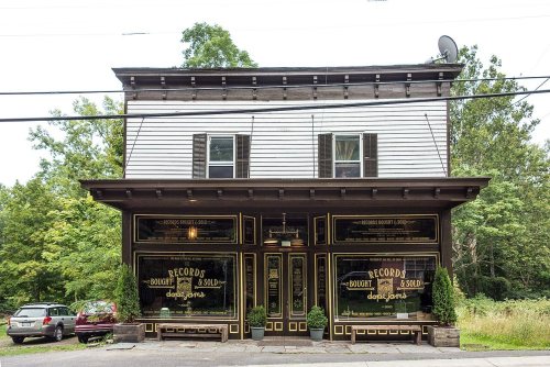
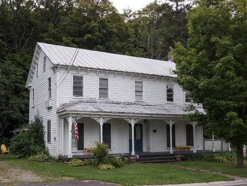
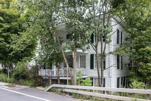


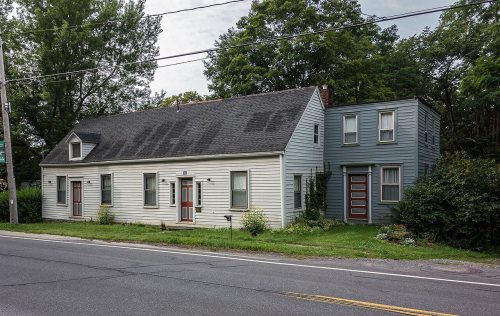


 1977
 1977
 1977
 1977
 1977
 1977
 2013
 2013
 2013
 2013
 2013
 2013
 2013
 2011
 2010


