Founding year: Wikipedia. First post office: 1824.The full story ↓
History grade
What drives Crawford’s History grade
On its age, its old homes and the National Register, Crawford is more historic than 90% of U.S. towns, #272 of 758 in New York. All 3 inputs are above most U.S. towns; its age ranks highest and its share of homes from before 1940 lowest.
A
HistoryA character grade: shown, never part of Crawford’s overall grade.
New York towns list more on the Register than most of the country (a typical New York town has 12.3 per 10,000 residents, the U.S. 2.4), so Crawford’s 23.1 sits near the middle of its state (58% of New York towns have fewer) while its 21 historic buildings outnumber those of 80% of U.S. towns.
NoteThe founding year comes from Wikipedia alone; no second source gives 1740.
How sure. Graded on any two of the three inputs instead, the letter would range from A− to A. The pre-1940 share is a Census survey estimate (±5.8 points).
Founding year: Wikipedia (other dates in Quick answers). Homes: Census ACS 2020–24. National Register: National Park Service, May 2026 list; each listing counted once (boundary changes and added documentation belong to their listing), and a historic district counts its contributing buildings. How TownRatings grades history →
What stands out about Crawford’s past
Read from the archive, the National Register and the record. The page puts what stands out first.
Crawford was originally settled c. 1740. Crawford was originally part of the town of Montgomery. Crawford was established as a town in 1823. Ten years earlier, in 1813, it had been branded as the butter capital of the world. Searsville, once an economic center and location of the town government, lost its status when the railroad came to the town through another area.
Passages that mention Crawford, cut from the printed page as they were published.
Our country and its people. A historical and memorial record of Crawford County, Pennsylvania.1899 · page 582Read the page →
Read the text
Rockdale was one of the original subdivisions of Crawford County, erected by the first court held in Meadville, in 1800. As then established its boundaries were as follows: "Beginning at the mouth of Woodcock Creek; thence up said creek to where the same intersects the line of the Seventh Donation District : thence north along said line to the northwest corner of said district; thence east along the north line of said district, ten miles, to the western line of the township of Oil Creek ; thence north along said line to the northern boundary of Crawford County; thence west along said boundary to French
Text read by machine from the scan; it may contain errors.
An historical account of the expedition against Sandusky under Col. William Crawford in 17821873 · page 168Read the page →
Read the text
1 68 Crawford' 's Expedition There was also a camp of Delawares about two miles in a northwest direction from the present village of Crestline, in Crawford county. Crawford and his men passed to the south of, but very near, this camp, on the 2d of June, without discovering it. It was the temporary abode of a war-chief, Wingenund,8 and a small number of his tribe ; and was located upon a trace leading east-
Text read by machine from the scan; it may contain errors.
An historical account of the expedition against Sandusky under Col. William Crawford in 17821873 · page 387Read the page →
Read the text
11 The legislature of Ohio, finding this particular locality within the limits of one of the new counties erected in 1820 out of the New Purchase, very appropriately gave that one the name of Crawford. Afterward, on the 3d of February, 1845, the county of Wyandot was set off from western Crawford, when the spot fell within the limits of the new county.
Text read by machine from the scan; it may contain errors.
Our country and its people. A historical and memorial record of Crawford County, Pennsylvania.1899 · page 659Read the page →
Read the text
SHENANGO was one of the townships into which Crawford County was divided in 1800, and its boundaries were described as follows: ''Beginning at the southwest corner of Crawford County : thence nortliwardly the breadth of a certain fraction of a tract, distance unknown, together with the breadth of eleven full tracts : thence eastwardly the breadth of one tract adjoining the State line, together with the length of eight tracts ; thence southwardly to the southern boundary of Crawford County ; thence by the same to the place of beginning." As thus constituted it occupied the whole
Text read by machine from the scan; it may contain errors.
Scans and text from the Internet Archive. Books published in 1930 or earlier, which are in the public domain.
Timeline
Crawford, 1740 to 1905
Woven from the archive, old maps, post office records, the National Register and the people born here.
In 1740, according to Wikipedia’s history of the town. Crawford’s post office opened in 1824, and the census of 1830 counted 2,019 people here.
How does Crawford rank for history?
Crawford is more historic than 90% of U.S. towns, #272 of 758 in New York. The History grade combines the town’s founding era, the share of homes built before 1940 and its National Register listings. It’s a character grade, so it isn’t part of the overall grade. How it works.
What is on the National Register in Crawford?
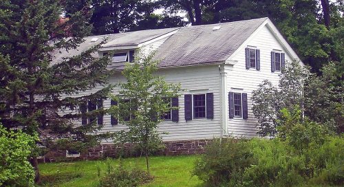
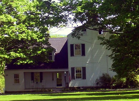
8 listings: 8 buildings, among them the Alexander Thompson House (listed 1997, the first). 21 historic buildings in all.
How old are the homes in Crawford?
18% of Crawford’s homes were built before 1940 (Census estimate, ±5.8 points), against a typical 27% for a New York town; the median home was built in 1977.
Founding dates: Wikidata, Wikipedia, the U.S. post office records of Blevins & Helbock (CC0) and the Census. Homes by year built: Census ACS 2020–24. National Register of Historic Places: National Park Service (list of May 22, 2026). Old photos, postcards and papers: Wikimedia Commons, the Library of Congress and other public archives, credited on each item’s page. Maps: U.S. Geological Survey historical topographic maps (via Esri) and Sanborn fire-insurance maps (Library of Congress). History text and census tables: Wikipedia (CC BY-SA 4.0). Places that used to be: USGS Geographic Names Information System (2021).
From Wikimedia Commons (10), Wikidata (2), the National Register of Historic Places (8), Wikipedia, U.S. Geological Survey historical maps, U.S. Census counts (via Wikipedia), the US Post Offices dataset (Blevins & Helbock), the USGS Geographic Names Information System and old county and town histories (Internet Archive). Archive images are copied here with their credits and licenses, shown on each photo’s page. Refreshed monthly.




 2007
 2007
 2007
 2007
 2007
 2007
 2007
 2007
 2006