Cohoes’ historic district, a National Historic Landmark, takes in 298 buildings
More historic than 97% of U.S. towns · #75 of 758 in New York. What drives it
17 places in town are on the National Register, among them 2 National Historic Landmarks and six historic districts with 486 buildings between them. Below: 6 old photos and papers, maps from 1885 on, and the census since 1850.
Founding year: the first Cohoes post office (Blevins & Helbock, CC0). Wikidata: 1913.The full story ↓
History grade
What drives Cohoes’ History grade
On its age, its old homes and the National Register, Cohoes is more historic than 97% of U.S. towns, #75 of 758 in New York. All 3 inputs are above most U.S. towns; its share of homes from before 1940 ranks highest and its age lowest.
A+
HistoryA character grade: shown, never part of Cohoes’ overall grade.
New York towns list more on the Register than most of the country (a typical New York town has 12.3 per 10,000 residents, the U.S. 2.4), so Cohoes’ 274 sits above most of its state (85% of New York towns have fewer) while its 498 historic buildings outnumber those of 97% of U.S. towns.
How sure. Graded on any two of the three inputs instead, the letter would range from A to A+. The pre-1940 share is a Census survey estimate (±5.1 points). The founding year is the first post office, not a stated founding date; Wikidata gives 1913.
Founding year: the first post office (other dates in Quick answers). Homes: Census ACS 2020–24. National Register: National Park Service, May 2026 list; each listing counted once (boundary changes and added documentation belong to their listing), and a historic district counts its contributing buildings. How TownRatings grades history →
What stands out about Cohoes’ past
Read from the archive, the National Register and the record. The page puts what stands out first.
In the early years of Dutch colonial settlement, the majority of the city's territory was once part of the area of Manor of Rensselaerswyck, a feudal-style manor or patroonship. The land north of a line crossing the Cohoes Falls (today Manor Avenue) was outside the Manor and was owned by the Van Olohde family between 1725 and 1750. Rensselaerswyck was established by Killiaen Van Rensselaer, the patroon and a Dutch merchant. In 1632, he had an agent pace off an enormous triangle-shaped area around the confluence of the Mohawk and Hudson rivers, from the Peebles Island northwest to the Cohoes Falls and south to today's Watervliet; this area was the core of the future city of Cohoes. Starting in the 1690s the Patroon began to issue leases for the area of Cohoes, reserving for himself a strip below the Cohoes Falls for the future site of mills powered by water.
Passages that mention Cohoes, cut from the printed page as they were published.
The history of Cohoes, New York, from its earliest settlement to the present time1877 · page 210Read the page →
Read the text
The project of uniting Lansingburg and Cohoes by bridges across the Hudson and Mohawk rivers, which had been agitated in the papers of the vicinity at different times previous, assumed definite shape by the incorporation of the Lansingburg and Cohoes Bridge Co. in March. The bill provided for the construction of " a bridge and the approaches thereto, over the Hudson from some point on Van Schaick's Island, in the city of Cohoes to some point in the
Text read by machine from the scan; it may contain errors.
The history of Cohoes, New York, from its earliest settlement to the present time1877 · page 13Read the page →
Read the text
recently at Northside. In relation to this, the following, published in the Albany Evening Journal in 1859, will be of interest: " About the 5th of June, 1839, Moore received a letter from some person, a resident of the village of Cohoes, which so attracted his notice that he spoke of it to Daniel Webster, whom, on the 9th of June, he met at dinner.
Text read by machine from the scan; it may contain errors.
Scans and text from the Internet Archive. Books published in 1930 or earlier, which are in the public domain.
Timeline
Cohoes, 1760 to 1999
Woven from the archive, old maps, post office records, the National Register and the people born here.
Fire insurance maps drew every building, what it was made of and what it was used for, so insurers could price the risk of fire. Pick a year, then a sheet.
The Cohoes post office opened in 1832, the earliest record of the town by name (U.S. post office records). Wikidata gives 1913.
How does Cohoes rank for history?
Cohoes is more historic than 97% of U.S. towns, #75 of 758 in New York. The History grade combines the town’s founding era, the share of homes built before 1940 and its National Register listings. It’s a character grade, so it isn’t part of the overall grade. How it works.
What is on the National Register in Cohoes?
17 listings, 2 of them National Historic Landmarks: 10 buildings, among them the Harmony Mill No. 3 (a National Historic Landmark since 1999), 6 historic districts with 486 contributing buildings, and 1 structure. 498 historic buildings in all.
How old are the homes in Cohoes?
40% of Cohoes’ homes were built before 1940 (Census estimate, ±5.1 points), against a typical 27% for a New York town; the median home was built in 1954.
Founding dates: Wikidata, Wikipedia, the U.S. post office records of Blevins & Helbock (CC0) and the Census. Homes by year built: Census ACS 2020–24. National Register of Historic Places: National Park Service (list of May 22, 2026). Old photos, postcards and papers: Wikimedia Commons, the Library of Congress and other public archives, credited on each item’s page. Maps: U.S. Geological Survey historical topographic maps (via Esri) and Sanborn fire-insurance maps (Library of Congress). History text and census tables: Wikipedia (CC BY-SA 4.0). Places that used to be: USGS Geographic Names Information System (2021).
From the Library of Congress (6), the National Register of Historic Places (17), Wikipedia, Wikidata and Wikipedia for famous people, U.S. Geological Survey historical maps, U.S. Census counts (via Wikipedia), the US Post Offices dataset (Blevins & Helbock), the USGS Geographic Names Information System, Sanborn fire insurance maps (Library of Congress) and old county and town histories (Internet Archive). Archive images are copied here with their credits and licenses, shown on each photo’s page. Refreshed monthly.


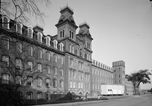 ★ Landmark
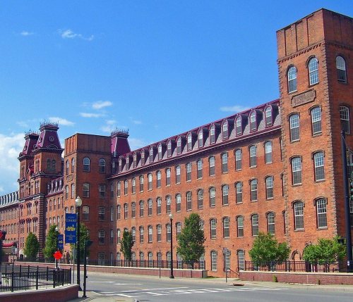 ★ Landmark
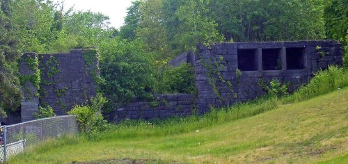


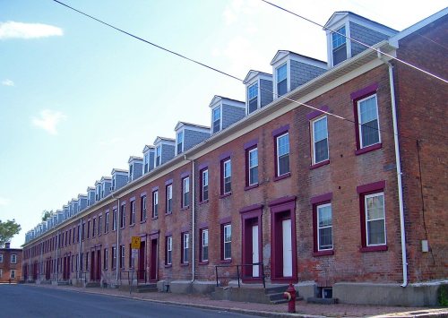



 1760
 1828
 1828
 1828

