Cherry Valley dates to 1739, and 49% of its homes were built before 1940
Among the most historic 1% of U.S. towns. What drives it
2 places in town are on the National Register, among them a historic district with 226 buildings. Below: 5 old photos and papers, maps from 1887 on, and the census since 1820.
Founding year: Wikidata. First post office: 1794.The full story ↓
History grade
What drives Cherry Valley’s History grade
On its age, its old homes and the National Register, Cherry Valley is among the most historic 1% of U.S. towns. All 3 inputs put Cherry Valley near the top nationally; its share of homes from before 1940 ranks highest.
A+
HistoryA character grade: shown, never part of Cherry Valley’s overall grade.
New York towns list more on the Register than most of the country (a typical New York town has 12.3 per 10,000 residents, the U.S. 2.4), so Cherry Valley’s 2,084 sits above most of its state (99% of New York towns have fewer) while its 227 historic buildings outnumber those of 94% of U.S. towns.
NoteThe founding year comes from Wikidata alone; no second source gives 1739.
How sure. Graded on any two of the three inputs instead, the letter would still be A+. The pre-1940 share is a Census survey estimate (±8.7 points).
Founding year: Wikidata (other dates in Quick answers). Homes: Census ACS 2020–24. National Register: National Park Service, May 2026 list; each listing counted once (boundary changes and added documentation belong to their listing), and a historic district counts its contributing buildings. How TownRatings grades history →
What stands out about Cherry Valley’s past
Read from the archive, the National Register and the record. The page puts what stands out first.
The modern history of Cherry Valley begins with John Lindesay receiving a land grant from George II of Great Britain; he moved there in 1739, and seven Anglo-Scottish families from New Hampshire moved into the area the following year. Due to high snow, the community almost failed but was saved by provisions from local natives.
During the American Revolutionary War, Walter Butler, a New York Loyalist, led a mixed force of Indians and Loyalists to the area, resulting in the Cherry Valley Massacre, during which more than 40 people were killed and many were captured. This massacre was followed by a second raid in 1780, leading to the temporary abandonment of the village.
Passages that mention Cherry Valley, cut from the printed page as they were published.
History of Otsego County, New York. With illustrations and biographical sketches of some of its prominent men and pioneers1878 · page 351Read the page →
Read the text
The territory embraced within the boundaries of this town originally comprised a portion of the old town of Cherry Valley. It became a part of Worcester when that town was taken oiF from Cherry Valley, and remained as such until March 25, 1808, when from Worcester was set off the three present towns of Westford, Maryland, and Decatur. It lies southeast of the centre of the county, and is bounded as follows: on the north by Middlcfield
Text read by machine from the scan; it may contain errors.
History of Otsego County, New York. With illustrations and biographical sketches of some of its prominent men and pioneers1878 · page 317Read the page →
Read the text
This church was organized eleven years before the town of Roseboom was set off from Cherry Valley (in 1848), as " The First Baptist Church of Cherry Valley." It was organized by Deacon Sherman with eighteen mombcrs.
Text read by machine from the scan; it may contain errors.
The centennial celebration at Cherry Valley, Otsego co. N. Y. July 4th, 1840. The addresses of William W. Campbell, esq. and Gov. W. H. Seward, with letters, toasts, &c., &c1840Read the page →
Read the text
The Citizens of the town of Cherry Valley ; may they cherish in grateful recollection the privations and sufferings of the first settlers ; may they properly estimate the price paid for liberty, and may they appreciate the value of institutions which secure to the Citizen equal rights and privileges.
Text read by machine from the scan; it may contain errors.
The centennial celebration at Cherry Valley, Otsego co. N. Y. July 4th, 1840. The addresses of William W. Campbell, esq. and Gov. W. H. Seward, with letters, toasts, &c., &c1840Read the page →
Read the text
on the God of Hosts and their own right arm, plant there the foundations of the white man's home. But the increase of these frontier settlements was very slow. In 1752, twelve yfcars after the first settlement of Cherry Valley, there were but eight families in the place. In 1765, they had increased to forty families. The number in 1775, and at the com.
Text read by machine from the scan; it may contain errors.
Scans and text from the Internet Archive. Books published in 1930 or earlier, which are in the public domain.
By decade
Cherry Valley, decade by decade
4 decades in the archive, from the 1850s to the 1910s. Scroll each row; tap a photo for its story.
Nothing in the archives for these yearsWeddings on Main Street, storms, parades, school pictures, the old store. If it’s in your family album, it belongs here.
Every edition of the U.S. Geological Survey’s map of Cherry Valley. Tap a year, or press play to watch the town change.
1903Richfield Springs sheet · 1:62,500
U.S. Geological Survey historical topographic maps (public domain), via Esri’s collection of the scans. The red ring marks the center of Cherry Valley.
Every building
Cherry Valley, building by building, 1887
Fire insurance maps drew every building, what it was made of and what it was used for, so insurers could price the risk of fire. Pick a sheet.
In 1739, according to Wikidata. Cherry Valley’s post office opened in 1794, and the census of 1820 counted 3,684 people here.
How does Cherry Valley rank for history?
Cherry Valley is among the most historic 1% of U.S. towns. The History grade combines the town’s founding era, the share of homes built before 1940 and its National Register listings. It’s a character grade, so it isn’t part of the overall grade. How it works.
What is on the National Register in Cherry Valley?
Two places: the Cherry Valley Village Historic District (listed 1988) and the Tepee, The (2011).
How old are the homes in Cherry Valley?
49% of Cherry Valley’s homes were built before 1940 (Census estimate, ±8.7 points), against a typical 27% for a New York town; the median home was built in 1942.
Founding dates: Wikidata, Wikipedia, the U.S. post office records of Blevins & Helbock (CC0) and the Census. Homes by year built: Census ACS 2020–24. National Register of Historic Places: National Park Service (list of May 22, 2026). Old photos, postcards and papers: Wikimedia Commons, the Library of Congress and other public archives, credited on each item’s page. Maps: U.S. Geological Survey historical topographic maps (via Esri) and Sanborn fire-insurance maps (Library of Congress). History text and census tables: Wikipedia (CC BY-SA 4.0). Places that used to be: USGS Geographic Names Information System (2021).
From Wikimedia Commons (1), the Library of Congress (4), Wikidata (1), the National Register of Historic Places (2), Wikipedia, Wikidata and Wikipedia for famous people, U.S. Geological Survey historical maps, U.S. Census counts (via Wikipedia), the US Post Offices dataset (Blevins & Helbock), the USGS Geographic Names Information System, Sanborn fire insurance maps (Library of Congress) and old county and town histories (Internet Archive). Archive images are copied here with their credits and licenses, shown on each photo’s page. Refreshed monthly.


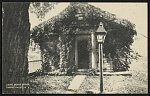


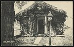 1890


