Guest, Sign inJoin

Post to Albany

We’ll email a one-tap link to publish your post. No password, and nothing is public until you click it.
Already a member? Sign in
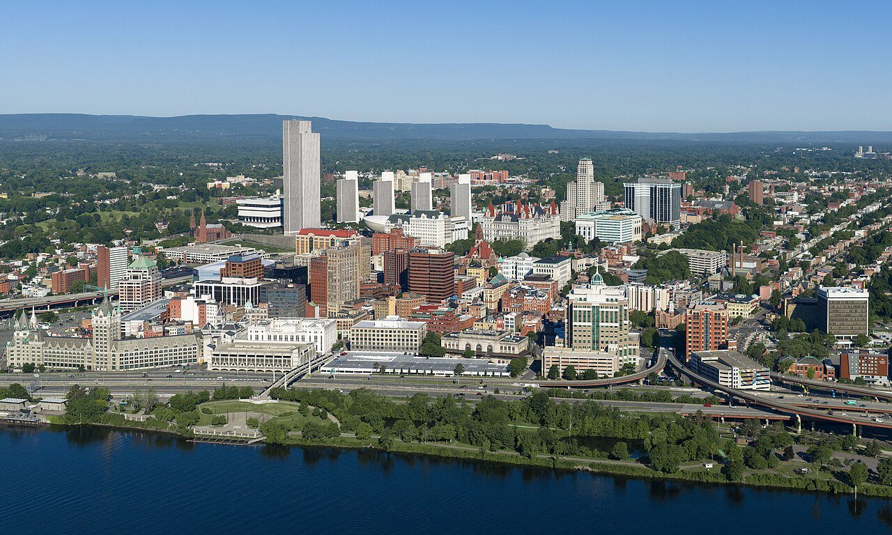
Albany, New YorkPhoto: Quintin Soloviev · CC BY 4.0
AOutdoors
Outdoors in Albany

Albany has 49 miles of mapped trails, 2.3 for every square mile of land

98% of residents live within a half mile of a park. 15% of Albany’s land is conserved, about 2,128 acres. The biggest trail networks: Albany Pine Bush Preserve (7.7 mi), Tivoli Nature Preserve (4.1 mi), Washington Park (3.8 mi).

Ahead of 95% of U.S. towns · #74 of 758 in New York. What drives it

Conserved land
15%
2,128 acres · of 21.4 sq mi of land
Trails
49 mi
2.3 per sq mi of land
Park land
1,932 ac
19 acres per 1,000 residents
Near a park
98%
of residents within ½ mile
Bike routes
22 mi
6.4 mi lanes · 9.2 mi paths
Lakes & rivers
5
4 boat launches

What kind of outdoors town is Albany?

Read from the map. The page puts what stands out first.

Outdoors grade

How much outdoors does Albany have?

On conserved land, trails, park land and how close residents live to a park, Albany is ahead of 95% of U.S. towns, #74 of 758 in New York. All four inputs are above most U.S. towns; trail miles rank highest, park acres per resident lowest.

A
OutdoorsA character grade: shown, never part of Albany’s overall grade.
All U.S. towns we grade (21,298)Ahead of 95%
LessMore
New York towns of 2,500+ (758)Ahead of 90%

Among the 400 U.S. cities of 100,000 or more, Albany ranks #35 on Outdoors.

How sure. Graded on any three of the four inputs instead, the letter would range from A to A+. Trails and many small parks come from OpenStreetMap, mapped by volunteers, so coverage varies from town to town; the half mile is a straight line from each census block, so a river or highway in the way isn’t counted against it.

PAD-US, OpenStreetMap (© OpenStreetMap contributors), Census 2025 Gazetteer and 2020 blocks; details in Sources below. How TownRatings grades the outdoors →

The map

Conserved land, trails & bike routes

Tap a number to zoom to a park. Tap a layer to hide it.

12345678
Easements protect land from building but are usually private.© OpenStreetMap contributors · USGS PAD-US
Places to walk

Pick a walk

The longest trail network is Albany Pine Bush Preserve, with 7.7 miles. Directions go to the nearest trailhead or public parking.

Albany Pine Bush Preserve

Managed by New York State Department of Environmental Conservation
826 acres7.7 mi of trail
Great Dune Red TrailBlueberry Hill East Yellow TrailKarner Barrens Yellow TrailBlueberry Hill West Red Trail+1
Dog rules not recorded
Directionsto Great Dune ParkingWebsite ↗

Tivoli Nature Preserve

Nature preserve
162 acres4.1 mi of trail
The TrailBrother Yusuf Burgess TrailOuter LoopThe Exit+1
Dog rules not recorded
Directionsto the parking lot

Washington Park

Park
81 acres3.8 mi of trail
Dog rules not recorded
Directionsto the parking lot

Six Mile Waterworks Park

Park
175 acres1.9 mi of trail
Red trailNature Trail
Dog rules not recorded
Directionsto the parking lot

Lincoln Park

Park
69 acres1.7 mi of trail
Dog rules not recorded
Directionsto the parking lot

Westland Hills Park

Park
23 acres1 mi of trail
Dog rules not recorded
Directionsto the parking lot

Buckingham Lake Park

Park
15 acres1 mi of trail
Dog rules not recorded
Directionsto the parking lot

Hoffman Park

Park
36 acres0.9 mi of trail
Dog rules not recorded
Directionsto the parking lot
All 67 parks & preserves
Albany Pine Bush Preserve826 acres · 7.7 mi of trail · New York State Department of Environmental Conservation
Directions
Tivoli Nature Preserve162 acres · 4.1 mi of trail
Directions
Washington Park81 acres · 3.8 mi of trail
Directions
Six Mile Waterworks Park175 acres · 1.9 mi of trail
Directions
Lincoln Park69 acres · 1.7 mi of trail
Directions
Westland Hills Park23 acres · 1 mi of trail
Directions
Buckingham Lake Park15 acres · 1 mi of trail
Directions
Hoffman Park36 acres · 0.9 mi of trail
Directions
Corning City Preserve22 acres · 0.8 mi of trail
Directions
Swinburne Park21 acres · 0.7 mi of trail
Directions
City of Albany83 acres · 0.5 mi of trail · City of Albany
West Capitol Park4 acres · 0.4 mi of trail
Directions
Krank Park9 acres · 0.3 mi of trail
Directions
Ridgefield Park8 acres · 0.3 mi of trail
Directions
Island Creek Waterfront Park5 acres · 0.3 mi of trail
Directions
East Capitol Park3 acres · 0.3 mi of trail
Directions
LaFayette Park3 acres · 0.3 mi of trail
Directions
Academy Park2 acres · 0.3 mi of trail
Directions
Nature Conservancy36 acres · 0.2 mi of trail · Nature Conservancy
Normans Kill Fishing Access Site13 acres · 0.2 mi of trail · City of Albany
Directions
Arbor Hill Park9 acres · 0.2 mi of trail
Directions
West Albany Memorial Park4 acres · 0.2 mi of trail
Directions
Woodlawn Park8 acres · 0.1 mi of trail
Directions
Lark Park6 acres · 0.1 mi of trail
Directions
Ten Broeck Mansion4 acres · 0.1 mi of trail
Directions
Lincoln Square Park4 acres · 0.1 mi of trail
Directions
SUNY Administration Plaza2 acres · 0.1 mi of trail
Directions
Schuyler Mansion State Historic Site2 acres · 0.1 mi of trail · New York State Office of Parks, Recreation and Historic Preservation
Directions
Madison Park1 acres · 0.1 mi of trail
Directions
Tricentennial Park1 acres · 0.1 mi of trail
Directions
North Swan Street Park1 acres · 0.1 mi of trail
Directions
Bleecker Park1 acres · 0.1 mi of trail
Directions
Riverfront Preserve68 acres
Directions
MHLC25 acres · Mohawk Hudson Land Conservancy
W.A. Harriman Memorial Park7 acres
Directions
Beverwyck Park6 acres
Directions
Hackett Park4 acres
Directions
Rosemont Park4 acres
Sheridan Park3 acres
Directions
Mayor Jennings Baseball Field3 acres
Directions
Whitehall Park3 acres
Directions
Mullens Park2 acres
Directions
Memorial Grove2 acres
Directions
Albany Skyway2 acres
Directions
Black Lives Matter Park2 acres
Directions
Giffen Elementary Playground2 acres
Directions
Sunset Park1 acres
Directions
Colby Park1 acres
Directions
NYSDTF Welcome Park1 acres
Directions
Sacred Heart Park1 acres
Hummel Street Park1 acres
Directions
Saint Joseph's Park1 acres
Directions
Mount Hope Playground1 acres
Directions
Wallenburg Park1 acres
Directions
Van Rensselaer Park1 acres
Directions
McKown Park1 acres
Directions
South End Connector Linear Park1 acres
Directions
Quackenbush Square1 acres
Directions
Colonie Street Park1 acres
Directions
Overlook Park1 acres
Directions
Philip Street Park1 acres
Directions
Henry Johnson Park1 acres
Directions
Hudson–Jay Park1 acres
Elizabeth Street Park1 acres
Directions
Roosevelt Park1 acres
Charles Young Memorial Park1 acres
Oak Street Playground1 acres
Directions
Who protects it

2,128 conserved acres

15% of Albany’s land. Who manages Albany’s conserved land, from the USGS Protected Areas Database. Approximate, because parcels can overlap.

Town or city1,226 ac
State conservation625 ac
Other state land422 ac
Land trusts & nonprofits126 ac
State parks2 ac
Regional Water Districts1 ac
Local Park · 1,228 acState Conservation Area · 625 acState Other or Unknown · 403 acPrivate Conservation · 117 acState Resource Management Area · 15 ac
Good to know

Conserved doesn’t always mean open to visitors. 3 acres are conservation easements, usually private land. Public access isn’t recorded for 3 of 60 parcels. The walks above are places people visit.

The biggest protected parcels
Parcel (PAD-US)Managed byAcresPublic access
Albany Pine Bush Preserve
State Conservation Area
State conservation715Open
Capital Hills at Albany
Local Park
Town or city423Open
W Averell Harriman New York State Office Building Campus
State Other or Unknown
Other state land403Unknown
City of Albany Land
Local Park
Town or city276Unknown
Riverfront Preserve
Local Park
Town or city83Open
Washington Park
Local Park
Town or city82Open
Lincoln Park
Local Park
Town or city72Open
Tivoli Park
Local Park
Town or city67Open
Six Mile Waterworks Park
Local Park
Town or city56Open
Hoffman Park
Local Park
Town or city34Open

5 smaller protected places aren’t shown.

Things to do

140 places to go in Albany

Beaches, playgrounds, peaks, falls and more. Pick a kind.

Community gardens in Albany
9/11 MemorialIn NYSDTF Welcome Park
Directions
Eden's Rose Foundation 1st & Quail Community CornerEden's Rose Foundation
Directions
Friendship GardenDelaware Community School and Lutheran Church of the Holy Spirit
Directions
West Hill Community Blueberry Orchard
Directions

Plus 3 community gardens without a name on the map.

Trails & water

25 named trails and 5 lakes & rivers

Named trails
Open to bikes · 3.6 miUnpaved · 16.3 mi
The Trail1.8 mi
Great Dune Red Trail1.8 mi
Blueberry Hill East Yellow Trail1.3 mi
Capital Hills Hiking Trail1.1 mi
Karner Barrens Yellow Trail0.9 mi
Blueberry Hill West Red Trail0.9 mi
Red trail0.8 mi
Brother Yusuf Burgess Trail0.7 mi
Truax Trail (Green)0.7 mi
Kaikout Kill - White Trail0.7 mi
15 more trails
Stevens Farm Trail
0.5 mi
Karner Barrens East Blue Trail
0.5 mi
Great Dune Blue Trail
0.5 mi
Outer Loop
0.4 mi
Madison Avenue Pinelands Yellow Trail
0.4 mi
Great Dune White Trail
0.4 mi
Blueberry Hill Red/Yellow Trail
0.4 mi
Karner Barrens East Yellow/Blue Trail
0.3 mi
The Exit
0.3 mi
Loop 1
0.2 mi
Madison Avenue Pinelands Purple Trail
0.2 mi
Nature Trail
0.1 mi
Loop 2
0.1 mi
Karner Barrens Discovery Trail
0.1 mi
Mill Road Connector Path
0.1 mi
Lakes & rivers tap for directions
Biking & sports

22 miles of bike routes

Bike lanes are often missing from the map in smaller towns, so that number is likely low.

6.4 mi
painted or protected bike lanes
9.2 mi
off-road bike paths
6.0 mi
shoulders & shared lanes
Courts & fields
66Tennis
49Baseball
41Basketball
21Soccer
7Golf
6Football
6Pickleball
4Softball

Includes school and college facilities, which aren’t always open to the public.

History along the way

72 places on the National Register, 6 of them National Historic Landmarks

The country’s official list of places worth saving (National Park Service). The map also marks 80 historic points from OpenStreetMap: plaques, memorials and old buildings.

History →
★
Philip Schuyler MansionNational Historic Landmark · Building · listed 1967
About it
★
New York State CapitolNational Historic Landmark · Building · listed 1971
About it
★
St. Peter's ChurchNational Historic Landmark · Building · listed 1972
About it
★
James Hall OfficeNational Historic Landmark · Building · listed 1976
About it
★
Fort Orange Archeological SiteNational Historic Landmark · Site · listed 1993
About it
★
USS Slater (Destroyer Escort)National Historic Landmark · Structure · listed 1998
About it
Albany AcademyBuilding · listed 1971
About it
Albany Union StationBuilding · listed 1971
About it
Cherry HillBuilding · listed 1971
About it
New York Executive MansionBuilding · listed 1971
About it
New York State Court of Appeals BuildingBuilding · listed 1971
About it
New York State Department of Education BuildingBuilding · listed 1971
About it

60 more on the History page.

When to get out

The best walking months in Albany: May, August and September

NOAA’s 1991–2020 normals for the town and the daylight at its latitude. Outlined months have long days, highs of 59 to 86 °F and little rain for the place.

JanFebMarAprMayJunJulAugSepOctNovDec
Daylight (h)9.410.511.813.314.615.315.013.912.411.09.79.1
High (°F)333645597179838274624938
Rain (in)2.72.43.03.33.54.24.13.93.84.02.93.3

February is the driest month (2.4 in) and July the warmest (highs of 83 °F). 4.2 inches fall in June, the wettest month. The climate in Albany →

Next door

Albany and its neighbors

Albany has the second most mapped trails of the 8 towns around it. Tap a town to see its outdoors.

TownConserved
of land
Trail mi
per sq mi
Park acres
per 1,000
Near a park
½ mile
Outdoors
Albany15%2.31998%A
Bethlehem4%1.03166%B+
Guilderland10%0.84667%A−
Colonie7%1.42978%A−
Roessleville— not graded: under 1,000 residents or part of its town
Rensselaer3%1.51599%+A
Westmere— not graded: under 1,000 residents or part of its town
Menandsunder 1%1.02398%B+

The four inputs of the Outdoors grade, from the engine; shares are of land, not water.

Questions about parks and trails in Albany

Where can I hike in Albany?

The longest trail networks: Albany Pine Bush Preserve, 7.7 miles; Tivoli Nature Preserve, 4.1 miles; Washington Park, 3.8 miles; Six Mile Waterworks Park, 1.9 miles. Each one is on the map above, with directions to the nearest trailhead or parking.

How much of Albany is conserved land?

15% of its land, against a typical 5% for a New York town and 4% nationally (PAD-US). Conserved doesn’t always mean open to visitors: easements are usually private land.

Are dogs allowed on Albany’s trails?

Albany Pine Bush Preserve and Tivoli Nature Preserve don’t have dog rules recorded on the map; check the signs at the trailhead.

Where can I bike in Albany?

22 miles of bike routes are on the map: 6.4 of painted or protected lanes, 9.2 of off-road paths and 6.0 of shoulders and shared lanes.

Is there public land near Albany?

20,419 acres of parks and open public land lie inside Albany or within 10 miles of it (PAD-US), 1,947 of them inside the city line.

How much outdoors does Albany have?

Ahead of 95% of U.S. towns on the Outdoors grade, #74 of 758 in New York. The grade combines the share of land that is conserved, miles of mapped trail per square mile of land, park acres per 1,000 residents and the share of residents within a half mile of a park. It’s a character grade, so it isn’t part of the overall grade. How it works.

Trail talk

Conditions, parking and favorite walks from Albany neighbors.
Town Square →
Share a tip
Sources

Where this page comes from

Conserved and public land: USGS Protected Areas Database of the United States (PAD-US), service updated July 2026. Parks, trails, playgrounds, beaches and other places: OpenStreetMap (© OpenStreetMap contributors, ODbL), map data as of 2026-10-28. Land and water area: Census 2025 Gazetteer. Residents near a park: 2020 Census blocks. National Register: National Park Service. How TownRatings grades the outdoors →