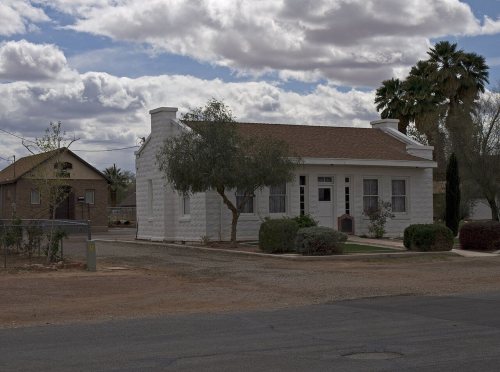
Moapa Valley’s overall grade of C− puts it better than 22% of U.S. towns, 27th of 42 in Nevada. Its weakest subject is walkability (D). Most errands need a car: it is less walkable than 87% of U.S. towns. Schools are weaker too (C) — its schools rank behind nearly three quarters of the state's. It lags on hazard risk as well — FEMA rates its natural-hazard risk higher than just over four fifths of U.S. communities, with inland flooding at the top. Cost of living is its strong suit (B): a typical home costs about $362K, 4.7 years of the Las Vegas metro’s $76K median household income. The town’s average trip to work is 38 minutes, where Nevada’s towns sit at 24 minutes and U.S. towns at 25 minutes. Moapa Valley’s typical July afternoon high is 108°F, above both the Nevada town median (94°F) and the median of U.S. towns (85°F).
Figures: home values, Zillow · incomes, Census ACS, 2020–24 · schools, state test and graduation results · FEMA National Risk Index · NOAA normals, 1991–2020.
Moapa Valley trades lower home prices for longer drives to work and keeps more of its land conserved than most of Nevada, but it is a long drive from an emergency room.
Its 19,460 conserved acres are a larger share of the town than in any other Nevada town.
The biggest park or preserve is Clark County Fairgrounds, at 52 acres. There are 102 miles of trail across 5 parks and preserves. Moapa Valley’s trail density is 2.3 miles per square mile.
FEMA puts 46% of Moapa Valley’s expected hazard losses down to inland flooding, and 26% to earthquakes. The FEMA risk score here is 82 of 100. Since 1981, 13 flood insurance claims have been paid out in the town.
The average commute for its 1,776 working residents takes 38.4 minutes, against 24.8 across Nevada. Jobs based here grew from 412 in 2013 to 787.
Just 13% of Moapa Valley’s working residents have a job in town. For residents here, the share who live below the poverty line is 5.8%. Between 2013 and 2023, jobs in the town rose by 375, to 787. The top destinations are Las Vegas (23%), Mesquite (13%) and Paradise (9%).
13%work in town
Moapa Valley
Nevada towns
U.S. towns
Average trip to work
38 minutes
24 minutes
25 minutes
Below the poverty line
5.8%
11%
9.6%
Working residents who work in town
13%
19%
8%
Median household income
$89,000
$78,000
$80,000
Where working residents work
In Moapa Valley13%
Las Vegas23%
Mesquite13%
Paradise9%
North Las Vegas6%
48 mi
median commute distance
787
jobs based in Moapa Valley
A commuter town
jobs vs. working residents
D
Walkability grade: more walkable than 13% of U.S. towns
The Overton weather station records that about 160 days a year reach 90°, more than in 99% of U.S. towns. July afternoons average 108.3°, hotter than in 100% of U.S. towns; January nights average 37.4°.
For Moapa Valley, the January low is 37°F. Winters here are mild and summers scorching, with very little rain. Snow is almost unheard of.
The nearest emergency room, Mesa View Regional Hospital, is 23.3 miles away in a straight line.
23% of adults have been diagnosed with depression in Moapa Valley. The town beats the Nevada average on 8 of 32 CDC measures and trails it on 3. In Moapa Valley, three quarters of adults had a checkup this year, and 19% report frequent mental distress.
Homes are within reach (B for cost of living), but half of working residents commute more than 48 miles.
Homes sold in Moapa Valley spent a median 89 days on the market. The midpoint rent for Moapa Valley comes to $1,135 a month. The share of households in Moapa Valley who own their home: 81%.
Moapa Valley is an unincorporated town in Clark County, Nevada, United States. As of the 2010 census, it had a population of 6,924. The valley in which the community lies, also named Moapa Valley, is about 40 miles (64 km) long and lies roughly northwest to southeast.
Moapa Valley grades C− overall, better than 22% of U.S. towns and #27 of 42 in Nevada. It grades B− for health and C for schools. Hazard risk is its weak spot, with a D.
Is Moapa Valley, NV expensive?
The typical home is worth about $363,000, 18% below the Nevada typical home. Cost of living, which also weighs rents, property taxes and how many households pay 30% or more of their income for housing, grades B.


 12 mi
 5 mi
 5 mi
 39 mi
 25 mi