Portsmouth dates to 1630, and 33% of its homes were built before 1940
Among the most historic 1% of U.S. towns · #6 of 126 in New Hampshire. What drives it
42 places in town are on the National Register, among them 8 National Historic Landmarks and three historic districts with 158 buildings between them. Below: 10 old photos and papers, maps from 1887 on, and the census since 1790.
Founding year: Wikidata. First post office: 1775.The full story ↓
History grade
What drives Portsmouth’s History grade
On its age, its old homes and the National Register, Portsmouth is among the most historic 1% of U.S. towns, #6 of 126 in New Hampshire. All 3 inputs put Portsmouth near the top nationally; its age ranks highest.
A+
HistoryA character grade: shown, never part of Portsmouth’s overall grade.
New Hampshire towns list more on the Register than most of the country (a typical New Hampshire town has 9.5 per 10,000 residents, the U.S. 2.4), so Portsmouth’s 90.5 sits above most of its state (82% of New Hampshire towns have fewer) while its 204 historic buildings outnumber those of 93% of U.S. towns.
NoteThe founding year comes from Wikidata alone; no second source gives 1630.
How sure. Graded on any two of the three inputs instead, the letter would still be A+. The pre-1940 share is a Census survey estimate (±3.0 points).
Founding year: Wikidata (other dates in Quick answers). Homes: Census ACS 2020–24. National Register: National Park Service, May 2026 list; each listing counted once (boundary changes and added documentation belong to their listing), and a historic district counts its contributing buildings. How TownRatings grades history →
What stands out about Portsmouth’s past
Read from the archive, the National Register and the record. The page puts what stands out first.
The first European to explore and write about the area was Martin Pring in 1603. The Piscataqua River is a tidal estuary with a swift current, but forms a good natural harbor. The west bank of the harbor was settled by European colonists in 1630 and named Strawbery Banke, after the many wild strawberries growing there. The village was protected by Fort William and Mary on what is now New Castle Island. Strategically located for trade between upstream industries and mercantile interests abroad, the port prospered. Fishing, lumber and shipbuilding were the principal businesses of the region.
“The New Hampshire Gazette,” about 1794, carried much more advertising than previously. In 1792 the New Hampshire Bank was established in Portsmouth.2 In 1794 a corporation was formed for the building of a bridge over that part of the Piscataqua flowing into Great Bay, thus connecting Portsmouth with Dover Point. The bridge connected Newington and Durham, just below the outlet of Little Bay.2 This,
Text read by machine from the scan; it may contain errors.
Sometime in the night of October 1, 1775, the British ship " Prince George" came into the " Lower Harbor" at Portsmouth, in a storm. On the next day, Oct. 2, Pickering, with a picked crew in a boat — boarded and took the ship, and brought her up to town. This prize was very opportune — as the town of Portsmouth and Washington's army at Cambridge were out of flour, and the Prince George Lad on board 1891 barrels of that necessary article. She
Text read by machine from the scan; it may contain errors.
Portsmouth in 1750 was a civic and a social center of importance and interest. “The first book of the Records and Proceedings of the Library Society in Portsmouth in the Province of New Hampshire begun and formed the ninth day of August 1750 by a pre¬ vious joint subscription and a public general meeting of the subscribers,” reads as follows: “Proposals for beginning a social library in Portsmouth.” “As the
Text read by machine from the scan; it may contain errors.
Scans and text from the Internet Archive. Books published in 1930 or earlier, which are in the public domain.
By decade
Portsmouth, decade by decade
5 decades in the archive, from the 1760s to the 1810s. Scroll each row; tap a photo for its story.
Every edition of the U.S. Geological Survey’s map of Portsmouth. Tap a year, or press play to watch the town change.
1916Dover sheet · 1:62,500
U.S. Geological Survey historical topographic maps (public domain), via Esri’s collection of the scans. The red ring marks the center of Portsmouth.
Every building
Portsmouth, building by building, 1887–1920
Fire insurance maps drew every building, what it was made of and what it was used for, so insurers could price the risk of fire. Pick a year, then a sheet.
Earl of Halifax TavernbuildingFort WashingtonmilitaryPortsmouth AcademyschoolPortsmouth BrewerylocaleQueens ChapelchurchRockingham County JailbuildingStoodleys TavernbuildingWentworth Home for Aged Peoplebuilding
9cemeteries and burying grounds inside Portsmouth
AfricanCalvaryNorthPoint of GraveProprietorsSaint John’sSaint MarysTemple IsraelUnion
US Post Offices dataset (Blevins & Helbock, CC0). Places and cemeteries from the USGS Geographic Names Information System (2021).
Help out
Finish Portsmouth’s story
Most archives stop around 1920. The photos from after that are in family albums, not libraries.
Decades since 1900 with photos
00s10s20s30s40s50s60s70s80s90s
0 of 10 decades. The empty ones are waiting for someone’s album.
In 1630, according to Wikidata. Portsmouth’s post office opened in 1775, and the first U.S. census counted 4,720 people here in 1790.
How does Portsmouth rank for history?
Portsmouth is among the most historic 1% of U.S. towns, #6 of 126 in New Hampshire. The History grade combines the town’s founding era, the share of homes built before 1940 and its National Register listings. It’s a character grade, so it isn’t part of the overall grade. How it works.
What is on the National Register in Portsmouth?
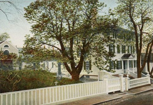
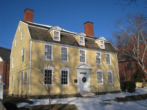
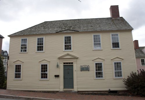
42 listings, 8 of them National Historic Landmarks: 37 buildings, among them the MacPheadris-Warner House (a National Historic Landmark since 1960), 3 historic districts, the Strawbery Banke Historic District, the Wentworth-Gardner and Tobias Lear Houses and the Atlantic Heights Development, with 158 contributing buildings, 1 site, and 1 structure. 204 historic buildings in all.
How old are the homes in Portsmouth?
33% of Portsmouth’s homes were built before 1940 (Census estimate, ±3.0 points), against a typical 17% for a New Hampshire town; the median home was built in 1959.
Founding dates: Wikidata, Wikipedia, the U.S. post office records of Blevins & Helbock (CC0) and the Census. Homes by year built: Census ACS 2020–24. National Register of Historic Places: National Park Service (list of May 22, 2026). Old photos, postcards and papers: Wikimedia Commons, the Library of Congress and other public archives, credited on each item’s page. Maps: U.S. Geological Survey historical topographic maps (via Esri) and Sanborn fire-insurance maps (Library of Congress). History text and census tables: Wikipedia (CC BY-SA 4.0). Places that used to be: USGS Geographic Names Information System (2021).
From Wikimedia Commons (9), the Library of Congress (1), Wikidata (8), the National Register of Historic Places (42), Wikipedia, Wikidata and Wikipedia for famous people, U.S. Geological Survey historical maps, U.S. Census counts (via Wikipedia), the US Post Offices dataset (Blevins & Helbock), the USGS Geographic Names Information System, Sanborn fire insurance maps (Library of Congress) and old county and town histories (Internet Archive). Archive images are copied here with their credits and licenses, shown on each photo’s page. Refreshed monthly.

 ★ Landmark
 ★ Landmark
 ★ Landmark
 ★ Landmark
 ★ Landmark
 ★ Landmark
 ★ Landmark
 ★ Landmark


 1770
 1777
 1781
 1789
 1798


