Durham dates to 1635, and 14% of its homes were built before 1940
More historic than 89% of U.S. towns · #45 of 126 in New Hampshire. What drives it
4 places in town are on the National Register, among them the Gen. John Sullivan House, a National Historic Landmark, and a historic district with 43 buildings. 4 places in town are on the National Register, among them the Gen. John Sullivan House, a National Historic Landmark, and a historic district with 43 buildings. Below: 13 old photos and papers, maps from 1916 on, and the census since 1790.
Founding year: Wikidata. First post office: 1795.The full story ↓
History grade
What drives Durham’s History grade
On its age, its old homes and the National Register, Durham is more historic than 89% of U.S. towns, #45 of 126 in New Hampshire. All 3 inputs are above most U.S. towns; its age ranks highest and its share of homes from before 1940 lowest.
A
HistoryA character grade: shown, never part of Durham’s overall grade.
New Hampshire towns list more on the Register than most of the country (a typical New Hampshire town has 9.5 per 10,000 residents, the U.S. 2.4), so Durham’s 30.5 sits above most of its state (70% of New Hampshire towns have fewer) while its 46 historic buildings outnumber those of 84% of U.S. towns.
NoteThe founding year comes from Wikidata alone; no second source gives 1635.
How sure. Graded on any two of the three inputs instead, the letter would range from A− to A+. The pre-1940 share is a Census survey estimate (±4.0 points).
Founding year: Wikidata (other dates in Quick answers). Homes: Census ACS 2020–24. National Register: National Park Service, May 2026 list; each listing counted once (boundary changes and added documentation belong to their listing), and a historic district counts its contributing buildings. How TownRatings grades history →
What stands out about Durham’s past
Read from the archive, the National Register and the record. The page puts what stands out first.
Durham sits beside Great Bay at the mouth of the Oyster River, an ideal location for people who lived close to the land, like the Western Abenaki and their ancestors who have lived in the region for an estimated 11,000 years. The Shankhassick (now Oyster) River provided shellfish and access to the north woods for hunting and trapping; the sea provided food and access to long-established trade routes between tribes both north and south; and the open meadows provided land on which crops could be easily cultivated. Wecannecohunt (or Wecohamet), as the settlement was known until English settlers arrived, proved immediately attractive to them, too.
Passages that mention Durham, cut from the printed page as they were published.
History of Strafford County, New Hampshire1914 · page 333Read the page →
Read the text
November 18th 1765 — at a Publick Town meeting, (Legally Notified) of the Inhabitants of Durham, held this day at the falls in Durham — Joseph Atkinson Esqr Chosen moderator, for Said meeting — Capt Benjm Smith Esqr and Capt Joseph Sias Brought the following Vote to the Town in writing — That The western End of Said Town of Durham, be voted, to be Sat of as a parish, Agrcable to the Result or a Report of a Committee, (Chosen and appointed for that puqjose) and Brought into Publick Town meeting, the 24th day ,of Septr 1764 — with this addition, thereto, that the
Text read by machine from the scan; it may contain errors.
History of Strafford County, New Hampshire1914 · page 438Read the page →
Read the text
The census of 1790 shows there were 562 inhabitants in the town of which number 138 were free white males 16 years of age and upward, including heads of families of whom there were 104. There were 142 children. In 1785 there were 70 poll tax payers. New Durham was settled largely by citizens of Durham, as is shown by the United States census of 1790, as published in 1907. Following are some of the Old Durham names that appear in the New Durham census. Samuel Runnels, 13 in family; Thomas Tash, 10 in family; John Edgerly, 4 in family; Josiah Doe, 5 in family; Caleb
Text read by machine from the scan; it may contain errors.
Scans and text from the Internet Archive. Books published in 1930 or earlier, which are in the public domain.
By decade
Durham, decade by decade
One decade in the archive so far: the 1890s. Scroll each row; tap a photo for its story.
Nothing in the archives for these yearsWeddings on Main Street, storms, parades, school pictures, the old store. If it’s in your family album, it belongs here.
ChesleyDemerittDurhamGriffithsHamilton Smith ChapelIndian GravesJonesJoyMathesMcDanielMooneyOdiorneOyster RiverPendergastSmithSmithSullivanThompsonThompsonTwomblyVillageWoodmanWoodmanWoodmanYoung
US Post Offices dataset (Blevins & Helbock, CC0). Places and cemeteries from the USGS Geographic Names Information System (2021).
Help out
Start Durham’s collection
The first neighbors to add old photos shape how Durham’s history is told.
Decades since 1900 with photos
00s10s20s30s40s50s60s70s80s90s
0 of 10 decades. The empty ones are waiting for someone’s album.
In 1635, according to Wikidata. Durham’s post office opened in 1795, and the first U.S. census counted 1,247 people here in 1790.
How does Durham rank for history?
Durham is more historic than 89% of U.S. towns, #45 of 126 in New Hampshire. The History grade combines the town’s founding era, the share of homes built before 1940 and its National Register listings. It’s a character grade, so it isn’t part of the overall grade. How it works.
What is on the National Register in Durham?
4 listings: 3 buildings, among them the Gen. John Sullivan House (a National Historic Landmark since 1972), and 1 historic district, the Durham Historic District, with 43 contributing buildings. 46 historic buildings in all.
How old are the homes in Durham?
14% of Durham’s homes were built before 1940 (Census estimate, ±4.0 points), against a typical 17% for a New Hampshire town; the median home was built in 1981.
Founding dates: Wikidata, Wikipedia, the U.S. post office records of Blevins & Helbock (CC0) and the Census. Homes by year built: Census ACS 2020–24. National Register of Historic Places: National Park Service (list of May 22, 2026). Old photos, postcards and papers: Wikimedia Commons, the Library of Congress and other public archives, credited on each item’s page. Maps: U.S. Geological Survey historical topographic maps (via Esri) and Sanborn fire-insurance maps (Library of Congress). History text and census tables: Wikipedia (CC BY-SA 4.0). Places that used to be: USGS Geographic Names Information System (2021).
From Wikimedia Commons (34), the Library of Congress (13), Wikidata (4), the National Register of Historic Places (4), Wikipedia, Wikidata and Wikipedia for famous people, U.S. Geological Survey historical maps, U.S. Census counts (via Wikipedia), the US Post Offices dataset (Blevins & Helbock), the USGS Geographic Names Information System, Sanborn fire insurance maps (Library of Congress) and old county and town histories (Internet Archive). Archive images are copied here with their credits and licenses, shown on each photo’s page. Refreshed monthly.


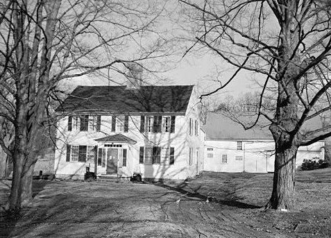 ★ Landmark
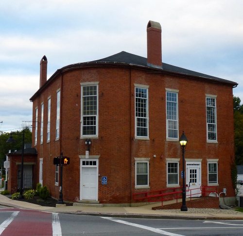


 Date?
 Date?
 Date?
 Date?
 Date?
 Date?
 Date?
 Date?
 Date?
 Date?
 Date?
 Date?
 2017
 2017
 2017
 2017
 2017
 2016
 2015
 2013
 2013
 2013
 2013
 2013
 2013
 2013
 2013
 2013
 2013
 2013
 2013
 2013
 2013
 2013
 2012
 2012
 2011
 2011
 2011
 2011
 2005
 2005
 2005
 2005
 2005
 2005


