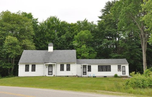
Merrimack dates to 1673, and 2 of its places are on the National Register
More historic than 59% of U.S. towns · #107 of 126 in New Hampshire. What drives it
Most of Merrimack was built recently: 4% of its homes predate 1940 and the median home dates from 1985. Its Register listings are the Signer's House and Matthew Thornton Cemetery and the McClure-Hilton House. Below: 1 old photo or paper, maps from 1905 on, and the census since 1790.
Founding year: Wikidata. First post office: 1810.The full story ↓
History grade
What drives Merrimack’s History grade
On its age, its old homes and the National Register, Merrimack is more historic than 59% of U.S. towns, #107 of 126 in New Hampshire. Its age holds the grade up; its share of homes from before 1940 pulls it down.
B
HistoryA character grade: shown, never part of Merrimack’s overall grade.
New Hampshire towns list more on the Register than most of the country (a typical New Hampshire town has 9.5 per 10,000 residents, the U.S. 2.4), so Merrimack’s 1.1 sits below most of its state (18% of New Hampshire towns have fewer) while its 3 historic buildings outnumber those of 65% of U.S. towns.
NoteThe founding year comes from Wikidata alone; no second source gives 1673.
How sure. Graded on any two of the three inputs instead, the letter would range from C to A−. The pre-1940 share (±1.8 points) is firm at this size.
Founding year: Wikidata (other dates in Quick answers). Homes: Census ACS 2020–24. National Register: National Park Service, May 2026 list; each listing counted once (boundary changes and added documentation belong to their listing), and a historic district counts its contributing buildings. How TownRatings grades history →
What stands out about Merrimack’s past
Read from the archive, the National Register and the record. The page puts what stands out first.
The first known settlers of the area appeared sometime after the last ice age. Merrimack is a Native American term meaning sturgeon, a type of fish. The Pennacook people named the Merrimack River after this fish because of the vast population that once existed there. The Pennacooks spelled it Monnomoke or Merramake. "When the town was incorporated, it took the name of the river and spelled it Merrymac," according to the Merrimack Historical Society.
Passages that mention Merrimack, cut from the printed page as they were published.
History of Merrimack and Belknap counties, New Hampshire1885 · page 905Read the page →
Read the text
Railroads. — Concord and Claeemoxt Railroad was chartered June 24, 1848 ; united with Central Railroad Company June 8, 1853, under title of Merrimack and Connecticut Rivers Railroad Company. The road from Concord to Bradford, twentyseven miles, was completed July 10, 1850 ; the branch (Contoocook River Railroad) from Contoocook to Hillsborough, fourteen and one-half miles, was
Text read by machine from the scan; it may contain errors.
History of the town of Henniker, Merrimack County, New Hampshire, from the date of the Canada grant by the province of Massachusetts, in 1735, to 18801880 · page 549Read the page →
Read the text
Hillsborough county farm three years ; train-master Concord Railroad one year ; assistant superintendent Merrimack county farm from April, 1866, to October, same year, when he was appointed superintendent, which position he held until April, 1869, when he was appointed deputy sheriff and jailor for Merrimack county. He was temporary superintendent of the State Reform School, and in June* 1872, was ap-
Text read by machine from the scan; it may contain errors.
History of Merrimack and Belknap counties, New Hampshire1885 · page 293Read the page →
Read the text
The town of Dunbarton is situated in the extreme southwestern part of Merrimack County, but previous to the incorporation of Merrimack County, in 1 852, it formed a part of Hillsborough County ; its latitude is 43° 5' ; its present area is twenty thousand nine hundred and sixty-six acres; there are many hills, but no mountains. Among the highest arc Duncanowett, Mills, Putney, Prospect, Jameson
Text read by machine from the scan; it may contain errors.
Biographical review ... containing life sketches of leading citizens of Merrimack and Sullivan counties, New Hampshire1897 · page 130Read the page →
Read the text
annua] elections then being the law. Immediately after his installation as Mayor a severe freshet injured five of the seven wooden bridges over the Merrimack and Contoocook Rivers. As superintendent of roads and bridges he repaired these structures in such a manner as to demonstrate his mechanical knowledge, replacing the insecure bridges by substantial
Text read by machine from the scan; it may contain errors.
Scans and text from the Internet Archive. Books published in 1930 or earlier, which are in the public domain.
In 1673, according to Wikidata. Merrimack’s post office opened in 1810, and the first U.S. census counted 819 people here in 1790.
How does Merrimack rank for history?
Merrimack is more historic than 59% of U.S. towns, #107 of 126 in New Hampshire. The History grade combines the town’s founding era, the share of homes built before 1940 and its National Register listings. It’s a character grade, so it isn’t part of the overall grade. How it works.
What is on the National Register in Merrimack?
Two places: the Signer's House and Matthew Thornton Cemetery (listed 1978) and the McClure-Hilton House (1989).
How old are the homes in Merrimack?
4% of Merrimack’s homes were built before 1940 (Census estimate, ±1.8 points), against a typical 17% for a New Hampshire town; the median home was built in 1985.
Founding dates: Wikidata, Wikipedia, the U.S. post office records of Blevins & Helbock (CC0) and the Census. Homes by year built: Census ACS 2020–24. National Register of Historic Places: National Park Service (list of May 22, 2026). Old photos, postcards and papers: Wikimedia Commons, the Library of Congress and other public archives, credited on each item’s page. Maps: U.S. Geological Survey historical topographic maps (via Esri) and Sanborn fire-insurance maps (Library of Congress). History text and census tables: Wikipedia (CC BY-SA 4.0). Places that used to be: USGS Geographic Names Information System (2021).
From Wikimedia Commons (17), Wikidata (1), the National Register of Historic Places (2), Wikipedia, Wikidata and Wikipedia for famous people, U.S. Geological Survey historical maps, U.S. Census counts (via Wikipedia), the US Post Offices dataset (Blevins & Helbock), the USGS Geographic Names Information System and old county and town histories (Internet Archive). Archive images are copied here with their credits and licenses, shown on each photo’s page. Refreshed monthly.


![annua] elections then being the law. Immediately after his installation as Mayor a severe freshet injured five of the seven wooden bridges over the Merrimack and Contoocook Rivers. As superintendent of roads and bridges he repaired these structures in such a manner as to demonstrate his mechanical …](https://images.townratings.com/story/27720/bk-fa21592ccc6047cb-l.jpg)
 Date?
 2026
 2019
 2018
 2017
 2016
 2014
 2014
 2014
 2014
 2014
 2014
 2012
 2010
 2009
 2008
 2007