Rochester dates to 1854, and 13 of its places are on the National Register
More historic than 57% of U.S. towns · #87 of 273 in Minnesota. What drives it
Most of Rochester was built recently: 8% of its homes predate 1940 and the median home dates from 1989. 13 places in town are on the National Register, among them the Mayo Clinic Buildings, a National Historic Landmark, and two historic districts with 143 buildings between them. Below: 6 old photos and papers, maps from 1884 on, and the census since 1860.
Founding year: Wikidata; Wikipedia’s history section gives the same year. First post office: 1855.The full story ↓
History grade
What drives Rochester’s History grade
On its age, its old homes and the National Register, Rochester is more historic than 57% of U.S. towns, #87 of 273 in Minnesota. Its National Register listings hold the grade up; its age pulls it down.
B
HistoryA character grade: shown, never part of Rochester’s overall grade.
Among the 400 U.S. cities of 100,000 or more, Rochester ranks #219 on History.
Minnesota towns list about as much on the Register as the country (a typical Minnesota town has 2.1 per 10,000 residents, the U.S. 2.4), so Rochester’s 12.9 sits above most of its state (79% of Minnesota towns have fewer) while its 158 historic buildings outnumber those of 92% of U.S. towns.
How sure. Graded on any two of the three inputs instead, the letter would range from C to B+. The pre-1940 share (±1.0 points) is firm at this size. Two sources give 1854.
Founding year: Wikidata (other dates in Quick answers). Homes: Census ACS 2020–24. National Register: National Park Service, May 2026 list; each listing counted once (boundary changes and added documentation belong to their listing), and a historic district counts its contributing buildings. How TownRatings grades history →
What stands out about Rochester’s past
Read from the archive, the National Register and the record. The page puts what stands out first.
Several indigenous peoples such as Dakota, Ojibway, and Ho-Chunk inhabited the Rochester area. The community was founded by George Head and his wife Henrietta, who built a log cabin named Head's Tavern in 1854. It was named for Head's hometown of Rochester, New York. The city developed as a stagecoach stop along the Zumbro River on a route between Dubuque, Iowa, and Saint Paul, Minnesota. When the Winona and St. Peter Railroad initiated service in October 1864, it brought new residents and business opportunities and spurred growth.
Passages that mention Rochester, cut from the printed page as they were published.
History of Olmsted County, Minnesota1910 · page 285Read the page →
Read the text
Both the Chicago & Northwestern and the Chicago Great Westem Railroads, in building from Rochester to St. Paul, avoided Oronoco, running through New Haven township and establishing switches and small depots called Oronoco station, located in New Haven, about three miles west of the village of Oronoco, though of but little value to that place.
Text read by machine from the scan; it may contain errors.
History of Olmsted County, Minnesota1910 · page 97Read the page →
Read the text
The Duluth, Red Wing & Southern railroad was agitated and surveyed in 1887 and 1888. It was at first proposed that it should nui from Red Wing to Albert Lea by way of Rochester, and high hopes were entertained of getting it here, but it was built by way of Zumbrota and again Rochester was a disappointed community.
Text read by machine from the scan; it may contain errors.
Scans and text from the Internet Archive. Books published in 1930 or earlier, which are in the public domain.
Timeline
Rochester, 1854 to 1996
Woven from the archive, old maps, post office records, the National Register and the people born here.
Nothing in the archives for these yearsWeddings on Main Street, storms, parades, school pictures, the old store. If it’s in your family album, it belongs here.
Every edition of the U.S. Geological Survey’s map of Rochester. Tap a year, or press play to watch the town change.
1939Rochester sheet · 1:62,500
U.S. Geological Survey historical topographic maps (public domain), via Esri’s collection of the scans. The red ring marks the center of Rochester.
Every building
Rochester, building by building, 1884–1920
Fire insurance maps drew every building, what it was made of and what it was used for, so insurers could price the risk of fire. Pick a year, then a sheet.
In 1854, according to Wikidata and Wikipedia’s history of the town. Rochester’s post office opened in 1855, and the census of 1860 counted 1,424 people here.
How does Rochester rank for history?
Rochester is more historic than 57% of U.S. towns, #87 of 273 in Minnesota. The History grade combines the town’s founding era, the share of homes built before 1940 and its National Register listings. It’s a character grade, so it isn’t part of the overall grade. How it works.
What is on the National Register in Rochester?
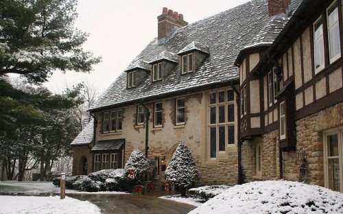
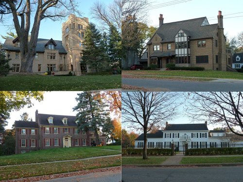
13 listings: 11 buildings, among them the Mayo Clinic Buildings (a National Historic Landmark since 1969), and 2 historic districts, the Pill Hill Residential Historic District and the Mayowood Historic District, with 143 contributing buildings. 158 historic buildings in all.
How old are the homes in Rochester?
8% of Rochester’s homes were built before 1940 (Census estimate, ±1.0 points), against a typical 8.1% for a Minnesota town; the median home was built in 1989.
Founding dates: Wikidata, Wikipedia, the U.S. post office records of Blevins & Helbock (CC0) and the Census. Homes by year built: Census ACS 2020–24. National Register of Historic Places: National Park Service (list of May 22, 2026). Old photos, postcards and papers: Wikimedia Commons, the Library of Congress and other public archives, credited on each item’s page. Maps: U.S. Geological Survey historical topographic maps (via Esri) and Sanborn fire-insurance maps (Library of Congress). History text and census tables: Wikipedia (CC BY-SA 4.0). Places that used to be: USGS Geographic Names Information System (2021).
From Wikimedia Commons (6), the National Register of Historic Places (13), Wikipedia, Wikidata and Wikipedia for famous people, U.S. Geological Survey historical maps, U.S. Census counts (via Wikipedia), the US Post Offices dataset (Blevins & Helbock), the USGS Geographic Names Information System, Sanborn fire insurance maps (Library of Congress) and old county and town histories (Internet Archive). Archive images are copied here with their credits and licenses, shown on each photo’s page. Refreshed monthly.


 ★ Landmark





 1909
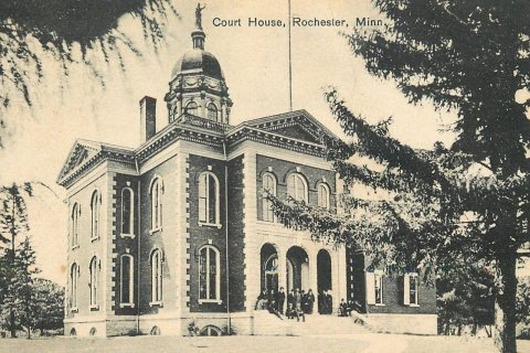 1909
 1909