Founding year: Wikipedia. First post office: 1794.The full story ↓
History grade
What drives Waldoboro’s History grade
On its age, its old homes and the National Register, Waldoboro is more historic than 89% of U.S. towns, #50 of 143 in Maine. All 3 inputs are above most U.S. towns; its age ranks highest and its National Register listings lowest.
A
HistoryA character grade: shown, never part of Waldoboro’s overall grade.
Maine towns list more on the Register than most of the country (a typical Maine town has 15.9 per 10,000 residents, the U.S. 2.4), so Waldoboro’s 11.4 sits near the middle of its state (45% of Maine towns have fewer) while its 6 listings outnumber those of 72% of U.S. towns.
NoteThe founding year comes from Wikipedia alone; no second source gives 1773.
How sure. Graded on any two of the three inputs instead, the letter would range from B+ to A. The pre-1940 share is a Census survey estimate (±6.3 points).
Founding year: Wikipedia (other dates in Quick answers). Homes: Census ACS 2020–24. National Register: National Park Service, May 2026 list; each listing counted once (boundary changes and added documentation belong to their listing), and a historic district counts its contributing buildings. How TownRatings grades history →
What stands out about Waldoboro’s past
Read from the archive, the National Register and the record. The page puts what stands out first.
US Post Offices dataset (Blevins & Helbock, CC0). Places and cemeteries from the USGS Geographic Names Information System (2021).
People over time
Waldoboro, census by census
Lost half of its people between 1860 and 1930, then more than doubled.
24 censuses, 1790–2020.
U.S. Census Bureau decennial counts, from the census table on Waldoboro’s Wikipedia page.
Every building
Waldoboro, building by building, 1884–1912
Fire insurance maps drew every building, what it was made of and what it was used for, so insurers could price the risk of fire. Pick a year, then a sheet.
1884Sheet 1 of 1
Edition
Sheets
BrickWoodStone
Sanborn Map Company, via the Library of Congress. Editions published in 1930 or earlier, which are in the public domain.
In 1629 the area that would become Waldoboro was granted to John Beauchamp of London and Thomas Leverett of Boston, England, and was known as the Muscongus Patent. The patent lay dormant until 1719 when Leverett's great-grandson, John Leverett, President of Harvard College, revived the ancient claim and formed the Lincolnshire Proprietors, also known as the Ten Proprietors, so named for the ten shares distributed, one to each member. General Samuel Waldo of Boston acquired a controlling interest in the patent in 1729 and it henceforward become known as the Waldo Patent.
Passages that mention Waldoboro, cut from the printed page as they were published.
History of the town of Waldoboro, Maine1910 · page 20Read the page →
Read the text
If we take Williamson s History of Maine, SewaW s Ancient Dominions of Maine, or Baton s Annals of Wa7'ren, as authority, there was a settlement at Waldoboro, then known as Broad Bay, as early as 1740. Eaton says: "The same year, 1740, forty German families from Brunswick and Saxony, tempted by the imposing offers, which the indefatigable Waldo, when in Europe,
Text read by machine from the scan; it may contain errors.
History of the town of Waldoboro, Maine1910 · page 117Read the page →
Read the text
curred in July/ April 1 2th, 18 1 7, the town adopted a resolution to the effect that "the vice of intoxication hath, in the town of Waldoboro, attained to an extent ruinous to the morals, destructive to the health and injurious to those addicted to it." The selectmen were instructed to use all legal means in their power to prevent the vending of rum and
Text read by machine from the scan; it may contain errors.
The centennial celebration of the incorporation of Waldoboro', Maine1873 · page 39Read the page →
Read the text
large offers of grants of land and plentiful promises of assistance upon their arrival, induced some fifteen hundred souls to remove from Germany and take up their abode at Broad Bay, now the present town of Waldoboro. It would be rare enough to find a landed proprietor keeping all his promises to his tenants ; and the settlers upon the Waldo grant found no exception to the general rule. Their sufferings and disappointments would have
Text read by machine from the scan; it may contain errors.
Scans and text from the Internet Archive. Books published in 1930 or earlier, which are in the public domain.
Timeline
Waldoboro, 1749 to 1972
Woven from the archive, old maps, post office records, the National Register and the people born here.
Nothing in the archives for these yearsWeddings on Main Street, storms, parades, school pictures, the old store. If it’s in your family album, it belongs here.
Nothing in the archives for these yearsWeddings on Main Street, storms, parades, school pictures, the old store. If it’s in your family album, it belongs here.
In 1773, according to Wikipedia’s history of the town. Waldoboro’s post office opened in 1794, and the first U.S. census counted 1,717 people here in 1790.
How does Waldoboro rank for history?
Waldoboro is more historic than 89% of U.S. towns, #50 of 143 in Maine. The History grade combines the town’s founding era, the share of homes built before 1940 and its National Register listings. It’s a character grade, so it isn’t part of the overall grade. How it works.
What is on the National Register in Waldoboro?
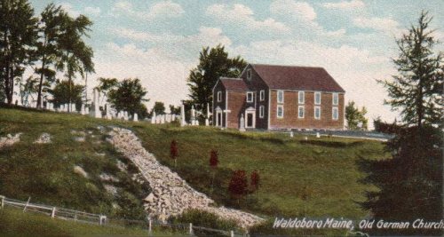
6 listings: 5 buildings, among them the German Church and Cemetery (listed 1970, the first), and 1 structure.
How old are the homes in Waldoboro?
22% of Waldoboro’s homes were built before 1940 (Census estimate, ±6.3 points), against a typical 19% for a Maine town; the median home was built in 1979.
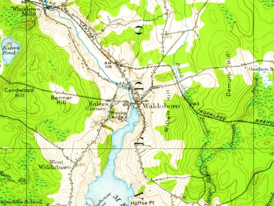
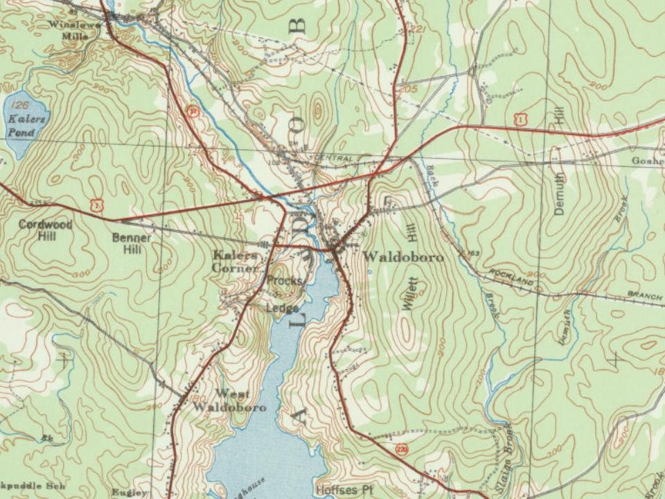
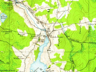
Founding dates: Wikidata, Wikipedia, the U.S. post office records of Blevins & Helbock (CC0) and the Census. Homes by year built: Census ACS 2020–24. National Register of Historic Places: National Park Service (list of May 22, 2026). Old photos, postcards and papers: Wikimedia Commons, the Library of Congress and other public archives, credited on each item’s page. Maps: U.S. Geological Survey historical topographic maps (via Esri) and Sanborn fire-insurance maps (Library of Congress). History text and census tables: Wikipedia (CC BY-SA 4.0). Places that used to be: USGS Geographic Names Information System (2021).
From Wikimedia Commons (26), the Library of Congress (1), Wikidata (3), the National Register of Historic Places (6), Wikipedia, Wikidata and Wikipedia for famous people, U.S. Geological Survey historical maps, U.S. Census counts (via Wikipedia), the US Post Offices dataset (Blevins & Helbock), the USGS Geographic Names Information System, Sanborn fire insurance maps (Library of Congress) and old county and town histories (Internet Archive). Archive images are copied here with their credits and licenses, shown on each photo’s page. Refreshed monthly.






 c. 1908
 1908
 c. 1930
 c. 1930
 c. 1930
 1984
 1984
 1984
 1985
 2018
 2018
 2018
 2018
 2018
 2018
 2017
 2014
 2012
 2012
 2012
 2012
 2012
 2005