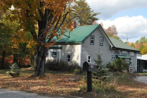
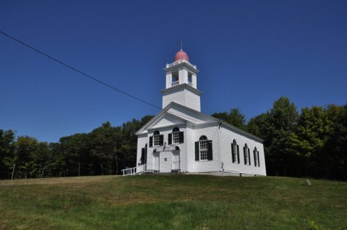
On its age, its old homes and the National Register, Otisfield is more historic than 81% of U.S. towns. All 2 inputs are above most U.S. towns; its National Register listings ranks highest and its share of homes from before 1940 lowest.
A−
HistoryA character grade: shown, never part of Otisfield’s overall grade.
Maine towns list more on the Register than most of the country (a typical Maine town has 15.9 per 10,000 residents, the U.S. 2.4), so Otisfield’s 41.0 sits above most of its state (71% of Maine towns have fewer) while its 8 historic buildings outnumber those of 74% of U.S. towns.
How sure. Graded on two of the three inputs, so a change in either one moves the letter more than it would with three. The pre-1940 share is a Census survey estimate (±4.5 points).
Founding year: our sources. Homes: Census ACS 2020–24. National Register: National Park Service, May 2026 list; each listing counted once (boundary changes and added documentation belong to their listing), and a historic district counts its contributing buildings. How TownRatings grades history →
What stands out about Otisfield’s past
Read from the archive, the National Register and the record. The page puts what stands out first.
It was granted by the Massachusetts General Court on June 15, 1771 to James Otis, Nathaniel Gorham and other descendants of Captain John Gorham and certain members of his company who had fought in the 1690 Battle of Quebec. It replaced a 1736 grant which was ruled invalid when the line between New Hampshire and Massachusetts was redrawn to satisfy claims by the heirs of John Mason. Many early settlers were veterans of the Revolutionary War, with the greater number coming from Groton, Massachusetts. First called Otis Field Plantation, it was incorporated on February 19, 1798 as Otisfield. It then included nearly all of Harrison, set off in 1805, and a large part of Naples, set off in 1834. The town was part of Cumberland County until 1978, when it joined Oxford County.
Passages that mention Otisfield, cut from the printed page as they were published.
History of Bethel, formerly Sudbury, Canada, Oxford County, Maine, 1768-18901891 · page 106Read the page →
Read the text
Turner and Minot, to the most northeasterly corner of the said town of Minot ; from thence southwesterly' on the lines between the towns of Minot and Hebron ; thence northwesterly on the line between Hebron and Otisfield, to the town of Norway ; thence westerly and northerly on the line between the towns of Otisfield and Norway, to the southeasterly corner of the town of Waterford ; thence westerlj' on the line between said Waterford and Otisfield to the northeasterly corner of the town of Bridgton ; thence westerly
Text read by machine from the scan; it may contain errors.
History of Rumford, Oxford County, Maine, from its first settlement in 1779, to the present time1890 · page 54Read the page →
Read the text
of Turner and Minot, to the most northeasterly corner of the said town of Minot ; from thence southwesterly on the lines between the towns of jMinot and Hebron ; thence northwesterly on the line between Hebron and Otisfield, to the town of Norway ; thence westerly and northerly on the line between the towns of Otisfield and Norway, to the southeasterly corner of the town of Waterford ; thence westerly on the line between said Waterford and Otisfield to the northeasterly corner of the town of Bridgton ; thence westerly
Text read by machine from the scan; it may contain errors.
Scans and text from the Internet Archive. Books published in 1930 or earlier, which are in the public domain.
Timeline
Otisfield, 1794 to 2020
Woven from the archive, old maps, post office records, the National Register and the people born here.
Bell HillCedar CrestCobb Hill RoadEast OtisfieldElmwoodHighlandHoyt Edwards FamilyMerrill MemorialOak HillOakdaleScribner Hill Lower YardScribner Hill Upper YardSouth OtisfieldWight
Places and cemeteries from the USGS Geographic Names Information System (2021).
Stories next door
History across the town line
Each neighbor’s History grade, on the same three inputs.
Otisfield is more historic than 81% of U.S. towns. The History grade combines the town’s founding era, the share of homes built before 1940 and its National Register listings. It’s a character grade, so it isn’t part of the overall grade. How it works.
What is on the National Register in Otisfield?
7 listings: 5 buildings, among them the Nutting Homestead, The (listed 1974, the first), and 2 structures. 8 historic buildings in all.
How old are the homes in Otisfield?
18% of Otisfield’s homes were built before 1940 (Census estimate, ±4.5 points), against a typical 19% for a Maine town; the median home was built in 1990.
Founding dates: Wikidata, Wikipedia, the U.S. post office records of Blevins & Helbock (CC0) and the Census. Homes by year built: Census ACS 2020–24. National Register of Historic Places: National Park Service (list of May 22, 2026). Old photos, postcards and papers: Wikimedia Commons, the Library of Congress and other public archives, credited on each item’s page. Maps: U.S. Geological Survey historical topographic maps (via Esri) and Sanborn fire-insurance maps (Library of Congress). History text and census tables: Wikipedia (CC BY-SA 4.0). Places that used to be: USGS Geographic Names Information System (2021).
From Wikimedia Commons (2), Wikidata (2), the National Register of Historic Places (7), Wikipedia, U.S. Geological Survey historical maps, U.S. Census counts (via Wikipedia), the USGS Geographic Names Information System and old county and town histories (Internet Archive). Archive images are copied here with their credits and licenses, shown on each photo’s page. Refreshed monthly.



 Date?