Guest, Sign inJoin

Post to Otisfield

We’ll email a one-tap link to publish your post. No password, and nothing is public until you click it.
Already a member? Sign in
Otisfield
Maine›Oxford County
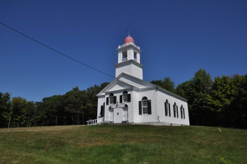
Bell Hill School · Public domain
Photo of Otisfield

Otisfield, ME · Bell Hill School · Public domain

Is Otisfield a good place to live?

The best of Otisfield’s subject grades is an A− for history; the weakest is a D for schools. Otisfield’s median age is 56.8 years, where Maine’s towns sit at 44.9 years and U.S. towns at 40.5 years. Most errands need a car: it is less walkable than 82% of U.S. towns. Only 2 of the 144 Maine towns we compare have a lower share of working residents who work in town than Otisfield. Its National Register listings include Levi Sargent House and Ryefield Bridge. Otisfield has fewer than 2,500 residents, so it gets subject grades but no overall grade.

What makes Otisfield stand out

Where Otisfield beats most towns.

A commuter town

98% of working residents leave Otisfield for work

Where Otisfield’s working residents go each day. Line width shows the share.

10% → Lewiston Lewiston 10% 9% → Paris Paris 9% 9% → Auburn Auburn 9% 9% → Oxford Oxford 9% 6% → Portland Portland 6% 6% → Norway Norway 6% Otisfield · 2% stay
105jobs based in Otisfield
2%of working residents work in town
18 mimedian commute distance

Census LEHD 2023

How Otisfield grades

Each subject compared with towns across the country (schools within Maine), ordered by how far Otisfield is from typical.

How grading works

Character Graded, but not part of the overall grade.
Described, not graded Taste, not quality: snow or an older crowd is neither good nor bad.

How TownRatings grades towns →

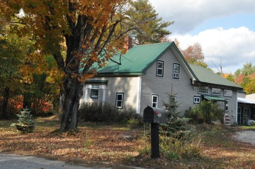
Nutting Homestead, The
Nutting Homestead, The · National Register of Historic Places
Otisfield’s story

Otisfield in pictures

Census counts: 197 in 1790, a low of 197 in 1790, 1,853 in 2020. The archive holds 4 old photos and papers going back to 1794 and 3 maps from 1896 on.

7 places on the National Register of Historic Places.

Explore the history →
Getting set up

Moving to Otisfield: who provides what

Who provides power, water and the rest in Otisfield, and how to reach them.

The full setup list →
PowerCentral Maine Power27.4¢/kWh · EIA 2025HIFLD · EIA
Internet6 providers95% of addresses get 100/20 MbpsFCC
Trash & dumpOtisfield Transfer StationDrop-off onlyTown site
SchoolsSchool Administrative District 17Which school depends on your addressNCES
Register to voteOnlineIn Maine you can register online until 21 days before Election Day, in person up to and including Election Day, or by mail (received 21 days before).vote.gov
Who runs elections hereOtisfield Registrar of VotersThe town itself; contacts on the Handbook page.FVAP, Oct 2026
ZIP code0427004270 100%Census 2020

EPA SDWIS (Oct 9, 2026) · HIFLD + EIA-861 2025 · Census 2020 ZCTAs · NCES 2024–25 · registration: vote.gov, updated Aug 3, 2026.

The data

Ordered by what stands out in Otisfield.

SchoolsD

Otisfield’s schools rank behind 87% of Maine districts

Its public schools are run by RSU 17/MSAD 17. Its one school is below.

13%of ME districts it outscoresDSchool Grade
SchoolLevelStudentsLetter
Otisfield Community SchoolLargest public elementary schoolGrades PK–6Grades PK–6115C+

NCES · EDFacts · graded within ME on state tests and graduation

HealthC−

On CDC estimates, Otisfield is less healthy than 75% of U.S. towns

Otisfield beats the Maine average on 0 of 32 CDC measures and trails it on 15. 17% of Otisfield adults report frequent physical distress, above both the Maine town median (14%) and the median of U.S. towns (14%). 19% of Otisfield adults smoke cigarettes.

25%healthier than U.S. townsC−Health Grade
OtisfieldMaine townsU.S. towns
Frequent physical distress (CDC PLACES)17%14%14%
Smoke cigarettes (CDC PLACES)19%15%14%
Diabetes (CDC PLACES)14%11%12%
Fair or poor health (CDC PLACES)23%19%19%
32 measures vs. Maine
0 better17 too close to call15 worse
What stands outOtisfieldME
More adults facing food insecurity15.3%10.7%
More adults facing housing insecurity13.1%9.8%
More smokers19.2%14.4%
Mainehealth Stephens Hospital
8.3 mi away · emergency room
2 of 3
care shortages: dental, mental health

CDC PLACES 2025 · modeled estimates for adults · CMS · HRSA

Work & commuteJobs & income grade C+

Most of Otisfield’s workers commute out: the town has 0.1 jobs for each of them

Most working residents leave Otisfield for work: only 2% work in town. The average trip to work in Otisfield is 33 minutes. Jobs based in Otisfield grew to 105 in 2023, 30 more than in 2013.

2%work in town
OtisfieldMaine townsU.S. towns
Average trip to work33 minutes25 minutes25 minutes
Median household income$84,000$78,000$80,000
Below the poverty line10%9%9.6%

Where working residents work

In Otisfield2%
Lewiston10%
Paris9%
Auburn9%
Oxford9%
18 mi
median commute distance
105
jobs based in Otisfield
A commuter town
jobs vs. working residents
C−
Walkability grade: more walkable than 18% of U.S. towns

Census LEHD 2023 · ACS

HousingCost of living grade C−

A typical Otisfield home is worth about $303K

The typical Otisfield home is worth about $303,000, down 7.8% in a year, 26% below the Maine typical home. 92% of households own their home in Otisfield.

$303KZillow home value

Typical home value

Otisfield$303K
Maine$412K
−7.8%
value change, 1 year

Census ACS, 2020–24 · Zillow Home Value Index · Redfin Data Center

Natural hazardsHazard risk grade B+

Inland flooding leads a low hazard risk in Otisfield

Expected storm and flood damage is lower than in 68% of U.S. communities. Since 1984, 3 flood insurance claims have been paid out in Otisfield.

32risk score of 100
FEMA risk score
32Low riskLowerHigher
Inland floodingHurricanesCold waves
3
paid flood claims since 1984
12
federal disasters paid out here

FEMA flood insurance claims · FEMA National Risk Index · OpenFEMA

Climate

Snowy winters and pleasant summers in Otisfield

Otisfield has cold, snowy winters and pleasant summers, with plenty of rain. Otisfield’s July high is 79°F.

84″snow a winter

Typical low → high °F

Winter12–31°
Spring31–53°
Summer55–77°
Fall37–58°
Oct 5
typical first frost
May 5
typical last frost
+1.8°
vs. the 20th-century average

NOAA U.S. Climate Normals, 1991–2020

Who lives here

More middle-aged adults than Maine overall

Adults 35 to 64 are 48% of residents (40% statewide); adults 18 to 34 are 12% of residents (20% statewide). Otisfield has grown 2.3% since 2020, to 1,893 residents in the Census Bureau’s 2025 estimate. 31% of adults 25 and older have a bachelor’s degree or more, vs 36% across Maine.

56.8median age · ME 44.8
OtisfieldMaine townsU.S. towns
Under 1816%18%22%
Aged 65 or older24%22%18%
OtisfieldMaineUnited States

Ages · share of residents

Education · adults 25 and older

No diploma4%
High school32%
Some college22%
Associate’s11%
Bachelor’s20%
Graduate11%

Women and men · all residents

47% women, 53% men

About 112 men for every 100 women (the survey’s margin: ±2 points). Across Maine, 50.7% of residents are women. Among residents 75 and older, 60% are men (ME 44%).

Ages and education in Otisfield
OtisfieldMEU.S.
Under 1010.2%9.5%11.6%
10 to 175.9%8.5%10.3%
18 to 243.7%8%9.1%
25 to 348.7%12%13.7%
35 to 447.3%12.2%13.2%
45 to 5411.4%12.2%12.2%
55 to 6429.1%15.1%12.7%
65 to 7415.4%13.4%10.2%
75 and older8.3%8.9%7%
No diploma4%5.2%10.4%
High school31.6%30.1%26%
Some college22.2%18.1%19.1%
Associate’s11.2%10.4%8.8%
Bachelor’s20.2%22.5%21.6%
Graduate10.8%13.7%14.1%

Census population estimates, 2025 · U.S. Census Bureau · ACS 2020-2024 5-year estimates · in a town of 1,900, single groups can be off by several points

OutdoorsB

Otisfield has set aside 8.5% of its land for conservation

11 miles of trail in 5 parks and preserves. The biggest place to walk is Jugtown Forest, 1,552 acres with 1.2 miles of trail.

8.5%conserved
OtisfieldMaine townsU.S. towns
Conserved land8.5%4.7%4.3%
Miles of trail per square mile0.3 miles per square mile0.70.4
8.5%
conserved · 2,384 of 28,133 acres
11 mi
of trails · 0.3 per sq mi
Biggest places to walkTrailsAcres
1. Twin Bridges Preserve3.8 mi182
2. Jugtown Forest1.2 mi1,552
3. Heniger Park—110

Trails & parks © OpenStreetMap contributors · Conserved land: USGS PAD-US

Keep exploring

Everything we know about Otisfield

18pages on Otisfield
After high school

Colleges nearby

None within 15 miles of Otisfield; the nearest are

Landmarks

7 places in Otisfield on the National Register of Historic Places.

All landmarks →

About Otisfield

Town in Maine, United States

Otisfield is a town in Oxford County, Maine, United States. Otisfield is included in the Lewiston-Auburn, Maine metropolitan New England City and Town Area. The population was 1,853 at the 2020 census. Otisfield is a summer recreation area, meaning the population grows substantially in the warmer months. It is also home to Seeds of Peace Camp and Camp Arcadia.

From Wikipedia, licensed CC BY-SA 4.0 · facts via Wikidata (CC0)

Area
44 sq mi
Elevation
666 ft
Area code
207

Otisfield’s neighbors

6 towns share a border with Otisfield.

Explore the map →
How the neighbors grade
TownME rankOverallCostSafetySchoolsHealth
Otisfield——C−—DC−
Harrison#136DB—DC+
Naples#107C−C—C−B+
Oxford#132DBC−DC−
Poland#118C−C—C−B
Norway#133DB−BDD
Casco#106C−C+—C−B

Otisfield has fewer than 2,500 residents, so it gets subject grades but no overall grade. Otisfield, Harrison, Naples, Poland and Casco report no FBI crime data of their own. Compare Otisfield with a neighbor →

Questions about Otisfield

Short answers, built from the data on this page.

Is Otisfield, ME expensive?

Yes. That is 5 years of the area's median household income ($60,173 across the county). Cost of living, which also weighs rents, property taxes and how many households pay 30% or more of their income for housing, grades C−.