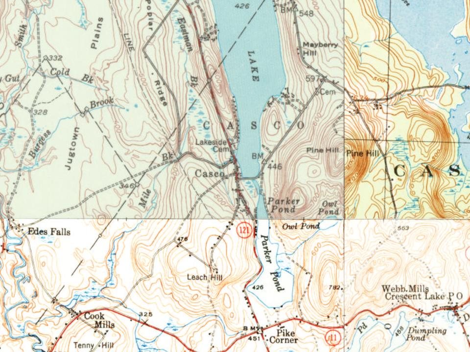
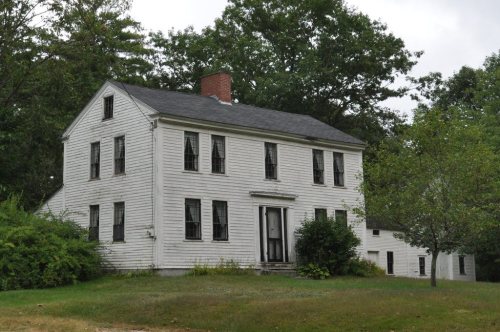
Casco dates to 1841, and 3 of its places are on the National Register
More historic than 61% of U.S. towns · #112 of 143 in Maine. What drives it
Most of Casco was built recently: 5% of its homes predate 1940 and the median home dates from 1988. Below: 3 old photos and papers, maps from 1946 on, and the census since 1850.
Founding year: Wikidata. First post office: 1829.The full story ↓
History grade
What drives Casco’s History grade
On its age, its old homes and the National Register, Casco is more historic than 61% of U.S. towns, #112 of 143 in Maine. Its age holds the grade up; its share of homes from before 1940 pulls it down.
B
HistoryA character grade: shown, never part of Casco’s overall grade.
Maine towns list more on the Register than most of the country (a typical Maine town has 15.9 per 10,000 residents, the U.S. 2.4), so Casco’s 18.9 sits near the middle of its state (56% of Maine towns have fewer) while its 7 historic buildings outnumber those of 73% of U.S. towns.
How sure. Graded on any two of the three inputs instead, the letter would range from B− to A−. The pre-1940 share (±2.6 points) is firm at this size. Two sources give 1841.
Founding year: Wikidata (other dates in Quick answers). Homes: Census ACS 2020–24. National Register: National Park Service, May 2026 list; each listing counted once (boundary changes and added documentation belong to their listing), and a historic district counts its contributing buildings. How TownRatings grades history →
What stands out about Casco’s past
Read from the archive, the National Register and the record. The page puts what stands out first.
On January 30, 1767, Raymondtown Plantation was granted by the Massachusetts General Court to Capt. William Raymond of Beverly, Massachusetts, and his company of soldiers for their service with Sir William Phipps in the 1690 Battle of Quebec. It replaced a 1735 grant called Beverly-Canada (now Weare, New Hampshire) which was ruled invalid in 1741 because of a prior claim by the heirs of John Mason. In 1803, Raymondtown Plantation was incorporated as Raymond. The town of Naples was created with land taken in 1838, the same year the western half of Raymond petitioned the legislature to be set off as a township because of its geographical separation behind Rattlesnake Mountain. The petition failed, but three years later another was accepted. On March 18, 1841, Casco was incorporated as a town.
Passages that mention Casco, cut from the printed page as they were published.
An historical sketch, guide book, and prospectus of Cushing's island, Casco bay, coast of Maine1886 · page 63Read the page →
Read the text
All of the shore line visible from the Island was included in the two ancient settlements of Casco and Westcustogo, which, upon incorporation, were named Falmouth and North Yarmouth respectively. The boundary line established between these two townships bears away from the Ottawa House piazza about east of north, past the end of Lower Clapboard Island, and remains to-day the dividing line between the present towns of Falmouth and Cumberland. The line between Falmouth and Deering, upon the shore, is the Presumpscot River, which debouches between Mackey's
Text read by machine from the scan; it may contain errors.
An historical sketch, guide book, and prospectus of Cushing's island, Casco bay, coast of Maine1886 · page 45Read the page →
Read the text
The combined force of French and Indians came into Casco Bay from the Kennebeck by way of New Meadows River, meeting no opposition from the scattered settlements whence the inhabitants had retired to the protection of Fort Loyal. They made their rendezvous on some of the islands, and soon spied out the weakness of the garrison, ascertaining quite well the number of English left after the departure of Captain Willard.
Text read by machine from the scan; it may contain errors.
Scans and text from the Internet Archive. Books published in 1930 or earlier, which are in the public domain.
Timeline
Casco, 1795 to 2010
Woven from the archive, old maps, post office records, the National Register and the people born here.
Nothing in the archives for these yearsWeddings on Main Street, storms, parades, school pictures, the old store. If it’s in your family album, it belongs here.
In 1841, according to Wikidata. Casco’s post office opened in 1829, and the census of 1850 counted 1,046 people here.
How does Casco rank for history?
Casco is more historic than 61% of U.S. towns, #112 of 143 in Maine. The History grade combines the town’s founding era, the share of homes built before 1940 and its National Register listings. It’s a character grade, so it isn’t part of the overall grade. How it works.
What is on the National Register in Casco?
Three places: the Friends Meetinghouse (listed 1975), the Watkins House and Cabins (1992) and the Richard Manning House (1993).
How old are the homes in Casco?
5% of Casco’s homes were built before 1940 (Census estimate, ±2.6 points), against a typical 19% for a Maine town; the median home was built in 1988.
Founding dates: Wikidata, Wikipedia, the U.S. post office records of Blevins & Helbock (CC0) and the Census. Homes by year built: Census ACS 2020–24. National Register of Historic Places: National Park Service (list of May 22, 2026). Old photos, postcards and papers: Wikimedia Commons, the Library of Congress and other public archives, credited on each item’s page. Maps: U.S. Geological Survey historical topographic maps (via Esri) and Sanborn fire-insurance maps (Library of Congress). History text and census tables: Wikipedia (CC BY-SA 4.0). Places that used to be: USGS Geographic Names Information System (2021).
From Wikimedia Commons (12), Wikidata (2), the National Register of Historic Places (3), Wikipedia, Wikidata and Wikipedia for famous people, U.S. Geological Survey historical maps, U.S. Census counts (via Wikipedia), the US Post Offices dataset (Blevins & Helbock), the USGS Geographic Names Information System and old county and town histories (Internet Archive). Archive images are copied here with their credits and licenses, shown on each photo’s page. Refreshed monthly.



 c. 1930
 2024
 2018
 2014
 2014
 2014
 2014
 2014
 2014
 2014