Founding year: Wikidata. First post office: 1833.The full story ↓
History grade
What drives Hollis’ History grade
On its age, its old homes and the National Register, Hollis is more historic than 82% of U.S. towns, #70 of 143 in Maine. All 3 inputs are above most U.S. towns; its age ranks highest and its National Register listings lowest.
A−
HistoryA character grade: shown, never part of Hollis’ overall grade.
Maine towns list more on the Register than most of the country (a typical Maine town has 15.9 per 10,000 residents, the U.S. 2.4), so Hollis’ 18.5 sits near the middle of its state (55% of Maine towns have fewer) while its 9 historic buildings outnumber those of 75% of U.S. towns.
NoteThe founding year comes from Wikidata alone; no second source gives 1798.
How sure. Graded on any two of the three inputs instead, the letter would still be A−. The pre-1940 share is a Census survey estimate (±6.9 points).
Founding year: Wikidata (other dates in Quick answers). Homes: Census ACS 2020–24. National Register: National Park Service, May 2026 list; each listing counted once (boundary changes and added documentation belong to their listing), and a historic district counts its contributing buildings. How TownRatings grades history →
What stands out about Hollis’ past
Read from the archive, the National Register and the record. The page puts what stands out first.
The town of Hollis was originally called Little Falls Plantation, which also encompassed all of the town of Dayton and a small part of Limington, namely the area south of the Little Ossipee River. It was bought in 1664 by Major William Phillips from Hobinowell and Mogg Hegon, sagamores of the local Abenaki people. In 1728, the Massachusetts General Court ordered that a combination trading post and stockaded blockhouse be constructed on the Saco River to conduct trade with the Native Americans. It was made crudely of logs and equipped with a cannon. Ten men and a sergeant garrisoned it.
Passages that mention Hollis, cut from the printed page as they were published.
History of York County, Maine. With illustrations and biographical sketches of its prominent men and pioneers1880Read the page →
Read the text
That part of the town of Hollis lying south of Cook's Brook was incorporated as a separate town, under the name of Dayton, April 7, 185-t, and was named in honor of Dayton, then a prominent leader in national politics. The town of Dayton is bounded ou the north by Hollis, on the east by Buxton and Saoo, on the south by Biddeford and Kennebunkport, and on the west by Lyman. The surface is undulating and varied. Talcose slate in the south gives
Text read by machine from the scan; it may contain errors.
History of York County, Maine. With illustrations and biographical sketches of its prominent men and pioneers1880 · page 425Read the page →
Read the text
This town appears to have been designed, from the first settlement, for a separate government. May 25, 1797, a petition, signed by Joseph Chadbourne and others, requested the General Court to set oif that part of Hollis south of Cook's Brook, and erect of it a separate plantation. This action was diverted by the incorporation of the town of Hollis the next year. It remained a part of Hollis until April 7, 1854, when it was incorporated by act of the
Text read by machine from the scan; it may contain errors.
Scans and text from the Internet Archive. Books published in 1930 or earlier, which are in the public domain.
Timeline
Hollis, 1798 to 2020
Woven from the archive, old maps, post office records, the National Register and the people born here.
In 1798, according to Wikidata. Hollis’ post office opened in 1833, and the census of 1800 counted 1,097 people here.
How does Hollis rank for history?
Hollis is more historic than 82% of U.S. towns, #70 of 143 in Maine. The History grade combines the town’s founding era, the share of homes built before 1940 and its National Register listings. It’s a character grade, so it isn’t part of the overall grade. How it works.
What is on the National Register in Hollis?
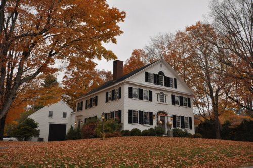
Two places: the Kate Douglas Wiggin House (listed 1977) and the Salmon Falls (West) Historic District (1987).
How old are the homes in Hollis?
20% of Hollis’ homes were built before 1940 (Census estimate, ±6.9 points), against a typical 19% for a Maine town; the median home was built in 1977.
Founding dates: Wikidata, Wikipedia, the U.S. post office records of Blevins & Helbock (CC0) and the Census. Homes by year built: Census ACS 2020–24. National Register of Historic Places: National Park Service (list of May 22, 2026). Old photos, postcards and papers: Wikimedia Commons, the Library of Congress and other public archives, credited on each item’s page. Maps: U.S. Geological Survey historical topographic maps (via Esri) and Sanborn fire-insurance maps (Library of Congress). History text and census tables: Wikipedia (CC BY-SA 4.0). Places that used to be: USGS Geographic Names Information System (2021).
From Wikimedia Commons (5), Wikidata (1), the National Register of Historic Places (2), Wikipedia, Wikidata and Wikipedia for famous people, U.S. Geological Survey historical maps, U.S. Census counts (via Wikipedia), the US Post Offices dataset (Blevins & Helbock), the USGS Geographic Names Information System and old county and town histories (Internet Archive). Archive images are copied here with their credits and licenses, shown on each photo’s page. Refreshed monthly.


 2016
 2016
 2016
 2015
 2015