Limington dates to 1792, and 4 of its places are on the National Register
More historic than 75% of U.S. towns · #91 of 143 in Maine. What drives it
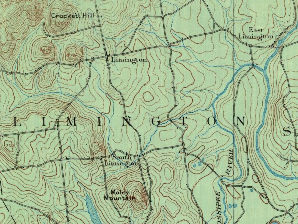
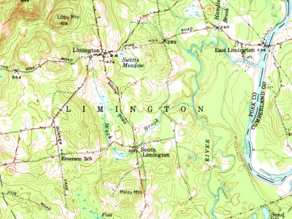
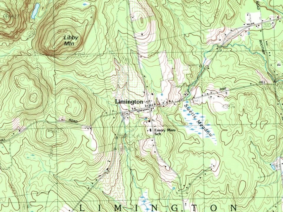
Most of Limington was built recently: 7% of its homes predate 1940 and the median home dates from 1986. 4 places in town are on the National Register, among them a historic district with 22 buildings. Below: 2 old photos and papers, maps from 1891 on, and the census since 1800.
Founding year: Wikidata. First post office: 1800.The full story ↓
History grade
What drives Limington’s History grade
On its age, its old homes and the National Register, Limington is more historic than 75% of U.S. towns, #91 of 143 in Maine. Its National Register listings hold the grade up; its share of homes from before 1940 pulls it down.
B+
HistoryA character grade: shown, never part of Limington’s overall grade.
Maine towns list more on the Register than most of the country (a typical Maine town has 15.9 per 10,000 residents, the U.S. 2.4), so Limington’s 64.7 sits above most of its state (79% of Maine towns have fewer) while its 26 historic buildings outnumber those of 81% of U.S. towns.
NoteThe founding year comes from Wikidata alone; no second source gives 1792.
How sure. Graded on any two of the three inputs instead, the letter would range from B to A−. The pre-1940 share is a Census survey estimate (±3.5 points).
Founding year: Wikidata (other dates in Quick answers). Homes: Census ACS 2020–24. National Register: National Park Service, May 2026 list; each listing counted once (boundary changes and added documentation belong to their listing), and a historic district counts its contributing buildings. How TownRatings grades history →
What stands out about Limington’s past
Read from the archive, the National Register and the record. The page puts what stands out first.
In 1668, Francis Small traded goods with the Newichewannock tribe of this area. Their Chief Wesumbe, also known as Captain Sunday, was friendly with Small and warned him of a plot against his life. A group of renegade tribesmen planned to murder Small rather than pay him the furs they owed him. Small escaped after watching his trading post in what is now Cornish burn to the ground. The chief made up for the loss by selling Small all the lands bounded by the Great and Little Ossipee Rivers, the Saco River and the New Hampshire border. Known as the Ossipee Tract, it comprised the present-day towns of Limington, Limerick, Cornish (formerly Francisborough), Newfield, Parsonsfield and Shapleigh (which then included Acton).
Passages that mention Limington, cut from the printed page as they were published.
History of York County, Maine. With illustrations and biographical sketches of its prominent men and pioneers1880 · page 406Read the page →
Read the text
Limington Academy took its rise from and grew out of the wants of the immediate neighborhood. It was incorporated in 1848, and located at Limington Corner, the chief village of the town. The academy owes its act of incorporation to the labor of Arthur and James McArthur, Rev.
Text read by machine from the scan; it may contain errors.
History of York County, Maine. With illustrations and biographical sketches of its prominent men and pioneers1880Read the page →
Read the text
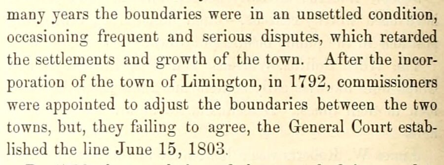
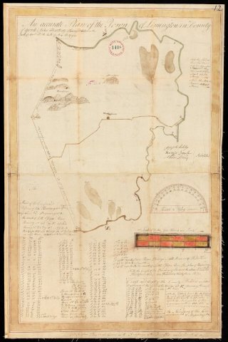
many years the boundaries were in an unsettled condition, occasioning frequent and serious disputes, which retarded the settlements and growth of the town. After the incorporation of the town of Limington, in 1792, commissioners were appointed to adjust the boundaries between the two towns, but, they failing to agree, the General Court established the line June 15, 1803.
Text read by machine from the scan; it may contain errors.
Scans and text from the Internet Archive. Books published in 1930 or earlier, which are in the public domain.
Timeline
Limington, 1792 to 2020
Woven from the archive, old maps, post office records, the National Register and the people born here.
Nothing in the archives for these yearsWeddings on Main Street, storms, parades, school pictures, the old store. If it’s in your family album, it belongs here.
In 1792, according to Wikidata. Limington’s post office opened in 1800, and the census of 1800 counted 1,323 people here.
How does Limington rank for history?
Limington is more historic than 75% of U.S. towns, #91 of 143 in Maine. The History grade combines the town’s founding era, the share of homes built before 1940 and its National Register listings. It’s a character grade, so it isn’t part of the overall grade. How it works.
What is on the National Register in Limington?
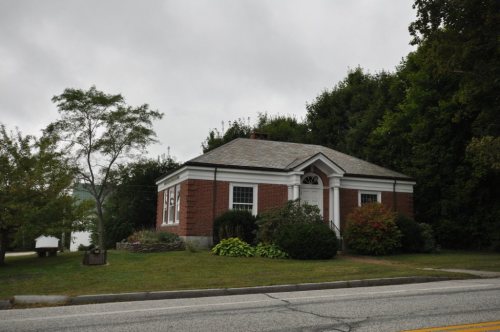
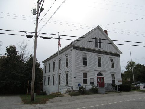
4 listings: 3 buildings, among them the Limington Academy (listed 1980, the first), and 1 historic district, the Limington Historic District, with 22 contributing buildings. 26 historic buildings in all.
How old are the homes in Limington?
7% of Limington’s homes were built before 1940 (Census estimate, ±3.5 points), against a typical 19% for a Maine town; the median home was built in 1986.
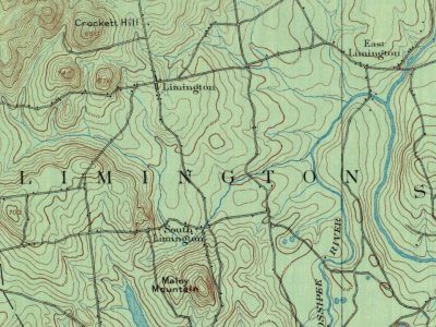
Founding dates: Wikidata, Wikipedia, the U.S. post office records of Blevins & Helbock (CC0) and the Census. Homes by year built: Census ACS 2020–24. National Register of Historic Places: National Park Service (list of May 22, 2026). Old photos, postcards and papers: Wikimedia Commons, the Library of Congress and other public archives, credited on each item’s page. Maps: U.S. Geological Survey historical topographic maps (via Esri) and Sanborn fire-insurance maps (Library of Congress). History text and census tables: Wikipedia (CC BY-SA 4.0). Places that used to be: USGS Geographic Names Information System (2021).
From Wikimedia Commons (6), the National Register of Historic Places (4), Wikipedia, Wikidata and Wikipedia for famous people, U.S. Geological Survey historical maps, U.S. Census counts (via Wikipedia), the US Post Offices dataset (Blevins & Helbock), the USGS Geographic Names Information System and old county and town histories (Internet Archive). Archive images are copied here with their credits and licenses, shown on each photo’s page. Refreshed monthly.




 2012
 2012
 2012
 2012