Guest, Sign inJoin

Post to Buxton

We’ll email a one-tap link to publish your post. No password, and nothing is public until you click it.
Already a member? Sign in
AHistory
History · Buxton

Buxton dates to 1772, and 19% of its homes were built before 1940

More historic than 89% of U.S. towns · #49 of 143 in Maine. What drives it

5 places in town are on the National Register, among them a historic district with 11 buildings. Below: 20 old photos and papers, maps from 1891 on, and the census since 1790.

1772founded
5on the National Register
19%homes built before 1940
20old photos & papers
7famous people
From Buxton’s archive · credits on each photo
Quick answers

How Buxton began

When was Buxton founded?

1772

Buxton dates its founding to 1772 (Wikidata). It appears in the first U.S. census, 1790.

First census: 1,508 in 17902020 census: 8,376254 years

How historic is Buxton?

A

More historic than 89% of U.S. towns, on its age, its old homes and the National Register.

What drives the grade ↓
Founding year: Wikidata. First post office: 1797.The full story ↓
History grade

What drives Buxton’s History grade

On its age, its old homes and the National Register, Buxton is more historic than 89% of U.S. towns, #49 of 143 in Maine. All 3 inputs are above most U.S. towns; its age ranks highest and its National Register listings lowest.

A
HistoryA character grade: shown, never part of Buxton’s overall grade.
All U.S. towns we grade (21,289)Ahead of 89%
NewerOlder
Maine towns of 2,500+ (143)Ahead of 66%

Maine towns list more on the Register than most of the country (a typical Maine town has 15.9 per 10,000 residents, the U.S. 2.4), so Buxton’s 17.6 sits near the middle of its state (54% of Maine towns have fewer) while its 15 historic buildings outnumber those of 78% of U.S. towns.

NoteThe founding year comes from Wikidata alone; no second source gives 1772.
How sure. Graded on any two of the three inputs instead, the letter would range from A− to A. The pre-1940 share is a Census survey estimate (±5.6 points).

Founding year: Wikidata (other dates in Quick answers). Homes: Census ACS 2020–24. National Register: National Park Service, May 2026 list; each listing counted once (boundary changes and added documentation belong to their listing), and a historic district counts its contributing buildings. How TownRatings grades history →

What stands out about Buxton’s past

Read from the archive, the National Register and the record. The page puts what stands out first.

★ What stands out · Places that used to be

Lost post offices, old corners, places now gone and burying grounds

Buxton had its own post office from 1797 to 1949. Four other post offices opened and closed inside today’s town.

Buxton
1797–1949
Hollis
1812–1908
Buxton Center
1826–1922
West Buxton
1843–today
Bar Mills
1853–today
Chicopee
1880–1900
Groveville
1884–1907
17901910today
Hamlets and corners on the map
Bar MillsBuxton CenterChicopeeEmory CornerGrovevilleKimbles CornerRoberts CornerSalmon FallsTory HillWest Buxton
Gone or out of use
Duck Pond SchoolschoolEliza Libby Elementary SchoolschoolFrank Jewett SchoolschoolSamuel D Hanson Schoolschool
21cemeteries and burying grounds inside Buxton
Bonny EagleCameChicopeeEast BuxtonElwellEmery BradburyFlandersFloodHighlandHillHobson JosephLeavittMartin - Titcomb ElwellMerrillPalmerPine GroveSawyer DeeringThompson - GrayTory HillWatermanWoodlawn
See all 21

Bonny Eagle Cemetery · Came Cemetery · Chicopee Cemetery · East Buxton Cemetery · Elwell Cemetery · Emery Bradbury Cemetery · Flanders Cemetery · Flood Cemetery · Highland Cemetery · Hill Cemetery · Hobson Joseph Cemetery · Leavitt Cemetery · Martin - Titcomb Elwell Cemetery · Merrill Cemetery · Palmer Cemetery · Pine Grove Cemetery · Sawyer Deering Cemetery · Thompson - Gray Cemetery · Tory Hill Cemetery · Waterman Cemetery · Woodlawn Cemetery

US Post Offices dataset (Blevins & Helbock, CC0). Places and cemeteries from the USGS Geographic Names Information System (2021).

People over time

Buxton, census by census

02,0004,0006,0008,000180018501900195020002,995 in 1850Low: 1,560

Lost half of its people between 1850 and 1920, then grew 5-fold.

24 censuses, 1790–2020.

U.S. Census Bureau decennial counts, from the census table on Buxton’s Wikipedia page.

On the map

Buxton on the map, 1891 to 1983

Every edition of the U.S. Geological Survey’s map of Buxton. Tap a year, or press play to watch the town change.

Buxton on the 1891 USGS mapBuxton on the 1942 USGS mapBuxton on the 1983 USGS map1891Buxton sheet · 1:62,500

U.S. Geological Survey historical topographic maps (public domain), via Esri’s collection of the scans. The red ring marks the center of Buxton.

The story

How Buxton came to be

From Wikipedia’s history of Buxton.

Read it all →

The township was granted by the Massachusetts General Court as Narragansett Number 1 in 1728. It was assigned to Philemon Dane of Ipswich, Massachusetts and 119 other veterans (or their heirs) who had fought in King Philip's War against the Narragansett people in 1675. Settlement was attempted in the early 1740s but abandoned because of the ongoing French and Indian Wars.

Text from Wikipedia, licensed CC BY-SA 4.0.

From the old history books

What they wrote about Buxton in 1926

Passages that mention Buxton, cut from the printed page as they were published.

The river, above the bridge, flows between two roads; one in the town of Buxton, the other in the town of Hollis. Quietly, serenely, and smoothly, with the trees upon the banks mirrored in its clear depths, flows the Saco until it reaches the dam. There it falls gently a few feet, froths and foams …
One hundred and fiftieth anniversary of the incorporation of the town of Buxton, Maine1926Read the page →
Read the text

The river, above the bridge, flows between two roads; one in the town of Buxton, the other in the town of Hollis. Quietly, serenely, and smoothly, with the trees upon the banks mirrored in its clear depths, flows the Saco until it reaches the dam. There it falls gently a few feet, froths and foams a little, and passes under the bridge. On both sides of the river rise high walls formed of rocks, which at some places are barren, bleak, and bare; at others covered with small trees which have their roots deep in the crevices

Text read by machine from the scan; it may contain errors.
first postoffice was at the Lower Corner, and the first mail was carried on horseback; then by the two-wheeled chaise, the old stage coach from Saco with a pair of horses, and now by automo¬ biles. At one time there were seven post offices: Buxton,* West Buxton,* Buxton Center, Groveville, Bar Mill…
One hundred and fiftieth anniversary of the incorporation of the town of Buxton, Maine1926Read the page →
Read the text

first postoffice was at the Lower Corner, and the first mail was carried on horseback; then by the two-wheeled chaise, the old stage coach from Saco with a pair of horses, and now by automo¬ biles. At one time there were seven post offices: Buxton,* West Buxton,* Buxton Center, Groveville, Bar Mills,* Chicopee, and South Buxton. Now (1924) there are but three.* The sick of this town were attended by out-of-town doctors for several years. One of these was Dr. Nathaniel W. Bowman of

Text read by machine from the scan; it may contain errors.

Scans and text from the Internet Archive. Books published in 1930 or earlier, which are in the public domain.

Timeline

Buxton, 1772 to 2020

Woven from the archive, old maps, post office records, the National Register and the people born here.

  1. 18th century
  2. 1772
    FoundingBuxton is established
  3. 1797Post officeThe Buxton post office opens
  4. 19th century
  5. 1812BuiltBuxton Powder House is built
  6. 1812Post officeThe Hollis post office opens
  7. 1814Born hereCyrus Woodman is born here
  8. 1826Post officeThe Buxton Center post office opens
  9. 1827Born hereAlanson M. Kimball is born here
  10. 1831Born hereThomas Lord Kimball is born here
  11. 1856Born hereCyrus W. Davis is born here
  12. 1870In the archiveOn the Saco, Buxton, Me
  13. 1891On the mapFirst mapped by the U.S. Geological Survey
  14. 20th century
  15. 1908Post officeThe Hollis post office closes
  16. 1922Post officeThe Buxton Center post office closes
  17. 1949Post officeThe Buxton post office closes
  18. 21st century
  19. 2020CensusPopulation peaks at 8,376
By decade

Buxton, decade by decade

One decade in the archive so far: the 1870s. Scroll each row; tap a photo for its story.

Then & now

Stand where they stood

No then-and-now pairs yet. Take a photo from the same spot as an old one and they appear here side by side.

On the Saco, Buxton, Me
Retake this viewOn the Saco, Buxton, Me, c. 1870

Find the spot, match the angle, and add your photo. It becomes the first then-and-now pair on Buxton’s page.

Retake this view · +15
On the National Register

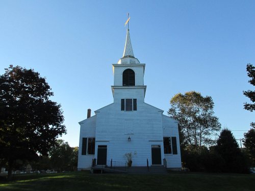
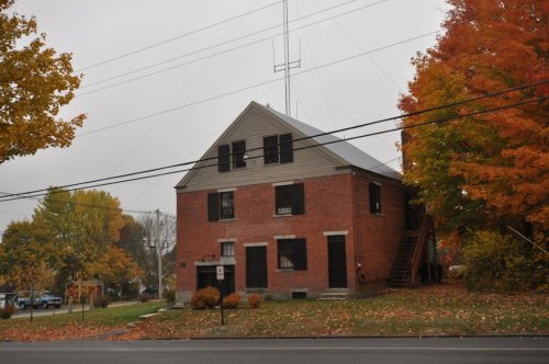
5 historic places in Buxton

The country’s official list of buildings and places worth saving.

places listed
5
National Historic Landmarks
0
none yet
historic buildings protected
15
each building in a district counts
first listed
1975
Royal Brewster House

National Park Service, National Register of Historic Places. Photos from Wikimedia Commons, credited on each place’s page.

Famous people

7 famous people were born in Buxton

Writers, athletes, leaders and more, ranked by how widely they’re known.

See all →
Help out

Finish Buxton’s story

Most archives stop around 1920. The photos from after that are in family albums, not libraries.

Decades since 1900 with photos
00s10s20s30s40s50s60s70s80s90s
0 of 10 decades. The empty ones are waiting for someone’s album.
Stories next door

History across the town line

Each neighbor’s History grade, on the same three inputs.

Questions about Buxton’s history

What year was Buxton founded?

In 1772, according to Wikidata. Buxton’s post office opened in 1797, and the first U.S. census counted 1,508 people here in 1790.

How does Buxton rank for history?

Buxton is more historic than 89% of U.S. towns, #49 of 143 in Maine. The History grade combines the town’s founding era, the share of homes built before 1940 and its National Register listings. It’s a character grade, so it isn’t part of the overall grade. How it works.

What is on the National Register in Buxton?

5 listings: 4 buildings, among them the Royal Brewster House (listed 1975, the first), and 1 historic district, the Salmon Falls (East) Historic District, with 11 contributing buildings. 15 historic buildings in all.

How old are the homes in Buxton?

19% of Buxton’s homes were built before 1940 (Census estimate, ±5.6 points), against a typical 19% for a Maine town; the median home was built in 1981.

Memory lane

What the archives can’t tell you, neighbors can.

Town Square →
Start a conversation
Sources

Where this page comes from

Founding dates: Wikidata, Wikipedia, the U.S. post office records of Blevins & Helbock (CC0) and the Census. Homes by year built: Census ACS 2020–24. National Register of Historic Places: National Park Service (list of May 22, 2026). Old photos, postcards and papers: Wikimedia Commons, the Library of Congress and other public archives, credited on each item’s page. Maps: U.S. Geological Survey historical topographic maps (via Esri) and Sanborn fire-insurance maps (Library of Congress). History text and census tables: Wikipedia (CC BY-SA 4.0). Places that used to be: USGS Geographic Names Information System (2021).

From Wikimedia Commons (23), Wikidata (1), the National Register of Historic Places (5), Wikipedia, Wikidata and Wikipedia for famous people, U.S. Geological Survey historical maps, U.S. Census counts (via Wikipedia), the US Post Offices dataset (Blevins & Helbock), the USGS Geographic Names Information System and old county and town histories (Internet Archive). Archive images are copied here with their credits and licenses, shown on each photo’s page. Refreshed monthly.