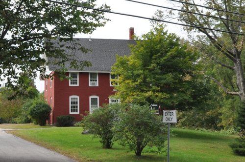
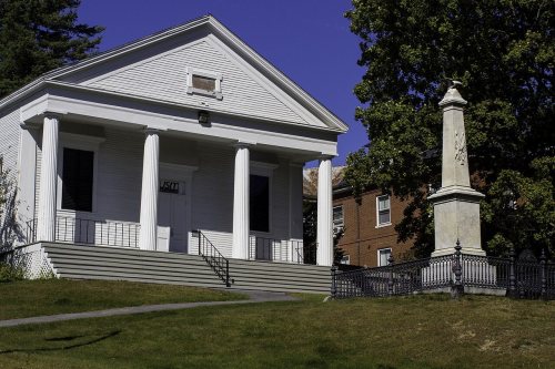
Gorham dates to 1736, and 14% of its homes were built before 1940
More historic than 90% of U.S. towns · #43 of 143 in Maine. What drives it
9 places in town are on the National Register, among them three historic districts with 68 buildings between them. Below: 8 old photos and papers, maps from 1885 on, and the census since 1800.
Founding year: Wikidata. First post office: 1797.The full story ↓
History grade
What drives Gorham’s History grade
On its age, its old homes and the National Register, Gorham is more historic than 90% of U.S. towns, #43 of 143 in Maine. All 3 inputs are above most U.S. towns; its age ranks highest and its share of homes from before 1940 lowest.
A
HistoryA character grade: shown, never part of Gorham’s overall grade.
Maine towns list more on the Register than most of the country (a typical Maine town has 15.9 per 10,000 residents, the U.S. 2.4), so Gorham’s 42.6 sits above most of its state (73% of Maine towns have fewer) while its 78 historic buildings outnumber those of 88% of U.S. towns.
NoteThe founding year comes from Wikidata alone; no second source gives 1736.
How sure. Graded on any two of the three inputs instead, the letter would range from A− to A+. The pre-1940 share is a Census survey estimate (±4.1 points).
Founding year: Wikidata (other dates in Quick answers). Homes: Census ACS 2020–24. National Register: National Park Service, May 2026 list; each listing counted once (boundary changes and added documentation belong to their listing), and a historic district counts its contributing buildings. How TownRatings grades history →
What stands out about Gorham’s past
Read from the archive, the National Register and the record. The page puts what stands out first.
Lost post offices, old corners, places now gone and burying grounds
Gorham’s post office has been open since 1797. Seven other post offices opened and closed inside today’s town.
Gorham
1797–today
North Gorman
1829–1838
West Gorham
1829–1900
South Durham
1830–1905
West Durham
1849–1910
White Rock
1860–1917
Great Falls
1872–1873
North Gorman
1873–1943
17901910today
Hamlets and corners on the map
Babb CornerDog CornerGag CornerLittle FallsMosher CornerNorth GorhamSouth GorhamWest GorhamWhite Rock
Gone or out of use
Lebi Hall SchoolschoolLongfellow SchoolschoolWhite Rock Schoolschool
12cemeteries and burying grounds inside Gorham
EasternFort HillHamblenHillsideNorth GorhamNorth StreetSapling HillShaws MillSouth GorhamSouth StreetWest GorhamWhite Rock
US Post Offices dataset (Blevins & Helbock, CC0). Places and cemeteries from the USGS Geographic Names Information System (2021).
On the map
Gorham on the map, 1891 to 1970
Every edition of the U.S. Geological Survey’s map of Gorham. Tap a year, or press play to watch the town change.
1891Portland sheet · 1:62,500
U.S. Geological Survey historical topographic maps (public domain), via Esri’s collection of the scans. The red ring marks the center of Gorham.
Every building
Gorham, building by building, 1885–1922
Fire insurance maps drew every building, what it was made of and what it was used for, so insurers could price the risk of fire. Pick a year, then a sheet.
1885Sheet 1 of 1
Edition
Sheets
BrickWoodStone
Sanborn Map Company, via the Library of Congress. Editions published in 1930 or earlier, which are in the public domain.
First called Narragansett Number 7, it was one of seven townships granted by the Massachusetts General Court to soldiers (or their heirs) who had fought in the Narragansett War of 1675, also called King Philip's War. The land was first settled in 1736 by Captain John Phinney and his family, followed in 1738 by Hugh McLellan and Daniel Mosher. By 1743, the first sawmill was established by John Gorham at Little River. Without window-glass, the first dwellings were constructed of logs chinked with moss and clay.
The town was incorporated as Gorham in 1764. It would annex land from Standish in 1831 and 1839, and from Scarborough in 1864.
Passages that mention Gorham, cut from the printed page as they were published.
A history of the town of Gorham, Maine1862 · page 76Read the page →
Read the text
ous and powerful that the town at length listened to their petitions. And .at a legal town meeting, held on the 14th day of June, 1781, the following vote was passed : " Voted, All the inhabitants of Gorham, avIio are of a different denomination to the Congregational, are to be excluded paying any future charges towards supplying the Desk in Gorham Meeting house, only upon bringing a certificate from the heads of either of the opposite societies, in Gorham,
Text read by machine from the scan; it may contain errors.
A history of the town of Gorham, Maine1862 · page 18Read the page →
Read the text
As the grant of the town of Gorham grew out of the Narrao-ansett war, and as several of the lineal descendants of those heroic men who fought in that terrible conflict, still reside in this town, they cannot be supposed to be indifferent to the history of those exertions which secured safety to their families and peace and plenty to their posterity. It may not, therefore, be amiss in tracing the history of our town to go back and speak of those events that gave rise to
Text read by machine from the scan; it may contain errors.
Scans and text from the Internet Archive. Books published in 1930 or earlier, which are in the public domain.
Timeline
Gorham, 1736 to 1910
Woven from the archive, old maps, post office records, the National Register and the people born here.
Nothing in the archives for these yearsWeddings on Main Street, storms, parades, school pictures, the old store. If it’s in your family album, it belongs here.
In 1736, according to Wikidata. Gorham’s post office opened in 1797, and the census of 1800 counted 2,503 people here.
How does Gorham rank for history?
Gorham is more historic than 90% of U.S. towns, #43 of 143 in Maine. The History grade combines the town’s founding era, the share of homes built before 1940 and its National Register listings. It’s a character grade, so it isn’t part of the overall grade. How it works.
What is on the National Register in Gorham?
9 listings: 6 buildings, among them the McLellan House (listed 1972, the first), and 3 historic districts, the South Street Historic District, the Gorham Historic District and the Isaac E. Dyer Estate, with 68 contributing buildings. 78 historic buildings in all.
How old are the homes in Gorham?
14% of Gorham’s homes were built before 1940 (Census estimate, ±4.1 points), against a typical 19% for a Maine town; the median home was built in 1988.
Founding dates: Wikidata, Wikipedia, the U.S. post office records of Blevins & Helbock (CC0) and the Census. Homes by year built: Census ACS 2020–24. National Register of Historic Places: National Park Service (list of May 22, 2026). Old photos, postcards and papers: Wikimedia Commons, the Library of Congress and other public archives, credited on each item’s page. Maps: U.S. Geological Survey historical topographic maps (via Esri) and Sanborn fire-insurance maps (Library of Congress). History text and census tables: Wikipedia (CC BY-SA 4.0). Places that used to be: USGS Geographic Names Information System (2021).
From Wikimedia Commons (17), Wikidata (1), the National Register of Historic Places (9), Wikipedia, Wikidata and Wikipedia for famous people, U.S. Geological Survey historical maps, U.S. Census counts (via Wikipedia), the US Post Offices dataset (Blevins & Helbock), the USGS Geographic Names Information System, Sanborn fire insurance maps (Library of Congress) and old county and town histories (Internet Archive). Archive images are copied here with their credits and licenses, shown on each photo’s page. Refreshed monthly.


 c. 1869
 1906
 1907
 1907
 c. 1915
 2013
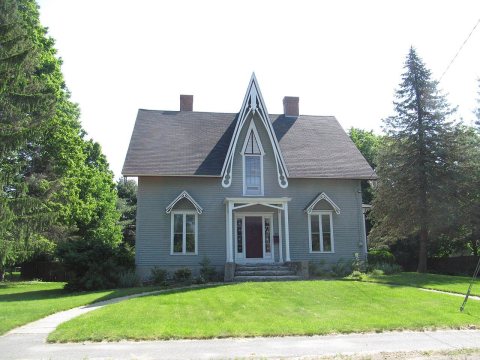 2013
 2013
 2013
 2013
 2012
 2012
 2012
 2010