Ellsworth dates to 1604, and 19% of its homes were built before 1940
More historic than 81% of U.S. towns · #74 of 143 in Maine. What drives it
14 places in town are on the National Register, among them two historic districts with 1 buildings between them. Below: 25 old photos and papers, maps from 1884 on, and the census since 1800.
Founding year: Wikipedia. First post office: 1794.The full story ↓
History grade
What drives Ellsworth’s History grade
On its age, its old homes and the National Register, Ellsworth is more historic than 81% of U.S. towns, #74 of 143 in Maine. All 2 inputs are above most U.S. towns; its National Register listings ranks highest and its share of homes from before 1940 lowest.
A−
HistoryA character grade: shown, never part of Ellsworth’s overall grade.
Maine towns list more on the Register than most of the country (a typical Maine town has 15.9 per 10,000 residents, the U.S. 2.4), so Ellsworth’s 23.1 sits near the middle of its state (62% of Maine towns have fewer) while its 20 historic buildings outnumber those of 79% of U.S. towns.
NoteThe founding year comes from Wikipedia alone; no second source gives 1604.
How sure. Graded on two of the three inputs, so a change in either one moves the letter more than it would with three. The pre-1940 share is a Census survey estimate (±5.1 points).
Founding year: Wikipedia (other dates in Quick answers). Homes: Census ACS 2020–24. National Register: National Park Service, May 2026 list; each listing counted once (boundary changes and added documentation belong to their listing), and a historic district counts its contributing buildings. How TownRatings grades history →
What stands out about Ellsworth’s past
Read from the archive, the National Register and the record. The page puts what stands out first.
Nothing in the archives for these yearsWeddings on Main Street, storms, parades, school pictures, the old store. If it’s in your family album, it belongs here.
Nothing in the archives for these yearsWeddings on Main Street, storms, parades, school pictures, the old store. If it’s in your family album, it belongs here.
According to the history of the Passamaquoddy people, the Ellsworth area was originally inhabited by members of the Passamaquoddy and Penobscot tribes: "Both groups speak closely related Algonquian languages, although anthropologists generally group the Passamaquoddies linguistically with the Maliseets and the Penobscots with the Abenakis."
of the said parts thus annexed to said town of Ellsworth shall hereafter be considered inhabitants of said town and shall then exercise and enjoy all civil rights and privileges and be subject to all civil duties and requisitions in like manner as the other inhabitants of said town. Provided, however, that the said inhabitants of the parts thus annexed to the Town of Ellsworth shall be respectively holden to pay their due proportions of all monies granted prior to the passing of this act by either of the
Text read by machine from the scan; it may contain errors.
application of a part of the inhabitants of Surry, Trenton and Ellsworth, to your Honorable body, a portion of Surry and Trenton against the inclinations of your petitioners and in opposition to a Remonstrance of the Town of Ellsworth, were set off to the said Town, as will appear by a Copy of the above mentioned Remonstrance annexed, which passed unanimously at a legal meeting holden in consequence of an order of notice on the petition of Solomon Jordan and others served upon said
Text read by machine from the scan; it may contain errors.
Scans and text from the Internet Archive. Books published in 1930 or earlier, which are in the public domain.
On the map
Ellsworth on the map, 1911 to 1981
Every edition of the U.S. Geological Survey’s map of Ellsworth. Tap a year, or press play to watch the town change.
1911Ellsworth sheet · 1:62,500
U.S. Geological Survey historical topographic maps (public domain), via Esri’s collection of the scans. The red ring marks the center of Ellsworth.
Every building
Ellsworth, building by building, 1884–1914
Fire insurance maps drew every building, what it was made of and what it was used for, so insurers could price the risk of fire. Pick a year, then a sheet.
In 1604, according to Wikipedia’s history of the town. Ellsworth’s post office opened in 1794, and the census of 1800 counted 227 people here.
How does Ellsworth rank for history?
Ellsworth is more historic than 81% of U.S. towns, #74 of 143 in Maine. The History grade combines the town’s founding era, the share of homes built before 1940 and its National Register listings. It’s a character grade, so it isn’t part of the overall grade. How it works.
What is on the National Register in Ellsworth?
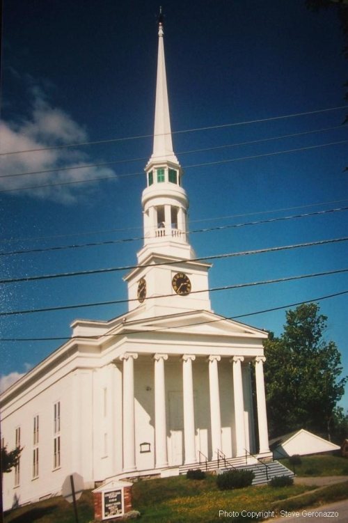
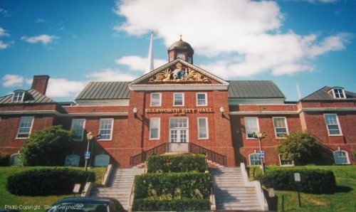
14 listings: 11 buildings, among them the Black Mansion (listed 1969, the first), 2 historic districts, the Ellsworth Power House and Dam and the Ellsworth Commercial Historic District, with 1 contributing buildings, and 1 site. 20 historic buildings in all.
How old are the homes in Ellsworth?
19% of Ellsworth’s homes were built before 1940 (Census estimate, ±5.1 points), against a typical 19% for a Maine town; the median home was built in 1980.
Founding dates: Wikidata, Wikipedia, the U.S. post office records of Blevins & Helbock (CC0) and the Census. Homes by year built: Census ACS 2020–24. National Register of Historic Places: National Park Service (list of May 22, 2026). Old photos, postcards and papers: Wikimedia Commons, the Library of Congress and other public archives, credited on each item’s page. Maps: U.S. Geological Survey historical topographic maps (via Esri) and Sanborn fire-insurance maps (Library of Congress). History text and census tables: Wikipedia (CC BY-SA 4.0). Places that used to be: USGS Geographic Names Information System (2021).
From Wikimedia Commons (19), the Library of Congress (8), Wikidata (2), the National Register of Historic Places (14), Wikipedia, Wikidata and Wikipedia for famous people, U.S. Geological Survey historical maps, U.S. Census counts (via Wikipedia), the US Post Offices dataset (Blevins & Helbock), the USGS Geographic Names Information System, Sanborn fire insurance maps (Library of Congress) and old county and town histories (Internet Archive). Archive images are copied here with their credits and licenses, shown on each photo’s page. Refreshed monthly.


 1907
 1922
 1922
 1922
 1922
 1922
 1922
 1922
 c. 1930
 c. 1930
 c. 1930
 c. 1930
 c. 1930
 c. 1930
 c. 1930
 c. 1930
 c. 1930
 c. 1930
 c. 1930
 c. 1930
 2002
 2002