Brooksville dates to 1817, and 32% of its homes were built before 1940
3 places in town are on the National Register, among them a historic district with 6 buildings. Below: 7 old photos and papers, maps from 1904 on, and the census since 1820.
The Brooksville area has likely been inhabited for over 11,000 years. In the centuries prior to European settler colonists arrival, Native Americans of the Wabanaki confederation lived in the region. The people living in the Brooksville area were probably Penobscot. According to the Brooksville Historical Society there is a story, difficult to confirm, that Englishmen massacred a Wabanaki village at Walker Pond some time between 1690 and 1704. Archaeologists found a grave of Native American origin on the northern edge of Walker Pond in 1912, but the date of the burial was not established.
Passages that mention Brooksville, cut from the printed page as they were published.
History of Castine, Penobscot, and Brooksville, Maine1875 · page 241Read the page →
Read the text
The town of Brooksville was incorporated by act of the General Court of Massachusetts, on June 13, 1817. It was named after Honorable John Brooks, the Governor of the Commonwealth of Massachusetts, at that time. The general history of Brooksville, prior to its incorporation, is included in that of Penobscot and Castine — of which it formerly composed a part — with the exception of the small pbrtion derived from Sedgwick. In the half century that
Text read by machine from the scan; it may contain errors.
History of Castine, Penobscot and Brooksville, Maine [microform]1875 · page 239Read the page →
Read the text
The town of Brooksville was incorporated by act of the General Court of Massachusetts, on June 13, 1817. It was named ufter Honorable John Brooks, the Governor of the Commonwealth of Massachusetts, at that time. The general history of Brooksville, prior to its incorporation, is included in that of Penobscot and Castine—of which it formerly composed a part—with the exception of the small portion derived from Sedgwick. In the half century that
Text read by machine from the scan; it may contain errors.
History of Castine, Penobscot and Brooksville, Maine [microform]1875 · page 351Read the page →
Read the text
been set to the town of Penobscot, and one-fifth part which would have been set to Castine, according to the last valuation, shall be taken from said towns and set to the said town of Brooksville. Sec. 8. Be it further enacted, That William Abbott, Esquire, be, and he is hereby authorized to issue a warrant, directed to some suitable inhabitant of said town of Brooksville, requiring him to notify the inhabitants thereof, to
Text read by machine from the scan; it may contain errors.
History of Castine, Penobscot, and Brooksville, Maine1875 · page 351Read the page →
Read the text
been set to the town of Penobscot, and one-fifth part which would have been set to Castine, according to the last valuation, shall be taken from said towns and set to the said town of Brooksville. Sec. 3. Be it further enacted. That William Abbott, Esquire, be, and he is hereby authorized to issue a warrant, directed to some suitable inhabitant of said town of Brooksville, requiring him to notify the inhabitants thereof, to
Text read by machine from the scan; it may contain errors.
Scans and text from the Internet Archive. Books published in 1930 or earlier, which are in the public domain.
Timeline
Brooksville, 1817 to 1961
Woven from the archive, old maps, post office records, the National Register and the people born here.
Nothing in the archives for these yearsWeddings on Main Street, storms, parades, school pictures, the old store. If it’s in your family album, it belongs here.
Founding dates: Wikidata, Wikipedia, the U.S. post office records of Blevins & Helbock (CC0) and the Census. Homes by year built: Census ACS 2020–24. National Register of Historic Places: National Park Service (list of May 22, 2026). Old photos, postcards and papers: Wikimedia Commons, the Library of Congress and other public archives, credited on each item’s page. Maps: U.S. Geological Survey historical topographic maps (via Esri) and Sanborn fire-insurance maps (Library of Congress). History text and census tables: Wikipedia (CC BY-SA 4.0). Places that used to be: USGS Geographic Names Information System (2021). How TownRatings grades history →
From Wikimedia Commons (11), the National Register of Historic Places (3), Wikipedia, Wikidata and Wikipedia for famous people, U.S. Geological Survey historical maps, U.S. Census counts (via Wikipedia), the US Post Offices dataset (Blevins & Helbock), the USGS Geographic Names Information System and old county and town histories (Internet Archive). Archive images are copied here with their credits and licenses, shown on each photo’s page. Refreshed monthly.


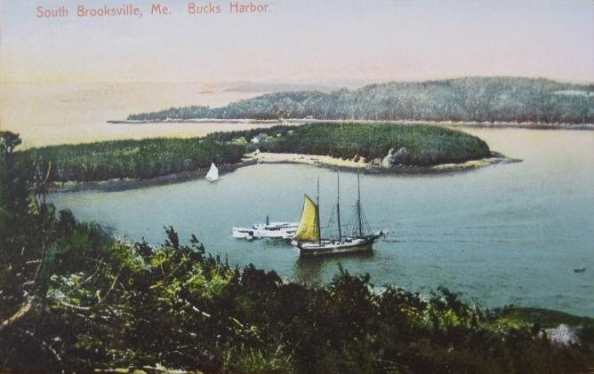


 1908
 1908
 1909
 2011
 2011
 2007
 2007
