


The story
Read it all →How Tolland came to be
From Wikipedia’s history of Tolland.
Tolland was first settled in 1750 when it was part of neighboring Granville. Tolland was officially incorporated in 1810.
Text from Wikipedia, licensed CC BY-SA 4.0.
Each edition grades its towns against each other only.
Most of Tolland was built recently: 7% of its homes predate 1940 and the median home dates from 1979. Below: 6 old photos and papers, maps from 1888 on, and the census since 1850.
Tolland dates its founding to 1750 (Wikidata). The census first counted it in 1850.
Read from the archive, the National Register and the record. The page puts what stands out first.
Lost two-thirds of its people between 1860 and 1960, then grew 4-fold.
18 censuses, 1850–2020.
U.S. Census Bureau decennial counts, from the census table on Tolland’s Wikipedia page.
Every edition of the U.S. Geological Survey’s map of Tolland. Tap a year, or press play to watch the town change.

U.S. Geological Survey historical topographic maps (public domain), via Esri’s collection of the scans. The red ring marks the center of Tolland.
Woven from the archive, old maps, post office records, the National Register and the people born here.
 Born hereJohn Easton Mills is born here
 On the mapFirst mapped by the U.S. Geological Survey
 In the archiveRichards standard atlas of Hampden County, Massachusetts - based upon, and carefully comp…
 In the archiveLand Utilization Town of Tolland - DPLA - d7d11dd8eb319c7f876d18205bd507b5
From Wikipedia’s history of Tolland.
Tolland was first settled in 1750 when it was part of neighboring Granville. Tolland was officially incorporated in 1810.
Text from Wikipedia, licensed CC BY-SA 4.0.
Passages that mention Tolland, cut from the printed page as they were published.
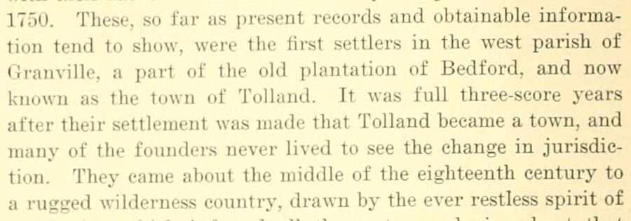
1750. These, so far as present records and obtainable information tend to show, were the first settlers in the west parish of (iraiiville. a part of the old plantation of Bedford, and now known as the town of Tolland. It was full three-score years after their settlement was made that Tolland became a town, and many of the founders never lived to see the change in jurisdiction. They came about the middle of the eighteenth century to a rugged wilderness country, drawn by the ever restless spirit of
Text read by machine from the scan; it may contain errors.
it enacted, &c., "That the West parishvin (Jranville, in the county of Hampshire, as known by its present Ijounds, be and hereby is incorporated and established as a separate town by the name of Tolland, with all the powers and privileges, and subject to all the requisitions of other towns, according to the constitution and laws of this commonwealth."
Text read by machine from the scan; it may contain errors.Scans and text from the Internet Archive. Books published in 1930 or earlier, which are in the public domain.
2 decades in the archive, from the 1910s to the 1930s. Scroll each row; tap a photo for its story.
1912Richards standard atlas of Hampden County, Massachuse…Map1937Land Utilization Town of Tolland - DPLA - d7d11dd8eb3… 1937Roads and Buildings Town of Tolland - DPLA - 3ba1e5f5…
 1937Roads and Waterways Town of Tolland - DPLA - acdc87cd…
 1937Soil Classification Town of Tolland - DPLA - b7e31129…
 1937Topography Town of Tolland - DPLA - 872052836e967d19a…
No then-and-now pairs yet. Take a photo from the same spot as an old one and they appear here side by side.

Find the spot, match the angle, and add your photo. It becomes the first then-and-now pair on Tolland’s page.
Retake this view · +15Writers, athletes, leaders and more, ranked by how widely they’re known.
Tolland had its own post office from 1811 to 1943.
US Post Offices dataset (Blevins & Helbock, CC0). Places and cemeteries from the USGS Geographic Names Information System (2021).
Most archives stop around 1920. The photos from after that are in family albums, not libraries.
Each neighbor’s History grade, on the same three inputs.
In 1750, according to Wikidata. Tolland’s post office opened in 1811, and the census of 1850 counted 594 people here.
What the archives can’t tell you, neighbors can.
Founding dates: Wikidata, Wikipedia, the U.S. post office records of Blevins & Helbock (CC0) and the Census. Homes by year built: Census ACS 2020–24. National Register of Historic Places: National Park Service (list of May 22, 2026). Old photos, postcards and papers: Wikimedia Commons, the Library of Congress and other public archives, credited on each item’s page. Maps: U.S. Geological Survey historical topographic maps (via Esri) and Sanborn fire-insurance maps (Library of Congress). History text and census tables: Wikipedia (CC BY-SA 4.0). Places that used to be: USGS Geographic Names Information System (2021). How TownRatings grades history →
From Wikimedia Commons (6), Wikipedia, Wikidata and Wikipedia for famous people, U.S. Geological Survey historical maps, U.S. Census counts (via Wikipedia), the US Post Offices dataset (Blevins & Helbock), the USGS Geographic Names Information System and old county and town histories (Internet Archive). Archive images are copied here with their credits and licenses, shown on each photo’s page. Refreshed monthly.