Guest, Sign inJoin

Post to Sandisfield

We’ll email a one-tap link to publish your post. No password, and nothing is public until you click it.
Already a member? Sign in
–Not graded
History · Sandisfield

Sandisfield dates to 1750, and 27% of its homes were built before 1940

4 places in town are on the National Register, among them a historic district with 48 buildings. Below: old-book passages.

1750founded
4on the National Register
27%homes built before 1940
4famous people
Quick answers

How Sandisfield began

When was Sandisfield founded?

1750

Sandisfield dates its founding to 1750 (Wikidata). Its post office opened in 1807.

2020 census: 989276 years
Founding year: Wikidata. First post office: 1807.The full story ↓

What stands out about Sandisfield’s past

Read from the archive, the National Register and the record. The page puts what stands out first.

★ What stands out · Help out

Start Sandisfield’s collection

The first neighbors to add old photos shape how Sandisfield’s history is told.

Decades since 1900 with photos
00s10s20s30s40s50s60s70s80s90s
0 of 10 decades. The empty ones are waiting for someone’s album.
Places that used to be

Lost post offices, old corners and burying grounds

Sandisfield had its own post office from 1807 to 1913. Three other post offices opened and closed inside today’s town.

Sandisfield
1807–1913
New Boston
1825–1956
South Sandisfield
1844–1956
Montville
1853–1956
Sandisfield
1956–today
18001910today
Hamlets and corners on the map
KonkapotMontvilleNew BostonRoostervilleSouth SandisfieldWest New Boston
4cemeteries and burying grounds inside Sandisfield
Beech PlainDuboisMontvilleRoberts

US Post Offices dataset (Blevins & Helbock, CC0). Places and cemeteries from the USGS Geographic Names Information System (2021).

On the National Register

4 listings protect 51 historic buildings

The country’s official list of buildings and places worth saving.

places listed
4
National Historic Landmarks
0
none yet
historic buildings protected
51
each building in a district counts
first listed
1982
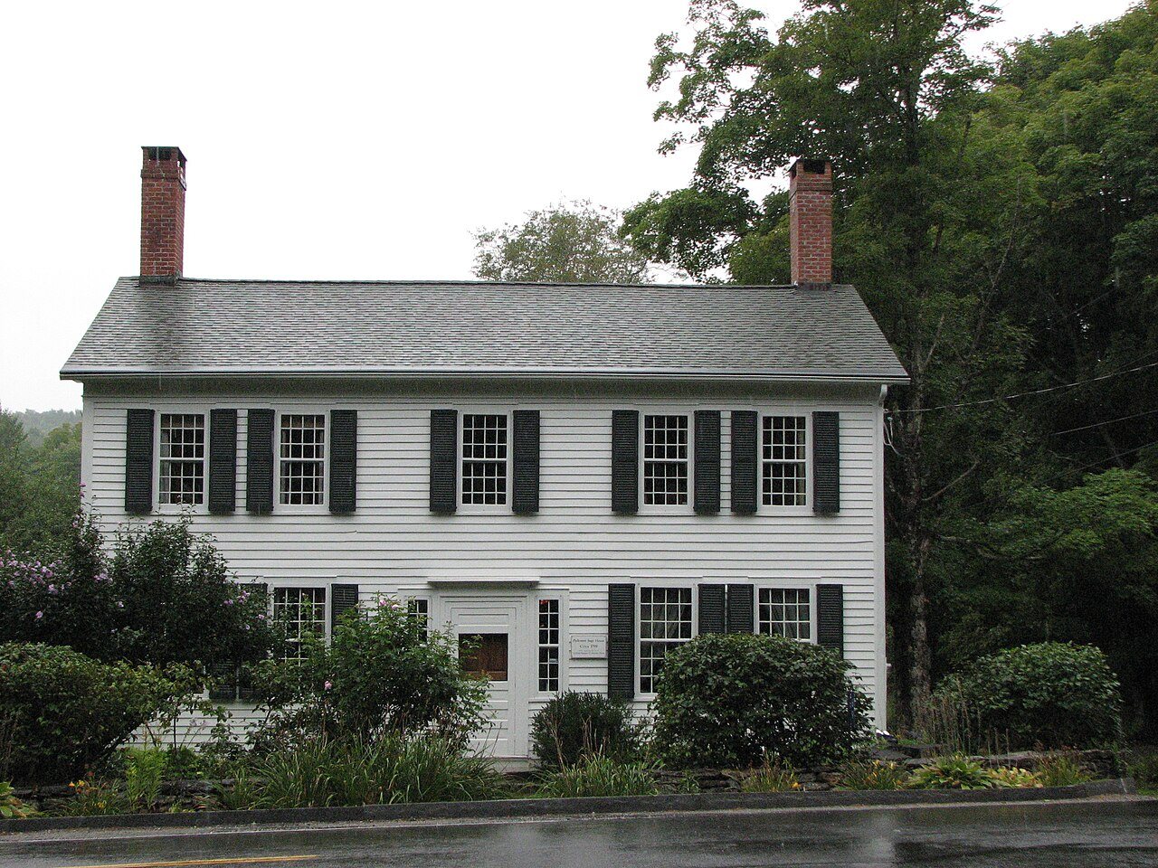
Philemon Sage House
BuildingsDistricts

Architectural styles listings

Federal2
New England Colonial1
Adamesque1
Greek Revival1

National Park Service, National Register of Historic Places. Photos from Wikimedia Commons, credited on each place’s page.

The story

How Sandisfield came to be

From Wikipedia’s history of Sandisfield.

Read it all →

Sandisfield was first settled in 1750 as Housatonic Township Number 4, and was officially incorporated in 1762. It was most likely named to honor Lord Sandys, a British colonial official—pronounced "Sands". The town was mostly agricultural, with rye fields and orchards filling the land. There were several sawmills built along the rivers, but most industry failed in the late nineteenth century when a planned railway along the Farmington River fell through. Significant numbers of Ukrainian farmers moved in during the late nineteenth century, many of them running chicken farms.

Text from Wikipedia, licensed CC BY-SA 4.0.

From the old history books

What they wrote about Sandisfield in 1882

Passages that mention Sandisfield, cut from the printed page as they were published.

with a width of two rods. This afterwards — 1803 to 1828 — formed part of a turnpike leading from Stockbridge, through the Muddy Brook yalley, New Marlboro, and part of Sandisfield, to the line of Connecticut. Between 1780 and 1800, seyeral highways were established in the north-easterly part of th…
History of Great Barrington, (Berkshire County,) Massachusetts1882 · page 340Read the page →
Read the text

with a width of two rods. This afterwards — 1803 to 1828 — formed part of a turnpike leading from Stockbridge, through the Muddy Brook yalley, New Marlboro, and part of Sandisfield, to the line of Connecticut. Between 1780 and 1800, seyeral highways were established in the north-easterly part of the town — the Beartown district — and in that interyal a number of families settled there. Prominent among these were

Text read by machine from the scan; it may contain errors.

Scans and text from the Internet Archive. Books published in 1930 or earlier, which are in the public domain.

Timeline

Sandisfield, 1750 to 1956

Woven from the archive, old maps, post office records, the National Register and the people born here.

  1. 18th century
  2. 1750
    FoundingSandisfield is established
  3. 1750BuiltNew Boston Inn is built
  4. 1787Born hereJohn Mills is born here
  5. 19th century
  6. 1802Born hereBarnas Sears is born here
  7. 1807Post officeThe Sandisfield post office opens
  8. 1825Post officeThe New Boston post office opens
  9. 1830Born hereCharles S. May is born here
  10. 1834Born hereMary Sears McHenry is born here
  11. 1844Post officeThe South Sandisfield post office opens
  12. 20th century
  13. 1913Post officeThe Sandisfield post office closes
  14. 1956Post officeThe New Boston post office closes
  15. 1956Post officeThe South Sandisfield post office closes
By decade

Sandisfield, decade by decade

Famous people

4 famous people were born in Sandisfield

Writers, athletes, leaders and more, ranked by how widely they’re known.

See all →
Stories next door

History across the town line

Each neighbor’s History grade, on the same three inputs.

Questions about Sandisfield’s history

What year was Sandisfield founded?

In 1750, according to Wikidata. Sandisfield’s post office opened in 1807.

What is on the National Register in Sandisfield?

4 listings: 3 buildings, among them the Philemon Sage House (listed 1982, the first), and 1 historic district, the New Boston Village Historic District, with 48 contributing buildings. 51 historic buildings in all.

Memory lane

What the archives can’t tell you, neighbors can.

Town Square →
Start a conversation
Sources

Where this page comes from

Founding dates: Wikidata, Wikipedia, the U.S. post office records of Blevins & Helbock (CC0) and the Census. Homes by year built: Census ACS 2020–24. National Register of Historic Places: National Park Service (list of May 22, 2026). Old photos, postcards and papers: Wikimedia Commons, the Library of Congress and other public archives, credited on each item’s page. Maps: U.S. Geological Survey historical topographic maps (via Esri) and Sanborn fire-insurance maps (Library of Congress). History text and census tables: Wikipedia (CC BY-SA 4.0). Places that used to be: USGS Geographic Names Information System (2021). How TownRatings grades history →

From Wikimedia Commons (4), the National Register of Historic Places (4), Wikipedia, Wikidata and Wikipedia for famous people, the US Post Offices dataset (Blevins & Helbock), the USGS Geographic Names Information System and old county and town histories (Internet Archive). Archive images are copied here with their credits and licenses, shown on each photo’s page. Refreshed monthly.