Plymouth dates to 1620, and 16% of its homes were built before 1940
More historic than 87% of U.S. towns · #166 of 283 in Massachusetts. What drives it
23 places in town are on the National Register, among them the Cole's Hill, a National Historic Landmark, and four historic districts with 169 buildings between them. Below: 2 old photos and papers, maps from 1885 on, and the census since 1790.
Founding year: Wikidata; Wikipedia’s history section gives the same year. First post office: 1792.The full story ↓
History grade
What drives Plymouth’s History grade
On its age, its old homes and the National Register, Plymouth is more historic than 87% of U.S. towns, #166 of 283 in Massachusetts. All 3 inputs are above most U.S. towns; its age ranks highest and its share of homes from before 1940 lowest.
A
HistoryA character grade: shown, never part of Plymouth’s overall grade.
Massachusetts towns list more on the Register than most of the country (a typical Massachusetts town has 46.0 per 10,000 residents, the U.S. 2.4), so Plymouth’s 29.4 sits near the middle of its state (39% of Massachusetts towns have fewer) while its 188 historic buildings outnumber those of 93% of U.S. towns.
How sure. Graded on any two of the three inputs instead, the letter would range from B+ to A. The pre-1940 share (±2.2 points) is firm at this size. Two sources give 1620.
Founding year: Wikidata (other dates in Quick answers). Homes: Census ACS 2020–24. National Register: National Park Service, May 2026 list; each listing counted once (boundary changes and added documentation belong to their listing), and a historic district counts its contributing buildings. How TownRatings grades history →
What stands out about Plymouth’s past
Read from the archive, the National Register and the record. The page puts what stands out first.
Chiltonville Post Officepost officeCranberry WorldbuildingCranberry World Visitor CenterbuildingFort MeetinghousechurchHedges WharflocaleManomet Post Officepost officeNorth Plymouth Post Officepost officeNorth Plymouth StationlocalePinewood Lodge Trailer ParklocalePlymouth National Wax MuseumbuildingThe Childrens Museum of Plymouthbuilding
14cemeteries and burying grounds inside Plymouth
Burial HillCedarvilleChiltonvilleCole's Hill SarcophagusIndianManometOak GroveParting WaysPlymouth County MemorialRussell MillsSaverySouth PondVine HillWhite Horse
US Post Offices dataset (Blevins & Helbock, CC0). Places and cemeteries from the USGS Geographic Names Information System (2021).
Prior to the arrival of the Pilgrims, the location of Plymouth was a village of the Wampanoag tribe called Patuxet. The region was visited twice by European explorers prior to the establishment of Plymouth Colony. In 1605, French explorer Samuel de Champlain sailed to Plymouth Harbor, calling it Port St. Louis. Captain John Smith was a leader of the colony at Jamestown, Virginia, and he explored parts of Cape Cod Bay and is credited with naming the region "New Plimouth."
Two plagues afflicted coastal New England in 1614 and 1617, killing between 90% and 95% of the local Wampanoag inhabitants. The near destruction of the tribe from disease resulted in their cornfields and cleared areas being vacant for the Pilgrims to occupy.
Passages that mention Plymouth, cut from the printed page as they were published.
Handbook of Old Burial Hill, Plymouth, Massachusetts1902 · page 65Read the page →
Read the text
Pilgrim Literature* A History of Plymouth, By William T. Davis. The best history of the town of Plymouth, from the landing of the PUgrims down to the present time. A concise yet comprehensive sketch of the Pilgrim movement, its origin, its growth, its development, and of the settlement at Plymouth, to which it finally led. Illustrated with diagrams and Plymouth views. Price by mail, $2.50.
Text read by machine from the scan; it may contain errors.
Handbook of Old Burial Hill, Plymouth, Massachusetts1902 · page 72Read the page →
Read the text
A new Pilgrim picture every month. Each monthly page of the Plymouth Calendar shows in half-tone a pretty view in the historic old town of Plymouth. By mail, 25 cents. Pilgrim Dolls.
Text read by machine from the scan; it may contain errors.
Michael Peirse was appointed ensign of a company raised in Plymouth Colony to go against the Dutch, in December, 1673, and captain of the company raised in the spring of 1675-6 as hereinafter told. It may be said here that as this was a Plymouth Colony Company, the lists of credits of the Treasurer, which are nearly complete for Massachusetts Colony, are not found as yet in Plymouth or Connecticut, so that we have to depend upon chance lists found here and there, and the lists of " Narraganset
Text read by machine from the scan; it may contain errors.
The Pequods now tried to make peace with the Narragansets, but in vain. They sought to break up the new English settlements, now being established on the Connecticut by settlers from Plymouth and Massachusetts, at Windsor, Wethersfield, and Hartford, and had shown their hostility to the garrison at Saybrook ; and now, when the Massachusetts troops retired, these new towns and the garrison were left in a very critical situation; and Lieut. Gardener complained of the affair to the Colonies.
Text read by machine from the scan; it may contain errors.
Scans and text from the Internet Archive. Books published in 1930 or earlier, which are in the public domain.
By decade
Plymouth, decade by decade
One decade in the archive so far: the 1860s. Scroll each row; tap a photo for its story.
Every edition of the U.S. Geological Survey’s map of Plymouth. Tap a year, or press play to watch the town change.
1886Plymouth sheet · 1:62,500
U.S. Geological Survey historical topographic maps (public domain), via Esri’s collection of the scans. The red ring marks the center of Plymouth.
Every building
Plymouth, building by building, 1885–1927
Fire insurance maps drew every building, what it was made of and what it was used for, so insurers could price the risk of fire. Pick a year, then a sheet.
In 1620, according to Wikidata and Wikipedia’s history of the town. Plymouth’s post office opened in 1792, and the first U.S. census counted 2,995 people here in 1790.
How does Plymouth rank for history?
Plymouth is more historic than 87% of U.S. towns, #166 of 283 in Massachusetts. The History grade combines the town’s founding era, the share of homes built before 1940 and its National Register listings. It’s a character grade, so it isn’t part of the overall grade. How it works.
What is on the National Register in Plymouth?
23 listings: 13 buildings, 4 historic districts with 169 contributing buildings, 1 site, 3 structures, and 2 objects. 188 historic buildings in all.
How old are the homes in Plymouth?
16% of Plymouth’s homes were built before 1940 (Census estimate, ±2.2 points), against a typical 21% for a Massachusetts town; the median home was built in 1982.
Founding dates: Wikidata, Wikipedia, the U.S. post office records of Blevins & Helbock (CC0) and the Census. Homes by year built: Census ACS 2020–24. National Register of Historic Places: National Park Service (list of May 22, 2026). Old photos, postcards and papers: Wikimedia Commons, the Library of Congress and other public archives, credited on each item’s page. Maps: U.S. Geological Survey historical topographic maps (via Esri) and Sanborn fire-insurance maps (Library of Congress). History text and census tables: Wikipedia (CC BY-SA 4.0). Places that used to be: USGS Geographic Names Information System (2021).
From Wikimedia Commons (2), Wikidata (4), the National Register of Historic Places (23), Wikipedia, Wikidata and Wikipedia for famous people, U.S. Geological Survey historical maps, U.S. Census counts (via Wikipedia), the US Post Offices dataset (Blevins & Helbock), the USGS Geographic Names Information System, Sanborn fire insurance maps (Library of Congress) and old county and town histories (Internet Archive). Archive images are copied here with their credits and licenses, shown on each photo’s page. Refreshed monthly.


 ★ Landmark


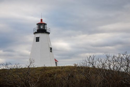
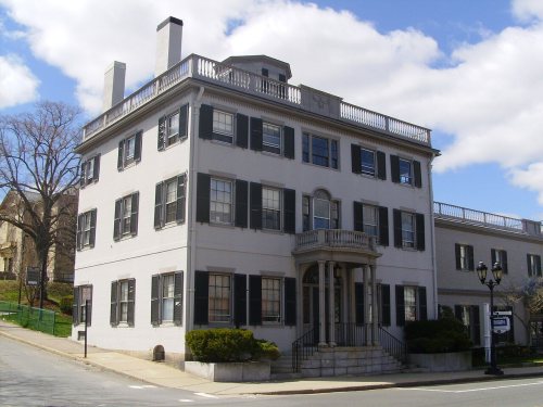


 c. 1865


