Medfield dates to 1649, and 13% of its homes were built before 1940
More historic than 84% of U.S. towns · #189 of 283 in Massachusetts. What drives it
7 places in town are on the National Register, among them a historic district with 53 buildings. Below: 1 old photo or paper, maps from 1887 on, and the census since 1790.
Founding year: Wikidata. First post office: 1807.The full story ↓
History grade
What drives Medfield’s History grade
On its age, its old homes and the National Register, Medfield is more historic than 84% of U.S. towns, #189 of 283 in Massachusetts. All 3 inputs are above most U.S. towns; its age ranks highest and its share of homes from before 1940 lowest.
A−
HistoryA character grade: shown, never part of Medfield’s overall grade.
Massachusetts towns list more on the Register than most of the country (a typical Massachusetts town has 46.0 per 10,000 residents, the U.S. 2.4), so Medfield’s 45.1 sits near the middle of its state (47% of Massachusetts towns have fewer) while its 59 historic buildings outnumber those of 86% of U.S. towns.
NoteThe founding year comes from Wikidata alone; no second source gives 1649.
How sure. Graded on any two of the three inputs instead, the letter would range from B+ to A. The pre-1940 share is a Census survey estimate (±3.5 points).
Founding year: Wikidata (other dates in Quick answers). Homes: Census ACS 2020–24. National Register: National Park Service, May 2026 list; each listing counted once (boundary changes and added documentation belong to their listing), and a historic district counts its contributing buildings. How TownRatings grades history →
What stands out about Medfield’s past
Read from the archive, the National Register and the record. The page puts what stands out first.
The territory that Medfield now occupies was, at the time of colonization, Neponset land. As part of the English settlement of the area, it was sold by the Neponset leader Chickatabot to William Pynchon in the late 1620s. In 1633, Chickatabot died in a smallpox epidemic that decimated nearby Neponset, Narragansett and Pequot communities. Because Chickatabot and Pynchon's deal left no written deed, the Massachusetts General Court ordered "those Indians who were present when Chickatabot sold lands to Mr. Pynchon, or who know where they were, to set out the bounds thereof". Fifty years later, Chickatabot's grandson Josias Wampatuck brought a land claim against Medfield and the other towns created within the borders of the Chickatabot purchase, for which he received payment. Of those lands, Dedham was the first town formed.
Passages that mention Medfield, cut from the printed page as they were published.
History of the town of Medfield, Massachusetts. 1650. 18861887Read the page →
Read the text
It is by the town of Dedham consented unto and ordered that the power, right, or privilege of town government that hath hitherto or is remaining in the township of Dedham, or any their trustees or assigns, whereby they have and did act in and on behalf of the town of Medfield, shall be, and hereby is, wholly and totally transmitted and delivered into the hands, power, and disposing of the township of Medfield in general and the selectmen thereof and their successors forever.
Text read by machine from the scan; it may contain errors.
History of the town of Medfield, Massachusetts. 1650. 18861887Read the page →
Read the text
Whereas the town of Medfield having been presented for some deficiency in a school according to law, we, whose names are underwritten, being selectmen of the said town of Medfield, do certifie your honors that for several years past we have had a constant schoolmaster who is very capable to learn to read and write &c. in English, and is very inclinable for that work ; and we have not at any time been without such a school except it were a small space of time last July, when the schoolmaster was taken ill and incapable of that work : we, the selectmen, did
Text read by machine from the scan; it may contain errors.
The Richardson memorial, comprising a full history and genealogy of the posterity of the three brothers, Ezekiel, Samuel, and Thomas Richardson, who came from England, and united with others in the foundation of Woburn, Massachusetts, in the year 1641, of1876 · page 744Read the page →
Read the text
He removed from Medfield, with his father's family, about 1770, to Rutland District, Mass. By this name, the northwesterly part of the town of Rutland was then known. It was incorporated as a district, March 28, 1753; as the town of Hutchinson, June, 1774; the name changed to Barre, November, 1776.* Removing from Barre, he settled in Chestei-field, N. H.
Text read by machine from the scan; it may contain errors.
Scans and text from the Internet Archive. Books published in 1930 or earlier, which are in the public domain.
By decade
Medfield, decade by decade
One decade in the archive so far: the 1860s. Scroll each row; tap a photo for its story.
Fire insurance maps drew every building, what it was made of and what it was used for, so insurers could price the risk of fire. Pick a year, then a sheet.
In 1649, according to Wikidata. Medfield’s post office opened in 1807, and the first U.S. census counted 731 people here in 1790.
How does Medfield rank for history?
Medfield is more historic than 84% of U.S. towns, #189 of 283 in Massachusetts. The History grade combines the town’s founding era, the share of homes built before 1940 and its National Register listings. It’s a character grade, so it isn’t part of the overall grade. How it works.
What is on the National Register in Medfield?
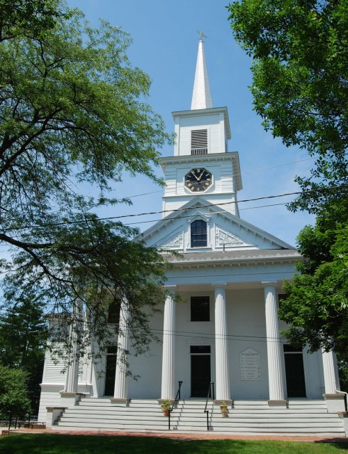
7 listings: 5 buildings, among them the First Parish Unitarian Church (listed 1974, the first), 1 historic district, the Medfield State Hospital, with 53 contributing buildings, and 1 site. 59 historic buildings in all.
How old are the homes in Medfield?
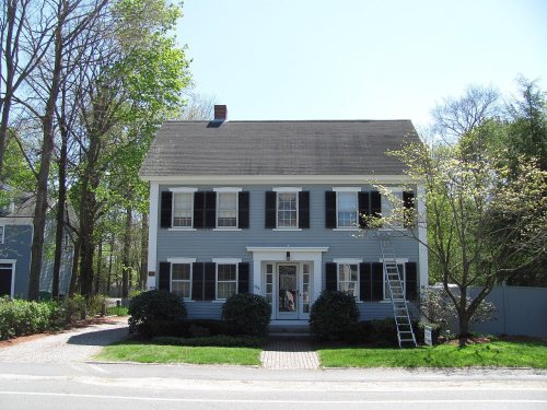
13% of Medfield’s homes were built before 1940 (Census estimate, ±3.5 points), against a typical 21% for a Massachusetts town; the median home was built in 1970.
Founding dates: Wikidata, Wikipedia, the U.S. post office records of Blevins & Helbock (CC0) and the Census. Homes by year built: Census ACS 2020–24. National Register of Historic Places: National Park Service (list of May 22, 2026). Old photos, postcards and papers: Wikimedia Commons, the Library of Congress and other public archives, credited on each item’s page. Maps: U.S. Geological Survey historical topographic maps (via Esri) and Sanborn fire-insurance maps (Library of Congress). History text and census tables: Wikipedia (CC BY-SA 4.0). Places that used to be: USGS Geographic Names Information System (2021).
From Wikimedia Commons (1), Wikidata (5), the National Register of Historic Places (7), Wikipedia, Wikidata and Wikipedia for famous people, U.S. Geological Survey historical maps, U.S. Census counts (via Wikipedia), the US Post Offices dataset (Blevins & Helbock), the USGS Geographic Names Information System, Sanborn fire insurance maps (Library of Congress) and old county and town histories (Internet Archive). Archive images are copied here with their credits and licenses, shown on each photo’s page. Refreshed monthly.