Guest, Sign inJoin

Post to New Bedford

We’ll email a one-tap link to publish your post. No password, and nothing is public until you click it.
Already a member? Sign in
A+History
History · New Bedford

New Bedford dates to 1640, and 52% of its homes were built before 1940

Among the most historic 1% of U.S. towns · #10 of 283 in Massachusetts. What drives it

41 places in town are on the National Register, among them 6 National Historic Landmarks and ten historic districts with 2,178 buildings between them. Below: 5 old photos and papers, maps from 1888 on, and the census since 1790.

1640founded
41on the National Register
52%homes built before 1940
5old photos & papers
37famous people
From New Bedford’s archive · credits on each photo
Quick answers

How New Bedford began

When was New Bedford founded?

1640

New Bedford dates its founding to 1640 (Wikidata). It appears in the first U.S. census, 1790.

First census: 3,313 in 17902020 census: 101,079386 years

How historic is New Bedford?

A+

Among the most historic 1% of U.S. towns, on its age, its old homes and the National Register.

What drives the grade ↓
Founding year: Wikidata. First post office: 1792.The full story ↓
History grade

What drives New Bedford’s History grade

On its age, its old homes and the National Register, New Bedford is among the most historic 1% of U.S. towns, #10 of 283 in Massachusetts. All 3 inputs put New Bedford near the top nationally; its share of homes from before 1940 ranks highest.

A+
HistoryA character grade: shown, never part of New Bedford’s overall grade.
All U.S. towns we grade (21,289)Among the top 1%
NewerOlder
Massachusetts towns of 2,500+ (283)Ahead of 97%

Among the 400 U.S. cities of 100,000 or more, New Bedford ranks #11 on History.

Massachusetts towns list more on the Register than most of the country (a typical Massachusetts town has 46.0 per 10,000 residents, the U.S. 2.4), so New Bedford’s 220 sits above most of its state (77% of Massachusetts towns have fewer) while its 2,217 historic buildings outnumber those of 99% of U.S. towns.

NoteThe founding year comes from Wikidata alone; no second source gives 1640.
How sure. Graded on any two of the three inputs instead, the letter would still be A+. The pre-1940 share (±2.0 points) is firm at this size.

Founding year: Wikidata (other dates in Quick answers). Homes: Census ACS 2020–24. National Register: National Park Service, May 2026 list; each listing counted once (boundary changes and added documentation belong to their listing), and a historic district counts its contributing buildings. How TownRatings grades history →

What stands out about New Bedford’s past

Read from the archive, the National Register and the record. The page puts what stands out first.

★ What stands out · On the National Register

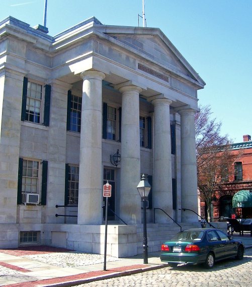
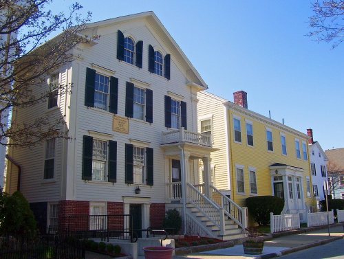
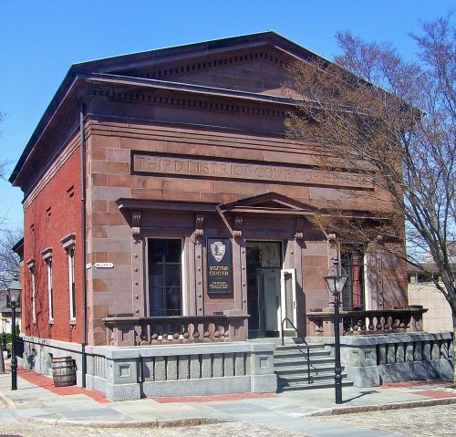
41 listings protect 2,217 historic buildings

The country’s official list of buildings and places worth saving. 6 are National Historic Landmarks, the highest tier.

places listed
41
National Historic Landmarks
6
New Bedford Historic District
historic buildings protected
2,217
each building in a district counts
first listed
1966
New Bedford Historic District
All 41 listings
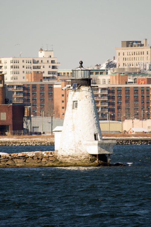
First Baptist ChurchBuilding · listed 1975Sgt. William H. Carney HouseBuilding · listed 1975Fire Station No. 4Building · listed 1975County Street Historic DistrictDistrict · listed 1976Merrill's Wharf Historic DistrictDistrict · listed 1977Union Street Railway Carbarn, Repair ShopBuilding · listed 1978North Bedford Historic DistrictDistrict · listed 1979Palmer Island Light StationBuilding · listed 1980Central New Bedford Historic DistrictDistrict · listed 1980Dawson BuildingBuilding · listed 1982Times and Olympia BuildingsBuilding · listed 1983Bradford Smith BuildingBuilding · listed 1984Dr. Samuel Warren HouseBuilding · listed 1985Butler Flats Light StationStructure · listed 1987Donaghy, Thomas, SchoolBuilding · listed 1989Acushnet Heights Historic DistrictDistrict · listed 1989Hotel WaverlyBuilding · listed 1990Thompson Street SchoolBuilding · listed 1990Howland Mill Village Historic DistrictDistrict · listed 1996Moreland Terrace Historic DistrictDistrict · listed 1996Buttonwood Park Historic DistrictDistrict · listed 2000New Bedford Gas and Edison Light ComplexDistrict · listed 2002Whitman MillsDistrict · listed 2003Union Baptist ChurchBuilding · listed 2008Wamsutta MillsDistrict · listed 2008Hazelwood ParkSite · listed 2010Manomet MillsDistrict · listed 2012Griffin Street CemeterySite · listed 2014Jewish CemeterySite · listed 2014Oak Grove CemeterySite · listed 2014Rural Cemetery and Friends CemeterySite · listed 2014New Bedford Whaling National Historical ParkBuilding · listed 2025Lightship No. 114Structure · listed 1990

National Park Service, National Register of Historic Places. Photos from Wikimedia Commons, credited on each place’s page.

Timeline

New Bedford, 1640 to 1933

Woven from the archive, old maps, post office records, the National Register and the people born here.

  1. 17th century
  2. 1640
    FoundingNew Bedford is established
  3. 1652In the archiveA Deed Appointed to be Recorded (Dartmouth Purchase) 1652
  4. 18th century
  5. 1789In the archiveGay Head Light, 1799
  6. 1792Post officeThe New Bedford post office opens
  7. 19th century
  8. 1820In the archiveMediterraneanPassport1820
  9. 1833In the archive1833 piper JulienHall NewBedfordMercury July12
  10. 1834Born hereHetty Green is born here
  11. 1842In the archiveGosnold at the Smoking Rockslabel QS:Len,"Gosnold at the Smoking Rocks"
  12. 1847Born hereAlbert Pinkham Ryder is born here
  13. 1849BuiltPalmer Island Light Station is built
  14. 1887BuiltBradford Smith Building is built
  15. 1887Post officeThe Clifford post office opens
  16. 1888On the mapFirst mapped by the U.S. Geological Survey
  17. 1889Post officeThe Shawmut post office opens
  18. 20th century
  19. 1915Born hereJohn Tukey is born here
  20. 1917Post officeThe Shawmut post office closes
  21. 1920CensusPopulation peaks at 121,217
  22. 1933Born hereIrwin M. Jacobs is born here
The story

How New Bedford came to be

From Wikipedia’s history of New Bedford.

Read it all →

Before the 17th century, the lands along the Acushnet River were inhabited by the Wampanoag Native Americans, who had settlements throughout southeastern Massachusetts and Rhode Island, including Martha's Vineyard and Nantucket. Their population is believed to have been about 12,000.

On May 15, 1602, English explorer Bartholomew Gosnold in the ship Concord landed on Cuttyhunk Island while exploring New England. From there, he explored Cape Cod and the neighboring areas, including the site of present-day New Bedford. Gosnold left and settled in the Jamestown Colony of Virginia.

Text from Wikipedia, licensed CC BY-SA 4.0.

From the old history books

What they wrote about New Bedford in 1918

Passages that mention New Bedford, cut from the printed page as they were published.

Woodward located in New Bedford, where he is now well established in public confidence as a lawyer of ability and integrity. On paternal lines he descends from that ancient Boston family, founded there in 1636, while on the maternal side he traces to the Hathaways of Plymouth, who later were of Tau…
History of New Bedford1918Read the page →
Read the text

Woodward located in New Bedford, where he is now well established in public confidence as a lawyer of ability and integrity. On paternal lines he descends from that ancient Boston family, founded there in 1636, while on the maternal side he traces to the Hathaways of Plymouth, who later were of Taunton, from Taunton coming to New Bedford, descendants being extensive land owners in Dartmouth and in New Bedford, prominent as merchants and manufacturers. Henry E. Woodward, of New Bedford, is a son of Henry A. C. Woodward, born in

Text read by machine from the scan; it may contain errors.
After school years were over William S. Cook came from his native Yarmouth, and began business life as an office boy. Not long after he entered the employ of the city of New Bedford as assistant city clerk, and from that point in his career until the present he has served the city in official capac…
History of New Bedford1918 · page 87Read the page →
Read the text

After school years were over William S. Cook came from his native Yarmouth, and began business life as an office boy. Not long after he entered the employ of the city of New Bedford as assistant city clerk, and from that point in his career until the present he has served the city in official capacity, 1893-1917, and for nearly ten years the funds of the city, as well as various special funds have been in his care. He has most worthily fulfilled every trust committed to him, and no man stands higher as an honorable, upright citizen and public official than the treasurer of

Text read by machine from the scan; it may contain errors.

Scans and text from the Internet Archive. Books published in 1930 or earlier, which are in the public domain.

By decade

New Bedford, decade by decade

5 decades in the archive, from the 1650s to the 1840s. Scroll each row; tap a photo for its story.

On the map

New Bedford on the map, 1888 to 1977

Every edition of the U.S. Geological Survey’s map of New Bedford. Tap a year, or press play to watch the town change.

New Bedford on the 1888 USGS mapNew Bedford on the 1893 USGS mapNew Bedford on the 1918 USGS mapNew Bedford on the 1936 USGS mapNew Bedford on the 1948 USGS mapNew Bedford on the 1964 USGS mapNew Bedford on the 1977 USGS map1888New Bedford sheet · 1:62,500

U.S. Geological Survey historical topographic maps (public domain), via Esri’s collection of the scans. The red ring marks the center of New Bedford.

Every building

New Bedford, building by building, 1888–1906

Fire insurance maps drew every building, what it was made of and what it was used for, so insurers could price the risk of fire. Pick a year, then a sheet.

New Bedford fire insurance map, 1888, sheet 21888Sheet 2 of 33
Edition
BrickWoodStone

Sanborn Map Company, via the Library of Congress. Editions published in 1930 or earlier, which are in the public domain.

Then & now

Stand where they stood

No then-and-now pairs yet. Take a photo from the same spot as an old one and they appear here side by side.

Gosnold at the Smoking Rockslabel QS:Len,"Gosnold at the Smoking Rocks"
Retake this viewGosnold at the Smoking Rockslabel QS:Len,"Gosnold at the Smoking Rocks", 1842

Find the spot, match the angle, and add your photo. It becomes the first then-and-now pair on New Bedford’s page.

Retake this view · +15
People over time

New Bedford, census by census

020,00040,00060,00080,000100,000120,000180018501900195020005,651 in 1810Low: 3,947

Lost a third of its people between 1810 and 1820, then grew more than tenfold.

24 censuses, 1790–2020.

U.S. Census Bureau decennial counts, from the census table on New Bedford’s Wikipedia page.

Famous people

37 famous people were born in New Bedford

Writers, athletes, leaders and more, ranked by how widely they’re known.

See all →
Places that used to be

Lost post offices, old corners, places now gone and burying grounds

New Bedford’s post office has been open since 1792. Two other post offices opened and closed inside today’s town.

New Bedford
1792–today
Clifford
1887–1951
Shawmut
1889–1917
17901910today
Hamlets and corners on the map
Acushnet StationCliffordInland ParkMount PleasantPine Hill AcresPlainvilleRockdaleWestgate ParkWestview Park
Gone or out of use
Mount Pleasant StationlocaleNew Bedford Army Air Fieldmilitary
8cemeteries and burying grounds inside New Bedford
Oak GrovePeckham WestPolish NationalReynoldsRuralSacred HeartSacred Heart OldSaint Marys

US Post Offices dataset (Blevins & Helbock, CC0). Places and cemeteries from the USGS Geographic Names Information System (2021).

Help out

Finish New Bedford’s story

Most archives stop around 1920. The photos from after that are in family albums, not libraries.

Decades since 1900 with photos
00s10s20s30s40s50s60s70s80s90s
0 of 10 decades. The empty ones are waiting for someone’s album.
Stories next door

History across the town line

Each neighbor’s History grade, on the same three inputs.

Questions about New Bedford’s history

What year was New Bedford founded?

In 1640, according to Wikidata. New Bedford’s post office opened in 1792, and the first U.S. census counted 3,313 people here in 1790.

How does New Bedford rank for history?

New Bedford is among the most historic 1% of U.S. towns, #10 of 283 in Massachusetts. The History grade combines the town’s founding era, the share of homes built before 1940 and its National Register listings. It’s a character grade, so it isn’t part of the overall grade. How it works.

What is on the National Register in New Bedford?

41 listings, 6 of them National Historic Landmarks: 19 buildings, 14 historic districts with 2,178 contributing buildings, 5 sites, and 3 structures. 2,217 historic buildings in all.

How old are the homes in New Bedford?

52% of New Bedford’s homes were built before 1940 (Census estimate, ±2.0 points), against a typical 21% for a Massachusetts town; the median home was built in 1938.

Memory lane

What the archives can’t tell you, neighbors can.

Town Square →
Start a conversation
Sources

Where this page comes from

Founding dates: Wikidata, Wikipedia, the U.S. post office records of Blevins & Helbock (CC0) and the Census. Homes by year built: Census ACS 2020–24. National Register of Historic Places: National Park Service (list of May 22, 2026). Old photos, postcards and papers: Wikimedia Commons, the Library of Congress and other public archives, credited on each item’s page. Maps: U.S. Geological Survey historical topographic maps (via Esri) and Sanborn fire-insurance maps (Library of Congress). History text and census tables: Wikipedia (CC BY-SA 4.0). Places that used to be: USGS Geographic Names Information System (2021).

From Wikimedia Commons (5), Wikidata (1), the National Register of Historic Places (41), Wikipedia, Wikidata and Wikipedia for famous people, U.S. Geological Survey historical maps, U.S. Census counts (via Wikipedia), the US Post Offices dataset (Blevins & Helbock), the USGS Geographic Names Information System, Sanborn fire insurance maps (Library of Congress) and old county and town histories (Internet Archive). Archive images are copied here with their credits and licenses, shown on each photo’s page. Refreshed monthly.